
Where Flight Simulation Enthusiasts Gather from Around the World!
AVSIM Library - Search Results

| Category: Flight Simulator 2004 - Scenery | |
| La Tortuga Island - SyDesigns |

|
File Description:
La Tortuga Island Scenery for Flight Simulator 2004: It is an accurate depiction of this paradise located near Margarita Island in Venezuela. It includes two airfields, new coastlines, mesh, landclass, visual details for VFR flying, and animated scenery.
| Filename: | La_Tortuga_Island__SyDesigns.zip |
| License: | Freeware, limited distribution |
| Added: | 3rd August 2006, 03:52:22 |
| Downloads: | 4,332 |
| Author: | Sabino Yacobone & Arnoldo Perdomo |
| Size: | 6.72 MB |
| Category: Flight Simulator 2004 - Scenery | |
| NZ Rural Airstrips, v3 |
|
Images related to this file:
File Description:
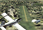
Replaces my previous versions. 9 more strips included. Gisborne area. Requires Christian Stock's payware NZ mesh in the form of "Mountains of New Zealand" and topo in the form of "Lakes and Rivers of New Zealand".
| Filename: | NZ_Rural_Airstrips_v3.zip |
| License: | Freeware |
| Added: | 17th April 2010, 16:18:18 |
| Downloads: | 149 |
| Author: | Godfrey Tier |
| Size: | 2.37 MB |
| Category: Flight Simulator 2004 - Scenery | |
| FYKT, J. G. H. Van Der Wath airport, Keetmanshoop, Namibia for FS9 |
|
File Description:
Based on googleEarth picture. Ez-scenery and rwy12 objects included. Compatible with Holger Sandmann's Namibia LOD9 Terrain mesh (namibia_ne.zip, namibia_nw.zip, namibia_se.zip, namibia_sw.zip, namibia_cp.zip) as well as his namibia_scenery_updates.zip, all found at avsim.com. (re-upload, originally uploaded 23rd November 2008)
| Filename: | FYKT_J_G_H_Van_Der_Wath_airport_Keetmanshoop_Namib.zip |
| License: | Freeware |
| Added: | 16th May 2010, 23:59:11 |
| Downloads: | 1,083 |
| Author: | Detlev J. Rohmer |
| Size: | 5.88 MB |
| Category: Flight Simulator 2004 - Scenery | |
| RANGITAIKI - NZRK |
|
Images related to this file:
File Description:
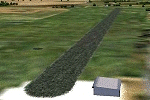
Simple rendition of this aerodrome, 16nm south-east of Taupo, (NAZP), New Zealand. Made for Christian Stock's NZ mesh in the form of "Mountains of New Zealand"
and topo in the form of "Lakes and Rivers of New Zealand".
| Filename: | RANGITAIKI__NZRK.zip |
| License: | Freeware |
| Added: | 6th February 2011, 03:46:28 |
| Downloads: | 207 |
| Author: | Godfrey Tier |
| Size: | 183.53 KB |
| Category: Flight Simulator 2004 - Scenery | |
| New Caledonia (Landclass and Terrain Mesh) AFCAD and Scenery Fix for file n_caled.zip |
|
File Description:
This is a fix for my New Caledonia Landclass and Terrain Mesh file n_caled.zip The AFCAD and scenery files included will repair the problems of AI Aircraft freezing on runways. Scenery modifications have also been made around many of the airports.
| Filename: | New_Caledonia_Landclass_and_Terrain_Mesh__AFCAD_an.zip |
| License: | Freeware |
| Added: | 14th May 2010, 05:07:26 |
| Downloads: | 567 |
| Author: | Charles Reid |
| Size: | 49.16 KB |
| Category: Flight Simulator 2004 - Scenery | |
| NZ DOC Airstrips vs.2 |
|
File Description:
Made to fit Christian Stock's 20-mesh. Will not work with 75mesh or default scenery. Fictional Department of Conservation floatplane-candy for New Zealand. Great Mercury Island, Little Barrier Island, Mayor Island, Cuvier Island,Motiti Island,White Island and Slipper Island.
| Filename: | NZ_DOC_Airstrips_vs2.zip |
| License: | Freeware |
| Added: | 16th July 2008, 18:33:47 |
| Downloads: | 251 |
| Author: | Godfrey Tier |
| Size: | 2.43 MB |
| Category: Flight Simulator 2004 - Scenery | |
| Tui Brewery |
|
File Description:
Tui Brewery, Mangatainoka, New Zealand. Real location, but a fictional runway. Just a 35nm chopper/small plane hop from Masterton. The Tui Brewery at Mangatainoka is a New Zealand icon.
Made to fit Christian Stock's 20-mesh and NZ Topo.
| Filename: | Tui_Brewery.zip |
| License: | Freeware |
| Added: | 9th August 2008, 00:18:02 |
| Downloads: | 261 |
| Author: | Godfrey Tier |
| Size: | 1.1 MB |
| Category: Flight Simulator 2004 - Scenery | |
| SCIR Isla Robinson Crusoe Chile |
|
Images related to this file:
File Description:
Terrain and Mesh for Robinson Crusoe Island and Selkirk Island, including the airport SCIR (Robinson Crusoe). Robinson Crusoe Island is located west of Santiago, Chile at approximately S33-40/W78-50. It is about 2.5 hours flying time from Santiago(SCEL).
| Filename: | SCIR_Isla_Robinson_Crusoe_Chile.zip |
| License: | Freeware, limited distribution |
| Added: | 23rd October 2011, 14:08:29 |
| Downloads: | 1,248 |
| Author: | Scott Smart |
| Size: | 9.44 MB |
| Category: Flight Simulator 2004 - Scenery | |
| Appalachian Mountains, Virginia / West Virginia |
|
File Description:
USGS SRTM30 1 arc-second, resampled to LOD10 (38.2 meters).
This high-resolution terrain mesh is centered in the Appalachian Mountains
between Virginia and West Virginia. Coverage area: From West -81° to West -79°
and North 37° to North 39°.
| Filename: | Appalachian_Mountains_Virginia__West_Virginia.zip |
| License: | Freeware, limited distribution |
| Added: | 10th January 2004, 18:06:59 |
| Downloads: | 3,681 |
| Author: | Andreas Trawny |
| Size: | 17.1 MB |
| Category: Flight Simulator 2004 - Scenery | |
| Balclutha Aerodrome - NZBA |
|
Images related to this file:
File Description:
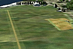
26nm south-east of Dunedin, New Zealand. The aerodrome is popular with model aircraft enthusiasts. Made for Christian Stock's NZ mesh in the form of "Mountains of New Zealand" and topo in the form of "Lakes and Rivers of New Zealand".
| Filename: | Balclutha_Aerodrome__NZBA.zip |
| License: | Freeware |
| Added: | 9th January 2011, 03:55:35 |
| Downloads: | 395 |
| Author: | Godfrey Tier |
| Size: | 2.42 MB |


© 2001-2026 AVSIM Online
All Rights Reserved
Privacy Policy |