
Where Flight Simulation Enthusiasts Gather from Around the World!
AVSIM Library - Search Results

| Category: Flight Simulator 2004 - Scenery | |
| NZCG - Centennial Park Aerodrome |

|
Images related to this file:
File Description:
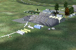
Small New Zealand aerodrome 5nm NE of Taupo, New Zealand. Horse Racing and Motosport Park. Taupo Gliding Club. Watch for radio mast 6.3nm NW of aerodrome. Made to fit Christian Stock's NZ 20m mesh.
| Filename: | NZCG__Centennial_Park_Aerodrome.zip |
| License: | Freeware |
| Added: | 13th August 2012, 09:27:58 |
| Downloads: | 364 |
| Author: | Godfrey Tier |
| Size: | 2.83 MB |
| Category: Flight Simulator 2004 - Scenery | |
| Cape Town, South Africa 76m SRTM Terrain Mesh |
|
File Description:
USGS SRTM 3 arc-second, resampled to LOD9 (76 meters). This is a terrain mesh scenery of Cape Town, South Africa. It includes Cape Town, Table Mountain, Cape of Good Hope
and surrounding mountains.
| Filename: | Cape_Town_South_Africa_76m_SRTM_Terrain_Mesh.zip |
| License: | Freeware, limited distribution |
| Added: | 4th April 2004, 19:40:56 |
| Downloads: | 14,592 |
| Author: | Andreas Trawny |
| Size: | 3.04 MB |
| Category: Flight Simulator 2004 - Scenery | |
| Colorado Lakes Project I |
|
File Description:
These files ADD 15 highly detailed lakes to Colorado. Although these lakes are specifically designed to show off their photo realistic detail when used in combination with 38.2m mesh, they work equally as well with the default mesh. All lake information was derived from detailed map data.
Included lakes are: the Antero, Eleven Mile, Spinney, Paonia, Lemon, Vallecito, Ruedi and Taylor Reservoirs, Cheesman Lake, Lake Grant, Peanut Lake, Meridian Lake, Nicholson Lake, Lake Irwin, and McPhee Reservoir, which is the second largest reservoir in the state.
| Filename: | Colorado_Lakes_Project_I.zip |
| License: | Freeware |
| Added: | 8th February 2004, 23:33:51 |
| Downloads: | 5,282 |
| Author: | Carlyle Sharpe |
| Size: | 253.36 KB |
| Category: Flight Simulator 2004 - Scenery | |
| Update - Terrain Mesh for Canada's Maritime Provinces |
|
File Description:
This package contains two files updating river and lake elevation for FS2002 and FS2004 in LOD09 terrain mesh (in Maritimes09a.zip and Maritimes09b.zip) for Canada's Maritime Provinces (including also Newfoundland, parts of Labrador and Saint-Pierre-et-Miquelon).
| Filename: | Update__Terrain_Mesh_for_Canadas_Maritime_Province.zip |
| License: | Freeware, limited distribution |
| Added: | 1st September 2003, 01:52:28 |
| Downloads: | 4,244 |
| Author: | Gilles Gauthier |
| Size: | 12.86 KB |
| Category: Flight Simulator 2004 - Scenery | |
| Atlas Mountains, Morocco 76m SRTM Terrain Mesh |
|
File Description:
USGS SRTM 3 arc-second, resampled to LOD9 (76 meters). This is a terrain mesh scenery of the Atlas Mountains in Morocco, Africa. It includes the High Atlas, the cities of Agadir & Marrakech and northwestern parts of the Sahara Desert.
| Filename: | Atlas_Mountains_Morocco_76m_SRTM_Terrain_Mesh.zip |
| License: | Freeware |
| Added: | 4th April 2004, 19:46:58 |
| Downloads: | 15,261 |
| Author: | Andreas Trawny |
| Size: | 15.95 MB |
| Category: Flight Simulator 2004 - Scenery | |
| Cape Farvel, Greenland 76m SRTM Terrain Mesh |
|
File Description:
USGS SRTM 3 arc-second, resampled to LOD9 (76 meters). This is a terrain mesh scenery of Cape Farvel in southern Greenland. Coverage area: From West 45.6° to West 42.8° and North 59.6° to North 60.4°. (Cape Farvel is the only part of Greenland available as SRTM elevation model)
| Filename: | Cape_Farvel_Greenland_76m_SRTM_Terrain_Mesh.zip |
| License: | Freeware, limited distribution |
| Added: | 17th April 2004, 23:35:14 |
| Downloads: | 4,184 |
| Author: | Andreas Trawny |
| Size: | 1.55 MB |
| Category: Flight Simulator 2004 - Scenery | |
| Europe SRTM mesh part 10: Lower Danube |
|
File Description:
Europe SRTM LOD9 mesh part 10 of 13: Covers a wide area centered over the Danube valley from Novi Sad to the Black Sea (42°N-46°N, 19°E-30°E). Includes Balkans & Transylvanian moutain ranges, and parts of the following countries: Romania, Bulgaria, Serbia and Albania.
This Europe SRTM project was optimized for the lowest HDD space use: Each part macthing exactly the boundaries of its neighbors, you'll have a complete corevage of Europe without gap or overlapping scenery. Based on SRTM Data v1 and v2 (3 arcsec, 90m) and sampled to LOD9 resolution (76m). Each SRTM tile was carefully checked and repaired with Blackart v4.02: water areas are now flattened (lighter mesh), and SRTM voids were treated taking advantage of Blackart's sophisticated interpolation algorithm. When required, biggest voids were patched with oversampled SRTM 30 arcsec data and/or manual input.
| Filename: | Europe_SRTM_mesh_part_10_Lower_Danube.zip |
| License: | Freeware, limited distribution |
| Added: | 19th October 2005, 17:55:10 |
| Downloads: | 11,735 |
| Author: | Yohann Baptiste |
| Size: | 39.14 MB |
| Category: Flight Simulator 2004 - Scenery | |
| Ultimate Malta - Landclass, Mesh, Roads and Towns |
|
File Description:
With this file you will get one of the best freeware sceneries for the island of Malta, including:
----- a more realistical landclass mixed with green grounds and southern dry grounds ----- Important roads around the airport ----- a more realistical mesh with small mountain, cliffs and beaches ----- Important towns that do not exist in FS2004 inlc. the capital of Malta, villages around the airport as well as the harbor town in the very south of Malta and some important ones more -----
| Filename: | Ultimate_Malta__Landclass_Mesh_Roads_and_Towns.zip |
| License: | Freeware |
| Added: | 7th September 2008, 22:59:31 |
| Downloads: | 4,541 |
| Author: | Dave Sheffield |
| Size: | 38.14 KB |
| Category: Flight Simulator 2004 - Scenery | |
| OryxSim Khasab / Northern Oman SRTM Mesh -FIX- |
|
Images related to this file:
File Description:

This fix removes the steep hill north of the airport when using the OryxSim Khasab scenery in combination with the Northern Oman SRTM mesh by Yohann Baptiste. This fix is not recommended for users using the default scenery. This file requires version 2.0 of OryxSim Khasab.
| Filename: | OryxSim_Khasab__Northern_Oman_SRTM_Mesh__FIX.zip |
| License: | Freeware |
| Added: | 15th February 2010, 10:47:45 |
| Downloads: | 1,649 |
| Author: | OryxSim |
| Size: | 1.42 KB |
| Category: Flight Simulator 2004 - Scenery | |
| Guadalupe Mountains National Park SRTM30_1ArcSec Terrain Mesh |
|
File Description:
USGS SRTM30 1 arc-second, resampled to LOD10 (38.2 meters).
This terrain mesh is centered in western Texas panhandle.
Coverage area: From West 104° to West 106° and North 31° to North 32°.
It includes Guadalupe Mountains National Park and its surrounding areas.
| Filename: | Guadalupe_Mountains_National_Park_SRTM30_1ArcSec_T.zip |
| License: | Freeware, limited distribution |
| Added: | 27th December 2003, 19:07:04 |
| Downloads: | 1,295 |
| Author: | Andreas Trawny |
| Size: | 7 MB |


© 2001-2026 AVSIM Online
All Rights Reserved
Privacy Policy |