
Where Flight Simulation Enthusiasts Gather from Around the World!
AVSIM Library - Search Results

| Category: Flight Simulator 2004 - Scenery | |
| Turkey Mesh, Part 3 of 5 |

|
File Description:
Created from 3 arc second data and re-sampled @LOD9 (best fit for this data). The created area extends from N35E025 (lower left corner) to N44E047 (upper right corner). You need all the five bgl-files plus the two correction files to cover the whole area. Otherwise you will have only a coverage of the corresponding file. Matthew Style's SRTM_3ARCSEC_TO_BGL program was used to interpolate the srtm data and automate the bgl file creation (Many Thanks to Matthew for his great utility).
| Filename: | Turkey_Mesh_Part_3_of_5.zip |
| License: | Freeware |
| Added: | 15th February 2010, 09:34:40 |
| Downloads: | 8,771 |
| Author: | Abdulkadir Ozturk |
| Size: | 41.97 MB |
| Category: Flight Simulator 2004 - Scenery | |
| Turkey Mesh, Part 4 of 5 |
|
File Description:
Created from 3 arc second data and re-sampled @LOD9 (best fit for this data). The created area extends from N35E025 (lower left corner) to N44E047 (upper right corner). You need all the five bgl-files plus the two correction files to cover the whole area. Otherwise you will have only a coverage of the corresponding file. Matthew Style's SRTM_3ARCSEC_TO_BGL program was used to interpolate the srtm data and automate the bgl file creation (Many Thanks to Matthew for his great utility).
| Filename: | Turkey_Mesh_Part_4_of_5.zip |
| License: | Freeware |
| Added: | 15th February 2010, 09:35:58 |
| Downloads: | 9,041 |
| Author: | Abdulkadir Ozturk |
| Size: | 49.47 MB |
| Category: Flight Simulator 2004 - Scenery | |
| Turkey Mesh, Part 5 of 5 |
|
File Description:
Created from 3 arc second data and re-sampled @LOD9 (best fit for this data). The created area extends from N35E025 (lower left corner) to N44E047 (upper right corner). You need all the five bgl-files plus the two correction files to cover the whole area. Otherwise you will have only a coverage of the corresponding file. Matthew Style's SRTM_3ARCSEC_TO_BGL program was used to interpolate the srtm data and automate the bgl file creation (Many Thanks to Matthew for his great utility).
| Filename: | Turkey_Mesh_Part_5_of_5.zip |
| License: | Freeware |
| Added: | 15th February 2010, 09:38:45 |
| Downloads: | 9,404 |
| Author: | Abdulkadir Ozturk |
| Size: | 27.58 MB |
| Category: Flight Simulator 2004 - Scenery | |
| Canary Islands 76m SRTM Terrain Mesh |
|
File Description:
USGS SRTM 3 arc-second, resampled to LOD9 (76 meters).
This is a terrain mesh scenery of the Canary Islands west of Morocco, Africa.
It includes the following islands: Hierro, La Palma, La Gomera, Tenerife, Gran Canaria, Fuerteventura, Lanzarote
| Filename: | Canary_Islands_76m_SRTM_Terrain_Mesh.zip |
| License: | Freeware, limited distribution |
| Added: | 4th April 2004, 06:56:49 |
| Downloads: | 18,602 |
| Author: | Andreas Trawny |
| Size: | 2.99 MB |
| Category: Flight Simulator 2004 - Scenery | |
| Turkey Mesh SRTM V2, Part II |
|
Images related to this file:
File Description:
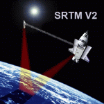
SRTM Version 2 is the result of a substantial editing effort by the National Geospatial Intelligence Agency and exhibits well-defined water bodies and coastlines and the absence of spikes and wells.
| Filename: | Turkey_Mesh_SRTM_V2_Part_II.zip |
| License: | Freeware |
| Added: | 25th January 2011, 14:32:45 |
| Downloads: | 2,883 |
| Author: | Tuncer Celik |
| Size: | 79.06 MB |
| Category: Flight Simulator 2004 - Scenery | |
| Terrain Mesh of Glacier National Park |
|
File Description:
New and updated scenery enhancements for the mountain ranges of southeastern British Columbia and parts of the Alberta Rocky Mountains. They require an existing installation of my files bcmesh9d.zip and/or bcmesh9e.zip. Scenery coverage follows the Trans-Canada Highway from Banff National Park to west of Revelstoke (~350km), with accurate transportation network, rivers and lakes, hydro dams, ski hills, glaciers, and landclass/waterclass updates based on satellite imagery. Also, similar enhancements to the parks and towns of the southern Kootenay, Selkirk, and Monashee mountains. The mesh source data are 0.75-arcsec (~23-m) CDED files, compiled at LOD10 (38-m) resolution. Due to significant changes in FS2004 to vector layering and autogen features, the special scenery enhancements cannot be used with FS2002. However, terrain mesh, new lakes and land/waterclass replacements will work well in FS2002.
| Filename: | Terrain_Mesh_of_Glacier_National_Park.zip |
| License: | Freeware, limited distribution |
| Added: | 18th December 2003, 23:17:35 |
| Downloads: | 8,858 |
| Author: | Holger Sandmann |
| Size: | 12.79 MB |
| Category: Flight Simulator 2004 - Scenery | |
| Turkey Mesh, Part 1 of 5 |
|
File Description:
Created from 3 arc second data and re-sampled @LOD9 (best fit for this data). The created area extends from N35E025 (lower left corner) to N44E047 (upper right corner). You need all the five bgl-files plus the two correction files to cover the whole area. Otherwise you will have only a coverage of the corresponding file. Matthew Style's SRTM_3ARCSEC_TO_BGL program was used to interpolate the srtm data and automate the bgl file creation (Many Thanks to Matthew for his great utility).
| Filename: | Turkey_Mesh_Part_1_of_5.zip |
| License: | Freeware |
| Added: | 15th February 2010, 09:30:31 |
| Downloads: | 12,000 |
| Author: | Abdulkadir Ozturk |
| Size: | 31.29 MB |
| Category: Flight Simulator 2004 - Scenery | |
| Turkey Mesh SRTM V2, Part I |
|
Images related to this file:
File Description:

SRTM Version 2 is the result of a substantial editing effort by the National Geospatial Intelligence Agency and exhibits well-defined water bodies and coastlines and the absence of spikes and wells.
| Filename: | Turkey_Mesh_SRTM_V2_Part_I.zip |
| License: | Freeware |
| Added: | 25th January 2011, 14:32:24 |
| Downloads: | 3,448 |
| Author: | Tuncer Celik |
| Size: | 88.4 MB |
| Category: Flight Simulator 2004 - Scenery | |
| Alps LOD10 Topo Mesh - Update 1 |
|
File Description:
Patch files to remove tall spike in terrain near Salzburg at N47 44´ E13 00´ and to add the missing/distorted peaks of La Grande Moucherolle at N45 00´ E5 34´ and Mont Aiguille at N44 50' E5 33'.
Requires the full version of our Alps LOD10 mesh files, alpse_fe.zip and alpsw_fe.zip. Source data by Jonathan de Ferranti, compiled for FS by Holger Sandmann. Fully compatible with FS2002. A big thank-you to those who reported the "Salzbug" and the missing peaks in the French Alps.
| Filename: | Alps_LOD10_Topo_Mesh__Update_1.zip |
| License: | Freeware, limited distribution |
| Added: | 9th February 2006, 15:02:59 |
| Downloads: | 32,360 |
| Author: | Holger Sandmann, Jonathan de Ferranti |
| Size: | 2.57 MB |
| Category: Flight Simulator 2004 - Scenery | |
| ACAPULCO MEXICO AIRPORT AND MESH (UPDATE). |
|
File Description:
This update includes movement to RADAR and some BUSES in the airport.
And other small changes for greater realism.
| Filename: | ACAPULCO_MEXICO_AIRPORT_AND_MESH__UPDATE.zip |
| License: | Freeware |
| Added: | 15th September 2005, 22:07:20 |
| Downloads: | 7,216 |
| Author: | Dr. José Luis Águila Boudib. |
| Size: | 348.58 KB |


© 2001-2026 AVSIM Online
All Rights Reserved
Privacy Policy |