
Where Flight Simulation Enthusiasts Gather from Around the World!
AVSIM Library - Search Results

| Category: Flight Simulator 2004 - Scenery | |
| Galatea Aerodrome - NZGA |

|
Images related to this file:
File Description:
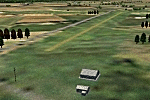
Aerodrome 27nm SE of Rotorua. Made for Christian Stock's NZ 20m mesh.
| Filename: | Galatea_Aerodrome__NZGA.zip |
| License: | Freeware |
| Added: | 15th January 2011, 19:08:44 |
| Downloads: | 206 |
| Author: | Godfrey Tier |
| Size: | 448.93 KB |
| Category: Flight Simulator 2004 - Scenery | |
| Schwaebische Alb, South Germany |
|
File Description:
This is a Mesh for the Schwaebische Alb, located in South Germany.
The highest mountain of this area is Lemberg with 1015 meters.The mesh covers the area N48 E8 to N48 E10. USGS SRTM 3 arc-second, resampled to LOD10 (38 meters).
| Filename: | Schwaebische_Alb_South_Germany.zip |
| License: | Freeware |
| Added: | 14th April 2004, 16:35:25 |
| Downloads: | 3,857 |
| Author: | Michael Speck |
| Size: | 7.4 MB |
| Category: Flight Simulator 2004 - Scenery | |
| Iraq VFR Southern - Terrain Mesh SRTM |
|
File Description:
Iraq VFR Southern - Enhanced Terrain Mesh SRTM. This scenery area is a terrain mesh SRTM 3 arc/sec (LOD 9) 76 mt., of part Southern of the Iraq and Kuwait.
This scenery area include whole region around Bassora city and Kuwait city.
| Filename: | Iraq_VFR_Southern__Terrain_Mesh_SRTM.zip |
| License: | Freeware |
| Added: | 30th September 2005, 23:46:11 |
| Downloads: | 2,677 |
| Author: | Giovanni Miduri |
| Size: | 13.89 MB |
| Category: Flight Simulator 2004 - Scenery | |
| Phoenix, Arizona 30 Meter Terrain Mesh Scenery |
|
File Description:
Mesh Scenery for Microsoft Flight Simulator 2004 and 2002.USGS NED 30 meter (1 arc-second), resampled to LOD10 (38.2 meters). This terrain mesh is centered at Phoenix, Arizona. Coverage area: From about West 111° to West 113° and North 33° to North 34°.
| Filename: | Phoenix_Arizona_30_Meter_Terrain_Mesh_Scenery.zip |
| License: | Freeware |
| Added: | 3rd January 2004, 19:53:36 |
| Downloads: | 3,718 |
| Author: | Phil Cruikshank |
| Size: | 4.66 MB |
| Category: Flight Simulator 2004 - Scenery | |
| SKBS - Jose Celestino Mutis - Bahia Solano, Colombia |
|
File Description:
I made this scenery using standard objects. I corrected the airport altitude which is 80ft instead of 535 ft of the default scenery. Therefore the airport scenery should be used with a mesh scenery, e.g. the freeware mesh of Colombia by Raimondo Taburet (flightsim.com).
| Filename: | SKBS__Jose_Celestino_Mutis__Bahia_Solano_Colombia.zip |
| License: | Freeware |
| Added: | 22nd June 2012, 21:55:44 |
| Downloads: | 730 |
| Author: | Detlev J. Rohmer |
| Size: | 8.05 MB |
| Category: Flight Simulator 2004 - Scenery | |
| Spain and Portugal SRTM Scenery Mesh |
|
File Description:
This is a terrain mesh scenery for Spain (with Balearic Islands) and Portugal.
Based on SRTM Data (3 arc/ sec), generated with Matthew Styles's program "SRTM To BGL v1.04", sampled to LOD9 resolution (76m).
While tested under Fs2004, this mesh should also run in FS2002.
| Filename: | Spain_and_Portugal_SRTM_Scenery_Mesh.zip |
| License: | Freeware |
| Added: | 5th November 2003, 19:58:55 |
| Downloads: | 7,010 |
| Author: | Ricard Alvarez |
| Size: | 91.24 MB |
| Category: Flight Simulator 2004 - Scenery | |
| Mesh Install Instructions for Oregon and Washington Sceneries |
|
File Description:
I forgot to upload this with the SRTM Mesh, Sorry for the mistake folks.
| Filename: | Mesh_Install_Instructions_for_Oregon_and_Washingto.zip |
| License: | Freeware |
| Added: | 5th April 2004, 03:58:59 |
| Downloads: | 4,611 |
| Author: | John Wardle |
| Size: | 116.72 KB |
| Category: Flight Simulator 2004 - Scenery | |
| Northern Alberta 3 Arc 2nd Mesh |
|
File Description:
LOD8 3 arc second Northern Alberta mesh created with srtm to bgl v1.04 software.
| Filename: | Northern_Alberta_3_Arc_2nd_Mesh.zip |
| License: | Freeware |
| Added: | 18th January 2004, 19:46:21 |
| Downloads: | 2,558 |
| Author: | Dwayne Matheson |
| Size: | 11.32 MB |
| Category: Flight Simulator 2004 - Scenery | |
| Cyprus & Crete incl. Surroundings SRTM Terrain Mesh |
|
File Description:
Cyprus & Crete incl. Surroundings SRTM Terrain Mesh.
3arcsec source data resampled to LOD9 76m
| Filename: | Cyprus__Crete_incl_Surroundings_SRTM_Terrain_Mesh.zip |
| License: | Freeware, limited distribution |
| Added: | 12th June 2004, 04:54:31 |
| Downloads: | 13,288 |
| Author: | Tom Finley |
| Size: | 4.16 MB |
| Category: Flight Simulator 2004 - Scenery | |
| Pennsylvania 30 Meter Mesh |
|
File Description:
Mesh Scenery for Microsoft Flight Simulator 2004 and 2002 covers the entire State of Pennsylvania. Compiled from NED 1 arc sec (30 meter) Data. Compression and conversion to bgl with MS Flight simulator SDK at LOD set to "Auto". Enjoy some nice VFR flying. Requires all 8 zips. 7 of 8.
| Filename: | Pennsylvania_30_Meter_Mesh.zip |
| License: | Freeware |
| Added: | 11th December 2003, 04:12:29 |
| Downloads: | 2,497 |
| Author: | Phil Cruikshank |
| Size: | 5.24 MB |
© 2001-2026 AVSIM Online
All Rights Reserved
Privacy Policy |