
Where Flight Simulation Enthusiasts Gather from Around the World!
AVSIM Library - Search Results

| Category: Flight Simulator 2004 - Scenery | |
| PHX - Phoenix Sky Harbor Airport |

|
Images related to this file:
File Description:

Custom scenery for (KPHX) Phoenix Sky Harbor Airport. All custom terminal buildings made using photo real textures. Also included are reworked night time ground textures. See 'readme' file for more information.
| Filename: | PHX__Phoenix_Sky_Harbor_Airport.zip |
| License: | Freeware, limited distribution |
| Added: | 2nd November 2009, 09:04:14 |
| Downloads: | 11,354 |
| Author: | Mach-1 Design Group, Jaxan Prier, Jose Gutierrez |
| Size: | 5.11 MB |
| Category: Flight Simulator 2004 - Scenery | |
| WaterWorks 5.1 |
|
Images related to this file:
File Description:
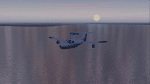
These textures re-colour and re-glint the FS2004 default waters. They work even better on payware, or other freeware water enviroment addons. They work best on WaterWrkx5. The textures are 32bit.
| Filename: | WaterWorks_51.zip |
| License: | Freeware |
| Added: | 24th December 2011, 09:30:25 |
| Downloads: | 1,214 |
| Author: | Lou McNeil |
| Size: | 28.84 MB |
| Category: Flight Simulator 2004 - Scenery | |
| Witbank Airport (FAWI), South Africa |
|
File Description:
This FS2004 airport includes photo realistic ground textures and buildings. Some enhancement to the city textures (Pretoria, Witbank, Middelburg) is also included, as well as some updates to the road/railways infrastructure.
| Filename: | Witbank_Airport_FAWI_South_Africa.zip |
| License: | Freeware, limited distribution |
| Added: | 1st July 2010, 02:47:46 |
| Downloads: | 1,036 |
| Author: | Aeroworx |
| Size: | 2.15 MB |
| Category: Flight Simulator 2004 - Scenery | |
| VFR Balice EPKK ext II V2 |
|
Images related to this file:
File Description:
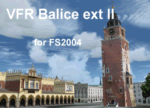
Very beautiful VFR scenery. Designed on ground textures of the old town Krakow in
the vicinity of EPKK Balice (Poland). This is an extension II of the base scenery VFR Balice with day and night textures. Almost one thousand 3D objects and photorealistic textures. Scenery does not contain EPKK airport itself and a mesh. EPKK airport can be
downloaded from www.pl-vacc.org
| Filename: | VFR_Balice_EPKK_ext_II__V2.zip |
| License: | Freeware, limited distribution |
| Added: | 6th May 2010, 18:50:18 |
| Downloads: | 2,076 |
| Author: | Lothar Tomczyk, Jakub Mista, Artur Apryjas |
| Size: | 42.01 MB |
| Category: Flight Simulator 2004 - Scenery | |
| Parker-Carson STOLport Version 2.1.1 |
|
Images related to this file:
File Description:
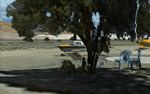
Parker-Carson STOLport is privately owned, public use airfield located east of Carson City, Nevada. Scenery features custom objects, custom terrain textures, HD airport textures (.5 ft/px), traffic, day, night and winter textures, and much more. This is version 2.1.1 of the scenery and is a stand alone install, all previous versions should be removed prior to installation. Created by Dustin Mosher
| Filename: | ParkerCarson_STOLport___Version_211.zip |
| License: | Freeware, limited distribution |
| Added: | 10th December 2009, 00:25:20 |
| Downloads: | 859 |
| Author: | Dustin Mosher |
| Size: | 57.7 MB |
| Category: Flight Simulator 2004 - Scenery | |
| Innsbruck Photoreal v2 |
|
Images related to this file:
File Description:
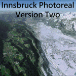
This is a photoreal scenery for the area of Innsbruck Austria for FS2004. it includes full seasonal textures, night time textures, and Autogen for the entire area. compatible with Austria Pro and Aerosoft Approaching Innsbruck.
| Filename: | Innsbruck_Photoreal_v2.zip |
| License: | Freeware, limited distribution |
| Added: | 25th January 2021, 19:20:15 |
| Downloads: | 909 |
| Author: | Joshua Moore |
| Size: | 170.08 MB |
| Category: Flight Simulator 2004 - Scenery | |
| Koyukuk KYU in Alaska |
|
Images related to this file:
File Description:
Koyukuk is a small village on the northern bank of the Yukon River, around 5 miles east of where the river turns from north-south to east-west, east being upstream towards the distant Fairbanks. The mouth of the Koyukuk River that joins the Yukon is just to the east of the village. The population is now under 100 and living from fishing and the land. During the late 1800's the local population lived off the land and also by the spin off from gold mining in the same way as the nearby Nulato, but when in the early 1900's gold mining activities moved to Nome and Fairbanks local prosperity plunged. In fact, the village only became a permanently inhabited establishment in 1939, when a school was built. The airfield is close by and has a gravel runway aligned 6-24 and 4,000 feet long with PAPI on the approach to 6. There is also a shorter and parallel grass runway that is only used in the winter snows by light planes that are on skis and without wheels. Apart from the airfield itself, and it's buildings, this scenery modifies the local land class, adds village buildings while reducing the village size to reality, and creates a new airfield background. Koyukuk is served by Wright Air from Fairbanks in the east and this is included in the AI provided with the post of Nulato. A note here about my scenery making. This is post number 509 and there will not be many more to follow this as I am almost at the end of the photos I either took or found for scenery purposes. There is a limit to what can be located online and I have already been making use of the little there is; eg Unalakleet. So, if you are near an airport (preferably Canadian or Alaskan) and have a camera..... Let me know.
| Filename: | Koyukuk_KYU_in_Alaska.zip |
| License: | Freeware, limited distribution |
| Added: | 30th August 2019, 18:23:12 |
| Downloads: | 125 |
| Author: | Roger Wensley |
| Size: | 3.26 MB |
| Category: Flight Simulator 2004 - Scenery | |
| Bethel area airfields in southwest Alaska close to the Yukon River |
|
Images related to this file:
File Description:
This presumes you have already installed my post of Bethel PABE. In the Yukon River area of Alaska there are a lot of small villages close together, which is unusual for Alaska. Almost all of them are on the coast or a river bank, and the local economies depend on fishing. Some are larger than others and have a fish processing plant, such as in Emmonak. This is the largest such plant and it exports prepared fish by cargo planes which fly in on a daily basis, using an extended runway. This post includes airfields to the south and west of PABE, 17 of them; some of them already included and now modified. There will be more airfields to the north and northwest of Bethel in a future post. There are revisions to Bethel to include parking spaces for Yute Air (newly included here) and extra spaces for Ryan Air. Both of these flew Cessna 205 planes into the smaller village strips from Bethel (past tense as Yute Air recently went bankrupt). The northwest area is served both from Bethel and also from St Mary's PASM, which is in the northwest and at a more economical range to the local airfields (100 miles closer than Bethel). These smaller airfields have few airfield buildings or any other creature comforts; featuring heavily are a new standard blue garage building (sometimes not yet installed) and a small and old terminal shed (that has sometimes collapsed and been removed). Go to "http://vfrmap.com/" for free vfr maps of the area, There is a pic of the local chart area included here. The screenshots are a random sample. Kipnuk PAKI is the one that appears to have a second and long grass runway; what it actually has is the ground prepared for a new and long gravel runway but which hasn't been started yet as it has taken 10 years just to prepare the ground. I have no idea why.
| Filename: | Bethel_area_airfields_in_southwest_Alaska_close_to.zip |
| License: | Freeware, limited distribution |
| Added: | 16th April 2019, 22:47:47 |
| Downloads: | 155 |
| Author: | Roger Wensley |
| Size: | 5.93 MB |
| Category: Flight Simulator 2004 - Scenery | |
| Edson CYET in Alberta, Canada |
|
Images related to this file:
File Description:
Edson is 120 miles west of Edmonton in Alberta, on Highway 16. It was originally named Heatherwood, but that was changed to honour the vice president of the Grand Trunk Pacific Railway when it was made the local railway centre. It thrived, and when Highway 16 was upgraded it thrived even more. Coal mining and industry connected with timber are the main employers of a population of around 8,500. The airport is at the western edge of the town at 3,041 feet asl, with a single lit runway 6,000 feet long and 100 feet wide aligned 07-25, with displaced thresholds and VASI at each end. The two joined aprons are at the eastern end of the airfield, with fire fighting chemical tanks beside the western one which is reserved in the summer months for the Lockheed Electra Air Spray planes; these are included in the AI. The eastern apron is for visiting charters and GA planes, next to a small terminal building. There is further parking on the grass for resident planes next to a large gravel car parking area and clubhouse. As the Air Spray planes would not be fighting fires in the winter there are in fact two editions of the AI, one for the summer fire fighting season and the other for the winter freeze. Use whichever one is appropriate for your flight time; I never strayed far from Ottawa in the winter so for me it is the summer one only. While making this I came across something new in the shape of some incorrectly installed edge lights in the stock fs9 version that refused to be deleted. There is still an "Edson TOP" folder which would normally be used to delete all unwanted taxiway edge lights, but in this case it deletes only some of them. Apologies, but there is nothing more that I can do and so I suggest you use this in daylight only.
| Filename: | Edson_CYET_in_Alberta_Canada.zip |
| License: | Freeware, limited distribution |
| Added: | 10th February 2019, 23:59:04 |
| Downloads: | 148 |
| Author: | Roger Wensley |
| Size: | 7.14 MB |
| Category: Flight Simulator 2004 - Scenery | |
| Dawson Creek CYDQ in British Columbia, Canada |
|
Images related to this file:
File Description:
Dawson Creek is at 2,148 feet asl just east of the Rocky Mountains, less than 10 miles west of the BC/Alberta border. The Peace River, 25 miles north of Dawson Creek, links the two sides of the Rockies, winding through peaks that reach up almost to 8,000 feet. The population grew when the Northern Alberta Railway was extended to Dawsons Creek in 1932, and grew even more more when the Alaska Highway was built in 1942 and Dawsons Creek was where it started from. The airport is just to the east of the town. The runway is 5,000 feet of wide asphalt (150 feet) aligned 06/24, lit, and with PAPI and approach lights. There is a water runway to the north of the main runway with the same alignment, separately designated as Dawson Creek CBD3. The two operate as one; traffic for both use the mandatory frequency of 122.2 and talk to one controller in one control tower. However, in FS9 the ATC for two separately designated airfields operates as if they are nowhere near each other and near misses are the result. I have put them both in un-manned tower mode so you will announce your position and intentions and select your own parking spots etc. There is in reality a lack of apron markings but I have marked the positions of both gates. The apron is not large so there is only one other apron parking spot (see the traffic cone) and most parking is either next to one of the hangars or on the grass. The aprons vary from asphalt, to concrete, onwards to gravel, and then further onwards to some gravel amid the bare dirt; I have replicated this variation as far as FS9 permits. The buildings are bespoke from photos. The AI includes Central Mountain Air with two daily scheduled flights and Northern Cariboo as one of the airlines that occasionally runs charter flights in CYDQ. There are also private GA flights, and float plane flights into and out of CBD3.
| Filename: | Dawson_Creek_CYDQ_in_British_Columbia_Canada.zip |
| License: | Freeware, limited distribution |
| Added: | 22nd November 2013, 23:31:40 |
| Downloads: | 654 |
| Author: | Roger Wensley |
| Size: | 16.65 MB |


© 2001-2026 AVSIM Online
All Rights Reserved
Privacy Policy |