
Where Flight Simulation Enthusiasts Gather from Around the World!
AVSIM Library - Search Results

| Category: Flight Simulator 2004 - Scenery | |
| RPLL Version 8 (Ninoy Aquino Internal Airport, Villamor Airbase, Sangley Airbase and Metro Manila) |

|
Images related to this file:
File Description:
Welcome to the latest version of the RPLL and Metro Manila scenery for FS9. This scenery is a a total rework of my previous scenery and contains a more accurate depiction of the entire metropolis. Over 4 years in the making and is the last upgrade for FS9.
This release coincides the first release sometime August of 2006. This scenery covers an area of around 1,400 sq. km. which includes major cities around Metro Manila: from Taytay in the east to Sangley in the west; from Alabang in the south to Novaliches/Caloocan-Bulacan boundaries in the north.
Sangley (RPLS) Airbase has also been redesigned (only the runway and taxiways). The entire Manila Bay coastline from Sangley to Novaliches has been recreated, adding fish-farms, correct coastal shape, breakwaters, reclaimed areas and marine ports. All major roads and river/water systems are also covered in this scenery.
The RPLL airport scenery contains 90 percent of the existing structures plus noticeable buildings around the vicinity including the new Newport City, Libingan ng mga Bayani, Fedex HQ and MIAA offices; and warehouse around rwys 06 and 24. 80 percent of the structures are individually textured. Also included in the package is Nestor d'Angelos Metro Manila buildings.
| Filename: | RPLL_Version_8_Ninoy_Aquino_Internal_Airport_Villa.zip |
| License: | Freeware, limited distribution |
| Added: | 4th August 2010, 03:48:52 |
| Downloads: | 4,619 |
| Author: | Lowil fred Espada |
| Size: | 25.37 MB |
| Category: Flight Simulator 2004 - Scenery | |
| CYSM - Fort Smith, Northwest Territories, Canada |
|
Images related to this file:
File Description:
Fort Smith is just north of the border between Alberta and Northwestern Territories, midway between Lake Athabasca to the southeast in (mostly) Saskatchewan (80 miles) and Great Slave Lake to the north west (90 miles). The runways all used to be larger, and while I don't know the history it looks as if it is ex-military and these are the remains of what were once 10,000 feet of asphalt. The main runway is now 11/29 and 6,000 feet long, and the secondary one is 1,800 feet of mostly gravel. There is an airline based at the field, Northwestern Air, and fuel (both 100LL and JA-1) is available at a self service point so long as you give it a credit card to read while you fill. The town of Fort Smith is two miles east of the airfield, on the bank of the Slave River and where there are some rapids that require a portage to get around them. Before aviation came along the river was a major route to the north and all those furry animals, which was why the Hudson's Bay Company established an outpost there in 1872. Today it has a population of 2,400 and the main activities are government administration of much of the Northwest Territories, education, and tourism.
| Filename: | CYSM__Fort_Smith_Northwest_Territories_Canada.zip |
| License: | Freeware, limited distribution |
| Added: | 28th January 2012, 17:11:47 |
| Downloads: | 592 |
| Author: | Roger Wensley |
| Size: | 4.29 MB |
| Category: Flight Simulator 2004 - Scenery | |
| CYGQ - Geraldton - Northern Ontario, Canada * Updated * |
|
Images related to this file:
File Description:
This is my last scenery post; read the text note in the zip. This greatly modifies my previous (2009) post of Geraldton, and has more purpose-made buildings. The new version is stand-alone and does not require you to have previously installed Geraldton; it interacts with Dryden and Sioux Lookout for AI flights. Geraldton is in northern Ontario, 70 miles northeast of Thunder Bay and 50 miles east of Lake Nipigon. The town is on the northern shore of Kenogamisis Lake and strung out northwards to the east-west railway line. The population is around 2,400 and the origins are in mining. The airport is a further 3 miles or so north, just south of Hutchison Lake. CYGQ has just over 5,000' of asphalt aligned 08-26; I think there used to be a second runway in a similar arrangement to the one at Dryden, but that was long ago. At the eastern end of the runway there are hangars that turn their back on an irregularly-shaped and seemingly unplanned apron; this is because it was unplanned. There was a large addition made so that fire fighting CL 415 planes could be parked there in the summer, adjacent to tanks containing foam and chemical additivies. The AI (available with my Sioux Lookout and Dryden posts) includes CL 415 flights.
| Filename: | CYGQ__Geraldton__Northern_Ontario_Canada___Updated.zip |
| License: | Freeware, limited distribution |
| Added: | 23rd March 2013, 10:55:04 |
| Downloads: | 428 |
| Author: | Roger Wensley |
| Size: | 4.26 MB |
| Category: Flight Simulator 2004 - Scenery | |
| Nikolski (IKO), Nelson Lagoon (Z73), & Perryville (AK5) - Alaska, USA |
|
Images related to this file:
File Description:
These are villages in Alaska, spread out east and west of Dutch Harbor in the Aleutians and the peninsula, served by Grant Aviation regional flights from Dutch Harbor, Cold Bay, or King Salmon.
Nikolski is 115 miles west of Dutch Harbor at the western end of Umnak Island, which is just west of Unalaska, the large island adjacent to Dutch Harbor. Nikolski is small, with a population of perhaps only 20 now, and the main claim to fame is the wrecked Reeve Aleutian DC3 at the end of the runway. The runway is 3,500 feet of gravel aligned 08-26. Nelson Lagoon is on the north shore of the peninsula, 55 miles north of Sand Point and on a long spit of land that curves around to make the lagoon. There is no access except by boat or plane for the population of around 50. The airfield is a mile east of the village with a gravel runway 08-26, 4,000 feet long. Perryville is on the south shore of the peninsula, 65 miles east of Sand Point. The population is around 115, and the airfield is southwest of the town with the 3,500 feet of gravel runway aligned 02-20 beside the shore. There is a hangar on the apron, but no terminal building.
| Filename: | Nikolski_IKO_Nelson_Lagoon_Z73__Perryville_AK5__Al.zip |
| License: | Freeware, limited distribution |
| Added: | 14th March 2015, 13:27:53 |
| Downloads: | 258 |
| Author: | Roger Wensley |
| Size: | 11.45 MB |
| Category: Flight Simulator 2004 - Scenery | |
| Fort Simpson CYFS in the Northwest Territories, Canada |
|
Images related to this file:
File Description:
Fort Simpson is the sixth in a series of airfields that follow (approximately) in a southward direction the Mackenzie River. At the far northern end of the river is Tuktoyaktuk, then Inuvik, Fort McPherson, Fort Good Hope, Deline, Wrigley, and Fort Simpson Island, all posted. Fort Simpson is at 555 feet asl and on the west bank of the the Liard River, close to Fort Simpson Island and where the Liard and the Mackenzie join up. The town of Fort Simpson is on an island, and has a population of 1,250 or so folks. The Hudson Bay trading post was established here in 1822. The new(er) Fort Simpson airport is just over seven miles south of the town, and has 6,000 feet of asphalt runway. It may be from the WW2 time, as it seems there was originally a second runway which has now totally disappeared, There are scheduled flights by First Air and Air Tindi, plus I have added a Buffalo DC3 and GA. There is a mandatory radio frequency which is for both CYFS and CET4 and in this case I have set the "tower" to "manned" so you will report position and obey instructions. There is fuel available. I have added the ferry at the crossing of the Liard River just south of the field.
| Filename: | Fort_Simpson_CYFS_in_the_Northwest_Territories_Can.zip |
| License: | Freeware, limited distribution |
| Added: | 7th July 2014, 22:46:00 |
| Downloads: | 309 |
| Author: | Roger Wensley |
| Size: | 14.18 MB |
| Category: Flight Simulator 2004 - Scenery | |
| Teslin CYZW in the Yukon, Canada |
|
Images related to this file:
File Description:
Teslin is a village on the Alaska Highway around 85 miles east of Whitehorse, on the banks of the very long Teslin Lake and where there is a sizeable bridge across an offshoot of the lake. The Hudson Bay trading company established a post there in 1903. The current population is a rather meagre 120 or so and the only reason I am making this scenery is that I know one of the 120. This scenery, in addition to the terrain, village, bridge, and airport items also modifies the Alaska Highway. The AI includes a school excursion trip on a chartered Air North Hawker Siddeley 748 on Saturday. There are no scheduled flights to the field. The runway is now around 5,600 feet of gravel aligned 08-26 and with VASI at both ends. It is lit with runway lighting on the tops of traffic cones, and you will need to download the lighting library from my earlier postings of either Allakaket Lights or Anaktuvuk Lights earlier this week. A note here about my scenery making. There will not be many more to follow this as I am almost at the end of the photos I either took or found for scenery purposes, plus I expect to move on from FS9 at some point during next year.
| Filename: | Teslin_CYZW_in_the_Yukon_Canada.zip |
| License: | Freeware, limited distribution |
| Added: | 5th December 2019, 18:37:13 |
| Downloads: | 132 |
| Author: | Roger Wensley |
| Size: | 6.87 MB |
| Category: Flight Simulator 2004 - Scenery | |
| Sioux Lookout CYXL in northern Ontario, Canada, updated |
|
Images related to this file:
File Description:
This greatly modifies my previous post of Sioux Lookout; it is stand-alone and does not require you to have the 2009 version. The AI provided with the post complements what was included with Dryden (March 2013). Sioux Lookout is in northern Ontario, 40 miles east of Dryden, and 145 miles northwest of Thunder Bay. The town is on the northeastern shore of a lake that I don't know the name of (I've been there, but has anyone COUNTED how many lakes Canada has?). It has a population of around 5,000. The main businesses are lumber, tourism, and health care. The airport is immediately adjacent to the northeastern corner of the town, and has 5,300' of asphalt which is aligned 16-34. There are two taxiways which curve and climb up to the apron which is 20 or 30 feet higher. When you taxi on them the knowledge that in reality you would be climbing makes sense of the curved routing. The apron is large and a mixture of asphalt and gravel. I did not make the terminal building and I have no photo or even a recollection of what it looks like, so you should first install Northwest Ontario Airports by Eric O'Link as he has a terminal building for CYXL that might be how it looks; some of his airfields collide with other and newer versions and I have kept only his CYXL and CYPL bgl's.
| Filename: | Sioux_Lookout_CYXL_in_northern_Ontario_Canada_upda.zip |
| License: | Freeware, limited distribution |
| Added: | 19th March 2013, 19:23:24 |
| Downloads: | 405 |
| Author: | Roger Wensley |
| Size: | 5.08 MB |
| Category: Flight Simulator 2004 - Scenery | |
| Smithers CYYD in British Columbia, Canada, Updated |
|
Images related to this file:
File Description:
Made in December 2018 as an update of the original post of 2014, to correct the apron markings, revise the AI, increase the number of GA parking spots, and most importantly to correct the runway lighting by adding the missing approach lights. This scenery is complete and can be installed as-is without first installing the 2014 version. Smithers is in northwest BC, 60 miles east and a bit north of Terrace, and directly east of the southern border of Alaska. The town has a population of 5,500 and is set in a north-south valley between mountains, the most impressive of which is Hudson Bay Mountain to the west. The airport is to the north of the town and has a single runway of 7,544 feet, aligned 33-15. The main user is Central Mountain Air, who are headquartered in Smithers and have a large maintenance hangar there next to the terminal building. The airport has scheduled flights by Central Mountain Air, Jazz, and Hawk Air, which are in the AI. The AI provided here is a new CYYD traffic bgl; in total the AI also includes a Dawson Creek traffic bgl (recently revised and posted) plus a Terrace traffic bgl (which will shortly be revised and posted). An Electra of Conair (who are the largest operator of fire fighting planes in BC, and have re-fill tanks in Smithers) is included and also a HS 748 of Air North.
| Filename: | Smithers_CYYD_in_British_Columbia_Canada_Updated.zip |
| License: | Freeware, limited distribution |
| Added: | 4th January 2019, 18:08:03 |
| Downloads: | 219 |
| Author: | Roger Wensley |
| Size: | 14.22 MB |
| Category: Flight Simulator 2004 - Scenery | |
| VFR of Lario, Area E2 - Como Lake, Italy (Update) |
|
Images related to this file:
File Description:
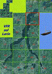
This 8th scenery covers approximately an area of 7.5x6 km, from S.Gregorio/Dongo (NW) to Colico (NE), and S.Siro (SW) to Tremenico/Aveno (SE) and includes six NLC piers: Dervio, Piona, Colico, Dongo, Musso, Pianello del Lario, in addition to the disused Cremia's one; a lot of dedicated buildings are included, as S.Tommaso of Canterbury church and fortification (Corenno), Cistercian abbey (Piona), pier and dock (Colico), S.Stefano church, factory buildings and airpollution control machinery (Dongo), Rezzonico's castle (S.Siro).
This VFR on Lario scenery includes several Dervio's details, and fully revises the previous Dervio scenery; Are included: Boldona's park office and stand, railway station, NLC shiphard, Pontile piers with Concordia steamer, dock bay with small floating pier and compass of the lake, S. Peter and Paul church and houses front of lake, hydro power station, Municipality and some other buildings, Castello's tower, windsurf school, windsurfers and kitesurfers on the lake, cross and Madonna on top of Legnoncino mountain. There are also included two viaducts between the tunnels of the freeway 36, with moted traffic. Catamarans Citta di Como and Tivano at Colico/Dongo piers together with other minor boats and docks alongside the lake coast; a moted regata with catamarans is placed in the lake between Pianello and Dervio.
This scenery SUPERSEDES AND CANCELS the previous "dervio_v2a" one, removed from the library. This is the eighth scenery of the "VFR of Lario" project, made with photorealistic terrain (multiseason & night) and with some 3D GMax realistic objects.
| Filename: | VFR_of_Lario_Area_E2__Como_Lake_Italy_Update.zip |
| License: | Freeware |
| Added: | 25th November 2012, 20:54:39 |
| Downloads: | 1,667 |
| Author: | Aldo Della Vedova, Daniele Lanfranchi, Gian Mario Verga |
| Size: | 39.39 MB |
| Category: Flight Simulator 2004 - Scenery | |
| Fort Smith CYSM in Northwest Territories, Canada Revised |
|
Images related to this file:
File Description:
This is an updated version to remove an incomplete static Beaver reported by Graeme (thanks Cobber) and to include other modifications that I made for my own version since posting the original; different taxiway lights, revised aprons, and in particular the revised AI that I mentioned in the original 2011 post. This is complete and can be installed as-is, or used to modify an existing post by changing the original folder contents. Fort Smith is just north of the border between Alberta and Northwestern Territories, midway between Lake Athabasca to the southeast and Great Slave Lake to the north west. You might stop there when flying between Yellowknife or Hay River to La Ronge or Saskatoon. It looks as if it is ex-military and these are the remains of what were once 10,000 feet of asphalt runways. The main runway is now 11/29 and 6,000 feet long, and the secondary one is 1,800 feet of mostly gravel. There is an airline based at the field, Northwestern Air, and fuel is available at a self service point. The town of Fort Smith is two miles east of the airfield, on the bank of the Slave River and where there are some rapids that require a portage to get around them. Before aviation came along the river was a major route to the north and all those furry animals, which was why the Hudson's Bay Company established an outpost there in 1872. Today it has a population of 2,400 and the main activities are government administration of much of the Northwest Territories, education, and tourism.
| Filename: | Fort_Smith_CYSM_in_Northwest_Territories_Canada_Re.zip |
| License: | Freeware, limited distribution |
| Added: | 23rd January 2019, 19:14:44 |
| Downloads: | 143 |
| Author: | Roger Wensley |
| Size: | 7.16 MB |


© 2001-2026 AVSIM Online
All Rights Reserved
Privacy Policy |