
Where Flight Simulation Enthusiasts Gather from Around the World!
AVSIM Library - Search Results

| Category: Flight Simulator 2004 - Scenery | |
| San Diego VFR Scenery version 2 |

|
File Description:
Compatable only with Ultimate Terrain USA or possibly any scenery that uses realistic coastlines, this file adds many scenery objects to the San Diego, CA area, including the USS Midway, Petco Park, the round hangars on North Island NAS, ships and boats in the bay and lots more. Much improved over version 1.
| Filename: | San_Diego_VFR_Scenery_version_2.zip |
| License: | Freeware |
| Added: | 24th July 2006, 02:17:15 |
| Downloads: | 3,314 |
| Author: | Tim Merrell |
| Size: | 412.26 KB |
| Category: Flight Simulator 2004 - Scenery | |
| KQA Akutan, Alaska |
|
Images related to this file:
File Description:
This is Akutan, which comprises the water airport, the town, and the Trident crab and fish processing plant just to the west of the town. Akutan is in the Aleutians in an inlet on the island of the same name, around 35 miles ENE of Dutch Harbor, and is served by a Grumman Goose amphibian that flies from Dutch Harbor. The population is just over a thousand, though this can increase as more seasonal workers are employed at the plant. The church is not as big as it looks; the long part is a gymnasium. The Ai includes the Akutan end of a Grumman Goose flight from Dutch Harbour (the AI files are part of the Dutch Harbor scenery) which will take off from the Dutch Harbor runway and land on water at Akutan. It will then park at the bottom of the ramp up onto the apron, which is actually usable if you want to taxi up it. In reality it is a PenAir flight, here it is Reeve Aleutian for technical reasons. The Sea AI includes fishing boats from the Trident dock and a Coast Guard cutter from the town dock; the latter as explained in the updated version of Dutch Harbor, which you should already have installed.
| Filename: | KQA_Akutan_Alaska.zip |
| License: | Freeware, limited distribution |
| Added: | 10th August 2012, 16:54:02 |
| Downloads: | 492 |
| Author: | Roger Wensley + Sidney Schwartz |
| Size: | 3.17 MB |
| Category: Flight Simulator 2004 - Scenery | |
| Tauranga Airport, New Zealand NZTG. |
|
File Description:
Welcome to Tauranga, a regional domestic airport serving the City of Tauranga and Mount Maunganui area.
Tauranga is situated in the Bay of Plenty region, on the east coast of the North Island of New Zealand, approximately 200 kilometers south-east of Auckland City.
Requires EZ Scenery Object sets (see INSTALL instructions for details).
| Filename: | Tauranga_Airport_New_Zealand__NZTG.zip |
| License: | Freeware, limited distribution |
| Added: | 6th March 2008, 14:11:29 |
| Downloads: | 1,321 |
| Author: | Lawrie Roache |
| Size: | 1.47 MB |
| Category: Flight Simulator 2004 - Scenery | |
| Auckland 2005 |
|
Images related to this file:
File Description:
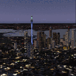
FS2004 Scenery-Auckland 2005,New Zealand Airports&Heliports incl.Auckland Intl,Ardmore, Mechanics Bay, Whenuapai,Hobsonville, North Shore,Pikes Point
and many others.Scenery incl CBD,Sky Tower,Auck Harbour Bridge,and many
other important landmarks. Also incl.excludes files for static scenery. A
major upgrade to the FS2002 scenery...By Savern Reweti, Dean Baunton &
Shayne Butler
| Filename: | Auckland_2005.zip |
| License: | Freeware |
| Added: | 10th March 2010, 22:44:49 |
| Downloads: | 31,139 |
| Author: | Savern Reweti, Deane Baunton and Shayne Butler |
| Size: | 30.37 MB |
| Category: Flight Simulator 2004 - Scenery | |
| Kangiqsualujjuaq CYLU in northern Quebec, Canada |
|
Images related to this file:
File Description:
Kangiqsualujjuaq is in northern Quebec on the east side of Ungava Bay, which is to the east of Hudson Bay and around 150 miles wide and 120 miles deep. Kuujjuaq, the administrative capital of northern Quebec, is 100 miles to the southwest. The town is on the bank of the George River, and has also been known as Fort George River, George River, etc. There was a Hudson Bay trading post at the town's location as early as 1838, though it was closed and reopened more than once and the town did not grow because of the trading post; the Inuit lived on the coast during the summer but moved 30 miles inland in winter for trapping. A cooperative was formed in 1959 to market fish, and this was the creative force that brought about establishment of the town; a school was built in 1963.
The airport is to the north of the town in a valley between the surrounding hills at 215 feet ASL. The gravel runway is just over 3,500 feet long and aligned 16/34; there is no PAPI, but there is fuel available, both 100LL and JetA. There are flights by Air Inuit and a warning of caribou on the runway during October and November.
| Filename: | Kangiqsualujjuaq_CYLU_in_northern_Quebec_Canada.zip |
| License: | Freeware, limited distribution |
| Added: | 1st February 2013, 21:24:55 |
| Downloads: | 277 |
| Author: | Roger Wensley |
| Size: | 2.76 MB |
| Category: Flight Simulator 2004 - Scenery | |
| Coral Harbour CYZS in Nunavut, Canada |
|
Images related to this file:
File Description:
Coral Harbour is on Southampton Island, which partly blocks the northern end of Hudson Bay and is around the size of Switzerland. The village has a population of just under 800 people and is some 200 miles from Cape Dorset, Ivujivik, and Repulse Bay, and 230 miles from Chesterfield Inlet to the southwest. Cape Dorset and Ivujivik have already been posted and Chesterfield Inlet will be posted later this month. The airfield is inland from the village and the 5,000 feet of gravel runway is aligned 155T/335T where T stands for "true" as opposed to magnetic in the Northern Domestic Airspace. JETA-1 fuel is officially available, and in practice so is 100LL, though the latter will be in drums. The visiting AI airlines are First Air and Calm Air.
| Filename: | Coral_Harbour_CYZS_in_Nunavut_Canada.zip |
| License: | Freeware, limited distribution |
| Added: | 29th November 2011, 00:43:08 |
| Downloads: | 370 |
| Author: | Roger Wensley |
| Size: | 3.83 MB |
| Category: Flight Simulator 2004 - Scenery | |
| Merrill Pass |
|
File Description:
FS2004 Scenery - Merrill Pass, Alaska
is one of the main air routes for VFR flight
from the Cook Inlet area, through the Alaska
Range, to the Bristol Bay area. This
fictional scenery places cabins at the lakes
on either side of this pass. Included is a
short flight to show the way through the
mountain pass.
| Filename: | Merrill_Pass.zip |
| License: | Freeware, limited distribution |
| Added: | 13th May 2004, 21:38:55 |
| Downloads: | 2,731 |
| Author: | Tom Fica |
| Size: | 734.97 KB |
| Category: Flight Simulator 2004 - Scenery | |
| DBWsim San Rafael 2005 |
|
File Description:
DBWsim proudly reopens Hamilton AFB in the northern San Francisco Bay Area. Included as well is scenery for the small local airfield of San Rafael. Both airports have been comprehensively redeveloped and the scenery features an improved local landclass.
VERSION 1.1
Major Content inclusion error fixed, the primary scenery for Hamilton AFB is now included in the pack.
| Filename: | DBWsim_San_Rafael_2005.zip |
| License: | Freeware |
| Added: | 28th September 2005, 13:02:06 |
| Downloads: | 3,168 |
| Author: | Derek and Brendan Webb |
| Size: | 1.59 MB |
| Category: Flight Simulator 2004 - Scenery | |
| Forggensee, v2 part 2 |
|
Images related to this file:
File Description:
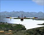
This AI-Package contains several pretty nice AI-Airplanes: Grumman-Albatross HU16,
Grumman-Goose G21, Dornier Do-24K, Junkers Ju-52 and a Bell-47G2 Helicopter on
floats , performing "Touch and Goes" on Water-Runway 21 as well as various beautiful
AI-Boats and two good looking female windsurfer cruising back and force at the lake.
All the attached outstanding AI-Objects have been created by well known designers
(see briefing below). My part was just to prepare them to work with the improved
Forggensee Scenery V2 Part 1.
There is some amazing traffic on the lake, have a look and have fun!
| Filename: | Forggensee_v2_part_2.zip |
| License: | Freeware |
| Added: | 14th April 2011, 02:26:52 |
| Downloads: | 868 |
| Author: | Klaus Jone |
| Size: | 11.12 MB |
| Category: Flight Simulator 2004 - Scenery | |
| LTFD - Edremit Korfez Airport |
|
File Description:
Edremit is a district in the coasts of Aegean Sea, linking to Balýkesir province, in the Marmara region of TURKEY.
Korfez Airport(LTFD) is located in between Kaz mountains and the gulf of Erdemit.
Edremit was founded in BC 1443 with the name of Adramyteion.Here was the most important settlement at that time.
Geographical characteristics of Edremit are determined by Kazdaðý
(Goose Mountain) which enclose the location in north direction.
The South part of Kazdaðý that commands the Gulf is ripped by innumerable deep valleys.The streams sourced from Kazdaðý give life to Edremit Gulf by passing canyons, flowing over waterfalls.
| Filename: | LTFD__Edremit_Korfez_Airport.zip |
| License: | Freeware |
| Added: | 22nd April 2008, 17:36:45 |
| Downloads: | 1,254 |
| Author: | Gökhan Bayrakdar |
| Size: | 7.19 MB |


© 2001-2026 AVSIM Online
All Rights Reserved
Privacy Policy |