
Where Flight Simulation Enthusiasts Gather from Around the World!
AVSIM Library - Search Results

| Category: Flight Simulator 2004 - Scenery | |
| Ketchikan PAKT in southern Alaska plus float planes 5KE and the town |

|
Images related to this file:
File Description:
This is Ketchikan PAKT in southern Alaska, 45 miles north of the Canadian border and 220 miles south of Juneau. It is the closest major Alaskan airport to the lower 48 and most flights from or to Seattle pass through Ketchikan en route. The airport is on the southern side of the stretch of water known as The Narrows and the town is on the northern side, with ferries connecting the two. The town side was somewhat modified as part of one of the three Misty Fjords sceneries, so there were already some marinas and docked cruise liners etc before I started this. In addition, Ketchikan Airport had been partly made way back in 2006, and further modified in 2007; I say "partly" as there is in fact no way to accurately make PAKT within the limitations of FS9 as there is a 50 or 60 feet difference in elevation between runway and apron, and the taxiways are actually ramps up from the apron to the ends of the runway. This has a knock-on effect on the float plane and ferry docks on the water below the airport. I can see why the Misty Fjord sceneries avoided it. This scenery retains the original buildings from the Alan Wright scenery. It also includes the modification made by John Hinson, who created the second taxiway to the western end of the runway; FS9 had not included this as the original airport started operations with only one taxiway in place. There are new vehicles on the apron (fuel etc), new apron markings and some parking modifications to enable AI with Boing 737, DC6, Beechcraft 1900, and GA, plus runway and taxiway signage, windsocks, some car parking, freight items, etc. There is a road and covered bridges down to the docks and ferry, and the town side of the water has been modelled to include other float plane docks along with waterfront buildings, including the ship repair facility with it's dry dock (actually a floating dock that lifts ships out of the water) and the Alaskan Ferry Terminal wharf etc. The ferry forms a part of the AI, generously permitted by FSAddon and originally a part of the payware Tongass Fjords package, as are the AI aircraft also included here. There are new waterside buildings that stretch from the ship repair yard, past the shopping plaza and onward to the stationary cruise liners (that were part of the Tongass payware scenery) including float docks for the float plane companies that are based in Ketchikan, plus a new AI liner. The AI is a further adaptation of the already posted CF36 AI and PAKN AI, as listed in the AI folder. Due to the surrounding hills there may be some interference with AI float aircraft, depending on the wind direction, though I have watched succesful Beaver landings with the wind from the east. The combined AI for float planes creates a float plane take off or landing at, on average, 20 minute intervals; this is still well short of the actual busy summertime period.
| Filename: | Ketchikan_PAKT_in_southern_Alaska_plus_float_plane.zip |
| License: | Freeware, limited distribution |
| Added: | 12th February 2017, 23:27:59 |
| Downloads: | 1,228 |
| Author: | Roger Wensley |
| Size: | 47.11 MB |
| Category: Flight Simulator 2004 - Scenery | |
| Fort Liard CYJF in the Northwest Territories, Canada |
|
Images related to this file:
File Description:
Fort Liard is the seventh in a series of airfields that follow (approximately) the Mackenzie River. At the far northern end of the river there is Tuktoyaktuk, then Inuvik, Fort McPherson, Fort Good Hope, Deline, Wrigley, and then Fort Simpson Island and Fort Simpson, all posted. Fort Liard is at 708 feet asl and on the east bank of the the Liard River, around 130 miles south of Fort Simpson where the Liard and Mackenzie join, and about 25 miles from the borders with both British Columbia and the Yukon. The town has a population of about 560 folks.
The airport is next to the town, and has almost 3,000 feet of gravel runway. I have no information regarding when it was built but it may be from the WW2 time; the cleared and grassed area is long enough for a runway 0f 6,000 feet. There are no scheduled flights but North Cariboo Air have a base at the airport for local charters to support survey teams etc. and are almost an on-demand-scheduled airline. I have also added a Buffalo DC3 and GA. There is fuel available, but only by prior arrangement with North Cariboo. Right hand circuits for runway 20.
| Filename: | Fort_Liard_CYJF_in_the_Northwest_Territories_Canad.zip |
| License: | Freeware, limited distribution |
| Added: | 11th July 2014, 13:38:49 |
| Downloads: | 301 |
| Author: | Roger Wensley |
| Size: | 10.07 MB |
| Category: Flight Simulator 2004 - Scenery | |
| Trail CAD4 in British Columbia, Canada |
|
Images related to this file:
File Description:
Trail is in the valley carved out by the Columbia River, around 7 miles north of the Canada-US border and on both banks of the river. The town has a population of just under 8,000 and the main industry is mining. The airport is around 3 miles south-east of the town and on the east bank, with the runway parallel to the river and aligned 16-34, 75 feet wide and asphalt. There are currently no runway or taxiway lights, though there is an overall improvement programme in place to cope with increasing passenger demand. A new terminal building was recently completed, along with alterations to road access and parking; as I have no information regarding these road changes I have left the original "terminal" building in place and in use by Pacific Coastal, the only airline to fly to Trail. There is a Youtube video which gives a very good idea of the basic facilities, and of the surrounding hilly terrain which is similar to that at Bella Cooola at the far side of Pacific Coastal's coverage area. The original position of the airport in FS9 before I corrected it was best described as "in a hole". The hole remains nearby as there is no easy way to deal with it.
| Filename: | Trail_CAD4_in_British_Columbia_Canada.zip |
| License: | Freeware, limited distribution |
| Added: | 23rd December 2018, 17:27:38 |
| Downloads: | 137 |
| Author: | Roger Wensley |
| Size: | 12.3 MB |
| Category: Flight Simulator 2004 - Scenery | |
| Cape Verde Islands Domestic Airports |
|
Images related to this file:
File Description:
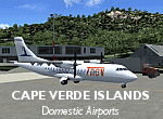
Googlyafcads and simple scenery for five airports in the Cape Verde Islands, all
of which are served by regular domestic flights of TACV - Transportes Aereos de
Cabo Verde. Each of these has been "overlooked" by Microsoft in Flight Simulator
2004 and are provided with nothing other than a runway. These scenery files add
aprons, taxiways, buildings and other airport features to Flight Simulator's bland
representation and allow you and "AI" traffic to land, taxi, park and take off
in a realistic manner.
The airports represented are: GVBA Rabil, GVMA Maio, GVSF Sao Filipe, GVSN Preguica and GVSV Sao Pedro.
The scenery does not purport to be ultra-accurate. Based on high-detail satellite
imagery from Google Earth (except Sao Filipe), the layout is proportianally correct
but the added airport features, such as buildings, are built from default Microsoft
objects and add-on libraries so will not look like the real thing. Sao Filipe is
largely imaginary owing to poor quality of the satellite image, but has been created
to be similar to other airports of like size.
You are not obliged to download and install any additional scenery libraries,
but to enjoy this scenery in its entirety, you may wish to. It will work fine,
with or without.
[File re-uploaded at request of AVSIM]
| Filename: | Cape_Verde_Islands_Domestic_Airports.zip |
| License: | Freeware |
| Added: | 15th June 2010, 01:00:46 |
| Downloads: | 6,995 |
| Author: | John Hinson |
| Size: | 84.1 KB |
| Category: Flight Simulator 2004 - Scenery | |
| LKKV - Karlovy Vary Version 1.1 |
|
Images related to this file:
File Description:

Karlovy Vary (former Karlsbad) is a small regional airport in the Czech Republik a 100 miles northwest of the capital Prag. It has only one cennection to Moskau Sheremetjewo, but will start a additional service to Düsseldorf in Germany this summer 2018. This is (in parts) a rework of the great scenery Karlova Vary for FSX made by Milan Puta, Vojtech Cerny and Pavel Brodsky. As special service for FSX users, a FSX AFCAD (as alternative) is added to this package. This new version replaces the former version 1.0 with missing texture files, apron fences and the missing firestation building.
| Filename: | LKKV__Karlovy_Vary_Version_11.zip |
| License: | Freeware |
| Added: | 17th December 2017, 20:27:26 |
| Downloads: | 511 |
| Author: | David Kolas |
| Size: | 4.17 MB |
| Category: Flight Simulator 2004 - Scenery | |
| LHDC Debrecen, Hungary |
|
File Description:
LHDC Debrecen, Hungary. Not finished versuon of Debrecen Airport. This scenery is for those, who asked me to create a scenery for a fly-in. Because of I don't have much time, I released a beta version, so they can use it for the fly-in. Only some buildings and ground macros missing. The apron and the runway(s) are done. Night lighting adde. V1.0 'll be released after I finshed my exams at the university. Enjoy! Good flyin' pilots! P.S:AFCAD 2 file inluded with the new ILS on RWY 05R: FREQ:110.1MHz, ID:DCN, CRS:045*.
| Filename: | LHDC_Debrecen_Hungary.zip |
| License: | Freeware |
| Added: | 6th June 2004, 17:15:10 |
| Downloads: | 763 |
| Author: | Kornél Várhelyi |
| Size: | 728.88 KB |
| Category: Flight Simulator 2004 - Scenery | |
| Budd Lake Airfield |
|
File Description:
FS2004 Scenery - This is another retro scenery I found interesting enough to design for your flying enjoyment.Budd Lake Airfield,Budd Lake, NJ was apparently opened at some point between 1945-49, as it was not depicted at all on the 1945 NY Sectional Chart nor on the 1947 USGS topo map.
The earliest depiction of the airfield which has been located was on the 1949 NY Sectional Chart. The airport began business shortly after WW2. The property owner's son wanted a place close to home where he could learn to fly & keep his airplane. Created with Instant Scenery by John B. Loney, Jr.
| Filename: | Budd_Lake_Airfield.zip |
| License: | Freeware, limited distribution |
| Added: | 2nd January 2009, 01:54:04 |
| Downloads: | 235 |
| Author: | John B. Loney, Jr. |
| Size: | 2.82 MB |
| Category: Flight Simulator 2004 - Scenery | |
| Salbani, India |
|
File Description:
You will need to download the original MCDMil.zip package by Michael Carr in order to use the MCD textures.
Based on 356 Squadron Salbani WW2 airport, India. A contemporary rendition. Yep, the main runway is just long enough for the Liberator to take off. There's even a camp cinema, (at night-time, you will see my Dad in the projection box). Developed mainly for eye-candy....oh and you must fly to the nearby camp, (but be careful of those tanks on the practice-range). I've placed a heli runway at the camp for AI purposes.
| Filename: | Salbani_India.zip |
| License: | Freeware, limited distribution |
| Added: | 12th February 2009, 21:01:00 |
| Downloads: | 336 |
| Author: | Godfrey Tier |
| Size: | 2.01 MB |
| Category: Flight Simulator 2004 - Scenery | |
| Deep Forest FD48 |
|
Images related to this file:
File Description:
FS2004 Scenery - Deep Forest (FD48) was acivated on 10/01/1985, on 50 acres. The airport is privately owned by George Hodges, Jr. Deep Forest is located in Jacksonville, FL.There are two aircrafts on the ground at Deep Forest. Both are jet aircraft. Runway stats: 18/36, Length: 6425 ft, Width: 60 ft, runway surface is asphalt or bituminous concrete.
This scenery was created in default FS9 using Instant Scenery. Compatible with UT and FSX, with two file changes for FSX. Read the readme file for instructions. By John B. Loney, Jr.
| Filename: | Deep_Forest_FD48.zip |
| License: | Freeware, limited distribution |
| Added: | 2nd November 2009, 20:02:29 |
| Downloads: | 185 |
| Author: | John B. Loney, Jr. |
| Size: | 711.8 KB |
| Category: Flight Simulator 2004 - Scenery | |
| FinneyGround_VERT_GSE for Rwy12 |
|
File Description:
This is a set of Ground Support Equiptment objects for Rwy12.
These objects were created in GMax and textured by Robert "Lt.Finney" Finnegan, and modified,grouped and formatted for Rwy12 by Gary "Gman" Mills.
These objects were custom made for use with the VERTva.com Base Sceneries so that our users could have some fun populating the VERT bases to give them some signs of activity. And of course they work well at any airport, and in some cases seaports, factories, heliports, etc.
For more information on VERTva Base sceneries, visit VERTva.com
This is #1 of 3 files
| Filename: | FinneyGround_VERT_GSE_for_Rwy12.zip |
| License: | Freeware, limited distribution |
| Added: | 17th September 2005, 00:36:55 |
| Downloads: | 8,207 |
| Author: | Robert Finnegan Gary Mills |
| Size: | 1.82 MB |
© 2001-2026 AVSIM Online
All Rights Reserved
Privacy Policy |