
Where Flight Simulation Enthusiasts Gather from Around the World!
AVSIM Library - Search Results

| Category: Flight Simulator 2004 - Scenery | |
| Rome Fiumicino Area 2013 |

|
Images related to this file:
File Description:
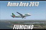
Dear Friends simmer, as always taking advantage of the beautiful objects bgl Gianluca Giovannini, I tried to improve with a symmetric pairing of autogen trees / towns / industrial buildings and grass in 3-D, the urban area near the Intercontinental Airport in Rome Fiumicino in the amazing scenery by the ISD project. "With the current integration I have created the town of Fiumicino located on the south west of the airport.The scenery is based videos of real landing and satellite photos availables on the web.
The purpose of visualization tasks is an overall improvement of the work of Leonardo da Vinci airport . The scenery is designed only for ISD project (even better with UTE by Flight one software), but i dont exclude that (which you should remove the file from the folder scenery the bgl Groups houses) or the more recent Payware published by Aerosoft. Most information inside the read me file. Best regards from Italy, Fafo !
| Filename: | Rome_Fiumicino_Area_2013.zip |
| License: | Freeware |
| Added: | 24th February 2013, 01:02:07 |
| Downloads: | 3,480 |
| Author: | Fabio Ferrari "fafo air" |
| Size: | 4.28 MB |
| Category: Flight Simulator 2004 - Scenery | |
| RPLL Version 8 (Ninoy Aquino Internal Airport, Villamor Airbase, Sangley Airbase and Metro Manila) |
|
Images related to this file:
File Description:
Welcome to the latest version of the RPLL and Metro Manila scenery for FS9. This scenery is a a total rework of my previous scenery and contains a more accurate depiction of the entire metropolis. Over 4 years in the making and is the last upgrade for FS9.
This release coincides the first release sometime August of 2006. This scenery covers an area of around 1,400 sq. km. which includes major cities around Metro Manila: from Taytay in the east to Sangley in the west; from Alabang in the south to Novaliches/Caloocan-Bulacan boundaries in the north.
Sangley (RPLS) Airbase has also been redesigned (only the runway and taxiways). The entire Manila Bay coastline from Sangley to Novaliches has been recreated, adding fish-farms, correct coastal shape, breakwaters, reclaimed areas and marine ports. All major roads and river/water systems are also covered in this scenery.
The RPLL airport scenery contains 90 percent of the existing structures plus noticeable buildings around the vicinity including the new Newport City, Libingan ng mga Bayani, Fedex HQ and MIAA offices; and warehouse around rwys 06 and 24. 80 percent of the structures are individually textured. Also included in the package is Nestor d'Angelos Metro Manila buildings.
| Filename: | RPLL_Version_8_Ninoy_Aquino_Internal_Airport_Villa.zip |
| License: | Freeware, limited distribution |
| Added: | 4th August 2010, 03:48:52 |
| Downloads: | 4,609 |
| Author: | Lowil fred Espada |
| Size: | 25.37 MB |
| Category: Flight Simulator 2004 - Scenery | |
| Prudhoe Bay area on Alaska North Slope US |
|
Images related to this file:
File Description:
The Prudhoe Bay area of the Alaska north slope is dominated by all the equipment and machinery that is necessary for the extraction of oil and its transfer by the pipeline that reaches south to Valdez. Prudhoe Bay airport is now closed, and its replacement just to the south is Deadhorse PASC, with numerous storage, maintenance, and accomodation areas immediately to the north of the apron, and others adjacent to the road between the two. The runway is just under 6,500 feet with approach lights at both ends and ILS on 04 (true heading of 75 degrees). This scenery reflects the overall situation in 2011 and oil production facilities and buildings are included here. The airport buildings and those close to the airport are replicas of the real life buildings; while as distance increases the accuracy fades somewhat there are everywhere replica trucks and cross country vehicles that are true to life. Deadhorse handles around 7,000 passengers per month as staff are rotated in and out on Alaska Air and ERA flights and by oil company private flights. There are also freight flights to complement the trucking effort up the Dalton Highway. The Alaska Airlines terminal building and ERA (the red buildings nearby) are at one end of the apron, while at the other end is a very large and new green terminal, storage, hangar building built by the airport authority. All of the airport components, runways, taxiways, and aprons, are built up on a gravel base to raise them above the surrounding terrain that floods with melting snow, freezes, or dries out, according to the seasons. There are other new airstrips included here that serve the oil industry. Around 33 miles to the east is Badami PABP airport servicing a subsiduary oil producing area, with 5,000 feet of gravel runway. Some 28 miles to the west of Deadhorse is Ugnu-Kuparuk UBW with just over 6,000 feet of gravel (gravel in 2011, it is now asphalted) servicing oil production by Conoco Phillips, which uses 737's to fly staff in and out. A further 32 miles west is Alpine AK15 with 5,400 feet of gravel and also served by the Conoco Phillips 737's. To the south of Alpine and connected by road is the village of Nuiqsut. To the north of Alpine and reachable only by air in the delta of the Sagavanirktok River is CD-3, an oil collection and pump station area with another gravel runway of 3,000 feet. Other airstrips that were prviously posted are now updated, Nuiqsut and Oliktok. I experimented, but decided against trying to reproduce the several hundred miles of pipelines. The are new AI aircraft, and there are notes regarding downloading. There is a new "cement" texture (not its name, but used as that by SBuilder) for the built up gravel bases. It is slightly darker than the original but not so much that any previous use will be spoilt. You may wish to download my "Alaska Frozen Rivers and Lakes" which freezes lakes and the northern sea and makes them landable on wheels.
| Filename: | Prudhoe_Bay_area_on_Alaska_North_Slope_US.zip |
| License: | Freeware, limited distribution |
| Added: | 19th December 2017, 00:38:06 |
| Downloads: | 583 |
| Author: | Roger Wensley |
| Size: | 28.54 MB |
| Category: Flight Simulator 2004 - Scenery | |
| Hydroport |
|
File Description:
This is a neat little airport 30k appx. west of cyvr (Vancouver,B.C>). It has VOR, NDB, ILS, & ai ready parking. Also there is a hangar with movable doors operated by your radio on NAV 1. All the pertinent numbers for all of the above are in the readme file. There are also some boats just off shore. The town is Nanaimo. There are some LAGO sound files in another file I will upload shorty.
| Filename: | Hydroport.zip |
| License: | Freeware |
| Added: | 12th January 2006, 05:37:55 |
| Downloads: | 1,915 |
| Author: | Robert Lacy |
| Size: | 5.57 MB |
| Category: Flight Simulator 2004 - Scenery | |
| Rangsdorf Airfield |
|
Images related to this file:
File Description:
Rangsdorf Airfield, the place where Graf Schenk von Stauffenberg once enter a aircraft to kill the fuehrer of the third reich adolf hitler. It was closed in 1990. In former times it was used by the soviet army as helicopter base. In the beginning, it was the homebase of buecker flugzeugwerke till world war II. The airfield is located ca. 2 miles south of Berlin-Schoenefeld Airport which will soon be Berlin-Brandenburg International.
| Filename: | Rangsdorf_Airfield.zip |
| License: | Freeware |
| Added: | 19th July 2014, 17:24:03 |
| Downloads: | 403 |
| Author: | David Kolas |
| Size: | 10.24 MB |
| Category: Flight Simulator 2004 - Scenery | |
| Hausen am Albis (LSZN) |
|
File Description:
Very detailed and accurate small airfield with a unique atmosphere with an asphalt and a grass runway
close to the city of Zug in the centre of Switzerland with the newest textured airport buildings and a monastery
all made by digital photographs. The autogen scenery has been modified to show correct forests,
fields, towns and roads. Static aircrafts and gliders, cars and caravans
smoke effects dynamic wind sail and a visual approach chart are available.
| Filename: | Hausen_am_Albis_LSZN.zip |
| License: | Freeware, limited distribution |
| Added: | 13th September 2003, 17:28:19 |
| Downloads: | 6,081 |
| Author: | Andreas Hegi |
| Size: | 2.63 MB |
| Category: Flight Simulator 2004 - Scenery | |
| Scenery-West Memphis Municipal, AR |
|
File Description:
FS2004 Scenery-West Memphis Municipal Airport, AR (KAWM) serves West Memphis and Crittenden County and is owned by the City Of West Memphis. The paved runway extends for 6003 feet. The facility is at an elevation of 212 feet at a distance of about 3 miles from West Memphis. Animated scenery created with FSDS2, Rwy12 and Lago's FSE. AFCAD2 file extensively modified. Textures the FSDS2 module are included. By John B. Loney, Jr.
| Filename: | SceneryWest_Memphis_Municipal_AR.zip |
| License: | Freeware |
| Added: | 25th November 2005, 17:07:29 |
| Downloads: | 763 |
| Author: | John B. Loney, Jr. |
| Size: | 969.29 KB |
| Category: Flight Simulator 2004 - Scenery | |
| Viva Scenery Volume 3 |
|
File Description:
Re-upload. This is a collection of scenery enhancements for smaller airports, mostly in British Columbia. It was not our intention to do anything fancy or particularly accurate, but simply to make the default scenery less boring and more fun. There are 127 airports in Volume 3. We've also included some general aviation AI traffic for many of these airports. The scenery for any individual airport may be removed without affecting the other airports.
| Filename: | Viva_Scenery_Volume_3.zip |
| License: | Freeware |
| Added: | 21st June 2010, 11:07:44 |
| Downloads: | 1,725 |
| Author: | Sidney Schwartz & Peter Ham |
| Size: | 11.12 MB |
| Category: Flight Simulator 2004 - Scenery | |
| Pete & Sid's Viva Scenery Volume 3 |
|
File Description:
Re-upload. This is a collection of scenery enhancements for smaller airports, mostly in British Columbia. It was not our intention to do anything fancy or particularly accurate, but simply to make the default scenery less boring and more fun. There are 127 airports in Volume 3. We've also included some general aviation AI traffic for many of these airports. The scenery for any individual airport may be removed without affecting the other airports.
| Filename: | Pete__Sids_Viva_Scenery_Volume_3.zip |
| License: | Freeware |
| Added: | 8th December 2011, 09:00:33 |
| Downloads: | 898 |
| Author: | Sidney Schwartz & Peter Ham |
| Size: | 11.12 MB |
| Category: Flight Simulator 2004 - Scenery | |
| Stealth AFB |
|
File Description:
This is a huge airport which can accomdate the Anotov. 3 runways. VOR, NDB, ILS numbers are in the readme file. Also a radio operated hangar door which opens and closes when you are in front of the hangar. Nav 1. To close simply change the nav 1 freq number. This is located in the Sahara, town is Sebha in Lybia. I designed this by request for a good friend in the Netherlands.
| Filename: | Stealth_AFB.zip |
| License: | Freeware |
| Added: | 12th January 2006, 05:45:10 |
| Downloads: | 632 |
| Author: | Robert Lacy |
| Size: | 21.8 MB |
© 2001-2026 AVSIM Online
All Rights Reserved
Privacy Policy |