
Where Flight Simulation Enthusiasts Gather from Around the World!
AVSIM Library - Search Results

| Category: Flight Simulator 2004 - Scenery | |
| Galena PAKP in Alaska |

|
Images related to this file:
File Description:
Galena is a village on the Yukon River, around 30 miles east of the corner where the westward running river turns south. The population is just under 500 and the city is noted for its educational facilities that attract residential students from across the state. Adjacent to the city is the Galena Air Force Station that previously shared the use of the Edward G. Pitna Snr. airport until 2007, when the station was closed and the air force personnel left. The station facilities have been taken over by the community and the airport became the largest state-maintained airport in the interior of Alaska. Substantial resurfacing and finishing work was then carried out, and the new asphalt runway is now 6,000 feet long and aligned 7-25, with VASI at both ends and ILS on 25. There is a secondary gravel runway beside part of the main asphalt runway, and this is treated in radio announcements as if it is not a separate runway and landing or take off are on the adjacent asphalt. The airport is serviced by ERA (now called Ravn) and Wrights Air, with cargo flights by the eternal Everts. Included here is a small modification for Allakaket, which deletes a single remaining stock FS9 taxiway light. The AI included here also provided Allakaket with a Saturday Everts delivery flight, but I neglected to mention that before. A note here about my scenery making. There will not be many more to follow this as I am almost at the end of the photos I either took or found for scenery purposes, plus I expect to move on from FS9 at some point during next year.
| Filename: | Galena_PAKP_in_Alaska.zip |
| License: | Freeware, limited distribution |
| Added: | 27th November 2019, 19:14:00 |
| Downloads: | 256 |
| Author: | Roger Wensley |
| Size: | 13.95 MB |
| Category: Flight Simulator 2004 - Scenery | |
| Bella Bella AI |
|
File Description:
This scenery is located in B.C Canada. All default enhanced. Traffic starts at 12:00 GMT
Airport name's,
1.Bella Bella(CYJQ). AI traffic doing touch and go's. Tune in 122.8 to listen to traffic at both airstrips.
2.Bella Bella(CAF2) AI doing Touch and go's.
Aircraft involved: Dc3, Both the vega's, and the Ryan.
| Filename: | Bella_Bella_AI.zip |
| License: | Freeware |
| Added: | 9th November 2003, 09:54:41 |
| Downloads: | 1,825 |
| Author: | Frank Betts |
| Size: | 1.61 MB |
| Category: Flight Simulator 2004 - Scenery | |
| Copenhagen Kastrup East addon for Aerosoft EKCH |
|
File Description:
Addon to Aerosoft EKCH scenery. This scenery covers the east aera of Copenhagen Kastrup airport.
The scenery covers the area along the road “Kystvejen”. It starts beside the SAS hangars and
in this scenery it ends just before RWY30. All the buildings along this road are designed and
placed according to the locations, which fits to the Aerosoft scenery.
| Filename: | Copenhagen_Kastrup_East_addon_for_Aerosoft_EKCH.zip |
| License: | Freeware |
| Added: | 31st January 2006, 15:27:00 |
| Downloads: | 3,316 |
| Author: | Claus Hansen |
| Size: | 3.96 MB |
| Category: Flight Simulator 2004 - Scenery | |
| Fresno, CA KFAT |
|
File Description:
This is a small enhancement to Fresno Air Terminal. It will liven things up a bit at this small California airport. Jetways and a new terminal building with lighting as well as an accurate AFCAD are included. Many thanks to the guys at RWY12 and S. Ansari for the programs and macros which make this possible.
| Filename: | Fresno_CA_KFAT.zip |
| License: | Freeware |
| Added: | 29th October 2005, 05:31:57 |
| Downloads: | 3,024 |
| Author: | William Morgan/FRF Studio |
| Size: | 523.8 KB |
| Category: Flight Simulator 2004 - Scenery | |
| Jetways for Dallas Love Field |
|
File Description:
Jetways for Dallas Love Field in Dallas TX.
Also include are an Afcad2 file (required
for correct aircraft positioning at gates)
and a set of custom flight plans for the
airport. Before attempting to install this
scenery please be aware that you must have
first installed the file FS9JETS.ZIP - See
the README FIRST.txt file for more details
| Filename: | Jetways_for_Dallas_Love_Field.zip |
| License: | Freeware, limited distribution |
| Added: | 25th January 2004, 20:23:20 |
| Downloads: | 1,915 |
| Author: | Patrick Finch |
| Size: | 126.15 KB |
| Category: Flight Simulator 2004 - Scenery | |
| Emergency Services Mission 2010-004 |
|
Images related to this file:
File Description:
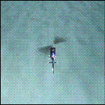
This is a series of missions called Emergency Services. All mission are flown using the Bell 206B JetRanger Helicopter. You may be flying for Fire Rescue, Medical Rescue or for the Police. In this mission you will be flying for Fire Rescue out of Half Moon Bay Airport in Half Moon Bay, CA. Your incident number is 2010-004
| Filename: | Emergency_Services_Mission_2010004.zip |
| License: | Freeware |
| Added: | 13th May 2010, 03:13:52 |
| Downloads: | 251 |
| Author: | David J Crandall |
| Size: | 3.78 MB |
| Category: Flight Simulator 2004 - Scenery | |
| St Clair Regional K39 |
|
Images related to this file:
File Description:
FS2004 Scenery - St Clair Regional Airport (K39) serves St Clair and Franklin County and is owned by the City Of St Clair, Missouri, USA. The paved runway extends for 3200 feet. The facility is at an elevation of 654 feet at a distance of about 2 miles from St Clair. Created with Instant Scenery by John B. Loney, Jr.
| Filename: | St_Clair_Regional_K39.zip |
| License: | Freeware, limited distribution |
| Added: | 2nd November 2009, 19:56:50 |
| Downloads: | 187 |
| Author: | John B. Loney, Jr. |
| Size: | 9.51 MB |
| Category: Flight Simulator 2004 - Scenery | |
| Carroll County-Tolson KTSO |
|
Images related to this file:
File Description:
FS2004 Scenery - Carroll County-Tolson Airport (KTSO) serves Carrollton and Carroll County, OH USA and is owned by Carroll County Arpt Auth. The paved runway extends for 4300 feet. The facility is at an elevation of 1163 feet at a distance of about one mile from Carrollton. Created with Instant Scenery by John B. Loney, Jr.
| Filename: | Carroll_CountyTolson_KTSO.zip |
| License: | Freeware, limited distribution |
| Added: | 2nd November 2009, 19:59:13 |
| Downloads: | 200 |
| Author: | John B. Loney, Jr. |
| Size: | 409.91 KB |
| Category: Flight Simulator 2004 - Scenery | |
| Italy, Marche 3, Ancona, Photo Real |
|
Images related to this file:
File Description:

Marche, Italy, Photoreal Scenery Part 3 (Ancona). The photoreal scenery covers a great area of Marche around the city of Ancona. The airport of Ancona (ICAO code LIBP) is found near the scenery (see map). For the best results, use it in association with other parts of Marche photoreal: Marche 1 Ascoli Piceno, Marche 2 Macerata.
| Filename: | Italy_Marche_3_Ancona_Photo_Real.zip |
| License: | Freeware |
| Added: | 31st May 2010, 10:27:48 |
| Downloads: | 5,270 |
| Author: | Fulvio Mazzokan |
| Size: | 92.97 MB |
| Category: Flight Simulator 2004 - Scenery | |
| Italy, Lazio 5, Gaeta, Photo Real |
|
Images related to this file:
File Description:
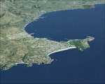
Lazio, Italy, Photoreal Scenery Part 5 (Gaeta).
The photoreal scenery covers a great area of Lazio around the city of Gaeta. The airport of Frosinone (LIRH) is found near the scenery (see map). For the best results, use it in association with other parts of Lazio photoreal: Lazio 1 Viterbo, Lazio 2 Roma, Lazio 3 Rieti, Lazio 4 Latina.
| Filename: | Italy_Lazio_5_Gaeta_Photo_Real.zip |
| License: | Freeware |
| Added: | 9th June 2010, 14:38:00 |
| Downloads: | 8,202 |
| Author: | Fulvio Mazzokan |
| Size: | 92.01 MB |
© 2001-2026 AVSIM Online
All Rights Reserved
Privacy Policy |