
Where Flight Simulation Enthusiasts Gather from Around the World!
AVSIM Library - Search Results

| Category: Flight Simulator 2004 - Scenery | |
| Fronconia NH 1B5 |

|
File Description:
This is my first attempt at making any kind of scenery for Flight Simulator. I live in Boston and love getting up into the White Mountains both in Summer and in Winter, so I decided to use my ultimate power of MSFS Eminent Domain and evicted the owners of this small private field right in the heart of the Presidential Range in order to create a fictionalized Pilot's home. It's nothing fancy, but it is a nice base for VFR flights throughout the region. We don't have the drastic vertical topography as many other places around the world here in New England, but I guarantee you that we have some of the prettiest, especially in the fall.
I hope you enjoy, and if you have any problems please e-mail me at [email protected]
Thanks,
John Combs
| Filename: | Fronconia_NH_1B5.zip |
| License: | Freeware |
| Added: | 28th June 2004, 16:05:56 |
| Downloads: | 489 |
| Author: | John Combs |
| Size: | 175.3 KB |
| Category: Flight Simulator 2004 - Scenery | |
| Fairbanks International PFAF Float Base in Alaska |
|
Images related to this file:
File Description:
This is the floatplane base which is part of Fairbanks International Airport, PFAF. It has a separate PAFX identifier here due to the limitations of AI in FS9. Though it doesn't come close to the activity level of Lake Hood in Anchorage Alaska it is still a fairly busy place. In Fairbanks there is this floatbase, Chena Marina to the southwest, Chena River to the northwest, and Metro Field to the east between Fairbanks and the river. You will need Ultimate Terrain Alaska Canada, and you must first install the version of Fairbanks International PFAF by William Morgan, as this scenery was the starting point for the floatplane base scenery, and without it the result would be disappointing. There are scenery and land class files, files that modify PFAF, AFCAD for AI, and a traffic file.
| Filename: | Fairbanks_International_PFAF_Float_Base_in_Alaska.zip |
| License: | Freeware, limited distribution |
| Added: | 19th August 2010, 22:55:46 |
| Downloads: | 796 |
| Author: | Roger Wensley |
| Size: | 1.03 MB |
| Category: Flight Simulator 2004 - Scenery | |
| Wunstorf AB - Germany |
|
Images related to this file:
File Description:
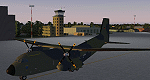
Wunstorf Air Base was originally opened in 1936 for the National Socialist Luftwaffe. Like most German airfields it did arduous duty during the Second World War. When the allies finally concluded their occupation the field was eventually returned to German control and hosted it's first German transport unit flying the Nord Atlas. This aircraft was replaced in 1971 with the current Transall 160 aircraft. With the recent adoption of the Airbus A400M by the Luftwaffe, Wunstorf is undergoing some significant remodeling including lengthening of runway 8-26 as well as construction of two new modern hangars and associated support buildings. This scenery is intended to be used with the great Transall 160 package by Ray Parker (available at Avsim.net as (gaf_c-160_transall.zip) but will of course accomodate any aircraft and is in itself a complete scenery package.
| Filename: | Wunstorf_AB__Germany.zip |
| License: | Freeware, limited distribution |
| Added: | 13th April 2014, 14:08:22 |
| Downloads: | 1,512 |
| Author: | John Stinstrom |
| Size: | 6.58 MB |
| Category: Flight Simulator 2004 - Scenery | |
| Level-D 767-300ER Wing Views |
|
File Description:
Wing views for Boeing 767-300ER by Level-D
| Filename: | LevelD_767300ER_Wing_Views.zip |
| License: | Freeware, limited distribution |
| Added: | 17th January 2006, 04:51:25 |
| Downloads: | 2,061 |
| Author: | Rafal Haczek |
| Size: | 4.64 KB |
| Category: Flight Simulator 2004 - Scenery | |
| Inuvik CYXT in the Northwest Territories, Canada |
|
Images related to this file:
File Description:
Inuvik is a town of 3,500 or so inhabitants at N68 18 W133 29, which puts it 120 miles inside the Arctic Circle on the east side of the Mackenzie River delta and around 90 miles from where the Mackenzie meets the Beaufort Sea. There is a Canadian Forces base at the eastern end of the field, with shelters for six F18 fighters; the base in one form or another has been there for a while and is the reason for the generous length of asphalt runway.
Inuvik was established in the early 1960's as a replacement regional center for Aklavik which is 40 miles to the west across the delta and which flooded on a regular and inconvenient basis. This probably works without Ultimate Terrain but I haven't tested it. I also haven't tested it in FSX but I was told it works there too.
| Filename: | Inuvik_CYXT_in_the_Northwest_Territories_Canada.zip |
| License: | Freeware, limited distribution |
| Added: | 6th October 2010, 13:22:04 |
| Downloads: | 943 |
| Author: | Roger Wensley |
| Size: | 4.12 MB |
| Category: Flight Simulator 2004 - Scenery | |
| Talkeetna Village AK44 in Alaska, REVISED |
|
Images related to this file:
File Description:
The town of Talkeetna is around 75 miles north of Anchorage in Alaska, on the east shore of the Susitna River where the Susitna, Talkeetna, and Chulitna rivers join. The town is where Don Sheldon started Talkeetna Air Services. His story is told in "Wager With The Wind" by James Greinar and is well worth reading for the descriptions of mountain flying. There are two airfields at Talkeetna, PATK with its long asphalt runway and Talkeetna Village AK44 in the town. This is AK44; measuring the space left for the runway between the river bank in the south and the curve in the road that marks the north end of the field there is just enough space for the 900 feet of runway that is described in the book. The result is a step back in time to 1973, when the second hangar was built. Neither hangar has survived to today.
| Filename: | Talkeetna_Village_AK44_in_Alaska_REVISED.zip |
| License: | Freeware, limited distribution |
| Added: | 18th April 2010, 09:52:26 |
| Downloads: | 871 |
| Author: | Roger Wensley |
| Size: | 3.47 MB |
| Category: Flight Simulator 2004 - Scenery | |
| Oberpfaffenhofen v2.2 |
|
Images related to this file:
File Description:
This factory airport is located in the west of Munich (lovely Bavaria, South-Germany).The simulated version of the airport I dedicated to Claude Dornier, one of the
very famous aviation pioneers in the last century. Civil and military aircraft are manufactured and/or serviced on this airport. Over the years the ownership has changed in 1996 from Dornier to Fairchild/Dornier and in December 2002 to RUAG (Swiss Company). The airport also is hosting the "DLR" (German Aerospace Center) at the south western part of the field.
Version 2.2 replaces version 1 and 2.1 completely. Several airport buildings have
been modified and all the scenery textures have been converted to the DXT1/DXT3 format.
All EZ-Scenery BGL's and Textures are on board, therefore no further library downloads
are required. Gentlemen, it's time to get the weather briefing.
Re-upload.
| Filename: | Oberpfaffenhofen_v22.zip |
| License: | Freeware |
| Added: | 8th April 2011, 11:44:36 |
| Downloads: | 2,556 |
| Author: | Klaus Jone |
| Size: | 32.76 MB |
| Category: Flight Simulator 2004 - Scenery | |
| Webster OFL (KNUI) for UT/USA |
|
File Description:
Webster Field is an outlying airport realted to PAX Naval Air Test Center in Maryland. According to what I have read, they use the airport mainly to test unmanned aircraft.
In a support note I saw an image of this airfield in Ultimate Terrain showing its runways extending out into the water. So I fixed it. I couldn't find much more info on it other than that on www.AirNav.com, so I've just kept the default layout for the most part. I did have to rotate the runways a bit to match the satellite photo about 10 degrees for 14/32. I kept the runway labels, however as that is how they are listed in Airnav and show up in the satellite photo. If anyone has any further info I'd be happy to add to it.
This version is meant for use with Ultimate Terrain USA.
| Filename: | Webster_OFL_KNUI_for_UTUSA.zip |
| License: | Freeware |
| Added: | 23rd February 2006, 05:20:49 |
| Downloads: | 377 |
| Author: | Thomas Perry |
| Size: | 218.88 KB |
| Category: Flight Simulator 2004 - Scenery | |
| Tillsonburg CNQ4 in Ontario Canada REPLACEMENT |
|
File Description:
This is a replacement (though complete in itself) for my original Tillsonburg post with the corrected office building included. Tillsonburg is a small town in southwest Ontario, mid way between Toronto, Buffalo, and Detroit. The airfield is some four miles north of the town. It was originally built by the RCAF as an emergency grass field to support flying training in WW2. It now has two grass runways, each 2,400 feet long, and another 4,000 feet long that is asphalt. There is a company that carries out painting and ulholstery work, a flight school, and of course the Canadian Harvard Aircraft Association, which is a volunteer organisation that does what the title suggests and takes care of Harvards, I think six of them plus a Tiger Moth, and something else. And when I was there two years ago and in the winter there was a licensed AME just starting up.
| Filename: | Tillsonburg_CNQ4_in_Ontario_Canada_REPLACEMENT.zip |
| License: | Freeware |
| Added: | 12th November 2008, 14:48:26 |
| Downloads: | 664 |
| Author: | Roger Wensley & Jim Turner |
| Size: | 1.43 MB |
| Category: Flight Simulator 2004 - Scenery | |
| EDCP Military Airfield Peenemunde (New Version) |
|
Images related to this file:
File Description:
The airfield Peenemunede is the one field of a row of military airfield sceneries of the former NVA. In the scenery are included the airfield and the technical supplies.
The airfield was put into operation in 1961 in duty of the NVA (National People's Army). It accommodated the 9th fighter wing with Mig-21 and MiG-23 aircraft.
New Version News: new seasonal textures, 2 new military bases (Navy, airforce), reworked ground layout, reworked airfield layout, new 3D objects (old powerplant etc.), new night lighting, static MiG-23, reworked isles of Ruden and Oi.
Peenemünde Airfield (IATA: PEF, ICAO: EDCP) is an airfield along the Baltic Sea north of Peenemünde, Germany. Today round trips in light aircraft take place from here and bus tours are also available. Because of its long runway the airfield is also a popular location for flight schools.
| Filename: | EDCP_Military_Airfield_Peenemunde_New_Version.zip |
| License: | Freeware |
| Added: | 4th May 2012, 15:38:21 |
| Downloads: | 1,794 |
| Author: | Volker Loew, Frithjof Koch |
| Size: | 10.77 MB |


© 2001-2026 AVSIM Online
All Rights Reserved
Privacy Policy |