
Where Flight Simulation Enthusiasts Gather from Around the World!
AVSIM Library - Search Results

| Category: Flight Simulator 2004 - Scenery | |
| KPCW Keller, Port Clinton, Ohio |

|
File Description:
Keller Field in Port Clinton Ohio is another feild that needs some more GA aircraft using it. this is not an acruate represntation but just a descent way to add some traffic. This scenery includes some RWY12 objects, while not required it looks alitte better with some hangers you can park you plane in. I have included an Afcad, Traffic file (adds a C208B making rounds at local fields), and the traffic text files for you to add your own planes to this field. Rwy 12 and all three scenery libraries needed to see the objects,also afcad and traffic tools are needed to adjust the traffic and parking to your personal taste. Look in the zip dive for images.
| Filename: | KPCW_Keller_Port_Clinton_Ohio.zip |
| License: | Freeware, limited distribution |
| Added: | 28th January 2006, 04:26:31 |
| Downloads: | 492 |
| Author: | Steve Juliano |
| Size: | 1.57 MB |
| Category: Flight Simulator 2004 - Scenery | |
| 1963 Tijuana Airport Scenery |
|
File Description:
This scenery represents the airport of Tijuana, Mexico, the world's leading tourist attraction, circa 1963. In 1959, Rodriguez Field, as the airport was then known, was served by Transmar de Cortez, Aeronaves de Mexico, and Mexicana. By 1963, the Mexican government had ousted Mexicana from serving Tijuana, and Aeronaves de Mexico had merged with Transmar de Cortez. The Bristol Britannia was the largest equipment serving Rodriguez Field at this time. Aeronaves had a DC-6 service to Los Angeles, making this truly an international airport. For connections to the rest of the world, it meant making the long flight down to Mexico City and then connecting. By the late 1960s Aeronaves de Mexico had DC-8 fanjets in and out of Tijuana.
| Filename: | 1963_Tijuana_Airport_Scenery.zip |
| License: | Freeware, limited distribution |
| Added: | 24th April 2008, 00:20:53 |
| Downloads: | 2,973 |
| Author: | Mike Stevens |
| Size: | 451.59 KB |
| Category: Flight Simulator 2004 - Scenery | |
| EDBR - Rothenburg 1990 |
|
Images related to this file:
File Description:
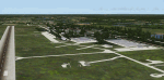
The airfield Rothenburg is the one field of a row of military airfield sceneries of the former NVA. In the scenery are included the airfield and the technical supplies. The airfield was put into operation in 1958 in duty of the NVA (National People's Army). It accommodated the FAG-15 with Mig-21U aircraft.
| Filename: | EDBR__Rothenburg_1990.zip |
| License: | Freeware, limited distribution |
| Added: | 26th November 2012, 22:13:59 |
| Downloads: | 925 |
| Author: | Volker Loew, Frithjof Koch, Rainer Mehlin |
| Size: | 19.79 MB |
| Category: Flight Simulator 2004 - Scenery | |
| Bank Farm Farm Field CF09 near Ottawa in Ontario, Canada |
|
Images related to this file:
File Description:
Bank Farm field is in Ontario and around 11 miles south and a bit east of Ottawa airport, just west of Bank Street that wriggles its way south out of Ottawa. There is a grass runway 08/26 (actually 085/265) that is 2,600 feet long, and the grass could not possibly be better. A small (and old) hangar is now only used to house the farm owner's Cessna 172 during the winter. There is a large (and also old) barn and the house is right on the approach to the runway from the east; approach 08 between the barn and the house and straightens it out on very short finals.
The hangar, barn, and house are modeled specifically for this scenery, as was the log pile.
| Filename: | Bank_Farm_Farm_Field_CF09_near_Ottawa_in_Ontario_C.zip |
| License: | Freeware, limited distribution |
| Added: | 9th February 2010, 13:36:59 |
| Downloads: | 403 |
| Author: | Roger Wensley |
| Size: | 4.13 MB |
| Category: Flight Simulator 2004 - Scenery | |
| Indian Creek Farm Field CF07 near Ottawa in Ontario, Canada |
|
Images related to this file:
File Description:
Indian Creek farm field (Re-upload WITH THE MISSING TEXTURES!) is in Ontario and southeast of Ottawa, less than two miles east of two other real-life farm fields I have already posted (Russell Farm, and Russellette Strip). The creek is just north of the runway in the trees, though it doesn't show in FS with or without Ultimate Terrain.
There is a grass runway 08/26 that is 2,100 feet long and has lights; the grass could be better (I mean there could be more of it) but the drainage is good. There is a large hangar that is right by the house and is heated (wow!); this is for the owner. There are also eight other hangars which are slightly basic and without doors, which means boxes over the wheels so the tires don't get chewed by the wild life and canvas hangar fronts for the winter. All the hangar buildings are modeled specifically for this scenery. The runway has been there for 22 years, and before that (though with a large gap between) there was a military grass strip as a relief field for nearby Pendleton .
| Filename: | Indian_Creek_Farm_Field_CF07_near_Ottawa_in_Ontari.zip |
| License: | Freeware, limited distribution |
| Added: | 8th February 2010, 09:45:16 |
| Downloads: | 443 |
| Author: | Roger Wensley |
| Size: | 11.35 MB |
| Category: Flight Simulator 2004 - Scenery | |
| Nursery Corner Farm Field CF13 near Ottawa in Ontario, Canada |
|
Images related to this file:
File Description:
Nursery Corner is a tree nursery around 12 miles southwest of Rideau Valley Airpark CPL3 (which did not appear in FS9, probably because it was then mainly used by gliders, but is a post of mine and downloadable) and 6 miles south of Hicks Farm, a recent post. CPL3 is 15 miles south of Ottawa Airport, tucked into a right angle bend of the Rideau River. Ultimate Terrain puts the river into place and I am not sure how CPL3 works without UT as the river is close by. Fly west from CPL3 along the river and Hicks Farm will be on the south side; fly south parallel to the roads, cross a small river, and in an area which has place names like Hutchins Corners and Pattersons Corners will be the farm field with two grass runways at right angles among the nursery rows of trees. The runways are 36/18 1,700 feet and 27/09 2,000 feet. The single T hangar houses what looked like a Citabria.
| Filename: | Nursery_Corner_Farm_Field_CF13_near_Ottawa_in_Onta.zip |
| License: | Freeware, limited distribution |
| Added: | 11th February 2010, 00:53:28 |
| Downloads: | 248 |
| Author: | Roger Wensley |
| Size: | 14.1 MB |
| Category: Flight Simulator 2004 - Scenery | |
| CYQR 2015 - Regina International Airport - Groome Field **Season Adjustment Option** |
|
Images related to this file:
File Description:

This is an update option for CYQR 2015 - Regina International Airport - Groome Field scenery.
The CYQR 2015 scenery was designed to match the more accurate North American winter season changes developed by Scott Smart, which is available in the AVSIM file library. Seasons in the scenery are mismatched if the North American Season Zones Adjustment is not installed. This update provides users with an option to adjust CYQR 2015 to the default seasons.
| Filename: | CYQR_2015__Regina_International_Airport__Groome_Fi.zip |
| License: | Freeware, limited distribution |
| Added: | 11th November 2015, 08:46:27 |
| Downloads: | 1,234 |
| Author: | Gregory Putz |
| Size: | 789.39 KB |
| Category: Flight Simulator 2004 - Scenery | |
| Burg Military Airfield |
|
Images related to this file:
File Description:
Burg military airfield, Paratrooper-training base-40. The airfield Cottbus is the one field of a row of military airfield sceneries. In the scenery are included the airfield and the technical supplies.
The airfield was put into operation in 1982 in duty of the NVA. Here were trained paratroopers of the NVA and other airborne-units.
| Filename: | Burg_Military_Airfield.zip |
| License: | Freeware |
| Added: | 4th May 2012, 15:51:13 |
| Downloads: | 480 |
| Author: | Volker Loew, Frithjof Koch |
| Size: | 1.38 MB |
| Category: Flight Simulator 2004 - Scenery | |
| La Purisima |
|
File Description:
La Purisima, Durango, Mexico Fictional Airport and Landclass of a Small town Northwest of Durango, Durango north of Tepehuanes, The airport is placed on somebody’s back yard and coming from the south you have to clear a house and tree, Excellent for practicing short field landings. Scenery includes a Dirt Runway plus the surrounding town and neighboring Tepehuanes.
| Filename: | La_Purisima.zip |
| License: | Freeware |
| Added: | 10th March 2004, 18:54:26 |
| Downloads: | 338 |
| Author: | Jose Munoz |
| Size: | 274.49 KB |
| Category: Flight Simulator 2004 - Scenery | |
| St Charles County (Smartt) |
|
File Description:
FS2004 Scenery - St Charles County (Smartt Field) KSET is a public owned airport lovated in St Charles, MO, USA. The airport has two asphalt runways 9/27 running 2000 ft and 18/36 running 3800 ft. This is a companion scenery for my recently released St Charles Municipal (3sq_v1.zip). Created with Instant Scenery. By John B. Loney, Jr.
| Filename: | St_Charles_County_Smartt.zip |
| License: | Freeware, limited distribution |
| Added: | 3rd April 2009, 18:57:54 |
| Downloads: | 388 |
| Author: | John B. Loney, Jr. |
| Size: | 6.4 MB |


© 2001-2026 AVSIM Online
All Rights Reserved
Privacy Policy |