
Where Flight Simulation Enthusiasts Gather from Around the World!
AVSIM Library - Search Results

| Category: Flight Simulator 2004 - Scenery | |
| Frozen rivers and lakes (and sea) for Alaska's winter |

|
Images related to this file:
File Description:
This "freezes" all lakes and rivers (and some sea) for winter flying and means they can be landed on with skis or wheels; it is meant for low level flying rather than high level jet flights. This edition covers all of Alaska, except for the Aleutian Islands, as the worst area to do this for is a string of islands. Terrible. Fiddly. It is reversible with an "untick" in the FS scenery library. I have spent some time making sure that the sea and the larger inlets along the southern coast do not get frozen too as they stay ice-free in winter. Along the north shore I went for the peak of the winter with sea ice all the way to the permanent polar cap; this is not totally realistic as there is usually a partially open lead along the coast, but anything else would be ...... fiddly. This is really for use with Ultimate Terrain, though it will work without it. But as UT is what gets all the lakes and rivers there and in the right place it would be a shame not to be using UT. There is a blurry transition between southern Alaska and Canada so you may need the recent Canada post too.
| Filename: | Frozen_rivers_and_lakes_and_sea_for_Alaskas_winter.zip |
| License: | Freeware, limited distribution |
| Added: | 8th September 2011, 11:53:51 |
| Downloads: | 681 |
| Author: | Roger Wensley |
| Size: | 493.23 KB |
| Category: Flight Simulator 2004 - Scenery | |
| Bethel: St Mary's area airfields in southwest Alaska close to the Yukon River |
|
Images related to this file:
File Description:
This presumes you have already installed Bethel PABE and Bethel Local Airfields. In the Yukon River area of Alaska to the north of Bethel there are small villages, served by flights from both Bethel and the nearer St Mary's PASM. St Mary's has a gravel runway like the other villages, but has a larger population and airport services including maintenance and fuel. This, plus the saving of an average one hundred miles of flying by a Cessna 205 when compared with flights from Bethel, means it acts as a distribution centre fed from Bethel by larger aircraft. Go to "http://vfrmap.com/" for free vfr maps of the area (see the attached). The ten village airfields included here are all to the north and west of St Mary's: Hooper Bay PAHP, Chevak VAK, Cape Romanzof PACZ (closed air force field servicing a radar station), Scammon Bay SCM, Sheldon Point SXP, Alakanuk AUK, Emmonak PAEM, Kotlik 2A9, Mountain Village MOU, and of course St Mary's PASM itself. With these airfields not everything is as it appears to be. For instance, Hooper Bay is not a new and modernised airfield, despite the asphalt runway and apron; the current version has dispensed with the aging asphalt and gone back to gravel. I have tended to go for the 2005 or so versions, which sometimes means a small runway amid or close to the housing; Kotlik was an early renewal for reasons of safety as much as anything else and has had (since 2003?) a new and longer runway located outside of the town. The second batch of airfields will be to the east of St Mary's.
| Filename: | Bethel_St_Marys_area_airfields_in_southwest_Alaska.zip |
| License: | Freeware, limited distribution |
| Added: | 29th April 2019, 17:07:24 |
| Downloads: | 225 |
| Author: | Roger Wensley |
| Size: | 11.53 MB |
| Category: Flight Simulator 2004 - Scenery | |
| Edinburgh Island, FOX-2, Horton River, Igloolik, & Kimmirut, adapted for the FSGenesis 76m North Canada Terrain Mesh |
|
Images related to this file:
File Description:
These are replacement bgl's to convert five northern Canada fields for use with the FSGenesis 76m terrain mesh for northern Canada. The five are Edinburgh Island CWEI, the FOX-2 DEW line station, Horton River CWHR, Igloolik CYGT, and Kimmirut CYLC. These are not stand-alone, and the presumption is that you have already downloaded and installed the previously posted sceneries. This installation consists solely of replacing the existing scenery bgl's with the new. There will be further posts of northern airfields in groups of five, alphabetically, and observations regarding the amendments and any further corrections that are required would be welcomed.
| Filename: | Edinburgh_Island_FOX2_Horton_River_Igloolik__Kimmi.zip |
| License: | Freeware, limited distribution |
| Added: | 10th September 2017, 19:29:57 |
| Downloads: | 86 |
| Author: | Roger Wensley |
| Size: | 3.55 MB |
| Category: Flight Simulator 2004 - Scenery | |
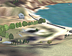
| Reichenbach LSAZ |
|
File Description:
The virtual airfield includes several buildings such as a hangar, a restaurant, a club house, military shelters, a playground and stationary cars. The surrounding area of Reichenbach has been populated with autogens: From the lake of Thoune down to Gemmi pass South of Kandersteg, and up until Adelboden to the West. Moreover, there is a high-voltage power line from Gemmi pass to the Gürbe valley, which should help during visual flight.
The scenery has been designed in Gmax and optimized for the mesh of Switzerland Professional. In order to save system performance, a series of LODS have been created.
| Filename: | Reichenbach_LSAZ.zip |
| License: | Freeware |
| Added: | 20th January 2006, 04:36:22 |
| Downloads: | 4,238 |
| Author: | Michael Röthlisberger |
| Size: | 2.95 MB |
| Category: Flight Simulator 2004 - Scenery | |
| Hauraki Gulf, v6 |
|
Images related to this file:
File Description:
This replaces all my previous Pakatoa Island and Hauraki Gulf sceneries. You must have Christian Stock's NZ mesh in the form of "Mountains of New Zealand" and topo in the form of "Lakes and Rivers of New Zealand" (payware).
New additions...PAKIHI ISLAND: Small jetty and nearby buildings. TAKANGAROA ISLAND: House on Island. House & Jetty island north of Takangaroa Island. MOTUREKAREKA ISLAND: Wreck of the Rewa. PONUI ISLAND: Chamberlain's Bay Airstrip. Chamberlain's Donkey Farm. Third Bay Airstrip. Motunau Bay Jetty. KARAMURAMU ISLAND: Jetty and quarry. ROTOROA ISLAND: Rotoroa Jetty. MOTUIHE ISLAND: Motuihe Wharf.
| Filename: | Hauraki_Gulf_v6.zip |
| License: | Freeware |
| Added: | 17th April 2010, 16:10:12 |
| Downloads: | 218 |
| Author: | Godfrey Tier |
| Size: | 6.61 MB |
| Category: Flight Simulator 2004 - Scenery | |
| Project Mexico Real LOD10 File 1 of 11 |
|
Images related to this file:
File Description:
File 1st of 11 of a Terrain Mesh that covers the entirety of Mexican Territory and related bordering U.S., Guatemala and Belice areas, part of the "Proyecto Mexico Real" project, compiled at LOD10 (1.24 arcseconds in latitude and 1.65 arcseconds in longitude) resolution from INEGI data. Intended to enhance the virtual flying experience complementing the LOD8 and LOD9 versions compiled from the same data. Compatible backwards with Flight Simulator 2000, Flight Simulator 2002 and Combat Flight Simulator 2. Refer to the file contents about the cover area to this compressed file. (Re-upload due to AVSIM hack)
| Filename: | Project_Mexico_Real_LOD10_File_1_of_11.zip |
| License: | Check within download |
| Added: | 6th June 2010, 09:05:59 |
| Downloads: | 4,162 |
| Author: | Juan Jose Galvan Bautista |
| Size: | 73.44 MB |
| Category: Flight Simulator 2004 - Scenery | |
| Old Rhinebeck Aerodrome |
|
File Description:
Old Rhinebeck, the living museum of antique aviation, located at NY94 in Rhinebeck NY. Included are all the buildings and hangars at the field. Photoreal ground textures for the Rock City area surrounding ORA. All lakes streams, and rivers were hand edited for accuracy. Hand placed autogen and trees to match the ground textures. Special effects that make crowds of people appear during show times, and a few easter eggs as well. Mesh compliled from clean 1 arc sec SRTM data. Afcad is AI ready for your flightplans. All Gmax 3d models, and optimized textures for smooth performance.
happy flyin.
| Filename: | Old_Rhinebeck_Aerodrome.zip |
| License: | Freeware, limited distribution |
| Added: | 4th December 2005, 03:32:41 |
| Downloads: | 4,616 |
| Author: | Joe Binka |
| Size: | 38.57 MB |
| Category: Flight Simulator 2004 - Scenery | |
| Fernando de Noronha, Brazil - SBFN (Photoreal for Fs9) |
|
File Description:
Photoreal Fs9 Fernando de Noronha island. This addon WAS NOT created by me,
but I was given permission to upload it. It's author is Amengol.
The island is steeped in history and has it's own connection with aviation history. For it was one of the fuel stops that were used on the very first Africa to South America trans-atlantic flight. March 30 - June 17, 1922, using three Fairey IIID floatplanes. Perhaps you might like to retrace the brave pilots route to see if you can make the trip!
Featuring: Photoreal textures, A.I. Aircraft, and Custom Terrain mesh.
| Filename: | Fernando_de_Noronha_Brazil__SBFN_Photoreal_for_Fs9.zip |
| License: | Freeware |
| Added: | 27th January 2009, 00:55:22 |
| Downloads: | 2,223 |
| Author: | Amengol and Rob Barnett |
| Size: | 2.84 MB |
| Category: Flight Simulator 2004 - Scenery | |
| Project México Real LOD9 File 1 of 4 |
|
File Description:
File 1st of 4 of a Terrain Mesh that covers the entirety of Mexican Territory and related bordering U.S., Guatemala and Belice areas, part of the "Proyecto México Real" project, compiled at LOD9 (2.48 arcseconds in latitude and 3.3 arcseconds in longitude) resolution from INEGI data. Intended to enhance the virtual flying experience with the more detailed LOD10 version and complement the LOD8 version compiled from the same data. Compatible backwards with Flight Simulator 2000, Flight Simulator 2002 and Combat Flight Simulator 2. Refer to the file contents about the cover area to this compressed file.
| Filename: | Project_Mxico_Real_LOD9_File_1_of_4.zip |
| License: | Check within download |
| Added: | 7th March 2006, 01:29:51 |
| Downloads: | 3,181 |
| Author: | Juan José Galván Bautista |
| Size: | 54.99 MB |
| Category: Flight Simulator 2004 - Scenery | |
| Project México Real LOD9 File 2 of 4 |
|
File Description:
File 2nd of 4 of a Terrain Mesh that covers the entirety of Mexican Territory and related bordering U.S., Guatemala and Belice areas, part of the "Proyecto México Real" project, compiled at LOD9 (2.48 arcseconds in latitude and 3.3 arcseconds in longitude) resolution from INEGI data. Intended to enhance the virtual flying experience with the more detailed LOD10 version and complement the LOD8 version compiled from the same data. Compatible backwards with Flight Simulator 2000, Flight Simulator 2002 and Combat Flight Simulator 2. Refer to the file contents about the cover area to this compressed file.
| Filename: | Project_Mxico_Real_LOD9_File_2_of_4.zip |
| License: | Check within download |
| Added: | 14th March 2006, 03:33:28 |
| Downloads: | 2,590 |
| Author: | Juan José Galván Bautista |
| Size: | 55.36 MB |
© 2001-2026 AVSIM Online
All Rights Reserved
Privacy Policy |