
Where Flight Simulation Enthusiasts Gather from Around the World!
AVSIM Library - Search Results

| Category: Flight Simulator 2004 - Scenery | |
| Johnson Creek 3U2 Forest Service airfield in Idaho USA |

|
Images related to this file:
File Description:
This airfield is in the mountains of Idaho, around 25 miles south of Big Creek U60, which was the second in the series to be posted. Johnson Creek is very regularly used for picnic fly-ins and overnight camping, as can be seen from the number of videos posted. Again, the creek does not appear in FS9 as it is only around 20 feet or so wide, plus within Ultimate Terrain I have streams turned off for the reasons given in the U60 post. The runway is at 4,933 feet ASL, 3,480 feet long, aligned 35-17, and in good condition. The shower facilities are south of the centre of the runway and on the eastern side; as a result planes mostly, but not all, park on the eastern side and towards the south. There are Forest Service workshop buildings on the east side of the runway near the centre. If you have a wind from the south then some AI planes will actually manage to land. I should have mentioned before that these are all made with only the default FS9 mesh, and that I will be reposting them again for use with the FSGenesis 19m mesh.
| Filename: | Johnson_Creek_3U2_Forest_Service_airfield_in_Idaho.zip |
| License: | Freeware, limited distribution |
| Added: | 25th May 2017, 17:54:06 |
| Downloads: | 171 |
| Author: | Roger Wensley |
| Size: | 4.81 MB |
| Category: Flight Simulator 2004 - Scenery | |
| Stewart CZST and CAC9 in British Columbia Canada, plus Hyder 4Z7 in AK |
|
Images related to this file:
File Description:
Stewart is in northern British Columbia, around 115 miles north of Terrace, 70 miles northeast of the open sea, and 2 miles from the Canada/US border at the head of a fjord named the Portland Canal. Both Stewart and the nearby Hyder in AK thrived along with silver and gold mining in the early 1900's in the AK and BC interiors and in 1914 Stewart's population was over 10,000, but the current population is now less than 500. This scenery includes Stewart airport (CZST) and also Stewart floats (CAC9) plus Hyder floats 4Z7 which is within sight of Stewart but in Alaska. 4Z7 is based upon the three FSAddon freeware and payware Alaska sceneries, and without whichever one covers Hyder (I forget which) the float base will be isolated way offshore. The Stewart airport is adjacent to the town. There is a single runway that is unlit and just under 4,000 feet of asphalt aligned 18-36, with right hand circuits on 18; a brief view of the surrounding terrain makes it quite clear why. This version is for a period around 2010 to 2012 or so, before a second fuel tank was installed. There are no regularly scheduled flights to Stewart, only GA and charters, but the airport survives with the tourist trips. I have not forgotten the signage for CZST; there isn't any. There is also no clearly defined and fenced boundary to the airport, with a gravel apron beyond the asphalt that then fades to dirt and grass and a road. Hyder has no land connection to the rest of Alaska except through Stewart and a long road trip; the only direct link is by float plane to Ketchikan, 75 miles in a straight line. The AI includes this.
| Filename: | Stewart_CZST_and_CAC9_in_British_Columbia_Canada_p.zip |
| License: | Freeware, limited distribution |
| Added: | 18th January 2019, 18:08:29 |
| Downloads: | 172 |
| Author: | Roger Wensley |
| Size: | 8.9 MB |
| Category: Flight Simulator 2004 - Scenery | |
| Kivitoo, Paulatuk, Qikiqtarjuak, Rowley Island, & West Baffin, adapted for FSGenesis 76m North Canada Terrain Mesh |
|
Images related to this file:
File Description:
These are replacement bgl's to convert five northern Canada fields for use with the FSGenesis 76m terrain mesh for northern Canada. The five are Kivitoo CWFK, Paulatuk CYPC, Qikiqtarjuak CYVM, Rowley Island CWFR, and West Baffin CWFW. These are not stand-alone, and the presumption is that you have already downloaded and installed the previously posted sceneries. This installation consists solely of replacing the existing scenery bgl's with the new. This is the last post of adapted northern airfields (unless more are discovered needing revision) and observations regarding and any further corrections that are required would be welcomed.
| Filename: | Kivitoo_Paulatuk_Qikiqtarjuak_Rowley_Island__West_.zip |
| License: | Freeware, limited distribution |
| Added: | 18th September 2017, 22:28:33 |
| Downloads: | 87 |
| Author: | Roger Wensley |
| Size: | 3.02 MB |
| Category: Flight Simulator 2004 - Scenery | |
| Talkeetna Village AK44 in Alaska, home of Don Sheldon's Talkeetna Air Service |
|
Images related to this file:
File Description:
Talkeetna is around 75 miles north of Anchorage in Alaska on the east shore of the Susitna River. The town is where Don Sheldon got off the train in 1938, and where, ten years later, he started Talkeetna Air Services. There are two airfields in Talkeetna, PATK with its long asphalt runway and Talkeetna Village AK44 in the middle of the town. This is AK44; the default FS version with Ultimate Terrain installed had the runway half in the river, but there is still space for the 900 feet of runway that is described in the book "Wager With The Wind" that tells Don's story. The result is a step back in time to 1973, when the second hangar was built. If you also want to install PATK do a search. I have partially populated the village with cabins, and UT is probably required for the river to be there; I haven't tested this without it.
| Filename: | Talkeetna_Village_AK44_in_Alaska_home_of_Don_Sheld.zip |
| License: | Freeware |
| Added: | 4th February 2010, 01:24:40 |
| Downloads: | 564 |
| Author: | Roger Wensley |
| Size: | 3.66 MB |
| Category: Flight Simulator 2004 - Scenery | |
| Ketchikan PAKT in southern Alaska plus float planes 5KE and the town |
|
Images related to this file:
File Description:
This is Ketchikan PAKT in southern Alaska, 45 miles north of the Canadian border and 220 miles south of Juneau. It is the closest major Alaskan airport to the lower 48 and most flights from or to Seattle pass through Ketchikan en route. The airport is on the southern side of the stretch of water known as The Narrows and the town is on the northern side, with ferries connecting the two. The town side was somewhat modified as part of one of the three Misty Fjords sceneries, so there were already some marinas and docked cruise liners etc before I started this. In addition, Ketchikan Airport had been partly made way back in 2006, and further modified in 2007; I say "partly" as there is in fact no way to accurately make PAKT within the limitations of FS9 as there is a 50 or 60 feet difference in elevation between runway and apron, and the taxiways are actually ramps up from the apron to the ends of the runway. This has a knock-on effect on the float plane and ferry docks on the water below the airport. I can see why the Misty Fjord sceneries avoided it. This scenery retains the original buildings from the Alan Wright scenery. It also includes the modification made by John Hinson, who created the second taxiway to the western end of the runway; FS9 had not included this as the original airport started operations with only one taxiway in place. There are new vehicles on the apron (fuel etc), new apron markings and some parking modifications to enable AI with Boing 737, DC6, Beechcraft 1900, and GA, plus runway and taxiway signage, windsocks, some car parking, freight items, etc. There is a road and covered bridges down to the docks and ferry, and the town side of the water has been modelled to include other float plane docks along with waterfront buildings, including the ship repair facility with it's dry dock (actually a floating dock that lifts ships out of the water) and the Alaskan Ferry Terminal wharf etc. The ferry forms a part of the AI, generously permitted by FSAddon and originally a part of the payware Tongass Fjords package, as are the AI aircraft also included here. There are new waterside buildings that stretch from the ship repair yard, past the shopping plaza and onward to the stationary cruise liners (that were part of the Tongass payware scenery) including float docks for the float plane companies that are based in Ketchikan, plus a new AI liner. The AI is a further adaptation of the already posted CF36 AI and PAKN AI, as listed in the AI folder. Due to the surrounding hills there may be some interference with AI float aircraft, depending on the wind direction, though I have watched succesful Beaver landings with the wind from the east. The combined AI for float planes creates a float plane take off or landing at, on average, 20 minute intervals; this is still well short of the actual busy summertime period.
| Filename: | Ketchikan_PAKT_in_southern_Alaska_plus_float_plane.zip |
| License: | Freeware, limited distribution |
| Added: | 12th February 2017, 23:27:59 |
| Downloads: | 1,228 |
| Author: | Roger Wensley |
| Size: | 47.11 MB |
| Category: Flight Simulator 2004 - Scenery | |
| Merrill Field PAMR 2016 V3 in Anchorage, Alaska, including the Fedex 727 |
|
Images related to this file:
File Description:
This V3 version of Merrill Field 2016 finally adds the Fedex 727 to Merrill Field, the error being totally mine but left as unreported by all but two of the downloaders. Testing on the computer of one of the reporting downloaders solved the problem, and revealed the requirement to have the aircraft "installed" on every user's computer. This was unknown by me, and not "testable" on my computer for obvious reasons. Which is why I need user input!?! Only 2 out of a total of around 500 downloaders? This is not a stand-alone scenery. Put the Fedex727.bgl into the scenery folder of your downloaded Merrill Field V2 and the 727 will be visible. You already have the textures in the scenery texture folder.
| Filename: | Merrill_Field_PAMR_2016_V3_in_Anchorage_Alaska_inc.zip |
| License: | Freeware, limited distribution |
| Added: | 3rd October 2016, 21:38:27 |
| Downloads: | 479 |
| Author: | Roger Wensley |
| Size: | 406.97 KB |
| Category: Flight Simulator 2004 - Scenery | |
| Beartooth Mountain Enhancements |
|
File Description:
The Flight Simulator default scenery has no lakes for the Beartooth Mountains of south-central Montana and adjacent Wyoming. Streams and roads follow unnatural paths up and down mountainsides and valley and canyon walls. These modifications add more than 1,150 lakes and ponds to the Beartooth Mountain landscape and major streams and highways are more accurately located. Some secondary and other roads and the Red Lodge ski area have been added. Addon 38.2m mesh such as the excellent FSGenesis Rocky Mountains freeware is necessary to properly view these modifications.
| Filename: | Beartooth_Mountain_Enhancements.zip |
| License: | Freeware, limited distribution |
| Added: | 25th April 2004, 20:48:35 |
| Downloads: | 3,171 |
| Author: | Wilfred Husted |
| Size: | 110.48 KB |
| Category: Flight Simulator 2004 - Scenery | |
| Columbia-Willamette Rivers Fix |
|
File Description:
These flattening files lower the elevated water on the Columbia and Willamette rivers in and around Portland, Oregon. On the Columbia River they start east of Astoria, OR (KAST) and proceed east and south through Portland, OR (KPDX) then east to Cascade Locks, OR (KXZK). On the Willamette River they proceed from Portland south to just north of Aurora, OR (KUAO) ending at the collapsed bridge. Several bodies of water next to the Columbia and Willamette rivers have also been flattened. These files work well with FS default scenery and FS Genesis 38m mesh scenery.
| Filename: | ColumbiaWillamette_Rivers_Fix.zip |
| License: | Freeware |
| Added: | 19th April 2004, 22:19:32 |
| Downloads: | 3,062 |
| Author: | Dan Reynolds |
| Size: | 10.4 KB |
| Category: Flight Simulator 2004 - Scenery | |
| KCRW - Kanawha River Valley - West Virginia, USA |
|
Images related to this file:
File Description:
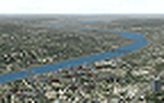
This scenery is made to blend with autogen scenery and the defaults of FS9. Transits crossing the southern Allegheny Mountains will follow this valley seeing some of the landmark bridges and dams of the central WV area. The New river bridge scenery is not included in this package because (not only my own version which works default mesh), but another fellow has made one. It also fits with this package and looks real good. This package blends well with default or compliments my Land Class Central Appalachia package.
| Filename: | KCRW__Kanawha_River_Valley__West_Virginia_USA.zip |
| License: | Freeware |
| Added: | 9th July 2015, 17:26:13 |
| Downloads: | 228 |
| Author: | Rick Connolly |
| Size: | 2.33 MB |
| Category: Flight Simulator 2004 - Scenery | |
| Cessnock and Hidden Valley Farm, NSW, AUSTRALIA. |
|
File Description:
CESSNOCK just a short 25 minute flight from Sydney. Cessnock
was once the center of a large coal mining industry, is now
one of the main jumping off points for the wine growing district
of the Hunter Valley. HIDDEN VALLY FARM is your destination
for that "rural" type getaway. The grass strip will accomodate
single and twin engined aircraft. If your really good, try the Lear.
Directions to the farm at Cessnock and Warnervale (warn2004.zip) airports.
For use with or without SATPAC mesh scenery.
Textured required are Airport 2.6, VOD, Nova and Nova Gold.
| Filename: | Cessnock_and_Hidden_Valley_Farm_NSW_AUSTRALIA.zip |
| License: | Freeware |
| Added: | 4th June 2004, 14:03:01 |
| Downloads: | 2,052 |
| Author: | Clive Marriott |
| Size: | 3.34 MB |
© 2001-2026 AVSIM Online
All Rights Reserved
Privacy Policy |