
Where Flight Simulation Enthusiasts Gather from Around the World!
AVSIM Library - Search Results

| Category: Flight Simulator 2004 - Scenery | |
| Lake Edward elevation modification |

|
Images related to this file:
File Description:
Modified HP and HL files to raise the level of Lake Edward to fit with terrain with 76m mesh.
The water area around Entebbe airport has also been modified.
Victoria-Nile River has been moved south of Chobe Safari Lodge Strip which was in the river before.
Some modified files for airstrips in Uganda.
| Filename: | Lake_Edward_elevation_modification.zip |
| License: | Freeware |
| Added: | 25th October 2022, 14:30:54 |
| Downloads: | 92 |
| Author: | John Tennent |
| Size: | 759.5 KB |
| Category: Flight Simulator 2004 - Scenery | |
| Mount Elbrus Area |
|
File Description:
This mesh includes the beautiful area of the great Elbrus. This mountain is with 5633 meters Europes highest Mountain, and is so one of the Seven Summits, the highest mountains on each continent. This scenery covers the area from N42 E40 to N43 E43.
USGS SRTM 3 arc-second, resampled to LOD9 (76 meters).
| Filename: | Mount_Elbrus_Area.zip |
| License: | Freeware |
| Added: | 13th April 2004, 22:05:18 |
| Downloads: | 1,824 |
| Author: | Michael Speck |
| Size: | 8.47 MB |
| Category: Flight Simulator 2004 - Scenery | |
| Hong Kong VFR v.0.5 Alpha (Photo Scenery) |
|
Images related to this file:
File Description:
This is a photo scenery of Hong Kong in alpha stage which was finished in 2010. The scenery is just similar with Project Visual Hong Kong but with accurate coordinates. The scenery covers a part of Shenzhen and most part of Hong Kong (Except the North East Part of Hong Kong). Terrain mesh is included.
| Filename: | Hong_Kong_VFR_v05_Alpha_Photo_Scenery.zip |
| License: | Freeware |
| Added: | 9th October 2011, 20:36:38 |
| Downloads: | 1,823 |
| Author: | Thomas Lau |
| Size: | 51.13 MB |
| Category: Flight Simulator 2004 - Scenery | |
| Rangitata Island Aerodrome - NZRI |
|
Images related to this file:
File Description:

Rangitata Island Aerodrome is a small airfield located on Rangitata Island, halfway between Timaru and Ashburton, (South Island, New Zealand). Home to the Geraldine Flying Group, De Havillands over New Zealand collection,New Zealand Microlight heritage museum, Shadows of Hawks WWI replica collection and the Ross Brodie Memorial museum and library.
Made to fit Christian Stock's NZ 20m mesh.
| Filename: | Rangitata_Island_Aerodrome__NZRI.zip |
| License: | Freeware |
| Added: | 24th November 2013, 02:16:00 |
| Downloads: | 270 |
| Author: | Godfrey Tier |
| Size: | 1.66 MB |
| Category: Flight Simulator 2004 - Scenery | |
| Anchorage to Valdez Trnn, Terrain |
|
File Description:
The files here display more scenery for default Fs2004 from Anchorage to Valdez. I wanted to make the flight from reading the report by Mac Af Uhr but wanted little better scenery. The terrain is Ocean and Inland waterbodies, Mesh, few flatten files. It might really be described “Freeware-quality” but I was trying to have it good…
| Filename: | Anchorage_to_Valdez_Trnn_Terrain.zip |
| License: | Freeware |
| Added: | 16th September 2005, 10:17:54 |
| Downloads: | 1,025 |
| Author: | Pierre G. Shlimon |
| Size: | 2.34 MB |
| Category: Flight Simulator 2004 - Scenery | |
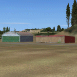
| Campbell River floats CAE3 UPDATE |
|
Images related to this file:
File Description:
This update deals with terrain variations that may be caused by an add-on mesh such as the Genesis one that I installed, and which I discovered made small hills that disrupted the fencing and car parks. This flatten will deal with this or a similar problem. If you aren't having a problem then you don't need this.
| Filename: | Campbell_River_floats_CAE3_UPDATE.zip |
| License: | Freeware, limited distribution |
| Added: | 15th July 2010, 01:58:09 |
| Downloads: | 412 |
| Author: | Roger Wensley |
| Size: | 572.44 KB |
| Category: Flight Simulator 2004 - Scenery | |
| CTH3 Canada, Quebec, Les Grandes-Bergeronnes |
|
Images related to this file:
File Description:
This is the scenery Les Grandes Bergeronnes (CTH3), which represents the reality. Les Grandes Bergeronnes is a small village located on Northern bank of the St-Laurent river of Quebec at Canada. This scenery is designed with FSDS and it accepts Mesh of Gilles Gauthier. This scenery functions for both FS-2004 and FS-X.
| Filename: | CTH3_Canada_Quebec_Les_GrandesBergeronnes.zip |
| License: | Freeware |
| Added: | 2nd January 2010, 19:29:43 |
| Downloads: | 374 |
| Author: | Regis Dassylva |
| Size: | 2.32 MB |
| Category: Flight Simulator 2004 - Scenery | |
| Karipur VOCL |
|
Images related to this file:
File Description:
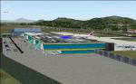
Karipur-VOCL for FS2004.
This contains the Airport of Calicut, Kerala, India
Karipur is a new International airport in Kozhikode or Calicut.
It handles planes to Middle East and Domestic.
This file contains the real airport.
Requeres South India Mesh and EZ library for small objects
to show up.
Terminal made in gmax and small objects added with EZ.
| Filename: | Karipur_VOCL.zip |
| License: | Freeware, limited distribution |
| Added: | 1st October 2010, 17:44:35 |
| Downloads: | 1,160 |
| Author: | Anstin Antony |
| Size: | 2.21 MB |
| Category: Flight Simulator 2004 - Scenery | |
| Lauterbrunnen LSXL |
|
File Description:
Scenery of the Air Glaciers heli base at Lauterbrunnen in the Bernese Oberland. The scenery contains Mönchsjochhütte, the highest refuge in the Bernese Alps, situated South of Mönch. The scenery has been designed in Gmax and optimized for the mesh of Switzerland Professional. In order to save system performance, a series of LODS have been created.
| Filename: | Lauterbrunnen_LSXL.zip |
| License: | Freeware |
| Added: | 13th July 2006, 02:58:06 |
| Downloads: | 3,535 |
| Author: | Michael Röthlisberger |
| Size: | 3.25 MB |
| Category: Flight Simulator 2004 - Scenery | |
| Altitude adjustment for Dawson City CYDA |
|
Images related to this file:
File Description:
I discovered that the Northern Canada Terrain Mesh that I installed a while back was dumping part of my Dawson City Airport CYDA into a deep hole. I tried making a flatten to reduce the height of the terrain mesh land but that did not look at all realistic. So, the solution is to raise CYDA to 1,457 feet above sea level instead of the correct (correct according to the Nav Canada Supplement) level of 1,215 feet so that it melts into the surrounding terrain. There are still some rocky faces but at least they are not in the airfield. Do you need it? Not if your version looks ok. If it doesn't look ok then try this, but save your current version so you can go back to it if you need to.
| Filename: | Altitude_adjustment_for_Dawson_City_CYDA.zip |
| License: | Freeware, limited distribution |
| Added: | 23rd July 2019, 17:24:26 |
| Downloads: | 103 |
| Author: | Roger Wensley |
| Size: | 855.58 KB |
© 2001-2026 AVSIM Online
All Rights Reserved
Privacy Policy |