
Where Flight Simulation Enthusiasts Gather from Around the World!
AVSIM Library - Search Results

| Category: Flight Simulator 2004 - Scenery | |
| NZ DOC Airstrips vs.2 |

|
File Description:
Made to fit Christian Stock's 20-mesh. Will not work with 75mesh or default scenery. Fictional Department of Conservation floatplane-candy for New Zealand. Great Mercury Island, Little Barrier Island, Mayor Island, Cuvier Island,Motiti Island,White Island and Slipper Island.
| Filename: | NZ_DOC_Airstrips_vs2.zip |
| License: | Freeware |
| Added: | 16th July 2008, 18:33:47 |
| Downloads: | 251 |
| Author: | Godfrey Tier |
| Size: | 2.43 MB |
| Category: Flight Simulator 2004 - Scenery | |
| SCIR Isla Robinson Crusoe Chile |
|
Images related to this file:
File Description:
Terrain and Mesh for Robinson Crusoe Island and Selkirk Island, including the airport SCIR (Robinson Crusoe). Robinson Crusoe Island is located west of Santiago, Chile at approximately S33-40/W78-50. It is about 2.5 hours flying time from Santiago(SCEL).
| Filename: | SCIR_Isla_Robinson_Crusoe_Chile.zip |
| License: | Freeware, limited distribution |
| Added: | 23rd October 2011, 14:08:29 |
| Downloads: | 1,244 |
| Author: | Scott Smart |
| Size: | 9.44 MB |
| Category: Flight Simulator 2004 - Scenery | |
| LWM & VTP Malaysia, Singapore & Brunei. |
|
File Description:
Enhancement of Malaysia, Singapore & Brunei LWM and VTP scenery with more rivers are visible and surrounding islets with accuracy. Scenery based on satellite images. Also include are missing mesh scenery for Pulau Jerejak and patches for my previous missing Malaysian airports.
| Filename: | LWM__VTP_Malaysia_Singapore__Brunei.zip |
| License: | Freeware |
| Added: | 17th March 2006, 02:56:29 |
| Downloads: | 7,432 |
| Author: | Mohammad Omar |
| Size: | 6.36 MB |
| Category: Flight Simulator 2004 - Scenery | |
| Idaho Altisurfaces |
|
File Description:
Idaho Altisurfaces. Sloped airstrips (altisurfaces) of Mile Hi USFS, Soldier Bar USFS and Vines, Idaho USA.To be used with FSGenesis 38M Rocky Mountain mesh. Afcad2 files by Phil "Snowman" Cayton. Packaged and uploaded by Don Lively with permission of the designer.
| Filename: | Idaho_Altisurfaces.zip |
| License: | Freeware |
| Added: | 30th December 2005, 20:27:43 |
| Downloads: | 813 |
| Author: | Guy Nemoz |
| Size: | 1.35 MB |
| Category: Flight Simulator 2004 - Scenery | |
| New Caledonia (Landclass and Terrain Mesh) AFCAD and Scenery Fix for file n_caled.zip |
|
File Description:
This is a fix for my New Caledonia Landclass and Terrain Mesh file n_caled.zip The AFCAD and scenery files included will repair the problems of AI Aircraft freezing on runways. Scenery modifications have also been made around many of the airports.
| Filename: | New_Caledonia_Landclass_and_Terrain_Mesh__AFCAD_an.zip |
| License: | Freeware |
| Added: | 14th May 2010, 05:07:26 |
| Downloads: | 566 |
| Author: | Charles Reid |
| Size: | 49.16 KB |
| Category: Flight Simulator 2004 - Scenery | |
| Appalachian Mountains, Virginia / West Virginia |
|
File Description:
USGS SRTM30 1 arc-second, resampled to LOD10 (38.2 meters).
This high-resolution terrain mesh is centered in the Appalachian Mountains
between Virginia and West Virginia. Coverage area: From West -81° to West -79°
and North 37° to North 39°.
| Filename: | Appalachian_Mountains_Virginia__West_Virginia.zip |
| License: | Freeware, limited distribution |
| Added: | 10th January 2004, 18:06:59 |
| Downloads: | 3,679 |
| Author: | Andreas Trawny |
| Size: | 17.1 MB |
| Category: Flight Simulator 2004 - Scenery | |
| Mt Taranaki/Egmont, NZ, Photoreal Scenery |
|
File Description:
40 x 50 kilometres of photo-real scenery. Fully autogenned, daytime summer textures only. (It will display throughout the year though.)
This showcases the amazing volcanic Mt Taranaki. Like many New Zealand mountains it has both a Maori and European name. Mt Taranaki dominates the Taranaki landscape, and is a spectacular example of of how the central North Island has been effected by volcanic activity.
This is a remake of the original Godzone Taranaki scenery adjusted to match the new elevaton meshes. It is best with the Geographx 20m elevation mesh, and the minimum recommended mesh is the Geographx 75m.
| Filename: | Mt_TaranakiEgmont_NZ__Photoreal_Scenery.zip |
| License: | Freeware, limited distribution |
| Added: | 16th January 2006, 05:57:36 |
| Downloads: | 4,873 |
| Author: | Robin Corn |
| Size: | 40.09 MB |
| Category: Flight Simulator 2004 - Scenery | |
| Madrid Barajas from 2005 onwards |
|
Images related to this file:
File Description:
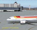
Madrid Barajas FS9 standalone airport, to substitute/update the original FS9 version with the actual 4 RWY operation and two new terminals. Resubmitted at libarian's request. You MUST have a good mesh for spanish terrain, otherwise this scenery won't look good. May I suggest a visit to AirHispania L.A.V. web site, www.airhispania.com, for a free download of their mesh from the scenery section, under "Publicaciones" (publications). Based on LEMDGB from the Zafra brothers original work to complement/update Simwings original Madrid airport, and published with their permission, this version does not require any payware. Taxiway signs now obsolete. Enjoy . Fernando de la Portilla
| Filename: | Madrid_Barajas_from_2005_onwards.zip |
| License: | Freeware |
| Added: | 21st February 2010, 01:45:52 |
| Downloads: | 8,191 |
| Author: | Fernando de la Portilla |
| Size: | 804.05 KB |
| Category: Flight Simulator 2004 - Scenery | |
| Alaska South Slope 3; Kiana PAIK |
|
Images related to this file:
File Description:
The town of Kotzebue is in the far northwest of Alaska, and served by Alaska Airlines. These are villages to the (mostly) east of Kotzebue on the South Slope of the Brooks Range of mountains, served by local flights from Kotzebue. There will be further additions. Kiana is a small village (population now around 360) on the bank of the Kobuk River, around 60 miles east of Kotzebue. The airfield, called Baker Memorial, is just north of the village, with 4,000 feet of lit gravel aligned 06-24 (as are several other runways in the area) with PAPI on 24. There are scheduled flights by Era (now renamed Ravn) and by Bering Air, both of them originating in Kotzebue and routing east to Noorvik, Kiana, Ambler, Shungnak, Kobuk, and then back again. The AI includes these flights along with Everts Air and Northern Air Cargo flights and GA. In real life the runway is around 200 yards closer to the village; this complicated the removal of roads and revised ground textures so I left it as is to make my life easier. The post includes missing night textures that were omitted from the post of Noatak PAWN. Noatak also has incorrectly installed original FS9 taxiway lights that were, as a result, impossible to remove. I had hoped to somehow manage it, but there is no way.
| Filename: | Alaska_South_Slope_3_Kiana_PAIK.zip |
| License: | Freeware, limited distribution |
| Added: | 7th September 2016, 22:00:17 |
| Downloads: | 211 |
| Author: | Roger Wensley |
| Size: | 4.5 MB |
| Category: Flight Simulator 2004 - Scenery | |
| Alaska South Slope 9; Wales IWK |
|
Images related to this file:
File Description:
There are four main northwestern Alaska towns which are serviced by Alaska Airlines, and from which local flights spread out. The northernmost is Barrow. Southwest of Barrow is Kotzebue, then Nome, and the furthest south is Bethel (not yet made). This is the second in a series for local flights from Nome, and it is on the furthermost mainland western point of Alaska, Wales IWK. It is 110 miles northwest of Nome and on the eastern shore of the Bering Strait, with a view of the two Diomede Islands. Wales is a small village with a population of only around 145, strung along the beach on a single road. The airfield is at the northwestern end of the village, with a runway of 4,500 feet of lit gravel aligned 35-17 and an apron at the southern end. There are scheduled flights by the usual Era and Bering Air, both of them originating in Nome and also visiting Shishmaref. The AI includes these flights along with Northern Air Cargo and GA. The runway is just long enough to accomodate a DC6 (as is Shishmaref) and I have revised the AI to include this, along with a revision of the parking at Shishmaref. To the southeast of Wales is Tin City, which was built as a base for the support of radar on the hills between the two. The radar is now automatic and unmanned and the base is unused except for the annual maintenance and fuel supply; I have left the airfield untouched but I have added the hilltop radar and the remains of the cable lift, which was used to get the material for the original station up to the top from the beach below.
| Filename: | Alaska_South_Slope_9_Wales_IWK.zip |
| License: | Freeware, limited distribution |
| Added: | 22nd October 2016, 01:26:24 |
| Downloads: | 569 |
| Author: | Roger Wensley |
| Size: | 3.77 MB |
© 2001-2026 AVSIM Online
All Rights Reserved
Privacy Policy |