
Where Flight Simulation Enthusiasts Gather from Around the World!
AVSIM Library - Search Results

| Category: Flight Simulator 2004 - Scenery | |
| Comb Ridge, Rock Point (49AZ), Utah/Arizona, Photo-Scenery |

|
Images related to this file:
File Description:

Comb Ridge, Rock Point (49AZ), Utah/Arizona, Photo-Scenery (FS9 & FSX)
This scenery extends my Monument Valley scenery to the east. It covers the area between the San Juan River in the north down to Rock Point, AZ (49AZ). Most of the scenery lies on the Navajo Nation Reservation. It completes the southeastern corner of Utah and paves our way into Colorado.
High resolution versions of this scenery for FS9 and FSX (much sharper, but larger and multiple downloads) are available at www.blueskyscenery.com/CNY_South3West6.html . The screenies are taken from the high-res versions, so expect this version to be slightly more blurry. Thanks to Joop Mak for providing custom AFCADs that correct airport layouts so that they align with the photo-textures! They are available at www.blueskyscenery.com/AFCADs.html . YourDonation@Work: Dedicated to Olivier, Kevin and Ruben.
| Filename: | Comb_Ridge_Rock_Point_49AZ_UtahArizona_PhotoScener.zip |
| License: | Freeware, limited distribution |
| Added: | 9th April 2010, 21:57:41 |
| Downloads: | 1,359 |
| Author: | Gottfried Razek, blueskyscenery.com |
| Size: | 90.99 MB |
| Category: Flight Simulator 2004 - Scenery | |
| Southwestern Ontario Part 1 - Version 1.0 |
|
File Description:
I decided to make Southern Ontario much more interesting for flight simulator general aviation pilots. I have released several packages already but this is by far the most complex. London International Airport will be very lively with this addon. During testing I was cleared number 5 for landing on one occasion! I made the AI plans to account for your traffic amount setting so on a lower system you will have less planes so you’re performance doesn’t die on you.
This package is fully compatible with all of my other releases and all of the Project AI official releases. It only uses default MS aircraft so no additional downloads are required.
Overall
• 7 Improved airports – London, Woodstock, Tillsonburg, Straffordville, Stratford Municipal, Strathroy and St. Thomas.
• 43 flight plans
• 64 new parking spaces
• 3 new gates
| Filename: | Southwestern_Ontario_Part_1__Version_10.zip |
| License: | Freeware, limited distribution |
| Added: | 14th November 2003, 03:58:59 |
| Downloads: | 1,659 |
| Author: | David Voogd |
| Size: | 780.81 KB |
| Category: Flight Simulator 2004 - Scenery | |
| The Oregon Coast Scenic Railroad (OCSR) |
|
Images related to this file:
File Description:
The Oregon Coast Scenic Railroad. All aboard! This is a re-creation of the OCSR, which runs from Garibaldi, Oregon along the seashore to Rockaway Beach. It is designed to compliment the Tillamook, Oregon Airport scenery by John McKeon and David "Opa" Marshall (tills47.zip and tillup.zip - available here).
The project utilizes objects from selected EZ and RWY12 libraries as well as the new Railroad Object library by John McKeon (ezrrobjm.zip - also available here). If you have the LAGO FSE program you will be able to hear the Steam Train whistle and the nearby seagulls as files for these sounds are included. This scenery was designed to display properly in the default FS2004 environment. Please unzip to a temporary folder and follow the simple installation instructions. Compiled for your flying enjoyment by David "Opa" Marshall.
| Filename: | The_Oregon_Coast_Scenic_Railroad_OCSR.zip |
| License: | Freeware |
| Added: | 1st February 2010, 11:20:40 |
| Downloads: | 1,324 |
| Author: | David "Opa" Marshall |
| Size: | 3.45 MB |
| Category: Flight Simulator 2004 - Scenery | |
| LOWS 2006, Designator Patch |
|
File Description:
Since the deployment of the freeware "W.A. Mozart Airport in Salzburg/Austria" (LOWS 2006) by Johannes Kimla the magnetic deviation has changed significantly. Thus, in the real world, it was decided to change the designators for the runways accordingly. Since a few weeks the runways have been renamed: the former RW34 is now named "RW33", and corresponding to this the former RW16 is named "RW15" now.
For those flight simulation enthusiasts who want to fly in a simulated world close to reality we are offering a small patch which take account of these changes: the new designators are now visible on the runways, the taxiway signs should lead to the correct runways. In addition a small file is included which controls the proper approaches on RW15. Please note that this patch is only working with Microsoft Flight Simulator 2004!!!
| Filename: | LOWS_2006_Designator_Patch.zip |
| License: | Freeware |
| Added: | 30th September 2012, 21:33:41 |
| Downloads: | 4,304 |
| Author: | Johannes Kimla |
| Size: | 143.2 KB |
| Category: Flight Simulator 2004 - Scenery | |
| Malta archipelago |
|
Images related to this file:
File Description:
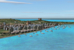
While I carried out a virtual flight from Africa toward Sicily I observes two totally naked islands. The biggest are Malta with its great airport LMML in the center. In Google earth I see that was the archipelago of Malta. Some islands that possess but churches that you hoist. I have just understood like in a piece of esth of 28x12 kilometers the biggest and 7x5 kilometers the island Gozo have been able to build so beautiful monuments. I have build some how many as some well strengths because Malta already takes many centuries defending of invasions of other towns and pirates. This archipelagos that I finish that it lacked to build in the Mediterranean. Now the "piccolissimas"
rot to alternate among my scenerys together with Baleares, Corcega, Cerdenia, Sicily, Cyprus, Crete and the group of islands of the Hreek territory.
| Filename: | Malta_archipelago.zip |
| License: | Freeware |
| Added: | 7th November 2009, 20:59:41 |
| Downloads: | 2,327 |
| Author: | Toni Agramont |
| Size: | 34.79 MB |
| Category: Flight Simulator 2004 - Scenery | |
| Fort Good Hope CZGH - Northwest Territories, Canada |
|
Images related to this file:
File Description:
This is the second in a series of airfields that follow that early access route to the Canadian northern shore, the Mackenzie River. At the far northern end of the river there are Tuktoyaktuk, Inuvik, and Fort McPherson, all posted. Fort Good Hope is at 268 feet ASL and on the east bank of the Mackenzie, 180 miles southeast of Fort McPherson and 100 miles west of Great Bear Lake. The town has a population of around 560, and the main sources of income are from the traditional trapping and hunting. The airport is a mile south of the town, and has almost 4,000 feet of gravel runway. There are scheduled flights to the town by North Wright; I also have two AI GA flights and a Buffalo Airways delivery trip that hops north and south from field to field.
| Filename: | Fort_Good_Hope_CZGH__Northwest_Territories_Canada.zip |
| License: | Freeware, limited distribution |
| Added: | 4th July 2014, 21:03:03 |
| Downloads: | 278 |
| Author: | Roger Wensley |
| Size: | 3.08 MB |
| Category: Flight Simulator 2004 - Scenery | |
| Fairbanks International PFAF Float Base in Alaska |
|
Images related to this file:
File Description:
This is the floatplane base which is part of Fairbanks International Airport, PFAF. It has a separate PAFX identifier here due to the limitations of AI in FS9. Though it doesn't come close to the activity level of Lake Hood in Anchorage Alaska it is still a fairly busy place. In Fairbanks there is this floatbase, Chena Marina to the southwest, Chena River to the northwest, and Metro Field to the east between Fairbanks and the river. You will need Ultimate Terrain Alaska Canada, and you must first install the version of Fairbanks International PFAF by William Morgan, as this scenery was the starting point for the floatplane base scenery, and without it the result would be disappointing. There are scenery and land class files, files that modify PFAF, AFCAD for AI, and a traffic file.
| Filename: | Fairbanks_International_PFAF_Float_Base_in_Alaska.zip |
| License: | Freeware, limited distribution |
| Added: | 19th August 2010, 22:55:46 |
| Downloads: | 796 |
| Author: | Roger Wensley |
| Size: | 1.03 MB |
| Category: Flight Simulator 2004 - Scenery | |
| RealityPack 1.2: Comprehensive Enhancement Package - Part 2 |
|
File Description:
RealityPack 1.2 is a major enhancement of FS2004. New forests, meadows, cliffs, runways, taxiways, roads with traffic, rails with trains, trees, airport lighting, complete texture set for Europe and more. More than 600 high-definition, highly detailed realistic textures reengineered by hand from aerial photographs for unprecedented detail.
Subtle 3D-effects, real sunlight emulation, careful colour blending, contrast and definition and seasonal variety combined with no frame rate impact will create a new level of realism and immersion. Real macrostructures with recognisable ground detail blend into a realistic landscape. Works well for both low level and high altitude flights. Summer, fall and soft winter seasons included (hard winter forests only for Europe at the moment). For a full list of contents check out the posts in the avsim screenshot forum or the included readme file.
| Filename: | RealityPack_12_Comprehensive_Enhancement_Package__.zip |
| License: | Freeware, limited distribution |
| Added: | 29th January 2006, 01:22:35 |
| Downloads: | 85,717 |
| Author: | Sascha Rieger |
| Size: | 10.48 MB |
| Category: Flight Simulator 2004 - Scenery | |
| RealityPack 1.2: Comprehensive Enhancement Package - Part 1 |
|
File Description:
RealityPack 1.2 is a major enhancement of FS2004. New forests, meadows, cliffs, runways, taxiways, roads with traffic, rails with trains, trees, airport lighting, complete texture set for Europe and more. More than 600 high-definition, highly detailed realistic textures reengineered by hand from aerial photographs for unprecedented detail.
Subtle 3D-effects, real sunlight emulation, careful colour blending, contrast and definition and seasonal variety combined with no frame rate impact will create a new level of realism and immersion. Real macrostructures with recognisable ground detail blend into a realistic landscape. Works well for both low level and high altitude flights. Summer, fall and soft winter seasons included (hard winter forests only for Europe at the moment). For a full list of contents check out the posts in the avsim screenshot forum or the included readme file.
| Filename: | RealityPack_12_Comprehensive_Enhancement_Package__.zip |
| License: | Freeware, limited distribution |
| Added: | 29th January 2006, 01:21:32 |
| Downloads: | 101,293 |
| Author: | Sascha Rieger |
| Size: | 22.64 MB |
| Category: Flight Simulator 2004 - Scenery | |
| Fortal v5 Addon (SBFZ/SNFF) |
|
Images related to this file:
File Description:
Adds trucks, cars and other FS9 default objetcs to Fortaleza International Airport (SBFZ) and Feijo Airfield (SNFF), Ceara, Brazil. This sceney "fortalv5-addon.zip" is a complement to the "fortalv5.zip" scenery of Fortaleza/SBFZ made by the scenery designer Alvaro Volponi. You need to have "fortalv5.zip" installed beforehand in order to "fortalv5-addon.zip" work properly. You find it here: http://fsbrasil.wordpress.com/2010/01/19/fortalv5-addon/
****************************
Adiciona caminhoes, carros e outros objetos default do FS9 no Aeroporto Internacional de Fortaleza/SBFZ e no Aerodromo do Feijo (SNFF), Ceara, Brasil. Este cenario "fortalv5-addon.zip" eh um complemento ao cenario de Fortaleza/SBFZ "fortalv5.zip", de autoria de Alvaro Volponi. Voce necessita ter o "fortalv5.zip" instalado previamente para que o "fortalv5-addon.zip" possa funcionar normamente. Voce o encontra aqui: http://fsbrasil.wordpress.com/2010/01/19/fortalv5-addon/
| Filename: | Fortal_v5_Addon_SBFZSNFF.zip |
| License: | Freeware |
| Added: | 21st January 2010, 02:22:20 |
| Downloads: | 4,554 |
| Author: | Rui Mesquita |
| Size: | 781.46 KB |


© 2001-2026 AVSIM Online
All Rights Reserved
Privacy Policy |