
Where Flight Simulation Enthusiasts Gather from Around the World!
AVSIM Library - Search Results

| Category: Flight Simulator 2004 - Scenery | |
| OryxSim Khasab / Northern Oman SRTM Mesh -FIX- |

|
Images related to this file:
File Description:

This fix removes the steep hill north of the airport when using the OryxSim Khasab scenery in combination with the Northern Oman SRTM mesh by Yohann Baptiste. This fix is not recommended for users using the default scenery. This file requires version 2.0 of OryxSim Khasab.
| Filename: | OryxSim_Khasab__Northern_Oman_SRTM_Mesh__FIX.zip |
| License: | Freeware |
| Added: | 15th February 2010, 10:47:45 |
| Downloads: | 1,649 |
| Author: | OryxSim |
| Size: | 1.42 KB |
| Category: Flight Simulator 2004 - Scenery | |
| VFAA - Pack V2.01 |
|
File Description:
Virtual Flight Air America - Laos Project -
Small airfields used 50 years ago.
14 Landing/Stol Sites placed according to real maps.
These files require asia-mesh-part4.zip, by Yohann Baptiste, that can be found in the AVSIM library
Included Readme file for further informations or consult the web site http://www.vfaa.net
| Filename: | VFAA__Pack_V201.zip |
| License: | Freeware |
| Added: | 5th May 2006, 13:32:32 |
| Downloads: | 743 |
| Author: | Jean-Luc Bouvron |
| Size: | 5.45 MB |
| Category: Flight Simulator 2004 - Scenery | |
| Manzhouli Xijiao Airport (ZBMZ) |
|
Images related to this file:
File Description:
Scheduled operators at ZBMZ: Air China, Hainan Airlines, Tianjin Airlines, China United Airlines.
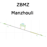
A basic "Google Earth" based scenery for Manzhouli Xijiao Airport (ZBMZ) which is missing in FS9 stock version.
All features accurately placed/shaped according to satellite imagery and Chinese AIP (AIRAC cycle 1112).
It features a basic default terminal, tower, and taxi signs.
ILS approaches for runway 12 & 30 coded for AI & UI with MZL transitions available.
| Filename: | Manzhouli_Xijiao_Airport_ZBMZ.zip |
| License: | Freeware, limited distribution |
| Added: | 8th January 2012, 07:47:22 |
| Downloads: | 671 |
| Author: | Yohann Baptiste |
| Size: | 276.28 KB |
| Category: Flight Simulator 2004 - Scenery | |
| Datong Beijiazao Airport (ZBDT) |
|
Images related to this file:
File Description:
Scheduled operators at ZBDT: Air China, China Express, China Eastern, China Southern, & China United Airlines.
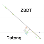
A basic "Google Earth" based scenery for the new Datong Beijiazao Airport (ZBDT) which is missing in FS9 stock version.
All airport features are accurately placed/shaped according to sat imagery. Navaids valid as AIRAC 1110.
It features basic default terminal, tower, and taxi signs.
ILS 32 & VOR 14 approaches coded for AI & UI.
| Filename: | Datong_Beijiazao_Airport_ZBDT.zip |
| License: | Freeware, limited distribution |
| Added: | 8th January 2012, 07:49:37 |
| Downloads: | 727 |
| Author: | Yohann Baptiste |
| Size: | 384.79 KB |
| Category: Flight Simulator 2004 - Scenery | |
| ZGBS - Bose Airport |
|
Images related to this file:
File Description:
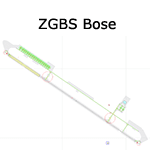
A google-earthed scenery for Bose airport (alternate spelling: Baise) which is missing in FS9 stock version, with basic default terminal & tower, and taxisigns.
All features accurately placed/shaped according to sat imagery. Navaids valid as AIRAC 1110.
No approach coded.
Current scheduled operators at ZGBS: China Express Airlines.
| Filename: | ZGBS__Bose_Airport.zip |
| License: | Freeware, limited distribution |
| Added: | 13th January 2012, 00:34:03 |
| Downloads: | 600 |
| Author: | Yohann Baptiste |
| Size: | 419.21 KB |
| Category: Flight Simulator 2004 - Scenery | |
| ZGCJ - Huaihua Zhijiang Airport |
|
Images related to this file:
File Description:
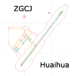
A scenery for Huaihua airport which is missing in FS9 stock version, with basic default buildings, tower, and taxisigns.
Based on december 2004 sat imagery, at a time when construction works were still going on. Navaids valid as AIRAC 1110.
Fictionnal ILS04 approach coded for UI & AI. A basic landclass is also provided, which covers only vicinity of the airport & Zhijiang town.
Current scheduled operators at ZGCJ: China Southern, Spring Airlines.
| Filename: | ZGCJ__Huaihua_Zhijiang_Airport.zip |
| License: | Freeware, limited distribution |
| Added: | 30th January 2012, 14:52:02 |
| Downloads: | 600 |
| Author: | Yohann Baptiste |
| Size: | 377.88 KB |
| Category: Flight Simulator 2004 - Scenery | |
| ZLJC - Jinchang Airport |
|
Images related to this file:
File Description:
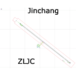
A semi-fictionnal scenery for Jinchang airport that opened on august 2011, with basic default terminal, tower, and taxisigns.
Based on october 2009 sat imagery, at a time when construction works were going on. Navaids valid as AIRAC 1201.
Fictionnal are: apron & stands, airport buildings, and ILS31 approach coded for UI & AI. A basic landclass is also provided, which covers the vicinity of the airport & Jinchang town.
Current scheduled operators at ZLJC: Tianjin Airlines.
| Filename: | ZLJC__Jinchang_Airport.zip |
| License: | Freeware, limited distribution |
| Added: | 1st February 2012, 13:12:05 |
| Downloads: | 441 |
| Author: | Yohann Baptiste |
| Size: | 355.08 KB |
| Category: Flight Simulator 2004 - Scenery | |
| ZLTS - Tianshui Airport |
|
Images related to this file:
File Description:
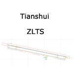
A google-earthed scenery for Tianshui airport (non FS9 stock), with basic default terminal, tower, and taxisigns.
Based on december 2009 sat imagery. Navaids valid as AIRAC 1201.
Fictionnal are: parking & taxiway designators, ILS10 approach coded for UI & AI.
Current scheduled operators at ZLTS: Tianjin Airlines.
| Filename: | ZLTS__Tianshui_Airport.zip |
| License: | Freeware, limited distribution |
| Added: | 5th February 2012, 19:31:42 |
| Downloads: | 478 |
| Author: | Yohann Baptiste |
| Size: | 447.37 KB |
| Category: Flight Simulator 2004 - Scenery | |
| ZBDS Dongsheng Ordos Airport (Non-Stock) |
|
Images related to this file:
File Description:
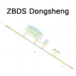
A basic, semi-fictionnal scenery for Dongsheng/Ordos airport which is missing in FS9 stock version.
All features placed/shaped upon sat imagery from august 2010, involving many guesses on new apron & new terminal. Parking spots, jetways & taxiway designators are purely fictionnal.
Navaids up-do-date with AIRAC cycle 1110, with ILS approach code for AI & UI users.
Since extension completed in 2011 ZBDS is one of the fastest growing airport in China. Currently scheduled operators are: Air China, China United Airlines, Shenzhen Airlines, Hainan Airlines, Sichuan Airlines, China Eastern, Tianjin Airlines, Shanghai Airlines, Shandong Airlines, China Southern, China Express.
| Filename: | ZBDS_Dongsheng_Ordos_Airport_NonStock.zip |
| License: | Freeware, limited distribution |
| Added: | 1st January 2012, 21:14:23 |
| Downloads: | 844 |
| Author: | Yohann Baptiste |
| Size: | 411.66 KB |
| Category: Flight Simulator 2004 - Scenery | |
| Europe SRTM mesh part 10: Lower Danube |
|
File Description:
Europe SRTM LOD9 mesh part 10 of 13: Covers a wide area centered over the Danube valley from Novi Sad to the Black Sea (42°N-46°N, 19°E-30°E). Includes Balkans & Transylvanian moutain ranges, and parts of the following countries: Romania, Bulgaria, Serbia and Albania.
This Europe SRTM project was optimized for the lowest HDD space use: Each part macthing exactly the boundaries of its neighbors, you'll have a complete corevage of Europe without gap or overlapping scenery. Based on SRTM Data v1 and v2 (3 arcsec, 90m) and sampled to LOD9 resolution (76m). Each SRTM tile was carefully checked and repaired with Blackart v4.02: water areas are now flattened (lighter mesh), and SRTM voids were treated taking advantage of Blackart's sophisticated interpolation algorithm. When required, biggest voids were patched with oversampled SRTM 30 arcsec data and/or manual input.
| Filename: | Europe_SRTM_mesh_part_10_Lower_Danube.zip |
| License: | Freeware, limited distribution |
| Added: | 19th October 2005, 17:55:10 |
| Downloads: | 11,735 |
| Author: | Yohann Baptiste |
| Size: | 39.14 MB |


© 2001-2026 AVSIM Online
All Rights Reserved
Privacy Policy |