
Where Flight Simulation Enthusiasts Gather from Around the World!
AVSIM Library - Search Results

| Category: Flight Simulator 2004 - Scenery | |
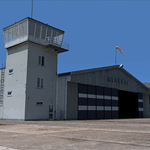
| Kotzebue PAOT on the northwestern coast of Alaska |

|
Images related to this file:
File Description:
There are four main northwestern Alaska towns which have good airports and are serviced by Alaska Airlines. From these airports local flights connect to nearby villages, "nearby" in Alaska meaning up to 150 miles away. The northernmost is Barrow. Southwest of Barrow is Kotzebue, then Nome, and the furthest south is Bethel. The town of Kotzbue is north of the Bering Strait on the northwestern coast, 320 miles southwest of Barrow. The population is just over 3,000 people. The location was for a long time a base for trading in furs, with three rivers emptying into the sea and providing routes into the interior land and villages; a meeting place between hunters and traders from Russia and elsewhere. The Kotzebue airport is called the Ralph Wien Memorial and has two runways. The modern one is aligned 08-26 and is 5,880 feet of 150 feet wide asphalt built across a shallow lagoon, with an ILS on 08 and PAPI on both ends. The second and older runway is originally military and gravel, aligned 17-35 and 3,786 feet long and used (wind allowing) by the GA planes that park alongside the runway. The prevalent wind is from the west; when the wind is from the east it is generally relatively feeble and with a much lower cloud base, possibly to the ground, hence the need for an ILS. All AI aircraft in FS9 much prefer to use a runway that has an ILS and so will continue to use 08-26 even if the wind is from the south until it reaches 30+ knots, even if they are a Cessna 150 flying VFR. So for AI realism in FS9 a northern or southern wind needs to be a strong one so that the runway is actually used. However, as Alaska Airlines, Northern Air Cargo, and Everts Air also fly to Kotzebue and can only use the east-west runway (as less than 4,000 feet of asphalt would be seriously inconvenient for a Boing 737 or DC6) it is necessary to have the northern or southern wind UNDER 30 knots at the times when they are landing or taking off. Your choice. I suppose a permanent strong wind from the west would be the most realistic on a daily basis, deterring all planes from ever using 17-35. The AI will develop along with further scenery additions in the neighbourhood.
| Filename: | Kotzebue_PAOT_on_the_northwestern_coast_of_Alaska.zip |
| License: | Freeware, limited distribution |
| Added: | 2nd August 2016, 16:47:52 |
| Downloads: | 457 |
| Author: | Roger Wensley |
| Size: | 19.32 MB |
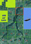
| Category: Flight Simulator 2004 - Scenery | |
| VFR of Lario - Como lake, Italy |
|
Images related to this file:
File Description:
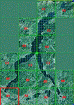
This is the first of the expected seventeen sceneries in the "VFR of Lario" project, that will include the full view of the Como Lake, made with photorealistic terrain (multiseason & night) and with 3D GMax realistic objects, including some motions. Further the Como seaplane airport, the project will include some other virtual ones, and all the piers of NLC (Navigation Lake Como). The project will be completed with a related AI seaplane traffic.
The "VFR of Lario" project REQUEST the installation of the scenery "Itcoast2.zip" & the related "ITAC2_P1.zip", both available for free download from different libraries.
Information: Como is the main and beautifull city on the namesake lake (called Lario), placed in the north of Italy, closed to the Helvetic border. It includes the AeroClub Como seaplanes international airport, with his own flight school. Como has the headseat of NLC, the fleet management for connection of forty Lario's piers. This first scenery covers approximately an area of 7.5x6 kmt.
Contents: airport water track with hangar and static seaplanes; breackwater and stadium lake front, war memorial monument, Volta's temple and lighthouse, main Cathedral, Social theater, city old towers and wall, villa Olmo, square Cavour's buildings, NLC main pier and some minor others, Como-Brunate's funicolar connection (animated), lake fountain, Tavernola shipyard, Baradello's castle, Valduce hospital; motor ships (animated), steamer, hydrofoils and other minor boats; several other buildings (GenericBuilding system), trees and lights widespread all over the scenery.
| Filename: | VFR_of_Lario__Como_lake_Italy.zip |
| License: | Freeware |
| Added: | 22nd December 2011, 23:30:47 |
| Downloads: | 3,549 |
| Author: | Aldo Della Vedova, Daniele Lanfranchi, Diego Caligiuri |
| Size: | 25.33 MB |
| Category: Flight Simulator 2004 - Scenery | |
| VFR of Lario, Area E2 - Como Lake, Italy (Update) |
|
Images related to this file:
File Description:
This 8th scenery covers approximately an area of 7.5x6 km, from S.Gregorio/Dongo (NW) to Colico (NE), and S.Siro (SW) to Tremenico/Aveno (SE) and includes six NLC piers: Dervio, Piona, Colico, Dongo, Musso, Pianello del Lario, in addition to the disused Cremia's one; a lot of dedicated buildings are included, as S.Tommaso of Canterbury church and fortification (Corenno), Cistercian abbey (Piona), pier and dock (Colico), S.Stefano church, factory buildings and airpollution control machinery (Dongo), Rezzonico's castle (S.Siro).
This VFR on Lario scenery includes several Dervio's details, and fully revises the previous Dervio scenery; Are included: Boldona's park office and stand, railway station, NLC shiphard, Pontile piers with Concordia steamer, dock bay with small floating pier and compass of the lake, S. Peter and Paul church and houses front of lake, hydro power station, Municipality and some other buildings, Castello's tower, windsurf school, windsurfers and kitesurfers on the lake, cross and Madonna on top of Legnoncino mountain. There are also included two viaducts between the tunnels of the freeway 36, with moted traffic. Catamarans Citta di Como and Tivano at Colico/Dongo piers together with other minor boats and docks alongside the lake coast; a moted regata with catamarans is placed in the lake between Pianello and Dervio.
This scenery SUPERSEDES AND CANCELS the previous "dervio_v2a" one, removed from the library. This is the eighth scenery of the "VFR of Lario" project, made with photorealistic terrain (multiseason & night) and with some 3D GMax realistic objects.
| Filename: | VFR_of_Lario_Area_E2__Como_Lake_Italy_Update.zip |
| License: | Freeware |
| Added: | 25th November 2012, 20:54:39 |
| Downloads: | 1,664 |
| Author: | Aldo Della Vedova, Daniele Lanfranchi, Gian Mario Verga |
| Size: | 39.39 MB |
| Category: Flight Simulator 2004 - Scenery | |
| Warsaw City 2015 DEMO |
|
Images related to this file:
File Description:
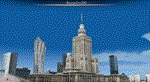
WARSAW CITY 2015 DEMO is a sophisticated scenery package, featuring a detailed scenery of Warsaw city in Poland with surrounding airports, fully compatible with FS2004.
This product is a fully functional DEMO version of the commercial payware product. It features same layouts as in the full version but with limited 3D objects and low resolution textures. Using this free demo ensures no problems with online (VATSIM, IVAO, multiplayer etc.) flying in case some users use the payware scenery and some don't.
Warsaw is the capital and the largest city of Poland located on the Vistula (Wisla) River. Warsaw City 2015 gives you a possibility to fly over an extremely large area of Warsaw city. We have included a photoreal ground textures of about 5200 square km. The city centre has hundreds of custom buildings modeled, there are all VFR-important landmarks on the whole included area too. We have also created 13 variously detailed airports and heliports for the project: Modlin EPMO, Babice EPBC, Chrcynno/Nasielsk, Sobienie EPSJ, Goraszka EPGO, Konstancin-Jeziorna, Konstancin Heliport, Reczaje (lite), Kroczewo (lite), Trebki Nowe (lite), Wincentow 1 (lite), Wincentow 2 (lite), Zabia Wola (lite).
The product is equipped with an automatic installer, which means that the scenery will be automatically added to the Flight Simulator Scenery Library. Please uninstall all previous versions of similar sceneries you may have installed before. Please make also sure that no duplicate AFCAD files are installed.
Enjoy your virtual flying with Drzewiecki Design!
| Filename: | Warsaw_City_2015_DEMO.zip |
| License: | Commercial demo |
| Added: | 2nd September 2015, 22:23:02 |
| Downloads: | 928 |
| Author: | Drzewiecki Design |
| Size: | 23.41 MB |
| Category: Flight Simulator 2004 - Scenery | |
| Chatrapatti Shivaji international Airport, Mumbai/ VABB |
|
Images related to this file:
File Description:
Mumbai is having frequent commissioning and decommissioning of various features especially aprons and stands and twy changing nomenclature. However the inf. and resources used while developing the scenery are as on Tue, 22 Jun 2010 13:14:00 UTC. Middle marker for rwy 27 has been permanently withdrawn so the missed approach point of the GP inop. procedure had been amended as 1D ILS/DME in place of middle marker(mm). Navaid BMB freq 396khz withdrawn from service.
New contents include - Commissioning of TWY L4 De-commissioning of portion of Taxi lane L beyond parking stand A1 Aircraft from parking stand A1 to A3 to push back facing west on the taxi lane L, to taxi out via TWY L4 on to TWY N.* Portion of taxi lane L beyond parking stand A1 shall be decommissioned w.e.f. 0430 UTC on 1st July 2010.1. Renaming portion of TWY P from RWY 14 to its junction with TWY E as E4 & TWY Y
as TWY S7
2. Commissioning of TWYs E7, E8, E9 & E10
3. Commissioning of one additional code C Parking Stand on Apron A named A1
4. Decommissioning of Parking Stands T4 & T5
5. Commissioning of Parking Stand G7and Decommissioning of Parking Stand G10 & G14
6. Renaming of Apron K(as apron J ) alongwith it's Parking Stands & Commissioning of
one additional code E Parking stand(J4).
7. Renaming of Apron M ( as apron K).layout chart included.
Scenery features includes - 3 different models of twy edge lights, holding point 3d lights at major intersection.check out pics. if you want extremely frame rate rate friendly update, look for file in library named as - Default mumbai.
| Filename: | Chatrapatti_Shivaji_international_Airport_Mumbai_V.zip |
| License: | Freeware |
| Added: | 22nd June 2010, 22:19:54 |
| Downloads: | 7,263 |
| Author: | Ashish Singh |
| Size: | 63.93 MB |
| Category: Flight Simulator 2004 - Scenery | |
| Polish Airports VOL. 1 DEMO |
|
Images related to this file:
File Description:

POLISH AIRPORTS VOL. 1 DEMO is a package of detailed sceneries of EPGD Gdansk, EPKT Katowice, EPRZ Rzeszow (including EPRJ) and EPLB Lublin (including EPSW) airports in Poland, fully compatible with FS2004.
This product is a fully functional DEMO version of the commercial payware product. It features same airports layout as in the full version but with limited 3D objects and low resolution textures. Using this free demo ensures no problems with online (VATSIM, IVAO, multiplayer etc.) flying in case some users use the payware scenery and some don't.
Gdansk Lech Walesa Airport (GDN/EPGD) is an international airport, the 3rd largest airport in Poland, often used as a diversionary airport for Warsaw Frederic Chopin Airport in the event of poor weather or emergencies. Katowice International Airport (KTW/EPKT) is an international airport, which service both passenger flow and cargo flights. Its concrete runway is 2,800 m * 60 m (9,186 ft * 197 ft) and can accommodate even heavy transports such as Antonov An-124 or An-225. Rzeszow-Jasionka Airport (RZE/EPRZ) is an international airport located in southeastern Poland. It is the seventh-busiest airport in Poland. Near to EPRZ there is located a smaller Rzeszow Jasionka Airport (EPRJ) used by Rzeszow Aeroclub (900x30m lighted asphalt runway (090/270), 700x100m grass strip). Lublin Airport (Port Lotniczy Lublin) (LUZ/EPLB) has a 2520m runway, and the terminal facilities are capable of handling 4 x B738/A320.
The product is equipped with an automatic installer, which means that the scenery will be automatically added to the Flight Simulator Scenery Library. Please uninstall all previous versions of this airport you may have installed before. Please make also sure that no duplicate AFCAD files are installed.
Enjoy your virtual flying with Drzewiecki Design!
| Filename: | Polish_Airports_VOL_1_DEMO.zip |
| License: | Commercial demo |
| Added: | 2nd September 2015, 22:18:50 |
| Downloads: | 1,052 |
| Author: | Drzewiecki Design |
| Size: | 35.47 MB |
| Category: Flight Simulator 2004 - Scenery | |
| Mielec EPML 2009 |
|
Images related to this file:
File Description:
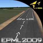
This is third version of EPML airport scenery. Main features of the scenery are: Airport ground high resolution textures - (four seasons + night textures); Highly detailed 3D objects, all photo textured; Detailed autogen and photorealistic trees. For more details please look at the README file attached to the scenery file.
EPML is home base of PZL-Mielec (Polskie Zaklady Lotnicze - Polish Aviation Works), formerly WSK-Mielec and WSK "PZL-Mielec" is the Polish aerospace manufacturer, based inMielec. It has been the biggest Polish post-war aerospace manufacturer. In 2007 it was acquired by Sikorsky Aircraft Corporation, retaining the brand.Starting from 1950, the factory developed much and became the biggest Polish aircraft producer. It was a licensed producer of the Soviet jet fighters MiG-15 (produced as Lim-1), MiG-15bis (Lim-2), MiG-17 (Lim-5) and its Polish attack variant, Lim-6. The first Lim-1s were manufactured of Soviet parts in 1952, a full-scale production started in 1953. About 1500 Lims were built by 1964. In 1957-1960 there were also produced 250 Polish-designed piston trainers TS-8 Bies. From 1963 there was produced Polish-designed jet trainer TS-11 Iskra, being a basic trainer in the Polish military aviation. Its successor, designed with a part of PZL-Mielec, the PZL I-22 Iryda, appeared however a failure for different reasons, mostly lack of proper funding, and only a small series was built.
The most numerous plane built in Mielec was the licensed Soviet Antonov An-2 utility biplane, produced from 1960 in different variants. Over 13,000 of these aircraft were manufactured by 1991, mostly on the Soviet order, but also used in Poland and exported to other countries. From 1984 PZL-Mielec manufactured Soviet STOL transport planes Antonov An-28, as its only producer in the world. The plane was subsequently developed in Mielec and in a modernized variant PZL M-28 Skytruck/Bryza is offered for the Polish Army, Polish Navy and services abroad, with some success.
| Filename: | Mielec_EPML_2009.zip |
| License: | Freeware |
| Added: | 15th May 2010, 09:47:41 |
| Downloads: | 3,778 |
| Author: | Marcin Bobro, Kuba Paczek |
| Size: | 56.33 MB |
| Category: Flight Simulator 2004 - Scenery | |
| EPGO Goraszka 2010 - The Airshow Challenge |
|
Images related to this file:
File Description:
EPGO Goraszka 2010 - The Airshow Challenge is a freeware, extremely detailed scenery of a general aviation airport located 12nm (20km) south-east of Warsaw downtown and Warsaw Frederic Chopin International Airport, Poland. EPGO Goraszka airfield was built in 1994 and currently belongs to a General Aviation company, which offers aero-taxi flights, air transport and special flights (air photo, patrol) and airport services. The airport has a 800m-long runway and a lightened helipad, which can be used by helicopters of up to 5700kg weight. General Aviation's fleet includes Antonov AN-2, PZL-104 Wilga 80, Bell 407 and 427. Since 1996 the International Air Picnic Goraszka is organized every year by the "Polish Eagles" foundation created on initiative of Zbigniew Niemczycki.
The scenery is equipped with an automatic installer. Currently we support a safe, manual way of adding new sceneries to the Scenery Library in Flight Simulator. This is just one thing users need to do for themselves. Detailed instructions will be given during the installation process.
Scenery features:
-Compatible with FS2004 only
-Highest level of accuracy in geographic positioning, modeling and texturing
-Incredibly high quality photoreal textures of all airport buildings. Textures are based on over 300 real world -photographs made for this project.
-Hundreds of 3D objects like tents, exhibitions, airport buildings and surrounding buildings
-Life in the airport: people and cars will enhance your feelings
-AI traffic, animations and effects, designed specifically for FS2004
-Some buildings include interior (control tower)
-High quality aerial photos of the airport surroundings (5 seasons + night) with autogen and water mask
-Ultra high quality aerial photos of the airport (with seasons)
-Plain airport scenery with no airshow objects available too (details in the manual)
-Product includes manual and airport charts in PDF format
EPGO Goraszka 2010 - The Airshow Challenge scenery is compatible with almost every payware add-on, including Ultimate Terrain Eastern Europe and Warsaw Photo Scenery by Simdesign.
Scenery by Drzewiecki Design - www.drzewiecki-design.net
| Filename: | EPGO_Goraszka_2010__The_Airshow_Challenge.zip |
| License: | Freeware |
| Added: | 14th July 2010, 09:49:07 |
| Downloads: | 3,751 |
| Author: | Drzewiecki Design - Stanislaw Drzewiecki, Jakub Paczek |
| Size: | 132.03 MB |
| Category: Flight Simulator 2004 - Scenery | |
| Ría de Vigo (Bay of Vigo) |
|
File Description:
Comprehensive revision of the area surroinding the Bay of Vigo, near the Vigo Airport (LEVX, aprox. at 42º18'N 8º38'W), in Galicia, Spain, including a more accurate coastline, from the Ría de Aldán until Toralla Island, plus the San Simon Island and other minor islands, detailed piers in Vigo and Cangas, several beaches, and a lot of 3D VFR references (more than 180 macros added), such as buildings (the City Hall, the Hospital Xeral, the Balaídos Stadium, the Castro stronghold...), working lighthouses, several monuments and statues, some main streets redrawn, a new version of my Rande Bridge, now with collision detection and landable surface, and a handfull of eye-candies I can't even remember! -
Completa revisión da costa da Ría de Vigo, dende a Ría de Aldán ata pasada a Illa de Toralla, incluíndo, por suposto, á Illa de San Simón e outros pequenos illotes, praias (Samil, Nerga...), os peiraos de Cangas e de Vigo, dende o Areal ata Bouzas, unha morea de novas referencias visuais (máis de 180 macros), con edificios (o Concello, o Hospital Xeral, o estadio de Balaídos, o castelo do Castro, o lazareto de San Simón...), faros (nas Cíes e na costa...), algún que outro monumento, unha revisión do trazado dalgunhas das vías principais, unha nova versión da miña Ponte de Rande, con detección de colisións e superficie "aterrable", e moitas cousas máis que xa nin eu mesmo lembro. -
Completa revisión de la costa de la Ría de Vigo (Galicia, España, aprox. en 42º18'N 8º38'O), desde la Ría de Aldán hasta pasada la Isla de Toralla, incluyendo la Isla de San Simón y otros pequeños islotes, playas (Samil, Nerga...), los muelles de Cangas y de Vigo, desde el Areal hasta Bouzas, un montón de nuevas referencias visuales (más de 180 macros), con edificios (el Ayuntamiento, el Hospital Xeral, el estadio de Balaídos, el castillo del Castro, el lazareto de San Simón...), faros (en las Cíes y en la costa...), algún que otro monumento, una revisión del trazado de algunas de las vías principales, una nueva versión de mi Puente de Rande, con detección de colisiones y superficie "aterrizable", y muchas cosas más de las que ni yo mismo me acuerdo.
| Filename: | Ra_de_Vigo_Bay_of_Vigo.zip |
| License: | Freeware |
| Added: | 16th May 2004, 23:48:38 |
| Downloads: | 4,478 |
| Author: | Rubén Castiñeiras |
| Size: | 366.85 KB |
| Category: Flight Simulator 2004 - Scenery | |
| Cameri and Turbigo sceneries (rev. 3) - north Italy |
|
Images related to this file:
File Description:
The following files are required by this file:
http://library.avsim.net/esearch.php?DLID=163723&UploadID=&Name=&FileName=&Author=&CatID=root
http://library.avsim.net/esearch.php?DLID=186350&UploadID=&Name=&FileName=&Author=&CatID=root
This scenery includes a global review of the previous Sceneries of Cameri Military airport (rev.2 Oct 2011), Cameri Museum (rev. 2 Oct 2011), Cameri Babini (rev. 2 oct 2011), Turbigo power station (rev. 2 Sep 2011 and update rev. 2.1 Oct 2014). All the above ARE NOW INCLUDED in this new unique scenery. Contents: Terrain in new version photo-realistic multi-seasons/night; adapted to Western Europe special elevation meshes; cover area of over 120 sqkm from Bellinzago-Oleggio (NW) to Magnago-Bienate (NE), from Novara (SW) to Cuggiono-Inveruno (SE); all the terrain has been restorated with 3D buildings, either through autogen that with specific dedicated objects (by GMax) and with significant addition of library objects ("dva51" and other existings). This scenery (located on the final approach to the Milan Malpensa international airport) includes the Cameri's Mil Airport with the Babini closed Army area and the planes of the Historical Museum of the airport; it is also included the thermoelectric power station of Turbigo. All the buildings are placed to recreate cities and villages covered in the photo-realistic terrain, including Bellinzago, Bienate, Buscate, Caltignaga, Cameri, Castano Primo, Castelletto Ticino, Cuggiono, Galliate, Inveruno, Magnago, Malvaglio, Nibbia, Novara, Oleggio, Pernate, Robecchetto, Romentino, Sant'Anna, San Pietro Mosezzo, Turbigo , Vanzaghello, and the covered Turin-Milan highway.
Details of the new buildings for the care and maintenance to F35 completely recreated, as obtainable from the current satellite view.
It REQUIRES the use of the following, to be downloaded separately :
- the libraries dva51 - the system of vegetations TreePlanter - the West Europe Meshes of Daniele Lanfranchi. See the Readme file. Enjoy!
Videos available here:
https://dl.dropboxusercontent.com/u/38829151/FS9/Cameri_Turbigo_v3%20shots.WMV
http://youtu.be/yVI2KeJKS5o
http://youtu.be/oKa0e_5kxIk
| Filename: | Cameri_and_Turbigo_sceneries_rev_3__north_Italy.zip |
| License: | Freeware |
| Added: | 21st January 2015, 21:32:36 |
| Downloads: | 990 |
| Author: | Aldo Della Vedova, Daniele Lanfranchi and Gian Mario Verga |
| Size: | 103.7 MB |
© 2001-2026 AVSIM Online
All Rights Reserved
Privacy Policy |