
Where Flight Simulation Enthusiasts Gather from Around the World!
AVSIM Library - Search Results

| Category: Flight Simulator 2004 - Scenery | |
| Polish Airports VOL. 2 DEMO |

|
Images related to this file:
File Description:

POLISH AIRPORTS VOL. 2 DEMO is a package of detailed sceneries of EPSC Szczecin, EPLL Lodz and EPZG Zielona Gora airports in Poland, fully compatible with FS2004.
This product is a fully functional DEMO version of the commercial payware product. It features same airports layout as in the full version but with limited 3D objects and low resolution textures. Using this free demo ensures no problems with online (VATSIM, IVAO, multiplayer etc.) flying in case some users use the payware scenery and some don't.
Szczecin-Goleniow "Solidarnosc" (SZZ/EPSC) is the main domestic and international airport serving the city of Szczecin in Poland. Lodz Wladyslaw Reymont (LCJ/EPLL), formerly known as Lodz-Lublinek Airport, is a regional airport in central Poland. Zielona Gora-Babimost (IEG/EPZG) is a regional post-military airport located within the greater Zielona Gora agglomeration and is the 11th busiest airport in Poland.
The product is equipped with an automatic installer, which means that the scenery will be automatically added to the Flight Simulator Scenery Library. Please uninstall all previous versions of this airport you may have installed before. Please make also sure that no duplicate AFCAD files are installed.
Enjoy your virtual flying with Drzewiecki Design!
| Filename: | Polish_Airports_VOL_2_DEMO.zip |
| License: | Commercial demo |
| Added: | 2nd September 2015, 22:19:48 |
| Downloads: | 583 |
| Author: | Drzewiecki Design |
| Size: | 9.11 MB |
| Category: Flight Simulator 2004 - Scenery | |
| RPLL Version 8 (Ninoy Aquino Internal Airport, Villamor Airbase, Sangley Airbase and Metro Manila) |
|
Images related to this file:
File Description:
Welcome to the latest version of the RPLL and Metro Manila scenery for FS9. This scenery is a a total rework of my previous scenery and contains a more accurate depiction of the entire metropolis. Over 4 years in the making and is the last upgrade for FS9.
This release coincides the first release sometime August of 2006. This scenery covers an area of around 1,400 sq. km. which includes major cities around Metro Manila: from Taytay in the east to Sangley in the west; from Alabang in the south to Novaliches/Caloocan-Bulacan boundaries in the north.
Sangley (RPLS) Airbase has also been redesigned (only the runway and taxiways). The entire Manila Bay coastline from Sangley to Novaliches has been recreated, adding fish-farms, correct coastal shape, breakwaters, reclaimed areas and marine ports. All major roads and river/water systems are also covered in this scenery.
The RPLL airport scenery contains 90 percent of the existing structures plus noticeable buildings around the vicinity including the new Newport City, Libingan ng mga Bayani, Fedex HQ and MIAA offices; and warehouse around rwys 06 and 24. 80 percent of the structures are individually textured. Also included in the package is Nestor d'Angelos Metro Manila buildings.
| Filename: | RPLL_Version_8_Ninoy_Aquino_Internal_Airport_Villa.zip |
| License: | Freeware, limited distribution |
| Added: | 4th August 2010, 03:48:52 |
| Downloads: | 4,617 |
| Author: | Lowil fred Espada |
| Size: | 25.37 MB |
| Category: Flight Simulator 2004 - Scenery | |
| Memmingen Airbase (ETSM, South-Germany) including MilCom AI-Traffic |
|
File Description:
This airbase, located in the beautiful Allgaeu (Bavaria, South-Germany) about
55 NM in the west of Munich, was the homebase of the JaBoG34 riding the F104
1964 thru 1987 and then the Tornado PA200. After JaboG34 had been dissolved
in 2003, it was decided to use the airfield for commercial air traffic.
In memory of the JaBoG34 at the "Memminger Berg" and to keep the ATC people busy,
I created this airfield with combined military / commercial AI-Traffic.
The included AI-Package contains Lockheed F-104 GAF, Republik F-84F GAF,
Panavia-Tornado GAF, Airbus-A310 GAF, Lockheed-P3 Orion GNY, Boeing-727 with
UN paint, Boeing-737 Lauda, Bombardier CRJ-200 Lufthansa and aircraft.cfg for
MS: Beech-Baron 58, King-Air 350, and Learjet 45.
Several F104's and Tornados perform touch and goes in the local area, further an
UN-B727 leaves IFR to Decimomannu (LIED) and a GAF-A310 goes IFR to Cologne.
Some of the commercial airplanes perform touch and goes also, a CRJ-200 goes
IFR to Munich and a Lauda-737 goes IFR to Vienna per attached flightplan.
Lago's FSE is required in order to see most of the major buildings / objects.
Welcome to the party again.
| Filename: | Memmingen_Airbase_ETSM_SouthGermany_including_MilC.zip |
| License: | Freeware, limited distribution |
| Added: | 16th November 2005, 16:22:23 |
| Downloads: | 7,704 |
| Author: | Klaus Jone |
| Size: | 11.47 MB |
| Category: Flight Simulator 2004 - Scenery | |
| EPMO - Modlin 2009 |
|
Images related to this file:
File Description:

EPMO MODLIN 2009 features an extremely detailed scenery of military airfield near Warsaw, Poland, fully compatible with FS2004. In the past it was a payware scenery, but Drzewiecki Design decided to provide you that old full product for FREE!
The airport was upgraded around 2012 and currently it has a nice passenger terminal and serves low-cost carriers like Ryanair, however back in 2009 it was an almost abandoned military airfield with some amazing structures inside. This scenery shows the status of Modlin airport in 2009 having many tumble-down buildings, deformed and rusty metal stairs and much more. Nothing has left of that old airport by now but using our scenery you can go back in time and check for yourself how it looked like.
The scenery features accurate positioning, modelling and texturing, high quality photoreal textures of all airport buildings (some buildings include interior) and high quality aerial photos of the airport. The package also includes charts and airfield specification.
The product is equipped with an automatic installer, but you need to manually add the airport into the Flight Simulator Scenery Library (see attached manual or read my text below). Please uninstall all previous versions of this airport you may have installed before. Please make also sure that no duplicate AFCAD files are installed.
Enjoy your virtual flying with Drzewiecki Design!
| Filename: | EPMO__Modlin_2009.zip |
| License: | Freeware, limited distribution |
| Added: | 2nd September 2015, 21:54:41 |
| Downloads: | 402 |
| Author: | Drzewiecki Design |
| Size: | 132.96 MB |
| Category: Flight Simulator 2004 - Scenery | |
| LFRD2004 Dinard/St-Malo VFR Scenery |
|
Images related to this file:
File Description:
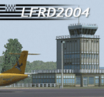
LFRD is a regional airport in Brittany, France. This scenery was created entirely with GMax and the latest Microsoft compilers. Everything was made to ensure maximum framerate while giving maximum visual impact, even on humbler machines. This scenery will run just as fast as the default one (which is very bare) with your current settings, even though there are literally thousands of houses, buildings, trees and a detailed airport.
This is a complete package:
-SRTM local mesh with custom coast trimming
-Custom phototexture (200sq km), with seamless blending into FS9 standard landclass
-Full autogen with custom local texture
-Custom landclass and waterclass
-AFCAD2 file with parking codes
-Custom Hi-res photographic textures at airport.
-Gmax buildings and xml librairy objects.
It was made by a real life pilot and is totally aimed at recreating the feeling of being there, not so much on the ground (after all, this is a FLIGHT simulator), but at circuit altitudes. This is not about recreating an airport in all its glorious details at the cost of framerate, but instead an exercise in balancing visual cues and details as viewed from up there to make it 'as real as it gets' within the limits of FS9. Scenery made by Vauchez (http://mapage.noos.fr/euro_vauchez/)
| Filename: | LFRD2004_DinardStMalo_VFR_Scenery.zip |
| License: | Freeware, limited distribution |
| Added: | 28th April 2010, 18:06:05 |
| Downloads: | 46,564 |
| Author: | Etienne Vauchez |
| Size: | 10.55 MB |
| Category: Flight Simulator 2004 - Scenery | |
| Hazyview Airfield, Hazyview, South Africa |
|
Images related to this file:
File Description:
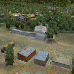
Hazyview is one of the gateway towns to the Kruger National Park and is located just to the West of Phabeni Gate, one of the main gates to use if you are travelling to Skukuza. The airfield in Hazyview is also called Numbi Airfield due to the location of the Numbi Hotel right next to the airfield.
Hazyview airfield is not included in the default scenery of FS2004. With this package, it has been faithfully produced in Gmax with photoreal textures on all the buildings and a photoreal ground as well. Even the Lowveld mall to the North of the airfield and right on the approach to Rwy 19 as well as the Building supplies store to the south and on approach to Rwy 01 is inlcuded with custom models and textures. Likewise, the buildings to the West of the runway (right at the edge of the runway) and the brickyard at the Northern end is modeled with custom models and textures. The two large cellphone antennas are also present in the airport scenery and custom made.
In real life, the runway is quite sloped and this was also recreated in the scenery under the limitations FS2004 presents with regards to non-flat airports.
The grass runway is aligned 01/19 and only 820m long. Take-off is on Rwy 01, with landings on Rwy 19.
| Filename: | Hazyview_Airfield_Hazyview_South_Africa.zip |
| License: | Freeware, limited distribution |
| Added: | 4th February 2022, 14:57:40 |
| Downloads: | 142 |
| Author: | Kobus van Wyk |
| Size: | 17.07 MB |
| Category: Flight Simulator 2004 - Scenery | |
| Exploring Our World - Part 2 - Easter Island, Chile - SCIP - a complete makover. |
|
File Description:
Exploring Our World - Part 2 - Easter Island, Chile. In part two of this new series you will find a complete makeover of Easter Island which MS virtually ignored. Designed to compliment the fine Mataveri International Airport by Daniel Rojas (scip_o7.zip at Flightsim.com), this package includes Mesh and adjusted coastlines by John Young. John has also provided a new Afcad which removes unrealistic pushback starts. A new landclass file by John Burford adds the villages near the airport and more realistic ground treatments. You will also find numerous scenery enhancements using objects from the RWY12 and EZ Scenery libraries. Francisco Vargas has contributed a set of Thermals which soaring fans will enjoy. Of special interest is the use of AI Volkswagens, as taxi's driving around the airport and AI Helicopters that take visiting tourists on sightseeing tours. The AI Volkswagens have been provided by Ranier Girbig and are used with his permission. Easter Island, home of the mysterious head statues (Moai) has many new and exciting things just waiting for you to explore. Even the small adjacent Moto Nui Island, which MS forgot, has been added. This is the second of a series exploring lesser known parts of our FS world. Please unzip (using folders option) to a temporary folder and follow the documentation very carefully to assure a proper installation. ......
| Filename: | Exploring_Our_World__Part_2__Easter_Island_Chile__.zip |
| License: | Freeware |
| Added: | 13th July 2006, 03:22:45 |
| Downloads: | 6,695 |
| Author: | David "Opa" Marshall and friends |
| Size: | 6.7 MB |
| Category: Flight Simulator 2004 - Scenery | |
| Avon STOLPort (KWHR) |
|
File Description:
A recreation of the Avon STOLPort (ident KWHR) for MS Flight Simulator 2004, A Century of Flight. Avon was operated as an exclusive destination for Rocky Mountain Airways between (approximately) 1978 and sometime in the late 80's or early 90's. The 4,000' runway was short for the nearly 7,500' elevation, and surrounded by mountains, some towering over 6,000' above the airport elevation. To allow all weather operation, the airport eventually featured what was reported as the steepest ILS ever constructed, with a seven degree glideslope. RMA had exclusive use of the tiny STOLPort and operated it with 50-passenger De Haviland Dash 7 equipement.
Lacking the original chart, I surveyed in FS and plotted what is hopefully an accurate representation of the ILS approach, using my best understanding of TERPS - the US standard for instrument approaches. I also created an NOS-style IAP chart of this approach for the package. A text Takeoff Minimums & Procedure is also included.
AI ATC & traffic recognition of the approach will hopefully follow, but does not exist yet. In other words, you can fly this approach and see the localizer in the GPS, but AI ATC will not give you vectors to it. You'll need to follow the full procedure included on the chart.
Please see the full Readme.txt in "Flight Simulator 9\Addon Scenery\KWHR\Docs" in this zipfile for information on installation of the scenery, flying the approach, and more on the history of the Avon STOLPort.
| Filename: | Avon_STOLPort_KWHR.zip |
| License: | Freeware, limited distribution |
| Added: | 12th May 2008, 23:14:38 |
| Downloads: | 418 |
| Author: | Stephen Comer |
| Size: | 2.1 MB |
| Category: Flight Simulator 2004 - Scenery | |
| Lechfeld, v2 |
|
Images related to this file:
File Description:
This airbase, located about 35 NM in the west of Munich (Bavaria, South Germany),
is the homebase of JaBoG32 riding the Tornado PA200. The German flight check
department GMFS, using C-47 in the early days and thereafter Hawker-Siddeley 748
as well as HS-125 for periodic recalibration of the radar- and navigational
equipment at civil and military airfields, was also on the base till 1994.
After the final decision was made not to establish commercial air traffic although
it had been discussed for a long time period, I reworked the airbase completely.
Among other objects, 38 hardened shelters for combat aircraft have been emplaced.
The included AI-Package contains: Lockheed F-104E GAF, Panavia Tornado PA200 GAF,
Mikoyan MiG-29 GAF, Douglas C-47 GAF, Canberra B.20 GAF, Boeing E3A Nato, Boeing
KC-135 USAF and an aircraft.cfg for the MS Learjet 45.
Several F104's, Tornadoes and MiGs perform touch and goes in the local area,
a Nato E3A leaves IFR to Geilenkirchen (ETNG), an USAF KC-135 routes IFR to
Decimomannu (LIED), a Canberra B.20 (was used for high altitude validations) goes
IFR to Cologne (EDDK) high in the sky and a Learjet shoots IFR to Bremen (EDDW) per
attached flight plan.
Lago's FSE is required in order to see most of the emplaced buildings /objects.
Lets get ready to rumble, but keep in mind, don't argue with the flight checkers
if they are on duty.
| Filename: | Lechfeld_v2.zip |
| License: | Freeware |
| Added: | 12th April 2011, 13:26:46 |
| Downloads: | 1,420 |
| Author: | Klaus Jone |
| Size: | 5.43 MB |
| Category: Flight Simulator 2004 - Scenery | |
| Graskop Airfield, South Africa |
|
Images related to this file:
File Description:
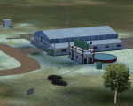
Graskop Airfield does not appear in the default FS2004, neither is the town included which is a pity as the airfield lies right on the edge of a gorge where bungee jumping and even a Gorge-lift (elevator) or a slide across the gorge can be enjoyed by the adrenaline junkies. Added to this, the airfield (and town of Graskop) is merely 10km from the world famous God's Window (also featured in the film, "The Gods must be Crazy").
This package will add a custom (Gmax & Sketchup) made Graskop Airfield, Mpumalanga, South Africa with photoreal textures and ground textures. The included Landclass file will also add the town.
The small airfield has been recreated with custom true to life models and photoreal textures. While being a very small airfield with only one hangar and a large antenna tower, the importance of the airfield far outweighs its size. The airfield plays a vital role in the fight against wildfires as there are water bombers based at the airfield during critical times. In real life the runway is quite challenging, being sloped quite significantly and very narrow, with a one-way-in one-way-out landing and takeoff procedure. Due to the limits within flightsim, the slope could not be replicated but all the other challenges are there.
The asphalt runway is aligned 15/33 and only 800m long by 8.5m wide and sits at an elevation of 4 854ft.
| Filename: | Graskop_Airfield_South_Africa.zip |
| License: | Freeware, limited distribution |
| Added: | 3rd September 2021, 00:55:30 |
| Downloads: | 163 |
| Author: | Kobus van Wyk & Morne van Wyk |
| Size: | 4.13 MB |


© 2001-2026 AVSIM Online
All Rights Reserved
Privacy Policy |