
Where Flight Simulation Enthusiasts Gather from Around the World!
AVSIM Library - Search Results

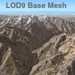
| Category: Flight Simulator 2004 - Scenery | |
| Himalayas LOD9 Base Mesh, Volume 4 - Kashmir and Jammu |

|
File Description:
Detailed terrain mesh of the Kashmir and Jammu Ranges, N30-39 E76-78. The files in this package are based on Shuttle Radar (SRTM) Version 2 data but with many of the void areas, especially the most significant sections, filled with elevation data generated from topographic maps by Jonathan de Ferranti. While Jonathan's work is unrelated to flight simulation he kindly gave me permission to compile his data for use in FS. The result is a wonderful improvement in detail and accuracy over any existing mesh file, freeware or commercial, based on SRTM or DTED data alone.
Due to the large area of the Himalayas I've compiled the source data as two separate series: the "Himalayan Peaks" series covers prominent mountains and ranges in higher detail and locally overrides any existing LOD9 terrain mesh. In addition, the LOD9 "base mesh" series, with LOD8 and LOD7 "buffer" mesh files, covering the entire Himalayas, is meant for those who do not yet have an add-on terrain mesh of these beautiful mountains.
| Filename: | Himalayas_LOD9_Base_Mesh_Volume_4__Kashmir_and_Jam.zip |
| License: | Freeware, limited distribution |
| Added: | 22nd February 2006, 20:32:50 |
| Downloads: | 7,503 |
| Author: | Holger Sandmann, Jonathan de Ferranti |
| Size: | 29.24 MB |
| Category: Flight Simulator 2004 - Scenery | |
| Himalayas LOD9 Base Mesh, Volume 3 - Southwestern Ranges |
|
Images related to this file:
File Description:
Detailed terrain mesh of the Southwestern Himalayan Ranges, N28-37 E78-82. The files in this package are based on Shuttle Radar (SRTM) Version 2 data but with many of the void areas, especially the most significant sections, filled with elevation data generated from topographic maps by Jonathan de Ferranti. While Jonathan's work is unrelated to flight simulation he kindly gave me permission to compile his data for use in FS. The result is a wonderful improvement in detail and accuracy over any existing mesh file, freeware or commercial, based on SRTM or DTED data alone.
Due to the large area of the Himalayas I've compiled the source data as two separate series: the "Himalayan Peaks" series covers prominent mountains and ranges in higher detail and locally overrides any existing LOD9 terrain mesh. In addition, the LOD9 "base mesh" series, with LOD8 and LOD7 "buffer" mesh files, covering the entire Himalayas, is meant for those who do not yet have an add-on terrain mesh of these beautiful mountains.
| Filename: | Himalayas_LOD9_Base_Mesh_Volume_3__Southwestern_Ra.zip |
| License: | Freeware, limited distribution |
| Added: | 30th May 2010, 10:00:26 |
| Downloads: | 155,808 |
| Author: | Holger Sandmann, Jonathan de Ferranti |
| Size: | 62.16 MB |
| Category: Flight Simulator 2004 - Scenery | |
| Himalayas LOD9 Base Mesh, Volume 5 - Hindu Kush and Pamir |
|
Images related to this file:
File Description:

Detailed terrain mesh of the Hindu Kush and Pamir Ranges, N32-40 E70-76. The files in this package are based on Shuttle Radar (SRTM) Version 2 data but with many of the void areas, especially the most significant sections, filled with elevation data generated from topographic maps by Jonathan de Ferranti. While Jonathan's work is unrelated to flight simulation he kindly gave me permission to compile his data for use in FS. The result is a wonderful improvement in detail and accuracy over any existing mesh file, freeware or commercial, based on SRTM or DTED data alone.
Due to the large area of the Himalayas I've compiled the source data as two separate series: the "Himalayan Peaks" series covers prominent mountains and ranges in higher detail and locally overrides any existing LOD9 terrain mesh. In addition, the LOD9 "base mesh" series, with LOD8 and LOD7 "buffer" mesh files, covering the entire Himalayas, is meant for those who do not yet have an add-on terrain mesh of these beautiful mountains.
| Filename: | Himalayas_LOD9_Base_Mesh_Volume_5__Hindu_Kush_and_.zip |
| License: | Freeware, limited distribution |
| Added: | 29th May 2010, 08:57:29 |
| Downloads: | 7,603 |
| Author: | Holger Sandmann, Jonathan de Ferranti |
| Size: | 85.72 MB |
| Category: Flight Simulator 2004 - Scenery | |
| Opotiki Airfield NZOP |
|
File Description:
Welcome to Opotiki, a small general aviation airfield just south of Whakatane, on the east coast of the North Island of New Zealand.
Requires some EZ Scenery object sets (see INSTALL instructions for details).
| Filename: | Opotiki_Airfield__NZOP.zip |
| License: | Freeware, limited distribution |
| Added: | 29th March 2008, 03:51:09 |
| Downloads: | 785 |
| Author: | Lawrie Roache |
| Size: | 1.45 MB |
| Category: Flight Simulator 2004 - Scenery | |
| Karamea Airfield, New Zealand. NZKM. |
|
File Description:
Welcome to Karamea Airfield, on the north-western coast of
the South Island of New Zealand.
The airfield is located 1nm North of the town of Karamea, and is the southern "gateway" to the
beautiful scenic wonderland of Able Tasman National Park.
Requires some EZ Scenery Object Sets (see INSTALL instructions for details).
| Filename: | Karamea_Airfield_New_Zealand__NZKM.zip |
| License: | Freeware, limited distribution |
| Added: | 29th October 2008, 10:34:39 |
| Downloads: | 689 |
| Author: | Lawrie Roache |
| Size: | 1.44 MB |
| Category: Flight Simulator 2004 - Scenery | |
| Pocono Mountains Municipal Airport |
|
Images related to this file:
File Description:
FS2004 Scenery - Pocono Mountains Municipal Airport (KMPO) serves Mount Pocono and Monroe County, PA and is owned by Pocono Mtns Muni Arpt Auth. The airport has more than one runway. The longest is a paved runway extending 5001 feet. The facility is at an elevation of 1916 feet at a distance of about 2 miles from Mount Pocono. Includes the runway 13/31 which was extended to 5,001 ft x 75 ft. Tested in Ultimate Terrain and Default FS. By John B. Loney, Jr.
| Filename: | Pocono_Mountains_Municipal_Airport.zip |
| License: | Freeware, limited distribution |
| Added: | 22nd February 2011, 23:02:23 |
| Downloads: | 388 |
| Author: | John B. Loney, Jr. |
| Size: | 813.69 KB |
| Category: Flight Simulator 2004 - Scenery | |
| Whakatane Airport , New Zealand . NZWK |
|
File Description:
Welcome to Whakatane, a small regional domestic airport south-east of Tauranga City, on the west coast of the North Island of New Zealand.
Requires some EZ Scenery object sets (see INSTALL instructions for details).
| Filename: | Whakatane_Airport__New_Zealand___NZWK.zip |
| License: | Freeware, limited distribution |
| Added: | 26th March 2008, 08:30:10 |
| Downloads: | 1,039 |
| Author: | Lawrie Roache |
| Size: | 1.44 MB |
| Category: Flight Simulator 2004 - Scenery | |
| Seagulls |
|
File Description:
This scenery will add seagulls circling near the lighthouses in Washington State.
Needs Washington Lighthouses for UT (wa_lighthouse_for_ut.zip)to display correctly.
| Filename: | Seagulls.zip |
| License: | Freeware |
| Added: | 14th September 2005, 19:27:24 |
| Downloads: | 734 |
| Author: | Larry Silsbee |
| Size: | 358 KB |
| Category: Flight Simulator 2004 - Scenery | |
| Hawk Logging, for Holger Sandmann's scenery |
|
Images related to this file:
File Description:
This is a logging camp, on Admiral Island at the northern end of Chatham Strait in southern Alaska, around 30 miles south of Juneau. It is marked on the chart of the area; if you are chartless then there is a section of the chart included here. This scenery is designed specifically for use in the Tongass Fjord scenery (or Glacier, or Misty? I don't remember now which area it is in!) and probably does not work with just Ultimate Terrain; I haven't tried it. The camp has an identifying code so it will show up on a gps as PELC but there is no interaction with atc as there are no designated water runways; PELC on the GPS just acts as a waypoint. There will be further posts for use with Tongass Fjords, Misty Fjords, and Glacier Bay, and I still find these scenery areas by Holger and his crew the most satisfying in FS9.
| Filename: | Hawk_Logging_for_Holger_Sandmanns_scenery.zip |
| License: | Freeware, limited distribution |
| Added: | 8th November 2014, 22:42:24 |
| Downloads: | 317 |
| Author: | Roger Wensley |
| Size: | 12.37 MB |
| Category: Flight Simulator 2004 - Scenery | |
| Excursion Inlet Cannery for the "Glacier Bay" scenery |
|
File Description:
Excursion Inlet is in Alaska and in the area covered by Holger Sandmann's scenery called "Glacier Bay" which you will need to have already installed. It might work with just Ultimate Terrain, but then there will be no float base in the same inlet (nicely modelled by Holger and the team) which from the air is pushed off to one side (as a significant landmark, not literally!) by a large cannery which has been there since 1908. And rebuilt several times, I hasten to add, so don't think you're getting a museum piece here. And the only thing nearby that looms larger than the cannery is nature; lots of water, mountains, and trees. For me to start this Holger's scenery had to be there, so without it you won't get the same result.
| Filename: | Excursion_Inlet_Cannery_for_the_Glacier_Bay_scener.zip |
| License: | Freeware |
| Added: | 17th June 2008, 07:37:59 |
| Downloads: | 1,472 |
| Author: | Roger Wensley & Jim Turner |
| Size: | 1.43 MB |
© 2001-2026 AVSIM Online
All Rights Reserved
Privacy Policy |