
Where Flight Simulation Enthusiasts Gather from Around the World!
AVSIM Library - Search Results

| Category: Flight Simulator 2004 - Scenery | |
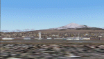
| Azores Islands, North Atlantic Ocean 76m SRTM Terrain Mesh |

|
File Description:
USGS SRTM 3 arc-second, resampled to LOD9 (76 meters). This is a terrain mesh scenery of the Azores Islands in the North Atlantic Ocean. It includes the following islands: Flores, Corvo, Faial, Pico with 7,711 feet (2,351m) high Pico Volcano, Sao Jorge, Graciosa, Terceira, Sao Miguel and Santa Maria.
| Filename: | Azores_Islands_North_Atlantic_Ocean_76m_SRTM_Terra.zip |
| License: | Freeware, limited distribution |
| Added: | 8th April 2004, 03:20:23 |
| Downloads: | 7,985 |
| Author: | Andreas Trawny |
| Size: | 1.81 MB |
| Category: Flight Simulator 2004 - Scenery | |
| Obre Lake CKV4 in the Northwest Territories Canada |
|
Images related to this file:
File Description:
This is a fifth airfield around or linked to Lake Athabasca, in Alberta and Saskatchewan. Obre Lake is some 120 miles northeast of Stony Rapids and is in the Northwest Territories, and the airfield is owned and run by North Of 60 Fishing Camps, which explains it all. It is one of several fishing vacation spots that are serviced by flights from Stony Rapids, and it is these flights to the north that explain the number of regular scheduled flights into Stony Rapids from the south. The Obre Lake camp has docks for boats and also for clients that want to arrive in their own float planes.
| Filename: | Obre_Lake_CKV4_in_the_Northwest_Territories_Canada.zip |
| License: | Freeware, limited distribution |
| Added: | 9th August 2018, 11:36:15 |
| Downloads: | 95 |
| Author: | Roger Wensley |
| Size: | 2.18 MB |
| Category: Flight Simulator 2004 - Scenery | |
| CWGP- Gladman Point - Nunavut, Canada |
|
Images related to this file:
File Description:
This is a DEW line Auxiliary Station on the south shore of King William Island; the island is around 70 miles square and Gjoa Haven is on the southeast corner. The station was closed in 1992 and has now been totally dismantled and removed, a pollutant hazard for the inhabitants of Gjoa Haven. The runway is still there and is a shade over 5,000 feet of gravel 150' wide. There are no lights, signage, or windsock, and in this case even the hangar has gone. A North Warning System station was built in 1990 on a small part of the site of the DEW Station, north of the runway.
| Filename: | CWGP_Gladman_Point__Nunavut_Canada.zip |
| License: | Freeware, limited distribution |
| Added: | 18th November 2012, 09:21:52 |
| Downloads: | 206 |
| Author: | Roger Wensley |
| Size: | 1.23 MB |
| Category: Flight Simulator 2004 - Scenery | |
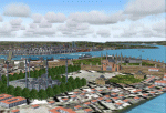
| CYPA Prince Albert (Glass Field) Saskatchewan |
|
Images related to this file:
File Description:
CYPA Prince Albert (Glass Field) is located 6 kms east of the city of Prince Albert, which is the Canadian province of Saskatchewan's gateway to the north. The airport is a major hub for scheduled and charter passenger service, as well as cargo service to the north. The scenery was constructed using GMAX. It includes custom models of all the buildings at the airport, as well as fencing, static aircraft, runway signs, runway and taxiway lighting, OPDAL strobes, SSALR running strobes, PAPI approach system, rotating beacon, working Wind Tee, refuelling facilities, vehicles, fencing, trees that properly change with the seasons, custom tarmac and runway textures, and seasonal ground textures.
| Filename: | CYPA_Prince_Albert_Glass_Field_Saskatchewan.zip |
| License: | Freeware |
| Added: | 14th September 2011, 09:25:36 |
| Downloads: | 1,899 |
| Author: | Gregory Putz |
| Size: | 57.53 MB |
| Category: Flight Simulator 2004 - Scenery | |
| Sicily version II |
|
Images related to this file:
File Description:
Sicily the island of Don Vito Corleone....but before then the Romans and they left beautiful monuments like memory of their culture.
The island of Sicily contains numerous communities. Of them 104 are represented specially in the coast. 5 airports exist plus two aerodromes. The following islands have been "urbanized": Stromboli,Lipari,Salina,Vulcano,Filicudi,Alcudi,Favignana,Maraona,Ustica,Pantelleria, Lampedusa and Linosa. Replacement for the previous version that was lost because of the Avsim hack.
| Filename: | Sicily_version_II.zip |
| License: | Freeware |
| Added: | 12th September 2010, 01:23:42 |
| Downloads: | 7,405 |
| Author: | Toni Agramont |
| Size: | 41.48 MB |
| Category: Flight Simulator 2004 - Scenery | |
| Turkey |
|
Images related to this file:
File Description:
The vedette of this scenery is without a doubt Istanbul. sandal until the meridian 30º East and the whole Turkish coast until Burnhaiyne I have carried out this work dedicated completely to the European capital of Turkey.
This scenery is complemented by Greece.zip, since of the islands next to the frontier that they contain 8 Greek airports is perfect to carry out flights VFR between Greece and Turkey. It contains 13 airports and 64 cities.
| Filename: | Turkey.zip |
| License: | Freeware |
| Added: | 16th July 2010, 18:02:21 |
| Downloads: | 4,271 |
| Author: | Toni Agramont |
| Size: | 54.99 MB |
| Category: Flight Simulator 2004 - Scenery | |
| Alaska South Slope 3; Kiana PAIK |
|
Images related to this file:
File Description:
The town of Kotzebue is in the far northwest of Alaska, and served by Alaska Airlines. These are villages to the (mostly) east of Kotzebue on the South Slope of the Brooks Range of mountains, served by local flights from Kotzebue. There will be further additions. Kiana is a small village (population now around 360) on the bank of the Kobuk River, around 60 miles east of Kotzebue. The airfield, called Baker Memorial, is just north of the village, with 4,000 feet of lit gravel aligned 06-24 (as are several other runways in the area) with PAPI on 24. There are scheduled flights by Era (now renamed Ravn) and by Bering Air, both of them originating in Kotzebue and routing east to Noorvik, Kiana, Ambler, Shungnak, Kobuk, and then back again. The AI includes these flights along with Everts Air and Northern Air Cargo flights and GA. In real life the runway is around 200 yards closer to the village; this complicated the removal of roads and revised ground textures so I left it as is to make my life easier. The post includes missing night textures that were omitted from the post of Noatak PAWN. Noatak also has incorrectly installed original FS9 taxiway lights that were, as a result, impossible to remove. I had hoped to somehow manage it, but there is no way.
| Filename: | Alaska_South_Slope_3_Kiana_PAIK.zip |
| License: | Freeware, limited distribution |
| Added: | 7th September 2016, 22:00:17 |
| Downloads: | 211 |
| Author: | Roger Wensley |
| Size: | 4.5 MB |
| Category: Flight Simulator 2004 - Scenery | |
| Anaktuvuk Pass PAKP in Alaska |
|
Images related to this file:
File Description:
Anaktuvuk Pass is a village located 85 miles north of Bettles and just north of the Brooks Range, in a valley that is a route between north and south. The inhabitants are mainly Numamiut, a section of the Inupiat that existed in history (and until today) away from the coastal food supply of fish etc. The current population is around 350. The airport has one gravel runway, aligned 1-19 with PAPI at both ends, and 5,500 feet long as there is no connection to the outside world other than the runway for all necessities that are not available on the tundra. There are two aprons, with light planes and passengers at the northern end of the runway and the Everts cargo flights unloading at the mid runway apron. A note here about my scenery making. There will not be many more to follow this as I am almost at the end of the photos I either took or found for scenery purposes, plus I expect to move on from FS9 at some point during next year.
| Filename: | Anaktuvuk_Pass_PAKP_in_Alaska.zip |
| License: | Freeware, limited distribution |
| Added: | 25th November 2019, 17:51:38 |
| Downloads: | 242 |
| Author: | Roger Wensley |
| Size: | 8.59 MB |
| Category: Flight Simulator 2004 - Scenery | |
| VTUK Project Version 1.0.1 |
|
File Description:
This is VTUK scenery version 1.0.1 upgraded from version 1.0. VTUK or KhonKaen airport located in North-East of Thailand. Friendly with frame rates. Enjoy the flight in KhonKaen all comments welcome at my email. If you already version 1.0 installed. Replace it with this version.
| Filename: | VTUK_Project_Version_101.zip |
| License: | Freeware |
| Added: | 15th November 2003, 17:08:41 |
| Downloads: | 1,022 |
| Author: | Krit Thivavarnvongs |
| Size: | 448.45 KB |
| Category: Flight Simulator 2004 - Scenery | |
| City of Birmingham, Alabama |
|
File Description:
City of Birmingham, Alabama State biggest city and located north from alabama state capitol city Montgomery. This add-on scenery adds four most famoust buildings into Birmingham downtown area: AmSouth-Sonat tower, Wachovia tower, Bellsouth and AmSouth-Harbert Plaza.
I hope you like this add-on.
| Filename: | City_of_Birmingham_Alabama.zip |
| License: | Freeware |
| Added: | 11th July 2004, 15:48:53 |
| Downloads: | 2,486 |
| Author: | Toni Hiltunen |
| Size: | 158.87 KB |
© 2001-2026 AVSIM Online
All Rights Reserved
Privacy Policy |