
Where Flight Simulation Enthusiasts Gather from Around the World!
AVSIM Library - Search Results

| Category: Flight Simulator 2004 - Scenery | |
| Anticosti Island in Quebec Canada |

|
Images related to this file:
File Description:
Anticosti Island is in the Gulf of St Lawrence, around 25 miles off the Quebec mainland coast. It is some 40 miles wide and 130 miles long on an east west axis. There are few urban areas and only one that can be described as a small town, namely Port Menier at the western end of the southern coast, with a population of under 1,000. There is a ferry service to the harbour. The airport, Port Menier CYPN, is around 3 miles northeast of the town, with an asphalt runway aligned 11-28, 4,875 feet long and 150 feet wide with PAPI at each end. In 2010 (the approximate date of this scenery) a gravel runway was still visible at the eastern end of the field. This was no longer in use by 2010, except perhaps by small planes on skis in the winter. The island, with its small population, small urban area, and no industry other than logging, has as a result a mainly undisturbed wildlife population. This has made deer hunting and fishing the main tourist activities, with one company (called Safari) having an exclusive licence to exploit large areas of mountains and rivers. Planeloads of hunters and fishermen are flown in on chartered Nolinor Aviation planes from the south. There are a further two airfields in the eastern end of the island, and in 2010 Rivere-Aux-Saumons CTH7 had a 5,500 feet gravel runway, linked by road to a lodge area at the mouth of the river. This is the only lodge area that I have been able to locate, but there are others. To the south Riviere Bell CRB5 had at that time a gravel runway that was 3,000 feet long. This has been lengthened since then and both runways were recently (2021) asphalted. If you find an error email me please, and note that my email address has been changed to rogwens at Gmail dot com.
| Filename: | Anticosti_Island_in_Quebec_Canada.zip |
| License: | Freeware, limited distribution |
| Added: | 31st July 2021, 18:23:40 |
| Downloads: | 80 |
| Author: | Roger Wensley |
| Size: | 11.78 MB |
| Category: Flight Simulator 2004 - Scenery | |
| KSHN Sanderson, WA Emma Field Add On |
|
File Description:
KSHN, Sanderson, WA for use with Lago's FSE for 2004. This was made as a present for the guys over at the Emma Field Flying Club but can be enjoyed by all who love to fly in the state of Washington. Included are full seasonal day/night sounds as well as dynamic scenery and plenty of eye candy. This is very dense scenery but mid level machines to high level machines should see no frame loss at all. Lago's FSE for 2004 required and FSGenesis US Landclass is recommended (freeware or payware) for full enjoyment.
| Filename: | KSHN_Sanderson_WA_Emma_Field_Add_On.zip |
| License: | Check within download |
| Added: | 6th January 2004, 20:19:48 |
| Downloads: | 2,540 |
| Author: | Lauren Robison |
| Size: | 2.77 MB |
| Category: Flight Simulator 2004 - Scenery | |
| VFR of Lario, Area A2 - Como lake, Italy |
|
Images related to this file:
File Description:
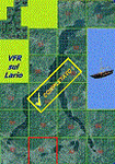
This is the seventeenth scenery, THE LAST ONE, of the "VFR of Lario" project.
This scenery covers approximately an area of 7.5x6 kmt, from the mountains over Albese con Cassano/Albavilla (NW) to Segrino small lake (NE), from Verzago/Alzate Brianza (SW) to Tabiago/Cibrone, Costa Masnaga (SE). Inside Verzago area is placed the AVL airport for gliders (LILB - Aeroclub Volovelistico Lariano).
Check video available here: http://youtu.be/r4h5PCVNMJM and https://youtu.be/huKdtYar_uQ
| Filename: | VFR_of_Lario_Area_A2__Como_lake_Italy.zip |
| License: | Freeware |
| Added: | 14th November 2013, 19:15:18 |
| Downloads: | 594 |
| Author: | Aldo Della Vedova, Daniele Lanfranchi, Gian Mario Verga |
| Size: | 16.66 MB |
| Category: Flight Simulator 2004 - Scenery | |
| Lanzarote OrtoScenery |
|
File Description:
Lanzarote PhotoScenery. Covers Lanzarote (Easternmost Canary Island)
and the small island group at its north (Alegranza and Lobos), also
called as "Chinijo´s Archipiélago".
Full season & custom night-lights texture set are included.
Enjoy!
| Filename: | Lanzarote_OrtoScenery.zip |
| License: | Freeware |
| Added: | 21st September 2008, 23:39:45 |
| Downloads: | 3,971 |
| Author: | Jesse Fonseca |
| Size: | 24.29 MB |
| Category: Flight Simulator 2004 - Scenery | |
| Whole Arkansas and Missouri States, USA, Soaring Scenery |
|
File Description:
FS2002/2004 Whole Arkansas and Missouri States,USA,Soaring Scenery. This file adds thermals lifts to flights over whole Arkansas and Missouri Regions, USA, North America.
It is freeware. Good Flights and better Landings
| Filename: | Whole_Arkansas_and_Missouri_States_USA_Soaring_Sce.zip |
| License: | Freeware |
| Added: | 29th May 2006, 17:41:25 |
| Downloads: | 242 |
| Author: | Francisco Augusto Vargas Carneiro |
| Size: | 946.33 KB |
| Category: Flight Simulator 2004 - Scenery | |
| Ferrara LIPF |
|
File Description:
LIPF_2004 v. 1.0.
Airport of Ferrara (LIPF) small city situated on north Italy.
Made with FSSC and EOD. Photorealistic textures and ortophoto ground. Correct ADF position. AF2 and AI traffic file included.By I-TALO.
| Filename: | Ferrara_LIPF.zip |
| License: | Freeware |
| Added: | 25th April 2004, 21:07:23 |
| Downloads: | 7,144 |
| Author: | Italo Balboni (I-BALB) |
| Size: | 2.26 MB |
| Category: Flight Simulator 2004 - Scenery | |
| Geilenkirchen v1 |
|
File Description:
This airfield, located about 40 NM in the west of Cologne (North-Rhine-Westfalia,
West-Germany) is one of the NATO's E-3A (AWACS, Early Warning and Control System)
Main Operating Bases. Re-upload.
| Filename: | Geilenkirchen_v1.zip |
| License: | Freeware |
| Added: | 8th April 2011, 11:42:08 |
| Downloads: | 812 |
| Author: | Klaus Jone |
| Size: | 619.24 KB |
| Category: Flight Simulator 2004 - Scenery | |
| Lapangan Terbang Sultan Abdul Halim, Alor Star (WMKA) |
|
File Description:
This is a representation of the Sultan Abdul Halim Airport Alor star, The airport, located 15 km away from town (Alor Star). Alor Star is the state capital of Kedah, Malaysia. It is located 93 kilometers north of Butterworth, Penang on the main road to the border with Thailand. The city serves a distribution center for manufacturing and agricultural products and as a transportation hub in the upper north. The new terminal is expected to be ready by end 2005 to cater for future traffic growth.
| Filename: | Lapangan_Terbang_Sultan_Abdul_Halim_Alor_Star_WMKA.zip |
| License: | Freeware |
| Added: | 25th August 2005, 15:34:19 |
| Downloads: | 4,539 |
| Author: | Mohammad Ibrahim Rahmat |
| Size: | 2.36 MB |
| Category: Flight Simulator 2004 - Scenery | |
| Hope Field near Ottawa Ontario, Canada |
|
Images related to this file:
File Description:
The field is newly included in the Canada Flight Supplement. Unusually for a grass field the runway has the numbers marked out in white; given that this is a private airfield that does not invite unexpected guests and has only one plane based there, and presuming that the owner can remember his own runway headings, it is unlikely that these will still be there in a year's time. There is no hangar as yet. To the west is highway 416 and to the east is the Rideau River, both of which run north-south. Lke Rockcliffe (which is to the north) the airfield is right on the edge of the Ottawa control zone, so you should already be below 1,500 feet ASL when approaching from the south and talking to Ottawa tower when arriving from the north. The runway is 07/25 and 2,800 feet long, which should be enough for almost anybody, and the field is at 315 feet ASL. Manotick is a mile to the north east on the Rideau River and the Rideau Valley Airpark CPL3 is six miles south in the bend of the Rideau where it turns west.
| Filename: | Hope_Field_near_Ottawa_Ontario_Canada.zip |
| License: | Freeware, limited distribution |
| Added: | 10th July 2010, 19:34:51 |
| Downloads: | 200 |
| Author: | Roger Wensley |
| Size: | 3.15 MB |
| Category: Flight Simulator 2004 - Scenery | |
| Alaska North Slope 10; Kivalina KVL in Alaska |
|
Images related to this file:
File Description:
The town of Barrow is in the far north of Alaska, and these are coastal villages or radar installations to the west, south, and east of Barrow on the North Slope. There will be further additions. Kivalina is a small village (population around 350) midway in the 150 mile gap between Point Hope to the north and Kotzebue to the south. The village is on a spit of land that is growing smaller and smaller with every year of erosion and the rise of sea level. The runway is 3,500 feet of gravel aligned 12-30 to the north of the village on the same spit. It was expected that 2025 would see the end of both village and runway, and possibly also the natural harbour that is the reason for the village's location. The modified width of the spit shown here is halved from the original FS9, and erosion has continued, enough that a sea defence wall has now been built. The AI has a daily flight by an ERA Alaska Cessna 208B, and some GA; read the note about the 208 to be downloaded and/or properly installed.
| Filename: | Alaska_North_Slope_10_Kivalina_KVL_in_Alaska.zip |
| License: | Freeware, limited distribution |
| Added: | 27th July 2016, 21:12:15 |
| Downloads: | 241 |
| Author: | Roger Wensley |
| Size: | 2.87 MB |
© 2001-2026 AVSIM Online
All Rights Reserved
Privacy Policy |