
Where Flight Simulation Enthusiasts Gather from Around the World!
AVSIM Library - Search Results

| Category: Flight Simulator 2004 - Scenery | |
| Photoreal landclass of Bayonne Anglet Biarritz |

|
File Description:
This landclass increases visual of the French Basque coast, mainly the city of Bayonne Anglet Biarritz. This landclass has the four seasons textures as well as the night texture. Realized on original textures of (C) ORTHOLITTORALE 2000. v1.1
| Filename: | Photoreal_landclass_of_Bayonne_Anglet_Biarritz.zip |
| License: | Freeware, limited distribution |
| Added: | 13th September 2005, 14:00:08 |
| Downloads: | 5,872 |
| Author: | Julien Scavini |
| Size: | 12.66 MB |
| Category: Flight Simulator 2004 - Scenery | |
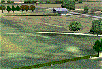
| Port McNeill CAT5 in British Columbia, Canada |
|
Images related to this file:
File Description:
Port McNeill is at the northern end of Vancouver Island, on the coast and around 20 miles east of Port Hardy. The town population is just over 2,000 and the main industry is logging, followed by sand and gravel quarrying and exporting for the construction industry. Tourism rates third.
The airport, a mile or so east of the town, provides a swift connection for nearby islands and the surrounding area to the rest of the west coast, and serves as the HQ main base for West Coast Helicopters. Their newly built large hangar and office accommodation is next to their older hangar to one side of the central public parking area, opposite the club house cum terminal and hangars. There are two runways: 06-24 which is asphalt, 2,400 feet long, and lit; and 11-29 of gravel, 3,650 feet long and also lit. There is some taxiway lighting, but not, for instance, for the connection between runways, which is in real life a ramp up to the gravel runway which is 15 feet higher. There are no regularly scheduled flights and traffic consists mainly of the West Coast helicopters, plus GA and irregular charters, the latter being mostly from Port Hardy.
| Filename: | Port_McNeill_CAT5_in_British_Columbia_Canada.zip |
| License: | Freeware, limited distribution |
| Added: | 18th November 2018, 05:49:13 |
| Downloads: | 136 |
| Author: | Roger Wensley |
| Size: | 13.29 MB |
| Category: Flight Simulator 2004 - Scenery | |
| 2nd Aviation Group Florida Fleets - by LBMartin |
|
File Description:
This scenery contains three fleets near Florida coast:
* Main Fleet: Missile Frigates, Tanker and LHD Ship.
* Hospital Fleet: Missile Frigate, Anti-Sub Frigate and USS Confort (Hospital)
* Anti-Sub Fleet: Missile Frigates and AS Frigate (for Deck Land Training)
| Filename: | 2nd_Aviation_Group_Florida_Fleets__by_LBMartin.zip |
| License: | Freeware |
| Added: | 1st September 2005, 17:33:55 |
| Downloads: | 2,696 |
| Author: | Martin Lopez a.k.a. LBMartin |
| Size: | 1.66 MB |
| Category: Flight Simulator 2004 - Scenery | |
| NZPI - Parakai Airfield, New Zealand |
|
File Description:
Welcome to Parakai, a small general aviation airfield at Helensville in North Auckland. Parakai is but a very short flight to the west from North Shore Airfield NZNE. Requires some EZ Scenery Object sets (see INSTALL instructions for details). Designed to fit "RealNZ Auckland City" by Robin Corn.
| Filename: | NZPI__Parakai_Airfield_New_Zealand.zip |
| License: | Freeware, limited distribution |
| Added: | 24th April 2008, 13:02:13 |
| Downloads: | 879 |
| Author: | Lawrie Roache / Charl Du Toit |
| Size: | 2.67 MB |
| Category: Flight Simulator 2004 - Scenery | |
| Cape Farvel, Greenland 76m SRTM Terrain Mesh |
|
File Description:
USGS SRTM 3 arc-second, resampled to LOD9 (76 meters). This is a terrain mesh scenery of Cape Farvel in southern Greenland. Coverage area: From West 45.6° to West 42.8° and North 59.6° to North 60.4°. (Cape Farvel is the only part of Greenland available as SRTM elevation model)
| Filename: | Cape_Farvel_Greenland_76m_SRTM_Terrain_Mesh.zip |
| License: | Freeware, limited distribution |
| Added: | 17th April 2004, 23:35:14 |
| Downloads: | 4,183 |
| Author: | Andreas Trawny |
| Size: | 1.55 MB |
| Category: Flight Simulator 2004 - Scenery | |
| North Shore Airfield, NZNE. ( to fit into "RealNZ Auckland City" Photoreal ) |
|
File Description:
Welcome to North Shore, a busy general aviation airfield situated in the Dairy Flat area of northern Auckland , New Zealand. North Shore is among New Zealands busiest GA airfields, and is home to a number of aviation companies such as North Shore Helicopers, and Great Barrier Air also have a base there. This scenery is designed to fit into the "RealNZ Auckland City" photoreal scenery (payware by Robin Corn).
Requires some EZ Scenery object sets (see INSTALL instructions for details).
| Filename: | North_Shore_Airfield_NZNE__to_fit_into_RealNZ_Auck.zip |
| License: | Freeware, limited distribution |
| Added: | 19th April 2008, 10:19:28 |
| Downloads: | 1,060 |
| Author: | Lawrie Roache / Charl Du Toit |
| Size: | 2.28 MB |
| Category: Flight Simulator 2004 - Scenery | |
| Hokitika Airport, New Zealand |
|
File Description:
Hokitika is a small town situated on the West Coast of the south island of New Zealand and was first settled in the 1860’s following the discovery of gold. This is an update of my FS2002 scenery for Hokitika
| Filename: | Hokitika_Airport_New_Zealand.zip |
| License: | Freeware |
| Added: | 7th March 2004, 04:39:58 |
| Downloads: | 3,067 |
| Author: | Clive Ryan |
| Size: | 1.24 MB |
| Category: Flight Simulator 2004 - Scenery | |
| California Central Coast Ultimate Terrain USA Compatible Version Revision 1 |
|
File Description:
This is revision #1 to CCCOASTU.ZIP dated 9/13/05 and only applies to that UT USA compatible version of my California Central Coast Scenery. Revised Morro Rock, added taxiway designations and signs at PRB, several other tweaks. CCCOASTU.ZIP is required.
| Filename: | California_Central_Coast_Ultimate_Terrain_USA_Comp.zip |
| License: | Freeware |
| Added: | 13th October 2005, 22:56:57 |
| Downloads: | 1,204 |
| Author: | Al Wheeler |
| Size: | 985.45 KB |
| Category: Flight Simulator 2004 - Scenery | |
| Australian Lighthouses - Part 1 - Queensland |
|
File Description:
Around Australia's coastline there are over 350 lighthouses.
I received a suggestion a month ago asking if I would do the locations of the lighthouses down the coast of New South Wales and when I did a bit of research I thought, why not do the whole 36,735 kilometres around Australia?
So here is the first chapter - the lighthouses that dot the Queensland coast, from the tip of Cape York to the border at Coolangatta, about 30 in all.
Note that only the default Flight Simulator items are used; there is no requirement for any third-party objects.
| Filename: | Australian_Lighthouses__Part_1__Queensland.zip |
| License: | Freeware |
| Added: | 4th February 2006, 18:05:11 |
| Downloads: | 3,214 |
| Author: | Bruce Kennewell |
| Size: | 118.01 KB |
| Category: Flight Simulator 2004 - Scenery | |
| Centre Bush Aerodrome - NZCB |
|
Images related to this file:
File Description:
Small New Zealand aerodrome, 22nm north of Invercargill, Southland. Made to fit Christian Stock's NZ 20m mesh.
| Filename: | Centre_Bush_Aerodrome__NZCB.zip |
| License: | Freeware |
| Added: | 17th April 2012, 22:13:32 |
| Downloads: | 161 |
| Author: | Godfrey Tier |
| Size: | 476.1 KB |
© 2001-2026 AVSIM Online
All Rights Reserved
Privacy Policy |