
Where Flight Simulation Enthusiasts Gather from Around the World!
AVSIM Library - Search Results

| Category: Flight Simulator 2004 - Scenery | |
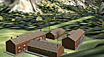
| KBIS Bismarck North Dakota |

|
Images related to this file:
File Description:
Here is a redesign of Bismarck North Dakota, as of summer 2010.
| Filename: | KBIS_Bismarck_North_Dakota.zip |
| License: | Freeware |
| Added: | 4th November 2010, 02:30:16 |
| Downloads: | 1,206 |
| Author: | Eric Cagan |
| Size: | 13.08 MB |
| Category: Flight Simulator 2004 - Scenery | |
| Sinop Airport |
|
File Description:
Highly detailed scenery of Sinop Airport (LTCM) in The North "Blacksea" Turkey
| Filename: | Sinop_Airport.zip |
| License: | Freeware |
| Added: | 1st October 2008, 21:54:41 |
| Downloads: | 2,672 |
| Author: | Vedat Sencan |
| Size: | 4.32 MB |
| Category: Flight Simulator 2004 - Scenery | |
| CFB North Star (CYNS) |
|
File Description:
CFB North Star (CYNS) fictional Canadian military base for FS2004. This is a complete rework of the previous offering. Features two runways of 12,500' length, custom buildings, and numerous "extras". Liven up the Great White North. FREEWARE by Brian Sturton.
| Filename: | CFB_North_Star_CYNS.zip |
| License: | Freeware, limited distribution |
| Added: | 18th March 2009, 18:30:16 |
| Downloads: | 304 |
| Author: | Brian Sturton |
| Size: | 3.81 MB |
| Category: Flight Simulator 2004 - Scenery | |
| Frozen rivers and lakes for winter ski operations along the Canada/USA border and Alaska |
|
Images related to this file:
File Description:
This "freezes" lakes and rivers in a wide strip along both sides of the Canadian and US border and part of Alaska (and is reversible with a tick in the FS9 library) and can be landed on with skis or wheels for winter operations. The area covered is from east of Quebec City to west of Calgary and Edmonton, with an extension north to cover Hudson Bay, so from from 70 west to 100 west and 40 north to 56 north (65 north in the Hudson Bay area). This includes large parts of Quebec, Ontario, Manitoba, Saskatchewan, Alberta, Michigan, Wisconsin, and Minnesota, and most of North Dakota and Montana, and the Alaska north shore and around Anchorage.
This is really for use with Ultimate Terrain, though it will work without it. But as UT is what gets all the lakes and rivers there and in the right place it would be a shame not to be using UT.
| Filename: | Frozen_rivers_and_lakes_for__winter_ski_operations.zip |
| License: | Freeware, limited distribution |
| Added: | 18th February 2010, 14:33:41 |
| Downloads: | 628 |
| Author: | Roger Wensley |
| Size: | 424.36 KB |
| Category: Flight Simulator 2004 - Scenery | |
| Quintin NZQT, New Zealand |
|
Images related to this file:
File Description:
A small landing-strip on the Milford Track, New Zealand. For chartered-only aircraft. A pleasant ride from NZMF, up the valley to Quintin Lodge.
You must have Christian Stock's NZ mesh in the form of "Mountains of New Zealand"
and topo in the form of "Lakes and Rivers of New Zealand".
| Filename: | Quintin_NZQT_New_Zealand.zip |
| License: | Freeware |
| Added: | 4th July 2010, 10:17:09 |
| Downloads: | 303 |
| Author: | Godfrey Tier |
| Size: | 91.79 KB |
| Category: Flight Simulator 2004 - Scenery | |
| Roanne Renaison airport (LFLO) |
|
File Description:
Updated and improved release for Roanne Renaison airport, located 50 nm west from Lyon, in France. Very busy center for general aviation, sailplanes, microlights. Located in a plain but very close to mountains areas, it is an interesting airfield for a flight to or from Lyon, the Alps, Loire-valley, and the Auvergne.
| Filename: | Roanne_Renaison_airport_LFLO.zip |
| License: | Freeware |
| Added: | 27th November 2006, 11:09:02 |
| Downloads: | 2,352 |
| Author: | Philippe Coutellier |
| Size: | 1.45 MB |
| Category: Flight Simulator 2004 - Scenery | |
| Aasiaat BGAA on the west coast of Greenland |
|
Images related to this file:
File Description:
I wrote that Qikiqtarjuaq, on the east coast of Baffin Island, was the jumping off airfield for ferry flights for small planes from Canada to Europe via Greenland. Aasiaat is the airfield in Greenland that they jump to, 300 miles across the Davis Strait. The airfield is on the northern coast of Aasiaat Island, and the town of the same name is just two miles to the west. The runway is 2,600 feet of asphalt almost 100 feet wide and lit, at 74 feet ASL, aligned 12/30, with the apron and terminal building at the western end. Air Greenland run regular flights with a Dash-7 or 8, & Twin Otters, and the markings for the taxiway and parking spot in front of the terminal are exactly as they were six years ago. I have seen video since then that has further taxiway and parking spot markings added in, but I like the simplicity of the original. Unfortunately, given the limitations of FS and the single runway and simple taxiway routing there was no way to replicate both the parking facing away from the terminal AND the "through" taxiing to complete the circle back to the runway; after parking correctly the AI Air Greenland Dash-8 will reverse before heading out to take off. There is both JetA and 100LL fuel available. The surrounding area is rocky, and there is no grass around the runway; the airfield has compacted gravel instead.
| Filename: | Aasiaat_BGAA_on_the_west_coast_of_Greenland.zip |
| License: | Freeware, limited distribution |
| Added: | 26th March 2012, 11:01:16 |
| Downloads: | 690 |
| Author: | Roger Wensley |
| Size: | 2.73 MB |
| Category: Flight Simulator 2004 - Scenery | |
| Static Aircraft for California Central Coast Scenery CCCoastF |
|
Images related to this file:
File Description:
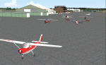
Static Aircraft for California Central Coast Scenery CCCoastF released
12/18/04. The static A/C are now separate from the CCC scenery per several requests. Requires CCCOASTF.ZIP.
This is a replacement file for the 12/18/04 file corrupted by the library hack.
| Filename: | Static_Aircraft_for_California_Central_Coast_Scene.zip |
| License: | Freeware |
| Added: | 9th May 2010, 11:38:40 |
| Downloads: | 1,601 |
| Author: | Al Wheeler |
| Size: | 1.43 MB |
| Category: Flight Simulator 2004 - Scenery | |
| California Central Coast Scenery with Ultimate Terrain USA |
|
File Description:
This is a complete revision to California Central Coast Scenery CCCOASTU.ZIP that was uploaded 9/13/05. This revision involves most of the files and replaces CCCOASTU.ZIP in it's entirety so the original version of CCCOASTU and it's Revisions 1 and 2 or any other versions of my CCC scenery are NOT required.
The primary goal for this revision was to replace as many API objects and effects as possible with XML/MDL library objects. The original intent for making these conversions was to begin to prepare for the FSX version of CCC scenery if that becomes practical. Because I also made several improvements and fixes during that process and because performance was improved due to use of object libraries I realized it might be appropriate to upload the results as a revision.
| Filename: | California_Central_Coast_Scenery_with_Ultimate_Ter.zip |
| License: | Freeware |
| Added: | 19th April 2006, 04:31:54 |
| Downloads: | 4,896 |
| Author: | Al Wheeler |
| Size: | 5.96 MB |
| Category: Flight Simulator 2004 - Scenery | |
| Kotzebue PAOT on the northwestern coast of Alaska |
|
Images related to this file:
File Description:
There are four main northwestern Alaska towns which have good airports and are serviced by Alaska Airlines. From these airports local flights connect to nearby villages, "nearby" in Alaska meaning up to 150 miles away. The northernmost is Barrow. Southwest of Barrow is Kotzebue, then Nome, and the furthest south is Bethel. The town of Kotzbue is north of the Bering Strait on the northwestern coast, 320 miles southwest of Barrow. The population is just over 3,000 people. The location was for a long time a base for trading in furs, with three rivers emptying into the sea and providing routes into the interior land and villages; a meeting place between hunters and traders from Russia and elsewhere. The Kotzebue airport is called the Ralph Wien Memorial and has two runways. The modern one is aligned 08-26 and is 5,880 feet of 150 feet wide asphalt built across a shallow lagoon, with an ILS on 08 and PAPI on both ends. The second and older runway is originally military and gravel, aligned 17-35 and 3,786 feet long and used (wind allowing) by the GA planes that park alongside the runway. The prevalent wind is from the west; when the wind is from the east it is generally relatively feeble and with a much lower cloud base, possibly to the ground, hence the need for an ILS. All AI aircraft in FS9 much prefer to use a runway that has an ILS and so will continue to use 08-26 even if the wind is from the south until it reaches 30+ knots, even if they are a Cessna 150 flying VFR. So for AI realism in FS9 a northern or southern wind needs to be a strong one so that the runway is actually used. However, as Alaska Airlines, Northern Air Cargo, and Everts Air also fly to Kotzebue and can only use the east-west runway (as less than 4,000 feet of asphalt would be seriously inconvenient for a Boing 737 or DC6) it is necessary to have the northern or southern wind UNDER 30 knots at the times when they are landing or taking off. Your choice. I suppose a permanent strong wind from the west would be the most realistic on a daily basis, deterring all planes from ever using 17-35. The AI will develop along with further scenery additions in the neighbourhood.
| Filename: | Kotzebue_PAOT_on_the_northwestern_coast_of_Alaska.zip |
| License: | Freeware, limited distribution |
| Added: | 2nd August 2016, 16:47:52 |
| Downloads: | 457 |
| Author: | Roger Wensley |
| Size: | 19.32 MB |
© 2001-2026 AVSIM Online
All Rights Reserved
Privacy Policy |