
Where Flight Simulation Enthusiasts Gather from Around the World!
AVSIM Library - Search Results

| Category: Flight Simulator 2004 - Scenery | |
| South East Qld Coast and Landclass |

|
File Description:
Updated scenery for my earlier released SE Qld Coast & landclass. Changes include new files that eliminate unwanted autogen power poles that cross airports & runways plus flatten switches for all lakes & waterways.
This is a complete scenery release & previous files are not required.
| Filename: | South_East_Qld_Coast_and_Landclass.zip |
| License: | Freeware |
| Added: | 7th February 2004, 19:15:10 |
| Downloads: | 2,374 |
| Author: | Ross Casey |
| Size: | 554.22 KB |
| Category: Flight Simulator 2004 - Scenery | |
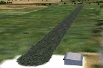
| Alaska North Slope 3: Atqasuk (PATQ) |
|
Images related to this file:
File Description:
The town of Barrow is in the far north of Alaska, and these are coastal villages or radar installations to the west and south of Barrow. There will be further additions. Atqasuk PATQ is 55 miles south of Barrow and is unusual in that it is one of the few settlements of the North Slope that is not on the coast. It is, however, on a narrow winding river that reaches the sea to the east of Barrow and seemingly provides fish in abundance. There could well be other good reasons for the village to be where it is, but they are unknown to me. The population is around 250. The airfield is to the south of the village and the runway is 4,900 feet of gravel aligned 06-24, lit, and with PAPI at each end.
| Filename: | Alaska_North_Slope_3_Atqasuk_PATQ.zip |
| License: | Freeware, limited distribution |
| Added: | 17th June 2016, 08:54:55 |
| Downloads: | 233 |
| Author: | Roger Wensley |
| Size: | 2.35 MB |
| Category: Flight Simulator 2004 - Scenery | |
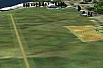
| RANGITAIKI - NZRK |
|
Images related to this file:
File Description:
Simple rendition of this aerodrome, 16nm south-east of Taupo, (NAZP), New Zealand. Made for Christian Stock's NZ mesh in the form of "Mountains of New Zealand"
and topo in the form of "Lakes and Rivers of New Zealand".
| Filename: | RANGITAIKI__NZRK.zip |
| License: | Freeware |
| Added: | 6th February 2011, 03:46:28 |
| Downloads: | 205 |
| Author: | Godfrey Tier |
| Size: | 183.53 KB |
| Category: Flight Simulator 2004 - Scenery | |
| Portugal |
|
Images related to this file:
File Description:
Scenery contains 294 cities and all the cities and harbors of the West coast
plus 45 airports. See readme for more information.
| Filename: | Portugal.zip |
| License: | Freeware |
| Added: | 15th March 2010, 19:50:56 |
| Downloads: | 15,107 |
| Author: | Toni Agramont |
| Size: | 25.64 MB |
| Category: Flight Simulator 2004 - Scenery | |
| LIPX2006 Verona Villafranca |
|
File Description:
Verona Villafranca aiport is a medium size airport located in north Italy near Verona town, best known for the Romeo&juliet tragedy.This airport has traffic of regular flight and many snow charter to Trentino mountains during thewinter and summer charter to Garda Lake. This scenery reproduces exactly the civil part of the airport using the best techniques to save the frame and improve the detail. The main features are: detailed ground with best texture and right sign and light, Seasonal texture,animation stand, animation object. This scenery is created with the Verona VFR scenery of Francesco Mandelli that you can download from avsim with this name: veronavfrscenery.zip for further information www.isdproject.com or [email protected]
| Filename: | LIPX2006_Verona_Villafranca.zip |
| License: | Freeware, limited distribution |
| Added: | 14th February 2006, 03:12:48 |
| Downloads: | 82,808 |
| Author: | ISDproject |
| Size: | 11.47 MB |
| Category: Flight Simulator 2004 - Scenery | |
| Balclutha Aerodrome - NZBA |
|
Images related to this file:
File Description:
26nm south-east of Dunedin, New Zealand. The aerodrome is popular with model aircraft enthusiasts. Made for Christian Stock's NZ mesh in the form of "Mountains of New Zealand" and topo in the form of "Lakes and Rivers of New Zealand".
| Filename: | Balclutha_Aerodrome__NZBA.zip |
| License: | Freeware |
| Added: | 9th January 2011, 03:55:35 |
| Downloads: | 392 |
| Author: | Godfrey Tier |
| Size: | 2.42 MB |
| Category: Flight Simulator 2004 - Scenery | |
| Murchison Aerodrome - NZMR |
|
Images related to this file:
File Description:

34nm east of Westport, New Zealand. $5 landing fee. Please place in honesty box. Made for Christian Stock's NZ mesh in the form of "Mountains of New Zealand" and topo in the form of "Lakes and Rivers of New Zealand".
| Filename: | Murchison_Aerodrome__NZMR.zip |
| License: | Freeware |
| Added: | 13th January 2011, 22:25:05 |
| Downloads: | 251 |
| Author: | Godfrey Tier |
| Size: | 118.85 KB |
| Category: Flight Simulator 2004 - Scenery | |
| New Detail Texture |
|
File Description:
Upgraded detail texture for FS9:COF, it should also work with FS2002. Works great for low flying in rural areas, less so for cities (acceptable though). Also improves texture on distant terrain/mountains. More repetitive than the standard detail texture.
| Filename: | New_Detail_Texture.zip |
| License: | Freeware, limited distribution |
| Added: | 6th December 2003, 07:25:53 |
| Downloads: | 1,413 |
| Author: | Daniel Buechter |
| Size: | 193.77 KB |
| Category: Flight Simulator 2004 - Scenery | |
| St. Donat Airfield, Québec Bush Scenery |
|
File Description:
St Donat is situated in the Laurentian mountains in Québec, very close to Mount Tremblant, well reputed for its skiing and vacation resort. This is about where the Québec Bush region begins. Sounds included for those who have the Lago program.
| Filename: | St_Donat_Airfield_Qubec_Bush_Scenery.zip |
| License: | Freeware |
| Added: | 30th March 2004, 19:52:09 |
| Downloads: | 1,879 |
| Author: | Leon Louis |
| Size: | 5.99 MB |
| Category: Flight Simulator 2004 - Scenery | |
| Kangirsuk CYAS in Quebec Canada |
|
Images related to this file:
File Description:
Kangirsuk is an Inuit village in northern Quebec, on the coast of Ungava Bay. The airport is the only means of access on this coast for the population of around 550, apart from a period in late summer. It is between Quaqtaq and Aupaluk, and around 140 miles north of Kuujjuaq, a major centre in this area for supplies, medical care, education, and anything to do with local government. This version of the airport and village is from around 2010, with the original terminal building that has now been replaced. The runway is just under 3,500 feet of lit gravel aligned 04-22 and the AI includes the daily Air Inuit flight that connects Kangirsuk with Kuujjuaq and other local airfields en route. This is almost certainly the last of the northern Quebec coastal airfields that I will be able to model with the correct buildings; only two missing so not too bad.
| Filename: | Kangirsuk_CYAS_in_Quebec_Canada.zip |
| License: | Freeware, limited distribution |
| Added: | 27th August 2020, 17:41:07 |
| Downloads: | 84 |
| Author: | Roger Wensley |
| Size: | 5.67 MB |
© 2001-2026 AVSIM Online
All Rights Reserved
Privacy Policy |