
Where Flight Simulation Enthusiasts Gather from Around the World!
AVSIM Library - Search Results

| Category: Flight Simulator 2004 - Scenery | |
| Talkeetna Village AK44 in Alaska, REVISED |

|
Images related to this file:
File Description:
The town of Talkeetna is around 75 miles north of Anchorage in Alaska, on the east shore of the Susitna River where the Susitna, Talkeetna, and Chulitna rivers join. The town is where Don Sheldon started Talkeetna Air Services. His story is told in "Wager With The Wind" by James Greinar and is well worth reading for the descriptions of mountain flying. There are two airfields at Talkeetna, PATK with its long asphalt runway and Talkeetna Village AK44 in the town. This is AK44; measuring the space left for the runway between the river bank in the south and the curve in the road that marks the north end of the field there is just enough space for the 900 feet of runway that is described in the book. The result is a step back in time to 1973, when the second hangar was built. Neither hangar has survived to today.
| Filename: | Talkeetna_Village_AK44_in_Alaska_REVISED.zip |
| License: | Freeware, limited distribution |
| Added: | 18th April 2010, 09:52:26 |
| Downloads: | 871 |
| Author: | Roger Wensley |
| Size: | 3.47 MB |
| Category: Flight Simulator 2004 - Scenery | |
| Diavik Diamond Mine CDK2 |
|
Images related to this file:
File Description:
The Diavik Diamond Mine is located about 200 miles NE of Yellowknife in Canada's Northwest Territory. It a relatively new facility, having been begun production in 2003. The only means of access are by air or ice road. (If you are a James Bondian super villian plotting world domination, Diavik would be a great place for your secret underground headquarters.) This scenery is completely scratch built. In addition to the airstrip itself, I used Google Earth pics to create a photo ground texture of the adjoining facility. The buildings of the main processing complex are very simply modeled, as is the large open pit mine.
This scenery was designed for use with Ultimate Terrain and was not tested in the default scenery. (As far as I can tell, Ulimate Terrain does not affect the area around Diavik, so it should work OK.) It may or may not work in FSX.
| Filename: | Diavik_Diamond_Mine_CDK2.zip |
| License: | Freeware |
| Added: | 4th February 2011, 18:07:48 |
| Downloads: | 581 |
| Author: | Sidney Schwartz & Peter Ham |
| Size: | 994.9 KB |
| Category: Flight Simulator 2004 - Scenery | |
| Canyonlands National Park, The Maze-North, Utah, Photo-Scenery (FSX too) |
|
Images related to this file:
File Description:
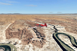
This is a re-upload of a package that was corrupted during the crash of the AVSIM library. The Maze is the wildest and least accessible district of Canyonlands National Park. It is a perplexing jumble of canyons that has been described as a '30 sq miles puzzle in sandstone'. The Maze covers the area west of the Green River and north of the Colorado River. Getting to most locations requires multiple hours of 4WD road driving. Hiking trails usually require multi day backpack trips.
Too strenous? Let's go flying! Checking out the area from an eagles perspective is certainly a stunning experience. The colors are awesome and the landforms are of breathtaking beauty. The scenery extends my Arches National Park scenery to the west and brings you another 3.500 sq km in 4.7m/pix quality. YourDonation@Work: Dedicated to Frans, Francois and James. Thanks!
| Filename: | Canyonlands_National_Park_The_MazeNorth_Utah_Photo.zip |
| License: | Freeware, limited distribution |
| Added: | 31st December 2009, 11:01:39 |
| Downloads: | 2,373 |
| Author: | Gottfried Razek - blueskyscenery.com |
| Size: | 92.88 MB |
| Category: Flight Simulator 2004 - Scenery | |
| Kimmirut CYLC on Baffin Island in Nunavut, Canada |
|
Images related to this file:
File Description:
Kimmirut is a village of some 400 folks at the southern end of the southwest-facing coast of Baffin Island, 75 miles southwest of Iqaluit. It is on the northern side of the Hudson Strait between Baffin Island and Quebec, opposite Kangiqsujuaq on the Quebec shore. The airfield is served by two flights per week, one on Monday and another on Friday, only half fueled to be able to use the 1,899' of gravel 75' wide runway. The terminal building is small and there is a garage building for airport maintenance vehicles (snow clearing). There are some nearby buildings that I have included. The village is "represented" (not "modeled") with approximately the right shape and road layout. Take enough fuel so that you can leave again, as fuel is no longer for sale here. The Cape Dyer bgls are to make a small correction, it is explained in the text. I will not be posting new sceneries in the future and this is the last one for Avsim; it completes Baffin Island.
| Filename: | Kimmirut_CYLC_on_Baffin_Island_in_Nunavut_Canada.zip |
| License: | Freeware, limited distribution |
| Added: | 25th July 2011, 17:36:57 |
| Downloads: | 535 |
| Author: | Roger Wensley |
| Size: | 2.53 MB |
| Category: Flight Simulator 2004 - Scenery | |
| CYYH - Taloyoak - Nunavut, Canada |
|
Images related to this file:
File Description:
Taloyoak is on the coast of northern mainland Canada, on the west of the Boothia Peninsula, where it is at it's narrowest. Gjoa Haven is 80 miles southwest, and Hall Beach is 300 miles to the east. Taloyoak was established around a Hudson Bay trading post that was relocated from Fort Ross in 1948 because of poor ice conditions. There is now a clinic, school, church, recreation centre, two markets, two small hotels, and housing for the population of around 900. The airfield is to the west of the village on higher ground at 92 feet asl, and the 4,020 feet of 100 feet wide gravel runway is aligned 151T/331T where T stands for "true" as opposed to magnetic in the Northern Domestic Airspace. Only JETA-1 is available, unless there is some 100LL in drums. There are flights by First Air and Canadian North and the AI includes a daily flight of each, plus an afternoon cargo visit by a Buffalo C46; the closest large city is Yellowknife, 750 miles southwest.
| Filename: | CYYH__Taloyoak__Nunavut_Canada.zip |
| License: | Freeware, limited distribution |
| Added: | 18th November 2012, 09:23:20 |
| Downloads: | 377 |
| Author: | Roger Wensley |
| Size: | 3 MB |
| Category: Flight Simulator 2004 - Scenery | |
| CZFM - Fort McPherson - Northwest Territories, Canada |
|
Images related to this file:
File Description:
This is the first of a series of airfields that follow (approximately) that early access route to the Canadian northern shore, the Mackenzie River. At the far northern end of the river and on the eastern side of the delta there is Tuktoyaktuk, then 80 miles south is Inuvik (both already posted). 70 miles south of Inuvik is Fort McPherson, on the east bank of the Peel River, 20 miles west of the junction with the Mackenzie and on the Dempster Highway. The town has a population of around 830, and (as usual in the north!) was the site of a Hudson Bay trading post, the main post for the Mackenzie delta area for over 50 years. The airport is less than 2 miles to the south of the town, and has 3,500 feet of gravel runway. AI is two ga flights and a Buffalo Airways delivery trip that hops north and south from field to field; this will change with further posts. There is no fuel available.
| Filename: | CZFM__Fort_McPherson__Northwest_Territories_Canada.zip |
| License: | Freeware, limited distribution |
| Added: | 4th July 2014, 05:33:03 |
| Downloads: | 290 |
| Author: | Roger Wensley |
| Size: | 2.3 MB |
| Category: Flight Simulator 2004 - Scenery | |
| CYYD - Smithers Regional Airport - Smithers, British Columbia, Canada |
|
Images related to this file:
File Description:
Smithers is in northwest BC, 60 miles east and a bit north of Terrace (my previous post) and directly east of the southern border of Alaska, 430 miles north of Vancouver on the Yellowhead highway. The town has a population of 5,500 and is set in a north-south valley between mountains, the most impressive of which is Hudson Bay Mountain to the west. The airport is to the north of the town and has a single runway of 7,544 feet, aligned 33-15. The main user is Central Mountain Air, who are headquartered in Smithers and have a large maintenance hangar there next to the terminal building. The airport has scheduled flights by Central Mountain Air, Jazz, and Hawk Air, which are in the AI along with a Lockheed Electra of Conair (who are the largest operator of fire fighting planes in BC and have re-fill tanks in Smithers) and also a HS 748 of Air North, which is actually for an upcoming post of Old Crow CYOC.
| Filename: | CYYD__Smithers_Regional_Airport__Smithers_British_.zip |
| License: | Freeware, limited distribution |
| Added: | 30th November 2014, 13:53:46 |
| Downloads: | 716 |
| Author: | Roger Wensley |
| Size: | 8.06 MB |
| Category: Flight Simulator 2004 - Scenery | |
| Cape Dorset CYTE, Baffin Island, Nunavut, Canada |
|
Images related to this file:
File Description:
Cape Dorset is a village of 1,300 or so inhabitants at N 64 13 W 76 31 on Dorset Island, off the southwest corner of Baffin Island. It's Inuit name is Kinngait, which means "High Mountains"; watch out if you fly there in low clouds. The village (again) does not feature in FS9 but is included in this scenery with approximately the right shape, or shapes as there are separate parts. The airfield runway is just under 4,000 feet of gravel 100 feet wide at 158 feet above sea level. There is a double gradient to it, but unfortunately this cannot be replicated in FS.
Cape Dorset had a Hudson Bay Company store as long ago as 1913, and is now known as a centre for Inuit art. I added the roads, a new airfield background, a pond between apron and runway, plus of course there is the scenery file and the AFCAD and AI, which has two planes visiting, a First Air HS748 and a Canadian North Dash 8-100, as per real life.
| Filename: | Cape_Dorset_CYTE_Baffin_Island_Nunavut_Canada.zip |
| License: | Freeware, limited distribution |
| Added: | 9th December 2010, 18:45:06 |
| Downloads: | 1,016 |
| Author: | Roger Wensley |
| Size: | 2.75 MB |
| Category: Flight Simulator 2004 - Scenery | |
| Doolittle Raid - Task Force 16 Scenery |
|
File Description:
Reenact the launch of the Doolittle Raiders with this scenery containing the task force centered around the carrier USS Hornet. Can you make it off the deck? By The Virtual Navy.
| Filename: | Doolittle_Raid__Task_Force_16_Scenery.zip |
| License: | Freeware, limited distribution |
| Added: | 16th April 2004, 12:42:26 |
| Downloads: | 5,657 |
| Author: | The Virtual Navy (James Smith- Bruce Baker) |
| Size: | 1.73 MB |
| Category: Flight Simulator 2004 - Scenery | |
| Lutselk'e CYLK in the Northwest Territories, Canada |
|
Images related to this file:
File Description:
Lutselk'e is a village on the southern shore of the Great Slave Lake, at the eastern end and about 120 miles east of Yellowknife. The Hudson Bay trading company established a post there in 1925, and the current school opened in 1960. The population is in the region of 330. There is no road access, but the government runs a freight shipping service during the ice-free period of the Summer. The airfield is a mile or so east of the village, with a runway of around 3,500 feet of gravel aligned 08-26 with PAPI at both ends and lit, with lights atop traffic cones. There are scheduled flights from Yellowknife by Air Tindi, included in the AI, as is a once a week freight flight by Buffalo Airways. You will need to have downloaded and installed my runway and taxiway lighting library from recent posts. A note here about my scenery making. There will not be many more to follow this as I am almost at the end of the photos I either took or found for scenery purposes, plus I expect to move on from FS9 at some point during next year.
| Filename: | Lutselke_CYLK_in_the_Northwest_Territories_Canada.zip |
| License: | Freeware, limited distribution |
| Added: | 9th December 2019, 18:04:52 |
| Downloads: | 107 |
| Author: | Roger Wensley |
| Size: | 3.25 MB |


© 2001-2026 AVSIM Online
All Rights Reserved
Privacy Policy |