
Where Flight Simulation Enthusiasts Gather from Around the World!
AVSIM Library - Search Results

| Category: Flight Simulator 2004 - Scenery | |
| The Oregon Coast Scenic Railroad (OCSR) |

|
Images related to this file:
File Description:
The Oregon Coast Scenic Railroad. All aboard! This is a re-creation of the OCSR, which runs from Garibaldi, Oregon along the seashore to Rockaway Beach. It is designed to compliment the Tillamook, Oregon Airport scenery by John McKeon and David "Opa" Marshall (tills47.zip and tillup.zip - available here).
The project utilizes objects from selected EZ and RWY12 libraries as well as the new Railroad Object library by John McKeon (ezrrobjm.zip - also available here). If you have the LAGO FSE program you will be able to hear the Steam Train whistle and the nearby seagulls as files for these sounds are included. This scenery was designed to display properly in the default FS2004 environment. Please unzip to a temporary folder and follow the simple installation instructions. Compiled for your flying enjoyment by David "Opa" Marshall.
| Filename: | The_Oregon_Coast_Scenic_Railroad_OCSR.zip |
| License: | Freeware |
| Added: | 1st February 2010, 11:20:40 |
| Downloads: | 1,324 |
| Author: | David "Opa" Marshall |
| Size: | 3.45 MB |
| Category: Flight Simulator 2004 - Scenery | |
| VFR of Lario, Area D2 - Como lake, Italy |
|
Images related to this file:
File Description:
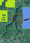
This is the seventh scenery of the "VFR of Lario" project, made with photorealistic terrain and some 3D GMax realistic objects. This scenery covers approximately an area of 7.5x6 kmt, from
north of Bellano (NW) to Casargo (NE), and from Fiumelatte (SW) to Cortenova (SE) and includes the NLC piers of Varenna and Bellano; it includes several dedicated buildings as Vezio castle (Perledo), villa Monastero, S.Giorgio church, marina, piers, hotel Olivedo, and some villas (Varenna), Tommaso Grossi square with pier and light fountain, S.Nazaro-Celso and S.Rocco-Sebastiano churches, Cantoni old cotton mill, group of houses by the lake (Bellano). There are also included four viaducts between the tunnels of the freeway 36, with moted traffic. Hydrofoil G. Marconi at Bellano pier together with other minor boats and docks alongside the lake coast; a moted traffic of motorboats is placed between Varenna's piers.
| Filename: | VFR_of_Lario_Area_D2__Como_lake_Italy.zip |
| License: | Freeware |
| Added: | 23rd July 2012, 15:45:14 |
| Downloads: | 1,261 |
| Author: | Aldo Della Vedova, Daniele Lanfranchi, Gian Mario Verga |
| Size: | 17.95 MB |
| Category: Flight Simulator 2004 - Scenery | |
| Southwestern Ontario Part 1 - Version 1.0 |
|
File Description:
I decided to make Southern Ontario much more interesting for flight simulator general aviation pilots. I have released several packages already but this is by far the most complex. London International Airport will be very lively with this addon. During testing I was cleared number 5 for landing on one occasion! I made the AI plans to account for your traffic amount setting so on a lower system you will have less planes so you’re performance doesn’t die on you.
This package is fully compatible with all of my other releases and all of the Project AI official releases. It only uses default MS aircraft so no additional downloads are required.
Overall
• 7 Improved airports – London, Woodstock, Tillsonburg, Straffordville, Stratford Municipal, Strathroy and St. Thomas.
• 43 flight plans
• 64 new parking spaces
• 3 new gates
| Filename: | Southwestern_Ontario_Part_1__Version_10.zip |
| License: | Freeware, limited distribution |
| Added: | 14th November 2003, 03:58:59 |
| Downloads: | 1,659 |
| Author: | David Voogd |
| Size: | 780.81 KB |
| Category: Flight Simulator 2004 - Scenery | |
| Europe SRTM mesh part 10: Lower Danube |
|
File Description:
Europe SRTM LOD9 mesh part 10 of 13: Covers a wide area centered over the Danube valley from Novi Sad to the Black Sea (42°N-46°N, 19°E-30°E). Includes Balkans & Transylvanian moutain ranges, and parts of the following countries: Romania, Bulgaria, Serbia and Albania.
This Europe SRTM project was optimized for the lowest HDD space use: Each part macthing exactly the boundaries of its neighbors, you'll have a complete corevage of Europe without gap or overlapping scenery. Based on SRTM Data v1 and v2 (3 arcsec, 90m) and sampled to LOD9 resolution (76m). Each SRTM tile was carefully checked and repaired with Blackart v4.02: water areas are now flattened (lighter mesh), and SRTM voids were treated taking advantage of Blackart's sophisticated interpolation algorithm. When required, biggest voids were patched with oversampled SRTM 30 arcsec data and/or manual input.
| Filename: | Europe_SRTM_mesh_part_10_Lower_Danube.zip |
| License: | Freeware, limited distribution |
| Added: | 19th October 2005, 17:55:10 |
| Downloads: | 11,741 |
| Author: | Yohann Baptiste |
| Size: | 39.14 MB |
| Category: Flight Simulator 2004 - Scenery | |
| Europe SRTM mesh part 01: LOD7 buffer mesh |
|
File Description:
Europe SRTM LOD9 mesh part 1 of 13: This is a LOD7 mesh covering the whole Europe from 35°N to 60°N and 12°W to 30°E, to be used as a buffer mesh in conjection with the LOD9 mesh. This Europe SRTM project was optimized for the lowest HDD space use: Each part macthing exactly the boundaries of its neighbors, you'll have a complete corevage of Europe without gap or overlapping scenery. Based on SRTM Data v1 and v2 (3 arcsec, 90m) and sampled to LOD7 resolution (300m). Each SRTM tile was carefully checked and repaired with Blackart v4.02: water areas are now flattened (lighter mesh), and SRTM voids were treated taking advantage of Blackart's sophisticated interpolation algorithm. When required, biggest voids were patched with oversampled SRTM 30 arcsec data and/or manual input.
| Filename: | Europe_SRTM_mesh_part_01_LOD7_buffer_mesh.zip |
| License: | Freeware, limited distribution |
| Added: | 19th October 2005, 16:11:05 |
| Downloads: | 19,075 |
| Author: | Yohann Baptiste |
| Size: | 50.28 MB |
| Category: Flight Simulator 2004 - Scenery | |
| Bethel: St Mary's area airfields in southwest Alaska close to the Yukon River |
|
Images related to this file:
File Description:
This presumes you have already installed Bethel PABE and Bethel Local Airfields. In the Yukon River area of Alaska to the north of Bethel there are small villages, served by flights from both Bethel and the nearer St Mary's PASM. St Mary's has a gravel runway like the other villages, but has a larger population and airport services including maintenance and fuel. This, plus the saving of an average one hundred miles of flying by a Cessna 205 when compared with flights from Bethel, means it acts as a distribution centre fed from Bethel by larger aircraft. Go to "http://vfrmap.com/" for free vfr maps of the area (see the attached). The ten village airfields included here are all to the north and west of St Mary's: Hooper Bay PAHP, Chevak VAK, Cape Romanzof PACZ (closed air force field servicing a radar station), Scammon Bay SCM, Sheldon Point SXP, Alakanuk AUK, Emmonak PAEM, Kotlik 2A9, Mountain Village MOU, and of course St Mary's PASM itself. With these airfields not everything is as it appears to be. For instance, Hooper Bay is not a new and modernised airfield, despite the asphalt runway and apron; the current version has dispensed with the aging asphalt and gone back to gravel. I have tended to go for the 2005 or so versions, which sometimes means a small runway amid or close to the housing; Kotlik was an early renewal for reasons of safety as much as anything else and has had (since 2003?) a new and longer runway located outside of the town. The second batch of airfields will be to the east of St Mary's.
| Filename: | Bethel_St_Marys_area_airfields_in_southwest_Alaska.zip |
| License: | Freeware, limited distribution |
| Added: | 29th April 2019, 17:07:24 |
| Downloads: | 228 |
| Author: | Roger Wensley |
| Size: | 11.53 MB |
| Category: Flight Simulator 2004 - Scenery | |
| VVCR Cam Ranh Airport |
|
Images related to this file:
File Description:
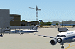
Cam Ranh is currently a fast-growing beauty spot and tourist area on the Vietnamese coast. In May 2004, Cam Ranh airport (VVCR) opened to commercial traffic, initially only serving domestic traffic but international flights will commence in 2005. The airport was once a massive US Air Force base, but was later used as a base for Russion spy plane activities.
This scenery adds this "missing" airport to Flight Simulator, but much is based around satellite views of the airport when the US were spying on the Russian base and other historical information and it may not accurately reflect the airport as it is today. Furthermore, my capabilities at scenery design are limited and restricted to scenery objects available through the Rwy12 scenery creation programme.
You do NOT need to download and install the full 45 MB Rwy 12 Object Placer programme, which is for the designers and not the end user.
Some of the scenery objects will appear without any extra downloads, but to get the greatest benefit from this scenery, you may optionally download following files, which should be installed according to the instructions within this download and not as described in their own download archive:
Level 2 objects
rwy12-lvl2.zip (Israel Roth and Seev Kahn/John Hinson),
Level 3 objects
jw_rwy12.zip (Shehryar Ansari),
tl_rwy12.zip (Todd Lucas) ,
ford_transit_collection.zip (S Legg),
hgrrwy12.zip (ESDG), and
ga-hangers_lib_for_rwy12.zip (S Legg)
Also included with this scenery are two EditVoicepack files which may be imported to that programme so that the controllers will be heard referring to "Cam Ranh".
[File re-uploaded at request of AVSIM] See also file vvcru11.zip.
| Filename: | VVCR_Cam_Ranh_Airport.zip |
| License: | Freeware |
| Added: | 15th May 2010, 01:13:46 |
| Downloads: | 4,180 |
| Author: | John Hinson |
| Size: | 21.36 KB |
| Category: Flight Simulator 2004 - Scenery | |
| Liverpool John Lennon (Speke) Airport (EGGP) Ver 4.0 |
|
File Description:
This all new version has been specifically created with the Default FS2004 scenery in mind. However, it is also aligned to the Visual Flight / getmapping VFR Scenery published by Just Flight. Files are also included to make the scenery FS2002 compatible.
Version 4.0 contains all new macros and textures including for the first time full night textures! Note however, the download no longer contains the additional landmark objects included with previous versions. These are still available however from the derbosoft website and from AVSIM.
This scenery forms part of the "UK2002 Scenery Project" co-ordinated by John Woodside - http://fsaviation.net/.
Thanks go to John Woodside and to Peter Leadbeater for the information they have supplied to me regarding the airport.
Special thanks also go to Dave Graham and the rest of the guys at North West Air News (www.nwan.co.uk) without whose photo's and information this new version just wouldn't exist!
| Filename: | Liverpool_John_Lennon_Speke_Airport_EGGP_Ver_40.zip |
| License: | Freeware |
| Added: | 27th June 2004, 05:09:39 |
| Downloads: | 22,322 |
| Author: | Paul Derbyshire |
| Size: | 6.14 MB |
| Category: Flight Simulator 2004 - Scenery | |
| The Victoria Falls of the Zambezi River, Zambia/Zimbabwe |
|
File Description:
One of the main landmarks of Africa, the spectacular Victoria Falls of the Zambezi River are missing in out-of-the-box FS. With a local SRTM LOD9 mesh as a base (included) and the help of satellite imagery, maps, Ground2K4, and GMax, we did our best to model a realistic representation of the falls, the river, and the gorge, complete with custom waterfall and spray effects. The portion of the Zambezi covered in this project extends from E25 to E26.5 (more than 100km), with the falls at its center. Also included is a replacement landclass file for an area of about 20km on either side of the Zambezi River and an optional AI boat (by Lynn and Bill Lyons) cruising on the Zambezi above the falls. Tested with FS2004 only but most scenery enhancements (not the AI boat) should work just as well in FS2002.
| Filename: | The_Victoria_Falls_of_the_Zambezi_River_ZambiaZimb.zip |
| License: | Freeware, limited distribution |
| Added: | 8th May 2004, 02:45:30 |
| Downloads: | 19,148 |
| Author: | Holger Sandmann and Johan van Wyk, Aeroworx |
| Size: | 3.5 MB |
| Category: Flight Simulator 2004 - Scenery | |
| Airstrips of Southern Germany |
|
Images related to this file:
File Description:
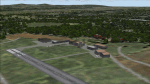
The next my Western Europe airstrips project, herewith about 170 small airfields, mostly in Baden-Wurttemberg and Bavaria, each enhanced with buildings, taxiways, parking spaces and aprons as appropriate, to further facilitate the generation of lightweight AI traffic in the area, without overloading the more major airfields.
Again, there's no photo-realism here, just a selection of basic 'generic' buildings, more or less accurately sized and placed to reflect the airfield layout as seen on on-line satellite imagery and aerial photography. These buildings have minimal effect on frame-rates, so are ideal for this kind of job. The airfields are aligned as well as possible with the roads etc. in UT Europe and the Genesis Europe mesh, but should mostly be fine in a default installation or other configuration.
Please read the rest of this "blurb" in the included text file. There may be some details of note or interest.
| Filename: | Airstrips_of_Southern_Germany.zip |
| License: | Freeware |
| Added: | 25th December 2024, 20:54:30 |
| Downloads: | 132 |
| Author: | Chris Eve |
| Size: | 2.84 MB |


© 2001-2026 AVSIM Online
All Rights Reserved
Privacy Policy |