
Where Flight Simulation Enthusiasts Gather from Around the World!
AVSIM Library - Search Results

| Category: Flight Simulator 2004 - Scenery | |
| Umiujaq CYMU in Northern Quebec, Canada |

|
Images related to this file:
File Description:
Umiujaq is a small village on the east coast of Hudson Bay, in Quebec, around 140 miles south of Inukjuak and 100 miles north of Kuujjuarapik; the latter is where some 500 inhabitants moved from in 1986 to avoid the effects of a hydroelectric dam project and founded Umiujaq. The airfield is a mile and a half inland and southeast of the village, and the 3,520 feet of gravel runway is aligned 03/21, and these are magnetic bearings as Inukjuak is not in the Northern Domestic Airspace zone. There is no fuel available, unless there is some 100LL in drums. The visiting AI airline is Air Inuit from Montreal.
| Filename: | Umiujaq_CYMU_in_Northern_Quebec_Canada.zip |
| License: | Freeware, limited distribution |
| Added: | 22nd December 2011, 01:00:20 |
| Downloads: | 635 |
| Author: | Roger Wensley |
| Size: | 1.95 MB |
| Category: Flight Simulator 2004 - Scenery | |
| Europe SRTM mesh Part 13: Western Spain & Portugal |
|
File Description:
Europe SRTM LOD9 mesh part 13 of 13: Covers Spain west of 4.5°W and Portugal.
This Europe SRTM project was optimized for the lowest HDD space use: Each part macthing exactly the boundaries of its neighbors, you'll have a complete corevage of Europe without gap or overlapping scenery. Based on SRTM Data v1 and v2 (3 arcsec, 90m) and sampled to LOD9 resolution (76m). Each SRTM tile was carefully checked and repaired with Blackart v4.02: water areas are now flattened (lighter mesh), and SRTM voids were treated taking advantage of Blackart's sophisticated interpolation algorithm. When required, biggest voids were patched with oversampled SRTM 30 arcsec data and/or manual input.
| Filename: | Europe_SRTM_mesh_Part_13_Western_Spain__Portugal.zip |
| License: | Freeware, limited distribution |
| Added: | 20th October 2005, 11:22:13 |
| Downloads: | 15,515 |
| Author: | Yohann Baptiste |
| Size: | 34.22 MB |
| Category: Flight Simulator 2004 - Scenery | |
| Africa 1960 |
|
Images related to this file:
File Description:
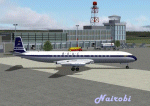
We've produced this scenery to provide taxiways, buildings and details as they
were around 1960 for airports with airline service in Africa. We've added custom GMAX or Sketchup terminals for the major airports, usually
with many other details included. We've added a library object terminal and
details to virtually every African airport that was served by an airline in the early 1960's. We have been working on this project for 13 months, and there are 105 airports/fields. All have scenery - some very sparse, others full of action. All airports have flags, lighting, windsocks, and rotating beacons. If possible, the airports are placed accurately with maps2bgl as reference.
| Filename: | Africa_1960.zip |
| License: | Freeware, limited distribution |
| Added: | 20th October 2010, 22:31:35 |
| Downloads: | 4,985 |
| Author: | Wolfgang Gersch, Harry Biard, Jaap de Baare, Mike Stevens, Tom Gibson, Nikko Yaginuma and Johan Dees |
| Size: | 15.45 MB |
| Category: Flight Simulator 2004 - Scenery | |
| Rae Lakes CYRA at Gameti in the Northwest Territories, Canada |
|
Images related to this file:
File Description:
Gameti is a village in the Northwest Territories, around 65 miles north of Whati which was recently posted. Until 2005 the village, which has a population of around 280, was known as Rae Lakes and the airfield is now renamed Gameti/Rae Lakes as shown in the 2010 version of the Nav Canada Flight Supplement, my standard reference year. Permanent settlement was established there in 1965. There is no all-weather road access and the village is reliant upon the airfield for supplies, along with an ice road in the winter months. The airfield is a mile or so east of the village, with a lit gravel runway of just over 3,000 feet aligned 14-32 and with PAPI at both ends. The airfield is served by Air Tindi from Yellowknife on an almost daily basis, included in the AI here along with some GA and a Friday delivery by a Buffalo DC3 that uses all of the runway. The runway has lake water at each end, ready for the unwary. A note here about my scenery making. There will not be many more to follow this as I am almost at the end of the photos I either took or found for scenery purposes, plus I expect to move on from FS9 at some point during next year.
| Filename: | Rae_Lakes_CYRA_at_Gameti_in_the_Northwest_Territor.zip |
| License: | Freeware, limited distribution |
| Added: | 26th December 2019, 19:32:09 |
| Downloads: | 125 |
| Author: | Roger Wensley |
| Size: | 4.81 MB |
| Category: Flight Simulator 2004 - Scenery | |
| Chisasibi CSU2 in northern Quebec, Canada |
|
Images related to this file:
File Description:
Chisasibi is in northern Quebec on the east shore of James Bay, 60 miles from the corner of James Bay and Hudson Bay. Originally called Fort George and founded at the mouth of La Grande Riviere around the Hudson Bay trading post that was established in 1803, the town had to move 5 miles upstream in 1981 when the Quebec hydro project increased the flow rate of the river. The name was changed to Chisasibi at the time of the move (Chisasibi = Great River in Cree) and the population (750 as early as 1940) has now grown to around 2,000. There is a paved road east to Radisson that connects to the north-south James Bay road, which was built at the time of the hydro project work. The original Fort George airport runway is still visible but not usable, just south of the original town site. Chisasibi airport is to the west of the new town, and the gravel runway is 3,792 feet long and aligned 14/32, which is approximately parallel to the river. There is officially no fuel available, but there is JetA on site for Air Creebec in a tank protected by used fuel drums (filled with sand?). The terminal and the garage building are both relatively new; the terminal dates from 2002 and has unusual touches. There are two AI flights by Air Creebec each day plus other private planes.
| Filename: | Chisasibi_CSU2_in_northern_Quebec_Canada.zip |
| License: | Freeware, limited distribution |
| Added: | 27th February 2013, 21:24:47 |
| Downloads: | 289 |
| Author: | Roger Wensley |
| Size: | 2.79 MB |
| Category: Flight Simulator 2004 - Scenery | |
| AI Helicopters for Penticton, British Columbia, Canada. |
|
Images related to this file:
File Description:
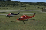
AI Helicopters for Penticton, British Columbia, Canada. This package is designed to compliment the exceptionaly fine enhancement of the airport (CYYF) by John Stinstrom. Featured are three repaints by John Burford of the Sikorsky S-76 AI Helicopter in Canadian Helicopter's colors. The AI Helicopter model by Chris "Elvis" Jones is not included but download details for it and other suggested enhancements are included in the documentation. The project uses the "invisible" airport and "forward departure" (no push-backs) techniques. Please unzip to a temporary folder and follow the very easy installation instructions. Compiled for your flying enjoyment by David "Opa" Marshall. ---
NOTE: This single package replaces three related files destroyed in the May hack upon Avsim.
| Filename: | AI_Helicopters_for_Penticton_British_Columbia_Cana.zip |
| License: | Freeware |
| Added: | 28th January 2010, 14:57:01 |
| Downloads: | 4,901 |
| Author: | David "Opa" Marshall & John Burford |
| Size: | 837.98 KB |
| Category: Flight Simulator 2004 - Scenery | |
| Newport, Oregon - KONP. A conservative enhancement of the Newport, Oregon airport. |
|
Images related to this file:
File Description:
Newport, Oregon - KONP. A conservative enhancement of the Newport, Oregon airport which lies some 130 miles Southwest of Portland, Oregon. Featured is an AI U.S. Coast Guard Helicopter (included in the package) making training and reconnaissance flights over and around the area. Also included is a new bridge allowing the fishing fleet access to and from the bay. Tillamook, which is just North of Newport, is famous for it's cheese but you will find much more to enjoy on this portion of the Oregon coastline. Default, RWY12 and EZ scenery objects were used in this project. Please unzip to a temporary folder and follow the easy installation instructions. Compiled for your flying enjoyment by David "Opa" Marshall.
| Filename: | Newport_Oregon__KONP__A_conservative_enhancement_o.zip |
| License: | Freeware |
| Added: | 31st January 2010, 21:22:48 |
| Downloads: | 4,057 |
| Author: | David "Opa" Marshall |
| Size: | 2.52 MB |
| Category: Flight Simulator 2004 - Scenery | |
| VFR of Lario, Area B2 - Como lake, Italy |
|
Images related to this file:
File Description:
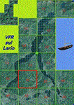
This is the fourth scenery of the "VFR of Lario" project, made with photorealistic terrain (multiseason & night) and with some 3D GMax realistic objects.
Information: Como's lake is in the north of Italy, closed to the Helvetic border. This third scenery covers approximately an area of 7.5x6 kmt, from Nesso/Erno (NW) to Barni (NE), and the ridge east of Monte Bolletto (SW) to Asso/Canzo (SE) and includes some details (GMax) of Pognana Lario NLC pier (fantasy), the A. Volta motorship with the Hydrofoil G. Marconi (both animated). GMax objects as above and other buildings, minor piers and boats together with autogen buildings and trees are fully spreaded on the scenery.
| Filename: | VFR_of_Lario_Area_B2__Como_lake_Italy.zip |
| License: | Freeware |
| Added: | 13th March 2012, 22:06:00 |
| Downloads: | 1,769 |
| Author: | Della Vedova Aldo, Daniele Lanfranchi, Gian Mario Verga, Diego Caligiuri |
| Size: | 11.09 MB |
| Category: Flight Simulator 2004 - Scenery | |
| VFR of Lario, Area D1 - Como lake, Italy |
|
Images related to this file:
File Description:
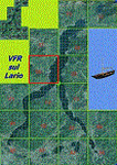
This is the sixth scenery of the "VFR of Lario" project, made with photorealistic terrain and some 3D GMax realistic objects. This scenery covers approximately an area of 7.5x6 kmt, from Val Cavargna mountains (NW) to Acquaseria/Sant'Abbondio (NE), and from Galbiga mountain (SW) to Cadenabbia/Griante (SE) and includes the NLC piers of Cadenabbia and Menaggio; it includes several dedicated buildings as S. Rocco church (Griante), NLC ticket-office, statue of Bowler and hotel Britannia (Cadenabbia), villa La Gaeta (S. Siro), Finalcial Police old building, NLC boarding square and Grand Hotel Menaggio (Menaggio). Motor ship Orione at Menaggio pier together with other minor boats and docks alongside the coast. Two little libraries that use default textures are added.
| Filename: | VFR_of_Lario_Area_D1__Como_lake_Italy.zip |
| License: | Freeware |
| Added: | 27th May 2012, 23:32:01 |
| Downloads: | 1,324 |
| Author: | Aldo Della Vedova, Daniele Lanfranchi, Gian Mario Verga, Diego Caligiuri |
| Size: | 13.34 MB |
| Category: Flight Simulator 2004 - Scenery | |
| LOD10 (38-m) Glacier Bay National Park, Alaska |
|
File Description:
This LOD10 (38-m) add-on mesh of Glacier Bay National Park and the adjacent Lynn Canal area between Juneau and Skagway (N58-60 W134-138) is an optional (!) upgrade of gl_bay_1.zip (by Holger Sandmann and Jim Keir). It adds more detail to the mountainous areas and allows to locally override other installed Alaska add-on meshes without having to deactivate them. The USGS NED seamless digital elevation data used for this mesh have a 2-arcsec (~60-m) resolution. Thus, the compilation as LOD10 (38-m) will reveal all terrain details contained in the source data. Please read the gl_bay_1.zip read-me file for further information about the special features of the Glacier Bay Project.
| Filename: | LOD10_38m_Glacier_Bay_National_Park_Alaska.zip |
| License: | Freeware, limited distribution |
| Added: | 16th February 2004, 03:40:57 |
| Downloads: | 8,595 |
| Author: | Holger Sandmann |
| Size: | 24.98 MB |


© 2001-2026 AVSIM Online
All Rights Reserved
Privacy Policy |