
Where Flight Simulation Enthusiasts Gather from Around the World!
AVSIM Library - Search Results

| Category: Flight Simulator 2004 - Scenery | |
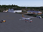
| VGCB Cox's Bazar, Bangladesh |

|
File Description:
Googly scenery for VGCB Cox's Bazar, Bangladesh, a small domestic airport
serving the fishing town of the same name in the Bay of Bengal, to the
south of Chittagong. It boasts extensive sandy beaches which has allowed
tourism development. The unusual name comes from Captain Hiram Cox of the
British East India Company who was appointed Superintendent of the outpost
in the late 1700s. The airport, which was originally a Pakistan Air Force
base, sees domestic flights (mostly to/from Dhaka) operated by Hawker
Siddeley 748s, de Havilland Dash 8s and Fokker Fellowship aircraft of Biman
Bangladesh Airlines, GMG Airlines, United Airways and Zoom Airlines.
Flight Simulator 2004 has made no provision for traffic with only a runway
provided and this scenery seeks to redress the situation.
The scenery does not purport to be ultra-accurate. Based on high quality
satellite imagery from Google Earth, the layout is proportionally correct but the
added airport features, such as buildings, are built from default Microsoft objects
and add-on libraries so will not look exactly like the real thing.
You are not obliged to download and install any additional scenery libraries,
but to enjoy this scenery in its entirety, you may wish to. It will work fine,
with or without.
| Filename: | VGCB_Coxs_Bazar_Bangladesh.zip |
| License: | Freeware |
| Added: | 14th April 2008, 21:13:08 |
| Downloads: | 1,348 |
| Author: | John Hinson |
| Size: | 67.71 KB |
| Category: Flight Simulator 2004 - Scenery | |
| SSJA Joaçaba, Brazil |
|
Images related to this file:
File Description:
Googly scenery for SSJA Joaçaba - a small domestic airport
in the state of Santa Caterina, Brazil, that is poorly provided for in Flight
Simulator 2004. These scenery files add taxiways, aprons, buildings and other
airport features, so that you and your "AI" traffic can land, taxi, park and
take off in a realistic manner.
The small but prosperous city of Joaçaba was originally established in 1917 as
Cruzeiro and later known as Limeira and Cruzeiro do Sol, but in 1943 adopted
the current name following the introduction of legislation prohibiting cities
in Brazil using the same name - not a bad idea really. Joaçaba has a high
quality medical centre serving the state of Santa Caterina and a renowned
university which both bring traffic to the airport which is served by mainly
by LET410 aircraft of local airline NHT Linhas Aéreas.
The scenery does not purport to be ultra-accurate. Based on high-detail satellite
imagery from Google Earth, the layout is proportionally correct but the added
airport features, such as buildings, are built from default Microsoft objects
and add-on libraries so will not look exactly like the real thing.
[File re-uploaded at request of AVSIM]
| Filename: | SSJA_Joaccedilaba_Brazil.zip |
| License: | Freeware |
| Added: | 14th May 2010, 04:47:22 |
| Downloads: | 1,263 |
| Author: | John Hinson |
| Size: | 65.83 KB |
| Category: Flight Simulator 2004 - Scenery | |
| DTTG Gabes, Tunisia |
|
File Description:
Googly scenery for Gabes (ICAO: DTTG), a somewhat nondescript airport
shoe-horned into one of Tunisia's largest industrial cities. Famed for
its beaches, the city hosts cement, chemical and brick factories and an
oil refinery, resulting in poor levels of air pollution. The airport is
a joint military and civilian operation although military traffic appears
to be mostly helicopter activity and the civilian traffic consists of an
ATR of Sevenair calling in once in a blue moon.
Microsoft have only provided a runway at this airport in Flight Simulator
2004 and this scenery seeks to redress the situation so that you and your
"AI" traffic can use the airport realistically.
The scenery does not purport to be ultra-accurate. Based on high quality
satellite imagery from Google Earth, the layout is proportionally correct but the
added airport features, such as buildings, are built from default Microsoft objects
and add-on libraries so will not look exactly like the real thing.
You are not obliged to download and install any additional scenery libraries,
but to enjoy this scenery in its entirety, you may wish to. It will work fine,
with or without.
| Filename: | DTTG_Gabes_Tunisia.zip |
| License: | Freeware |
| Added: | 14th October 2008, 13:18:33 |
| Downloads: | 757 |
| Author: | John Hinson |
| Size: | 83.15 KB |
| Category: Flight Simulator 2004 - Scenery | |
| Alps LOD10 Topo Mesh - Austria and Italy |
|
Images related to this file:
File Description:
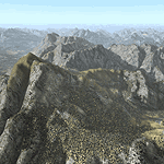
Yet another terrain mesh package of the European Alps? Well, this one is different in that it is NOT primarily based on the Shuttle Radar (SRTM) data with their incomplete coverage of prominent peaks and ridges. Instead, most of the source data for this project were developed over many months by Jonathan de Ferranti using detailed topographic maps. While Jonathan's work is unrelated to flight simulation he kindly gave me permission to compile his data for use in FS. The result is a wonderful improvement in detail and accuracy over any existing SRTM- or DTED-based mesh file, freeware or commercial (a link to an extensive set of screenshot comparisons is included in the read-me file).
I've compiled the source data at LOD10 (38-m) grid resolution because the coverage area is smaller than most existing mesh files. Thus, anyone can use these files without having to first uninstall their current mesh set. Also included are LOD9 and LO8 buffer mesh files. Note: if you own Austria Professional 2004 with its 1:50,000 scale terrain mesh then you don't need this package!
| Filename: | Alps_LOD10_Topo_Mesh__Austria_and_Italy.zip |
| License: | Freeware, limited distribution |
| Added: | 30th May 2010, 09:46:58 |
| Downloads: | 62,948 |
| Author: | Holger Sandmann, Jonathan de Ferranti |
| Size: | 73.32 MB |
| Category: Flight Simulator 2004 - Scenery | |
| CYPE - Peace River - Northwest Alberta, Canada |
|
Images related to this file:
File Description:
The Peace River flows east from the Rockies, joining up with the Slave River to empty into Great Slave Lake. The town is on both banks close to a bend, 245 miles northwest of Edmonton. The population is 7,000 and the surrounding area is either farmland or forest and used for winter sports; Peace River hosted the 2004 Alberta Winter Games. The airport is just over 3 miles west of the town. The runway is 5,000 feet of wide asphalt (150 feet) aligned 04/22, lit, and with PAPI. There is a second runway to the south of the main runway, 1,900 feet of grass and aligned 08/26. The apron is to the north of the runway at the eastern end and is large; there is a purpose-built terminal building, plus other hangar buildings along taxiway C that extends westward from the apron. The airport gives the impression that it is under-used; there are no long lines of parked planes waiting for the weekend and few scheduled flights. These are mainly (totally?) by Sunwest Home Aviation, but unfortunately nobody has made the textures for Sunwest and my talents do not run in that direction so I have made believable substitutions. There is also a small but obstinate AI difficulty, described in the notes.
| Filename: | CYPE__Peace_River__Northwest_Alberta_Canada.zip |
| License: | Freeware, limited distribution |
| Added: | 10th November 2013, 23:56:22 |
| Downloads: | 332 |
| Author: | Roger Wensley |
| Size: | 10.83 MB |
| Category: Flight Simulator 2004 - Scenery | |
| Whaler's Cove Lodge for Holger Sandmann's Tongass Fjords scenery |
|
Images related to this file:
File Description:
This is a fishing lodge on Killisnoo Island, just off the western shore of Admiral Island near Angoon. It is not marked on the chart of the area but there is a section of the chart here with a pointer to the island. This scenery is designed specifically for use in the Tongass Fjord scenery. The lodge has an identifying code so it will show up on a gps as a waypoint, PWCL. There is a nearby float base called Angoon which serves the small town of the same name, and this is visible in one of the screen shots. I still find these scenery areas by Holger and his crew the most satisfying in FS9, and at the time they were made they were spectacularly better than anything else.
| Filename: | Whalers_Cove_Lodge_for_Holger_Sandmanns_Tongass_Fj.zip |
| License: | Freeware, limited distribution |
| Added: | 26th November 2014, 23:03:22 |
| Downloads: | 418 |
| Author: | Roger Wensley |
| Size: | 3.57 MB |
| Category: Flight Simulator 2004 - Scenery | |
| Little Port Walter for Holger Sandmann's Tongass Fjords scenery |
|
Images related to this file:
File Description:
This is a second fish farm at the southern end of Baranof Island and Chatham Strait in southern Alaska. Big Port Walter is named on the chart of the area, and there is a section of the chart included here. Little Port Walter is a much smaller offshoot bay, sheltered from the weather and ideal for a fish farm. This scenery is designed specifically for use in the Tongass Fjord scenery. I may have incorrectly identified Tongass Fjords as being required for Hawk Logging when Glacier Bay is needed. Ah well, it is one or the other of them. The fish farm (or hatchery, the description varies) has an identifying code so it will show up on a gps as PWL. There is no interaction with atc as there are no designated water runways, so PWL on the gps just acts as a waypoint. There will be further posts for use with Tongass Fjords, Misty Fjords, and Glacier Bay, and I still find these scenery areas by Holger and his crew the most satisfying in FS9.
| Filename: | Little_Port_Walter_for_Holger_Sandmanns_Tongass_Fj.zip |
| License: | Freeware, limited distribution |
| Added: | 23rd November 2014, 01:33:12 |
| Downloads: | 233 |
| Author: | Roger Wensley |
| Size: | 3.38 MB |
| Category: Flight Simulator 2004 - Scenery | |
| Kaluga (Grabtsevo) Airport UUBC for Light Scenery by Rulexy |
|
Images related to this file:
File Description:
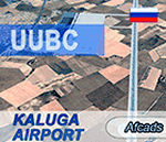
This is an updated afcad of the Kaluga (Grabtsevo) Airport (IATA: KLF, ICAO: UUBC) by Rulexy (Alexey Rubtsov) for his Light Scenery for FS2004. Added turn bays, changed runway numbers and ILS, and removed a nonexistent runway. IMPORTANT: Light Scenery and LS Addon 2 by Rulexy are required and should be installed prior to installing the afcad.
You can evaluate the airport in this video (taxi & takeoff):
https://youtu.be/wzkX9Oj5zD4
| Filename: | Kaluga_Grabtsevo_Airport_UUBC_for_Light_Scenery_by.zip |
| License: | Freeware |
| Added: | 28th November 2017, 05:22:57 |
| Downloads: | 58 |
| Author: | Gene Churumov |
| Size: | 236.24 KB |
| Category: Flight Simulator 2004 - Scenery | |
| Frozen rivers and lakes (and sea) for Alaska's winter |
|
Images related to this file:
File Description:
This "freezes" all lakes and rivers (and some sea) for winter flying and means they can be landed on with skis or wheels; it is meant for low level flying rather than high level jet flights. This edition covers all of Alaska, except for the Aleutian Islands, as the worst area to do this for is a string of islands. Terrible. Fiddly. It is reversible with an "untick" in the FS scenery library. I have spent some time making sure that the sea and the larger inlets along the southern coast do not get frozen too as they stay ice-free in winter. Along the north shore I went for the peak of the winter with sea ice all the way to the permanent polar cap; this is not totally realistic as there is usually a partially open lead along the coast, but anything else would be ...... fiddly. This is really for use with Ultimate Terrain, though it will work without it. But as UT is what gets all the lakes and rivers there and in the right place it would be a shame not to be using UT. There is a blurry transition between southern Alaska and Canada so you may need the recent Canada post too.
| Filename: | Frozen_rivers_and_lakes_and_sea_for_Alaskas_winter.zip |
| License: | Freeware, limited distribution |
| Added: | 8th September 2011, 11:53:51 |
| Downloads: | 681 |
| Author: | Roger Wensley |
| Size: | 493.23 KB |
| Category: Flight Simulator 2004 - Scenery | |
| California Central Coast Scenery for UT USA Revision #2 |
|
File Description:
This is revision #2 to CCCOASTU.ZIP dated 9/13/05. It only applies to that UT USA compatible version of my California Central Coast Scenery. Larry Silsbee created a more accurate Morro Rock that works better with textures. This revision replaces the previous rock. CCCOASTU.ZIP and CCCUREV1.ZIP are required. Al Wheeler and Larry Silsbee. 10/27/05
| Filename: | California_Central_Coast_Scenery_for_UT_USA_Revisi.zip |
| License: | Freeware |
| Added: | 28th October 2005, 07:05:58 |
| Downloads: | 1,016 |
| Author: | Al Wheeler and Larry Silsbee |
| Size: | 260.93 KB |
© 2001-2026 AVSIM Online
All Rights Reserved
Privacy Policy |