
Where Flight Simulation Enthusiasts Gather from Around the World!
AVSIM Library - Search Results

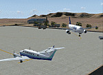
| Category: Flight Simulator 2004 - Scenery | |
| Retro Scenery for NAS Chase Field, Texas, U.S.A. |

|
Images related to this file:
File Description:

Originally opened as Beeville Municipal Airport, the land was leased from the Navy in 1943 for the construction of Chase Field, a training base for Naval Air Cadets and was one of three satellite airfields for Corpus Christi NAS. At the end of WWII the station was closed and re-purposed for various educational and local civic uses only to be reopened with the commencement of the Korean War in 1953. This resulted in a significant expansion of the original facilities and by the early 1980s Chase Field had a complement of 2,500, along with over 160 aircraft. Finally BRAC-ed in 1991 the field was finally closed in 1993. Scenery contains custom objects as well as photo-realistic ground cover with provisions for appropriate aircraft.
| Filename: | Retro_Scenery_for_NAS_Chase_Field_Texas_USA.zip |
| License: | Freeware, limited distribution |
| Added: | 27th April 2014, 21:31:40 |
| Downloads: | 668 |
| Author: | John Stinstrom |
| Size: | 2.58 MB |
| Category: Flight Simulator 2004 - Scenery | |
| ETUO - RAF Gutersloh AB |
|
Images related to this file:
File Description:

FS 2004 scenery - RAF Gutersloh AB (ICAO: ETUO)
The scenery represents the former airbase of RAF Gutersloh, one of the most populated military bases in West Germany during the Cold War, due to its location near the former East/West border. This scenery reflects the era at the end of the 1980s/beginning of the 90s, when the Harrier GR3 was in operation there, along with Chinook helicopters.
The airfield was built in 1935 and was used by the German Air Force during WW2, flying the Junkers JU-86 and Heinkel H-111. The first British squadrons were stationed there from 1947, with Mosquitos, Vampires and then Canberras.
The first Harrier arrived at Gutersloh in January 1977 and 3 and 4 Squadrons became resident until their farewell in 1993, after the cold war had ended. The airfield is currently used by the British army, but they will leave in 2014 to relinquish the area to the Government of Gutersloh for civil usage.
High detailed scenery by Manfred Schyma and Pete Beeby, supported by the Airfield Construction Group.
| Filename: | ETUO__RAF_Gutersloh_AB.zip |
| License: | Freeware |
| Added: | 10th October 2013, 20:30:01 |
| Downloads: | 1,925 |
| Author: | Manfred Schyma / Pete Beeby |
| Size: | 173.25 MB |
| Category: Flight Simulator 2004 - Scenery | |
| OPGD Gwadar International, Pakistan |
|
Images related to this file:
File Description:

Googly scenery for OPGD Gwadar International, Pakistan. In Flight Simulator
2004 only general aviation parking is provided at this so-called international airport but in the real world it is served two or three times a day by Airbii of Airblue and ATRs of Pakistan International Airways. These scenery files improve or add
aprons, taxiways, buildings and other airport features to Flight Simulator's limited
representation and allow "AI" traffic to land, taxi, park and take off in a realistic
manner.
The scenery does not purport to be ultra-accurate. Based on high-detail satellite
imagery from Google Earth, the layout is proportionally correct but the added
airport features, such as buildings, are built from default Microsoft objects
and add-on libraries so will not look like the real thing.
You are not obliged to download and install any additional scenery libraries,
but to enjoy this scenery in its entirety, you may wish to. It will work fine,
with or without.
[File re-uploaded at request of AVSIM]
| Filename: | OPGD_Gwadar_International_Pakistan.zip |
| License: | Freeware |
| Added: | 15th May 2010, 23:51:51 |
| Downloads: | 170 |
| Author: | John Hinson |
| Size: | 58.09 KB |
| Category: Flight Simulator 2004 - Scenery | |
| OPGD Gwadar International, Pakistan |
|
Images related to this file:
File Description:
Googly scenery for OPGD Gwadar International, Pakistan. In Flight Simulator
2004 only general aviation parking is provided at this so-called international airport but in the real world it is served two or three times a day by Airbii of Airblue and ATRs of Pakistan International Airways. These scenery files improve or add
aprons, taxiways, buildings and other airport features to Flight Simulator's limited
representation and allow "AI" traffic to land, taxi, park and take off in a realistic
manner.
The scenery does not purport to be ultra-accurate. Based on high-detail satellite
imagery from Google Earth, the layout is proportionally correct but the added
airport features, such as buildings, are built from default Microsoft objects
and add-on libraries so will not look like the real thing.
You are not obliged to download and install any additional scenery libraries,
but to enjoy this scenery in its entirety, you may wish to. It will work fine,
with or without.
[File re-uploaded at request of AVSIM]
| Filename: | OPGD_Gwadar_International_Pakistan.zip |
| License: | Freeware |
| Added: | 23rd May 2010, 01:26:15 |
| Downloads: | 1,065 |
| Author: | John Hinson |
| Size: | 58.09 KB |
| Category: Flight Simulator 2004 - Scenery | |
| Avon STOLPort (KWHR) |
|
File Description:
A recreation of the Avon STOLPort (ident KWHR) for MS Flight Simulator 2004, A Century of Flight. Avon was operated as an exclusive destination for Rocky Mountain Airways between (approximately) 1978 and sometime in the late 80's or early 90's. The 4,000' runway was short for the nearly 7,500' elevation, and surrounded by mountains, some towering over 6,000' above the airport elevation. To allow all weather operation, the airport eventually featured what was reported as the steepest ILS ever constructed, with a seven degree glideslope. RMA had exclusive use of the tiny STOLPort and operated it with 50-passenger De Haviland Dash 7 equipement.
Lacking the original chart, I surveyed in FS and plotted what is hopefully an accurate representation of the ILS approach, using my best understanding of TERPS - the US standard for instrument approaches. I also created an NOS-style IAP chart of this approach for the package. A text Takeoff Minimums & Procedure is also included.
AI ATC & traffic recognition of the approach will hopefully follow, but does not exist yet. In other words, you can fly this approach and see the localizer in the GPS, but AI ATC will not give you vectors to it. You'll need to follow the full procedure included on the chart.
Please see the full Readme.txt in "Flight Simulator 9\Addon Scenery\KWHR\Docs" in this zipfile for information on installation of the scenery, flying the approach, and more on the history of the Avon STOLPort.
| Filename: | Avon_STOLPort_KWHR.zip |
| License: | Freeware, limited distribution |
| Added: | 12th May 2008, 23:14:38 |
| Downloads: | 418 |
| Author: | Stephen Comer |
| Size: | 2.1 MB |
| Category: Flight Simulator 2004 - Scenery | |
| WION Ranai, Indonesia |
|
File Description:
Googly scenery for Ranai, a domestic airport located on Natuna Besar,
the main island of the 272 islands comprising the Natuna archipeligo in
Indonesia. The airport is served by daily flights of Riau Airlines using
Fokker 50 turboprop aircraft.
Flight Simulator 2004 has only provided a runway at this airport and this scenery
seeks to redress the situation so that you and your "AI" traffic can use the
airport.
The scenery does not purport to be ultra-accurate. Based on high quality
satellite imagery from Google Earth, the layout is proportionally correct but the
added airport features, such as buildings, are built from default Microsoft objects
and add-on libraries so will not look exactly like the real thing.
You are not obliged to download and install any additional scenery libraries,
but to enjoy this scenery in its entirety, you may wish to. It will work fine,
with or without.
| Filename: | WION_Ranai_Indonesia.zip |
| License: | Freeware |
| Added: | 11th October 2008, 13:12:55 |
| Downloads: | 1,242 |
| Author: | John Hinson |
| Size: | 60.07 KB |
| Category: Flight Simulator 2004 - Scenery | |
| OP0C Bandari, Pakistan |
|
File Description:
Googly scenery for Bandari, a minor airport in Palistan served once weekly by
Metroliner turboprops of Royal Airlines. The airport has neither ICAO not IATA
status, but Microsoft have given it an unofficial ICAO code of OP0C.
Flight Simulator 2004 has only provided a runway at this airport and this scenery
seeks to redress the situation so that you and your "AI" traffic can use the
airport.
The scenery does not purport to be ultra-accurate. Based on high quality
satellite imagery from Google Earth, the layout is proportionally correct but the
added airport features, such as buildings, are built from default Microsoft objects
and add-on libraries so will not look exactly like the real thing.
You are not obliged to download and install any additional scenery libraries,
but to enjoy this scenery in its entirety, you may wish to. It will work fine,
with or without.
| Filename: | OP0C_Bandari_Pakistan.zip |
| License: | Freeware |
| Added: | 20th April 2008, 17:04:59 |
| Downloads: | 556 |
| Author: | John Hinson |
| Size: | 74.99 KB |
| Category: Flight Simulator 2004 - Scenery | |
| LELC Murcia/San Javier, Spain |
|
File Description:
Googly scenery for LELC San Javier, Spain, a medium-sized airport on the Costa
Cálida 17 miles south of Murcia. The airport sees daily scheduled traffic
operated by Canadair Regional Jets and Dash 8 turboprops of Air Nostrum but a
large proportion of the airport's traffic is derived from tourist charter
traffic from operators such as Air Berlin, Easyjet, LTU International and
Ryanair and the airport can accept aircraft as large as the Boeing 767. The
north end of the airport is home to the Spanish Air Force Academy.
Flight Simulator 2004 has made little provision for traffic with facilities only
for general aviation aircraft and this scenery seeks to redress the situation.
The scenery does not purport to be ultra-accurate. Based on high quality
satellite imagery from Google Earth, the layout is proportionally correct but the
added airport features, such as buildings, are built from default Microsoft objects
and add-on libraries so will not look exactly like the real thing.
You are not obliged to download and install any additional scenery libraries,
but to enjoy this scenery in its entirety, you may wish to. It will work fine,
with or without.
| Filename: | LELC_MurciaSan_Javier_Spain.zip |
| License: | Freeware |
| Added: | 6th April 2008, 20:35:29 |
| Downloads: | 3,169 |
| Author: | John hinson |
| Size: | 20.51 KB |
| Category: Flight Simulator 2004 - Scenery | |
| Colorado 3, Soaring Scenery. |
|
File Description:
FS2002/2004 Colorado 3, Soaring Scenery.
This file came about because I wanted some lifts to keep gliders over Colorado Region, to soaring flights from Colorado Springs City,to South direction to Cuchara Valley Airport(07V),La Veta City,USA and so on.
It adds some thermals lifts to default Microsoft scenery
And it will be useful to everybody who wants begin primary and advanced glider flight instruction.
Installation:
Unzip Microsoft Games folder inside C:/Program Files
Good flights end better Landings.
It is Freeware.
Francisco Vargas.
E-mail: [email protected]
| Filename: | Colorado_3_Soaring_Scenery.zip |
| License: | Freeware |
| Added: | 6th March 2006, 01:58:36 |
| Downloads: | 486 |
| Author: | Francisco Augusto Vargas Carneiro |
| Size: | 83.34 KB |
| Category: Flight Simulator 2004 - Scenery | |
| Germany Pack Soaring Scenery |
|
File Description:
FS2002/2004 Germany Pack Soaring Scenery
This file add some thermals to default Microsoft Germany main Airports:
1.Schweighofen City(EDRO).
2.Berlin City(EDDT).
3.Hamburg City(EDDH).
4.Hannover City(EDDV).
5.Bremen City(EDDW).
6.Stuttgart City(EDDS).
7.Aachen City(EDKA).
8.Augsburg City(EDMA).
9.Dusseldorf City(EDDL).
10.Leipzig-Halle City(EDDP).
11.Dortmund City(EDLW).
13.Dresden City(EDDC).
13.Bonn City(EDKB).
14.Manheim City(EDFM).
15.Rheine City(EDXE).
16.Cologne-Bonn(EDDK).
It is freeware.
By Francisco Vargas.
E-mail:[email protected]
| Filename: | Germany_Pack_Soaring_Scenery.zip |
| License: | Freeware |
| Added: | 9th November 2005, 10:44:10 |
| Downloads: | 10,721 |
| Author: | Francisco Augusto Vargas Carneiro |
| Size: | 8.33 MB |
© 2001-2026 AVSIM Online
All Rights Reserved
Privacy Policy |