
Where Flight Simulation Enthusiasts Gather from Around the World!
AVSIM Library - Search Results

| Category: Flight Simulator 2004 - Scenery | |
| Namibia, Southwestern Africa Mesh Part 1 Of 5 |

|
File Description:
Add-on mesh for the entire country of Namibia (S17-29 E11-21), including the Caprivi Strip east to the Victoria Falls (Zambia/Zimbabwe). The source data are 3-arcsec (~90-m) Shuttle Radar (SRTM) files, compiled at LOD9 (76-m) resolution. Processing with John Childs' Blackart (v3.74) and Peter Guth's MicroDEM (v7.02). Includes a LOD7 buffer mesh to prevent blue slivers in the mid to far distance. Part 1 of 5.
| Filename: | Namibia_Southwestern_Africa_Mesh_Part_1_Of_5.zip |
| License: | Freeware |
| Added: | 5th April 2004, 00:17:54 |
| Downloads: | 6,375 |
| Author: | Holger Sandmann |
| Size: | 16.03 MB |
| Category: Flight Simulator 2004 - Scenery | |
| Vintage Wings of Canada hangar at Gatineau Quebec |
|
File Description:
Vintage Wings of Canada is based at Gatineau Airport in Quebec, just a few miles northeast of Rockcliffe CYRO where I learnt to fly. Three years ago the collection was Spitfire, two Hurricanes, Mustang, the recently arrived Corsair, Harvard, Chipmunk, Gypsy Moth, Fox Moth, Staggerwing, Swordfish, Beaver, Taperwing, Citabria, and maybe something else that I forgot. Now there is also a Kittyhawk and a Sabre. This is the hangar building of Vintage Wings of Canada, plus the apron and taxiway etc, and this presumes you have downloaded and installed the Gatineau scenery by Pierre Gallant.
| Filename: | Vintage_Wings_of_Canada_hangar_at_Gatineau_Quebec.zip |
| License: | Freeware |
| Added: | 3rd February 2010, 02:16:22 |
| Downloads: | 525 |
| Author: | Roger Wensley |
| Size: | 5.41 MB |
| Category: Flight Simulator 2004 - Scenery | |
| Removal of Nuclear Plant in Nova Scotia, Canada |
|
File Description:
The file "nuclear plant removal.bgl" excludes the nuclear plant that was placed by mistake in the default scenery next to the Halifax/Shearwater ( CYAW ) airport in Nova Scotia, Canada. The only nuclear plant in the Maritimes is located in Pointe-Lepreau in New Brunswick. It is a CANDU 6.
| Filename: | Removal_of_Nuclear_Plant_in_Nova_Scotia_Canada.zip |
| License: | Freeware |
| Added: | 18th July 2004, 17:03:39 |
| Downloads: | 1,646 |
| Author: | Marc Renaud |
| Size: | 558.7 KB |
| Category: Flight Simulator 2004 - Scenery | |
| Project México Real LOD9 File 1 of 4 |
|
File Description:
File 1st of 4 of a Terrain Mesh that covers the entirety of Mexican Territory and related bordering U.S., Guatemala and Belice areas, part of the "Proyecto México Real" project, compiled at LOD9 (2.48 arcseconds in latitude and 3.3 arcseconds in longitude) resolution from INEGI data. Intended to enhance the virtual flying experience with the more detailed LOD10 version and complement the LOD8 version compiled from the same data. Compatible backwards with Flight Simulator 2000, Flight Simulator 2002 and Combat Flight Simulator 2. Refer to the file contents about the cover area to this compressed file.
| Filename: | Project_Mxico_Real_LOD9_File_1_of_4.zip |
| License: | Check within download |
| Added: | 7th March 2006, 01:29:51 |
| Downloads: | 3,181 |
| Author: | Juan José Galván Bautista |
| Size: | 54.99 MB |
| Category: Flight Simulator 2004 - Scenery | |
| Project México Real LOD9 File 2 of 4 |
|
File Description:
File 2nd of 4 of a Terrain Mesh that covers the entirety of Mexican Territory and related bordering U.S., Guatemala and Belice areas, part of the "Proyecto México Real" project, compiled at LOD9 (2.48 arcseconds in latitude and 3.3 arcseconds in longitude) resolution from INEGI data. Intended to enhance the virtual flying experience with the more detailed LOD10 version and complement the LOD8 version compiled from the same data. Compatible backwards with Flight Simulator 2000, Flight Simulator 2002 and Combat Flight Simulator 2. Refer to the file contents about the cover area to this compressed file.
| Filename: | Project_Mxico_Real_LOD9_File_2_of_4.zip |
| License: | Check within download |
| Added: | 14th March 2006, 03:33:28 |
| Downloads: | 2,590 |
| Author: | Juan José Galván Bautista |
| Size: | 55.36 MB |
| Category: Flight Simulator 2004 - Scenery | |
| New Airport of Montserrat Island: "Gerald's Park TRPG" |
|
Images related to this file:
File Description:
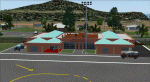
"Gerald's Park (TRPG)" is the Scenery of the new Airport of Montserrat Island, located not far from Antigua and Guadeloupe islands in the Caribbean.
| Filename: | New_Airport_of_Montserrat_Island_Geralds_Park_TRPG.zip |
| License: | Freeware |
| Added: | 9th December 2012, 20:00:52 |
| Downloads: | 1,345 |
| Author: | Delblond Christian |
| Size: | 2.4 MB |
| Category: Flight Simulator 2004 - Scenery | |
| Repost of Dryden Regional CYHD in Ontario Canada |
|
File Description:
This repost is first to deal with some lighting problems on the runways (though I still couldn't get rid of the taxiway lights that head off across the grass) and also to provide the right AFCAD file.
Dryden is in northwest Ontario on the shore of Wabigoon Lake. The airfield is some five miles northeast of the town. It has two runways, one 2,000 feet long and sand, the other 11/29 and 6,000 feet of asphalt 150 feet wide. There is a terminal building, a hangar for Thunder Airlines, and some GA hangars at and near the western apron, and in the Summer there is a flock of fire-fighting Canadair CL415 amphibs at the eastern apron together with the Ministry of Natural Resources Ontario fire fighting headquarters establishment, accomodation, and maintenance facilities. Among others Bearskin Airlines fly there, a wonderful punning name.
| Filename: | Repost_of_Dryden_Regional_CYHD_in_Ontario_Canada.zip |
| License: | Freeware |
| Added: | 15th February 2009, 15:34:49 |
| Downloads: | 597 |
| Author: | Roger Wensley |
| Size: | 4.51 MB |
| Category: Flight Simulator 2004 - Scenery | |
| Kotzebue PAOT on the northwestern coast of Alaska |
|
Images related to this file:
File Description:
There are four main northwestern Alaska towns which have good airports and are serviced by Alaska Airlines. From these airports local flights connect to nearby villages, "nearby" in Alaska meaning up to 150 miles away. The northernmost is Barrow. Southwest of Barrow is Kotzebue, then Nome, and the furthest south is Bethel. The town of Kotzbue is north of the Bering Strait on the northwestern coast, 320 miles southwest of Barrow. The population is just over 3,000 people. The location was for a long time a base for trading in furs, with three rivers emptying into the sea and providing routes into the interior land and villages; a meeting place between hunters and traders from Russia and elsewhere. The Kotzebue airport is called the Ralph Wien Memorial and has two runways. The modern one is aligned 08-26 and is 5,880 feet of 150 feet wide asphalt built across a shallow lagoon, with an ILS on 08 and PAPI on both ends. The second and older runway is originally military and gravel, aligned 17-35 and 3,786 feet long and used (wind allowing) by the GA planes that park alongside the runway. The prevalent wind is from the west; when the wind is from the east it is generally relatively feeble and with a much lower cloud base, possibly to the ground, hence the need for an ILS. All AI aircraft in FS9 much prefer to use a runway that has an ILS and so will continue to use 08-26 even if the wind is from the south until it reaches 30+ knots, even if they are a Cessna 150 flying VFR. So for AI realism in FS9 a northern or southern wind needs to be a strong one so that the runway is actually used. However, as Alaska Airlines, Northern Air Cargo, and Everts Air also fly to Kotzebue and can only use the east-west runway (as less than 4,000 feet of asphalt would be seriously inconvenient for a Boing 737 or DC6) it is necessary to have the northern or southern wind UNDER 30 knots at the times when they are landing or taking off. Your choice. I suppose a permanent strong wind from the west would be the most realistic on a daily basis, deterring all planes from ever using 17-35. The AI will develop along with further scenery additions in the neighbourhood.
| Filename: | Kotzebue_PAOT_on_the_northwestern_coast_of_Alaska.zip |
| License: | Freeware, limited distribution |
| Added: | 2nd August 2016, 16:47:52 |
| Downloads: | 457 |
| Author: | Roger Wensley |
| Size: | 19.32 MB |
| Category: Flight Simulator 2004 - Scenery | |
| Nome PAOM on the northwestern coast of Alaska |
|
Images related to this file:
File Description:
There are four main northwestern Alaska towns which have good airports and are serviced by Alaska Airlines. From these airports local flights connect to nearby villages, "nearby" in Alaska meaning up to 200 miles away. The northernmost is Barrow. Southwest of Barrow is Kotzebue, then Nome, and the furthest south is Bethel. The town of Nome is south of the Bering Strait on the southern coast of the Seward Peninsula, around 185 miles south of Kotzebue, with a population of about 3,800. It is the town that led to the creation of the most famous dogsledge race in the world, the Iditarod, which is based on the delivery to Nome of diphtheria serum during the blizzard conditions of the winter of 1925. The Nome airport (it currently has no other name) was originally built as the last of the refuelling airfields for planes being ferried to Russia during WW2. It has two runways, aligned 09-27 and 02-20 in FS9 (the wandering magnetic north has recently renamed the magnetic headings) and both of them around 6,000 feet with an ILS on 27. There is a modern airport layout diagram included showing taxiway names etc. Alaska Airlines, ERA, and Bering Air (which is headquartered in Nome), along with the shared cargo terminal for Northern Air Cargo and Everts Air, are all on the southern apron. The northern apron is mainly for GA, along with maintenance facilities, a garage building that also houses a weather bureau, and at the far northern end of runway 02-20 an apron and hanger for the Alaska Air National Guard. All AI aircraft in FS9 much prefer to use a runway that has an ILS and so will continue to use 09-27 even if the wind is from the north or south, right up until it reaches 30+ knots, so for AI realism in FS9 a permanent wind from the west would be the most realistic on a daily basis. There is also a small gravel strip just north of the town and this is included (94Z), as are some old line-of-sight radio communication reflectors on the hills above the town. There is a note about making adjustments to Ultimate Terrain Alaska-Canada regarding both realistic road lighting and also auto-generation.
| Filename: | Nome_PAOM_on_the_northwestern_coast_of_Alaska.zip |
| License: | Freeware, limited distribution |
| Added: | 18th October 2016, 02:38:42 |
| Downloads: | 486 |
| Author: | Roger Wensley |
| Size: | 22.65 MB |
| Category: Flight Simulator 2004 - Scenery | |
| Democratic Republic of the Congo Scenery Pak 1 |
|
File Description:
FS2004 Scenery enhancement. This adds parking areas, buildings, and objects to 2 small airfields in the Democratic Republic of the Congo. Freeware by Dale baker.
| Filename: | Democratic_Republic_of_the_Congo_Scenery_Pak_1.zip |
| License: | Freeware |
| Added: | 26th December 2006, 10:45:36 |
| Downloads: | 1,479 |
| Author: | Dale Baker |
| Size: | 679.19 KB |
© 2001-2026 AVSIM Online
All Rights Reserved
Privacy Policy |