
Where Flight Simulation Enthusiasts Gather from Around the World!
AVSIM Library - Search Results

| Category: Flight Simulator 2004 - Scenery | |
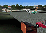
| Yangon International Airport, Yangon, Myanmar (VYYY) V2.0 |

|
File Description:
Yangon International Airport "MINGALADON" in Burma (Myanmar) will be able to accommodate bigger aircrafts and handle more passengers when work on extending its runway and upgrading its facilities is completed. The completion of the runway extension will enable Boeing 747 and Airbus 380 airplanes to use the airport. The work on extending the runway from 8100 feet to 11,200 feet began October 2004.
Version 2.0 with northward corrected and extended runway, taxiways and new taxisign. With Myanmar Air Force area, Helipads and even more parkings for civilian airplanes. This scenery was produced based on pictures of satellites. The ILS-correction is already contained here. Instructions in Deutsch and English.
| Filename: | Yangon_International_Airport_Yangon_Myanmar_VYYY_V.zip |
| License: | Freeware, limited distribution |
| Added: | 26th August 2006, 17:51:15 |
| Downloads: | 2,389 |
| Author: | HOUSE-RP, Robby Pauletto |
| Size: | 27.27 KB |
| Category: Flight Simulator 2004 - Scenery | |
| USA Pack2 |
|
File Description:
FS2002/2004 USA Pack2 Soaring Scenery
This file add some thermals to default Microsoft scenery for several cities of California and Nevada States,USA:
1.San Francisco(KSFO).
2.Los Angeles(KLAX).
3.Las Vegas(KLAS).
4.Crystal,CA(L01) - Great Western Soaring Club.
5.San Diego(CA84) - Associated Glider Club of Southern California.
6.Hemet-Ryan(KHMT) - Cypress Soaring.
7.Skylark Field(CA89) - Lake Elsinore Soaring Club.
8.Truckee(KTRK) - Soar Truckee.
9.Hollister(3O7) - Hollister Gliding Club.
10.California City(L71) - Caracoles Soaring.
11.Chico Mun(KCIC) - Chico Soaring
12.Avenal(CA69) - Central California Soaring Club.
It is freeware.
By Francisco Vargas.
E-mail:[email protected]
| Filename: | USA_Pack2.zip |
| License: | Freeware |
| Added: | 5th November 2005, 15:47:32 |
| Downloads: | 2,556 |
| Author: | Francisco Augusto Vargas Carneiro |
| Size: | 1.33 MB |
| Category: Flight Simulator 2004 - Scenery | |
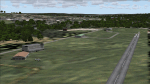
| HKUK Ukunda, Kenya |
|
Images related to this file:
File Description:
Googly scenery for HKUK Ukunda, Kenya, a small domestic airport in Kenya served
by about twice a day by flights of Mombasa Air Service. Oddly, Microsoft have
completely omitted this airport from Flight Simulator 2004 and these scenery files
provide the runway, aprons, taxiways, buildings and other airport features.
The scenery does not purport to be ultra-accurate. Based on high-detail satellite
imagery from Google Earth, the layout is proportionally correct but the added
airport features, such as buildings, are built from default Microsoft objects
and add-on libraries so will not look exactly like the real thing.
[File re-uploaded at request of AVSIM]
| Filename: | HKUK_Ukunda_Kenya.zip |
| License: | Freeware |
| Added: | 15th May 2010, 23:49:28 |
| Downloads: | 1,932 |
| Author: | John Hinson |
| Size: | 67.56 KB |
| Category: Flight Simulator 2004 - Scenery | |
| Burlington-Alamance Regional KBUY |
|
File Description:
This scenery is unique in that it is designed for the student or visiting pilot flying in
and out of this airport. All navaids are as accurate as possible for FS9. Glideslope is scheduled to be activated in October 2003.
(The new 6,000' extension has been delayed and completion date is now 2004). Both are
included. Numerous navaids and aerial photographs were used. Approved for practice but not for
navigation. Check current NOTAMS.
Special thanks to Dan the Airport Manager and Mark the Chief Flight
Instructor. See Dan or Mark for CD copies of this file.
If you are planning on coming to the Piedmont or are a student pilot you will want this! Special readme inside.
-jimmy R martin &
David Fraizer
[email protected].
| Filename: | BurlingtonAlamance_Regional__KBUY.zip |
| License: | Freeware |
| Added: | 4th September 2003, 18:20:47 |
| Downloads: | 1,963 |
| Author: | jimmy R martin & David Fraizer |
| Size: | 3.47 MB |
| Category: Flight Simulator 2004 - Scenery | |
| Ohio Islands - 3W9 Bass Isle |
|
File Description:
Microsoft Flight Simulator 2004 Scenery - Ohio Islands 3W9
Middle Bass Island - East Point, a general aviation airfield in northern Ohio located in Lake Michigan. Extensively reworked. Features FSDSv2 custom-built hangers and objects in high detail, VTP2 coded ground textures and a detailed airport with full seasonal changes and Autogen support. Includes an amphibious landing area and detailed, animated dock that rises and falls with the tidal swells. Custom lighting throughout. Opening/closing hangar doors. Includes full documentation and map. All required files and textures included. Optimized for FS2004. Created specifically to allow users to adjust frame rates through the use of the Scenery Density/Autogen sliders for increasing levels of detail and realism.
| Filename: | Ohio_Islands__3W9_Bass_Isle.zip |
| License: | Freeware |
| Added: | 12th September 2003, 00:34:28 |
| Downloads: | 2,518 |
| Author: | Mark Smith |
| Size: | 4.37 MB |
| Category: Flight Simulator 2004 - Scenery | |
| Windfarms of the UK Vol 2 'Wales' |
|
File Description:
This scenery places 13 wind farms into Wales. A total of 355 individual wind generators creating enough power for nearly 98 thousand Homes annually. They are geographically correct and designed to fit perfectly with Visual flight / Getmapping VFR Photographic scenery. Now with much better Gmax turbine model supplied by John "Bones" Woodside. (Also see Vol 1 windvol1.zip)
| Filename: | Windfarms_of_the_UK_Vol_2__Wales.zip |
| License: | Freeware, limited distribution |
| Added: | 25th February 2004, 22:58:14 |
| Downloads: | 4,273 |
| Author: | Dale Sedgwick (FS-Icarus Crew) |
| Size: | 1.27 MB |
| Category: Flight Simulator 2004 - Scenery | |
| Evergreen Lake, Colorado (just west of Denver) |
|
File Description:
Evergreen, CO is a beautiful little mountain community in the Rocky Mountain foothills (just west of Denver). This scenery and landclass adds the lake in Evergreen, the golf course and also adds the landclass for Kittredge and Morrison (nearby towns). Take a look at the pictures (the town doesn't even exist in the default FS2004).
| Filename: | Evergreen_Lake_Colorado_just_west_of_Denver.zip |
| License: | Freeware |
| Added: | 24th August 2003, 02:56:10 |
| Downloads: | 2,261 |
| Author: | Chris Klein |
| Size: | 211.79 KB |
| Category: Flight Simulator 2004 - Scenery | |
| Search and Rescue of a C 47 |
|
File Description:
A Douglas C47 took off from CZST for a flight to CBU2 both in BC Canada. Apx 11 minutes after takeoff the plane reported on 121.5, "smoke in the cabin". It was very close to a mountain side. A witness reported light smoke coming from the plane as it flew into a small cloudbank.
| Filename: | Search_and_Rescue_of_a_C_47.zip |
| License: | Freeware |
| Added: | 7th February 2004, 19:12:14 |
| Downloads: | 1,017 |
| Author: | Frank Betts |
| Size: | 78.88 KB |
| Category: Flight Simulator 2004 - Scenery | |
| Some Islands of St.Lawrence river, Quebec, Canada |
|
File Description:
The files in this package contain some islands of St.Lawrence river and other sceneries of province of Quebec, Canada. For FS2004 only. To use with terrain mesh for parts of this province after some corrections : qclod09a.zip to qclod09e.zip (5 files).
Les fichiers contenus dans cette archive corrigent la representation qui est faite dans FS2004 de quelques iles du fleuve Saint-Laurent. D'autres scenes sont egalement jointes. L'utilisation du mesh du Quebec est recommandée : 5 fichiers - qclod09a.zip a qclod09e.zip
| Filename: | Some_Islands_of_StLawrence_river_Quebec_Canada.zip |
| License: | Freeware, limited distribution |
| Added: | 20th April 2004, 16:55:41 |
| Downloads: | 4,860 |
| Author: | Gilles Gauthier |
| Size: | 1.82 MB |
| Category: Flight Simulator 2004 - Scenery | |
| Airstrips of Scandinavia and the Baltic States |
|
Images related to this file:
File Description:
Effectively an extension of my "Airstrips of Western Europe" project for FS2004, around 140 sceneries of small airfields in Scandinavia and the Baltic states, each enhanced with buildings, taxiways, parking spaces and aprons as appropriate, to further facilitate the generation of lightweight AI traffic in the area, without overloading the more major airfields.
Given the available comprehensive coverage of both Norway and Finland by other authors, and much of Denmark by myself in my earlier "Airstrips of North-West Europe" upload, this selection comprises mostly small Swedish and Baltic State airfields.
Unfortunately, due to the very nature of much of the area, some of these airstrips are just that, a grass/dirt runway on a flattened/mown area in the landscape with just an associated building or two. Nevertheless, they do perform the required function of providing sources for AI traffic. The very existence of those airstrips not included in FS2004 is referred to in various on-line databases.
Again, there's no photo-realism here, just a selection of basic 'generic' buildings, more or less accurately sized and placed to reflect the airfield layout as seen on on-line satellite imagery and aerial photography. These buildings have minimal effect on frame-rates, so are ideal for this kind of job. The airfields are aligned as well as possible with the roads etc. in UT Europe (where applicable) and the Genesis Europe mesh, but should mostly be fine in a default installation or other configuration.
Please read the rest of this "blurb" in the included text file. There may be some details of note or interest.
| Filename: | Airstrips_of_Scandinavia_and_the_Baltic_States.zip |
| License: | Freeware |
| Added: | 11th November 2024, 17:25:16 |
| Downloads: | 105 |
| Author: | Chris Eve |
| Size: | 2.52 MB |
© 2001-2026 AVSIM Online
All Rights Reserved
Privacy Policy |