
Where Flight Simulation Enthusiasts Gather from Around the World!
AVSIM Library - Search Results

| Category: Flight Simulator 2004 - Scenery | |
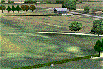
| Marine One at The White House |

|
Images related to this file:
File Description:
Marine One at The White House. This small scenery package places the Marine One Helicopter at The White House and optionally at Andrews Air Force Base - waiting to transport the President. Setups are included for the default FS2004 scenery and for those using the MAIW enhancement of Andrews AFB. All files are included. Helicopter model by D.Hardcastle with textures by Christopher Baird and Dallas Mullen.
The Marine One Helicopter is an "almost static" display. See instructions for further details regarding this procedure. Please unzip to a temporary folder and follow the installation instructions. Compiled for your flying enjoyment by David "Opa" Marshall.
| Filename: | Marine_One_at_The_White_House.zip |
| License: | Freeware |
| Added: | 18th July 2010, 19:01:23 |
| Downloads: | 563 |
| Author: | David "Opa" Marshall |
| Size: | 1.41 MB |
| Category: Flight Simulator 2004 - Scenery | |
| Rio de Janeiro Version 5 |
|
File Description:
Rio de Janeiro V5 for FS2004. This scenery for Rio de Janeiro improves on the default Rio, were MS missed so many landmarks the place didn't
even look like Rio. Most of the major items are now present, and there is an exclusion for the Rio-Niteroi Bridge included in the FS2004 Update, in
case you have the Update installed. Also enhanced is the Jacarepagua Airport (SBJR). The package includes traffic, some commercial, a complete
aircraft and a modification for the 737 to inlcude VARIG's colours. Those two aircraft are used in commuter traffic between Rio and Sao Paulo.
Authors are Newton Drumond (Rio) and Fern Marques (North Bay, Ontario).
| Filename: | Rio_de_Janeiro_Version_5.zip |
| License: | Freeware |
| Added: | 11th August 2005, 05:15:42 |
| Downloads: | 8,414 |
| Author: | Newton Drumond and Fern Marques |
| Size: | 12.03 MB |
| Category: Flight Simulator 2004 - Scenery | |
| Anticosti Island in Quebec Canada |
|
Images related to this file:
File Description:
Anticosti Island is in the Gulf of St Lawrence, around 25 miles off the Quebec mainland coast. It is some 40 miles wide and 130 miles long on an east west axis. There are few urban areas and only one that can be described as a small town, namely Port Menier at the western end of the southern coast, with a population of under 1,000. There is a ferry service to the harbour.
The airport, Port Menier CYPN, is around 3 miles northeast of the town, with an asphalt runway aligned 11-28, 4,875 feet long and 150 feet wide with PAPI at each end. In 2010 (the approximate date of this scenery) a gravel runway was still visible at the eastern end of the field. This was no longer in use by 2010, except perhaps by small planes on skis in the winter.
The island, with its small population, small urban area, and no industry other than logging, has as a result a mainly undisturbed wildlife population. This has made deer hunting and fishing the main tourist activities, with one company (called Safari) having an exclusive licence to exploit large areas of mountains and rivers. Planeloads of hunters and fishermen are flown in on chartered Nolinor Aviation planes, landing at CYPN. There are a further two airfields in the eastern end of the island, and in 2010 Rivere-Aux-Saumons CTH7 had a 5,500 feet gravel runway, linked by road to a lodge area at the mouth of the river. This is the only lodge area that I have been able to locate, but there are others. To the south Riviere Bell CRB5 had at that time a gravel runway that was 3,000 feet long. This has been lengthened since then and both runways were recently (2021) asphalted.
If you find an error email me please, and note that my email address has been changed to rogwens at Gmail dot com. The reason I am posting this now is that I discovered that my original post ended up in MSFS Original Aircraft instead of in FS2004 Scenery. Ooops!
| Filename: | Anticosti_Island_in_Quebec_Canada.zip |
| License: | Freeware, limited distribution |
| Added: | 28th January 2022, 17:39:46 |
| Downloads: | 121 |
| Author: | Roger Wensley |
| Size: | 11.78 MB |
| Category: Flight Simulator 2004 - Scenery | |
| Anticosti Island in Quebec Canada |
|
Images related to this file:
File Description:
Anticosti Island is in the Gulf of St Lawrence, around 25 miles off the Quebec mainland coast. It is some 40 miles wide and 130 miles long on an east west axis. There are few urban areas and only one that can be described as a small town, namely Port Menier at the western end of the southern coast, with a population of under 1,000. There is a ferry service to the harbour. The airport, Port Menier CYPN, is around 3 miles northeast of the town, with an asphalt runway aligned 11-28, 4,875 feet long and 150 feet wide with PAPI at each end. In 2010 (the approximate date of this scenery) a gravel runway was still visible at the eastern end of the field. This was no longer in use by 2010, except perhaps by small planes on skis in the winter. The island, with its small population, small urban area, and no industry other than logging, has as a result a mainly undisturbed wildlife population. This has made deer hunting and fishing the main tourist activities, with one company (called Safari) having an exclusive licence to exploit large areas of mountains and rivers. Planeloads of hunters and fishermen are flown in on chartered Nolinor Aviation planes from the south. There are a further two airfields in the eastern end of the island, and in 2010 Rivere-Aux-Saumons CTH7 had a 5,500 feet gravel runway, linked by road to a lodge area at the mouth of the river. This is the only lodge area that I have been able to locate, but there are others. To the south Riviere Bell CRB5 had at that time a gravel runway that was 3,000 feet long. This has been lengthened since then and both runways were recently (2021) asphalted. If you find an error email me please, and note that my email address has been changed to rogwens at Gmail dot com.
| Filename: | Anticosti_Island_in_Quebec_Canada.zip |
| License: | Freeware, limited distribution |
| Added: | 31st July 2021, 18:23:40 |
| Downloads: | 80 |
| Author: | Roger Wensley |
| Size: | 11.78 MB |
| Category: Flight Simulator 2004 - Scenery | |
| CYCS - Chesterfield Inlet - Nunavut, Canada Modified V1 |
|
Images related to this file:
File Description:
This version of Chesterfield Inlet corrects the VASI position on the runway, and also updates the taxiway edge lights to a newer and smaller version which is more realistically sized. This is a complete version and does not require you to have installed the old version. There is new AI, which is for Arviat, Whale Cove, and Chesterfield Inlet; this enlarges on and replaces the version posted with Whale Cove so use this one. The First Air and Calm Air flights also visit Rankin Inlet (made by Sid) and the GA flights originate in Rankin Inlet. There is a revised Rankin Inlet bgl so that the planes are allowed to use the gates. Chesterfield Inlet is a small village on the west coast of Hudson Bay, with a population of 340 or so. It is the oldest community in Nunavut and was established around a Hudson Bay Company post in 1911. It is 55 miles north of Rankin Inlet (Sid and Pete's post). The airfield is close to the village and has a gravel runway 3,600 feet long aligned 124T/304T (true, not magnetic).
| Filename: | CYCS__Chesterfield_Inlet__Nunavut_Canada_Modified_.zip |
| License: | Freeware, limited distribution |
| Added: | 23rd August 2014, 11:22:36 |
| Downloads: | 198 |
| Author: | Roger Wensley |
| Size: | 3.3 MB |
| Category: Flight Simulator 2004 - Scenery | |
| Buckland PABL in Alaska |
|
Images related to this file:
File Description:
Buckland is a village on a small river, around 45 miles east of Deering and 15 miles inland from the river mouth. Like Deering, the population of 420 live from fishing and the land. The airfield is close by and has a gravel runway aligned 10-24 and 3,300 feet long with VASI at both ends. Apart from the airfield itself, and it's buildings, this scenery modifies the local (mostly treeless) land class, adds village buildings while reducing the village size to reality, and creates a new airfield background. Bering Air flies into Buckland from Kotzebue and is included in the AI. A note here about my scenery making. This is post number 505 and there will not be many more to follow this as I am almost at the end of the photos I either took or found for scenery purposes. There is a limit to what can be located online and I have already been making use of the little there is; eg Unalakleet. So, if you are near an airport (preferably Canadian or Alaskan) and have a camera..... Let me know.
| Filename: | Buckland_PABL_in_Alaska.zip |
| License: | Freeware, limited distribution |
| Added: | 10th August 2019, 18:51:45 |
| Downloads: | 145 |
| Author: | Roger Wensley |
| Size: | 4.11 MB |
| Category: Flight Simulator 2004 - Scenery | |
| Steamboat Springs (KSBS), Flat Tops Wilderness Area, Colorado - Photo-Scenery |
|
Images related to this file:
File Description:

Steamboat Springs (KSBS), Flat Tops Wilderness Area, Colorado, Photo-Scenery (FS9 & FSX)
The Flat Tops Wilderness Area, which is the second largest wilderness area in Colorado, is named for its many flat topped mountains that are clearly visible from the sky. Trappers Lake, located in the north of the area inspired Arthur Carhart, a US Forest Service official, to initiate a plea for Wilderness preservation as early as 1919. Finally in 1975, three years before his death in 1978, the Flat Tops were designated a wilderness area. No wonder he found the area so entrancing: Behind Trappers Lake loom majestic volcanic cliffs, and beyond them a vast subalpine terrain reluctantly yields to alpine tundra with an average elevation of about 10.000 feet. More than 100 lakes dot the country above and below numerous flat-topped cliffs. Steamboat Springs is an internationally known winter resort destination.
To explore the scenery depart from Steamboat Springs Airport (KSBS) or Yampa Valley Airport (KHDN) and head south. High resolution versions of this scenery for FS9 and FSX (much sharper, but larger and multiple downloads) are available at www.blueskyscenery.com/GNB_West2.html . The screenies are taken from the high-res versions, so expect this version to be slightly more blurry. Thanks to Joop Mak for providing custom AFCADs that correct airport layouts so that they align with the photo-textures! They are available at www.blueskyscenery.com/AFCADs.html . YourDonation@Work: Dedicated to James.
| Filename: | Steamboat_Springs_KSBS_Flat_Tops_Wilderness_Area_C.zip |
| License: | Freeware, limited distribution |
| Added: | 26th April 2010, 17:53:25 |
| Downloads: | 1,303 |
| Author: | Gottfried Razek - blueskyscenery.com |
| Size: | 91.57 MB |
| Category: Flight Simulator 2004 - Scenery | |
| Spain and Portugal Thermals |
|
File Description:
A set of thermals that includes the complete Spanish and Portuguese Territory
Covers Baleares and Canary Islands
| Filename: | Spain_and_Portugal_Thermals.zip |
| License: | Freeware |
| Added: | 30th August 2005, 13:16:45 |
| Downloads: | 1,399 |
| Author: | Alejandro Villa |
| Size: | 3.63 MB |
| Category: Flight Simulator 2004 - Scenery | |
| Centre Bush Aerodrome - NZCB |
|
Images related to this file:
File Description:
Small New Zealand aerodrome, 22nm north of Invercargill, Southland. Made to fit Christian Stock's NZ 20m mesh.
| Filename: | Centre_Bush_Aerodrome__NZCB.zip |
| License: | Freeware |
| Added: | 17th April 2012, 22:13:32 |
| Downloads: | 161 |
| Author: | Godfrey Tier |
| Size: | 476.1 KB |
| Category: Flight Simulator 2004 - Scenery | |
| Sabadell Airport (LELL) |
|
File Description:
Scenery of Sabadell Airport (Near Barcelona, Spain) with all hangars, tower control, aeroclub buildings, displaced threshold RWY31.....
| Filename: | Sabadell_Airport_LELL.zip |
| License: | Freeware |
| Added: | 23rd February 2010, 02:57:17 |
| Downloads: | 2,074 |
| Author: | NN |
| Size: | 13.95 MB |
© 2001-2026 AVSIM Online
All Rights Reserved
Privacy Policy |