
Where Flight Simulation Enthusiasts Gather from Around the World!
AVSIM Library - Search Results

| Category: Flight Simulator 2004 - Scenery | |
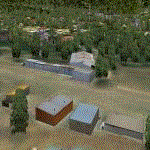
| Latina New |

|
File Description:
Scenario dell'aeroporto di Latina LIRL con traffico di Siai 260 e landclass.
Seconda versione. Corrette alcune cose dalla precedente versione. Scenery of the airport Latina LIRL with traffic of Siai 260 and landclass.
New version. Corrected some things from the previous version.
| Filename: | Latina_New.zip |
| License: | Freeware, limited distribution |
| Added: | 30th August 2008, 03:21:53 |
| Downloads: | 465 |
| Author: | Claudio "Werwolf" Carra and Andrea "Panty" Gritti |
| Size: | 3.07 MB |
| Category: Flight Simulator 2004 - Scenery | |
| Tarrant Rushton Disused |
|
File Description:
This is a revised version of Tarrant Rushton disused airfield in Dorset UK.
The main change is the addition of an AFCAD file so that the airfield will show in FS2004 Airfields list as EGWT/Tarrant Rushton, Blandford ,UK.
Also more suitable hangars.
| Filename: | Tarrant_Rushton_Disused.zip |
| License: | Freeware |
| Added: | 25th June 2004, 01:46:17 |
| Downloads: | 849 |
| Author: | Dave Fagan |
| Size: | 438.48 KB |
| Category: Flight Simulator 2004 - Scenery | |
| Goiabeiras, Vitória, Brazil |
|
File Description:
This is my FS2004 version of the Vitória airport (Goiabeiras) scenery. There are included in this file the Goiabeiras airport, some visual reference points (bridges and buildings) and a new landclass of the city. An AFCAD file from SBVT airport is also included.
| Filename: | Goiabeiras_Vitria_Brazil.zip |
| License: | Freeware, limited distribution |
| Added: | 3rd June 2004, 21:20:24 |
| Downloads: | 10,973 |
| Author: | Leandro Braun |
| Size: | 2.22 MB |
| Category: Flight Simulator 2004 - Scenery | |
| Hazyview Airfield, Hazyview, South Africa |
|
Images related to this file:
File Description:
Hazyview is one of the gateway towns to the Kruger National Park and is located just to the West of Phabeni Gate, one of the main gates to use if you are travelling to Skukuza. The airfield in Hazyview is also called Numbi Airfield due to the location of the Numbi Hotel right next to the airfield.
Hazyview airfield is not included in the default scenery of FS2004. With this package, it has been faithfully produced in Gmax with photoreal textures on all the buildings and a photoreal ground as well. Even the Lowveld mall to the North of the airfield and right on the approach to Rwy 19 as well as the Building supplies store to the south and on approach to Rwy 01 is inlcuded with custom models and textures. Likewise, the buildings to the West of the runway (right at the edge of the runway) and the brickyard at the Northern end is modeled with custom models and textures. The two large cellphone antennas are also present in the airport scenery and custom made.
In real life, the runway is quite sloped and this was also recreated in the scenery under the limitations FS2004 presents with regards to non-flat airports.
The grass runway is aligned 01/19 and only 820m long. Take-off is on Rwy 01, with landings on Rwy 19.
| Filename: | Hazyview_Airfield_Hazyview_South_Africa.zip |
| License: | Freeware, limited distribution |
| Added: | 4th February 2022, 14:57:40 |
| Downloads: | 138 |
| Author: | Kobus van Wyk |
| Size: | 17.07 MB |
| Category: Flight Simulator 2004 - Scenery | |
| Dolbeau-St-Felicien CYDO in Quebec Canada |
|
Images related to this file:
File Description:
This is the fourth of five sceneries around Lac Saint-Jean in Quebec, Canada. Saint-Felicien is a village on a small river at the western end of Lac Saint-Jean, and the airfield is just under 10 miles to the northeast. At the same distance further to the northeast of the airfield and on a slightly larger river is the village called Dolbeau. The village of Sainte-Methode is closer than either of the other villages but presumably lacked influence. The airfield effectively has one runway aligned 11-29 and just under 5,000 feet long, with approach lights on 11. There is, or was, a second runway aligned north-south but this has badly deteriorated without maintenance and has loose stones that threaten propellor damage. The taxiway that runs east-west is in a similar condition and all planes operate as if there is no taxiway. There is a clubhouse and a maintenance facility along with a line of old hangars that remain in full use, plus planes parked in the open. The landclass has been modified along with the grassed area of the airfield, and in the AI (included with the post of CYRC) there are scheduled flights by Max Aviation, and GA flights etc. It is a really typical airfield in northern(ish) rural Canada with a lot more activity than one might expect.
| Filename: | DolbeauStFelicien_CYDO_in_Quebec_Canada.zip |
| License: | Freeware, limited distribution |
| Added: | 19th November 2017, 15:52:32 |
| Downloads: | 167 |
| Author: | Roger Wensley |
| Size: | 4.17 MB |
| Category: Flight Simulator 2004 - Scenery | |
| Hassan Djamous International Airport (FTTJ) V1 |
|
Images related to this file:
File Description:
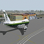
Thank you for downloading Hassan Djamous International Airport for FS9. This is the main gateway to the Republic of Chad. I tried to recreate the scenery as the airport currently looks like. Scenery contains Main terminal, VIP, Civilian hangars, Military Hangars, Fire station, Airforce base. Airport was built by Sketchup, ADE,AFL Lights SbuilderFS9, Bill Melichar Tropical Trees Macros. Scenery uses RWY12 Object library which you will find on Avsim or flightsim. Special thanks to HGS and Dedl for testing out and helping me fix issues.
| Filename: | Hassan_Djamous_International_Airport_FTTJ_V1.zip |
| License: | Freeware |
| Added: | 12th May 2021, 19:01:20 |
| Downloads: | 347 |
| Author: | EMMANUEL MWANDOSYA |
| Size: | 14.97 MB |
| Category: Flight Simulator 2004 - Scenery | |
| Koyuk PAKK in Alaska |
|
Images related to this file:
File Description:
Koyuk is a coastal village around 125 miles east of Nome at the mouth of the Koyuk River, with a population just under 400 living from fishing and the land. The airfield is close by and has a gravel runway aligned 18-36, 3,300 feet long with VASI at both ends. Apart from the airfield itself, and it's buildings, this scenery modifies the local land class, adds village buildings while reducing the village size to reality, and creates a new airfield background. Bering Air and ERA both fly into Deering and are included in the AI. A note here about my scenery making. This is post number 506 and there will not be many more to follow this as I am almost at the end of the photos I either took or found for scenery purposes. There is a limit to what can be located online and I have already been making use of the little there is; eg Unalakleet. So, if you are near an airport (preferably Canadian or Alaskan) and have a camera..... Let me know.
| Filename: | Koyuk_PAKK_in_Alaska.zip |
| License: | Freeware, limited distribution |
| Added: | 15th August 2019, 17:56:50 |
| Downloads: | 140 |
| Author: | Roger Wensley |
| Size: | 3.88 MB |
| Category: Flight Simulator 2004 - Scenery | |
| Ford India Scenery Project - Part 1 |
|
Images related to this file:
File Description:

The Ford India Project is a 6 part Project to create a 1930's India - Part 1 Pondicherry UT India VOPC is now available for your Flight Sim enjoyment. The scenery is a historical rendition of VOPC Pondicherry circa 1930's. This package is the first part and the foundation of the other 5 parts. Part 2 is also complete which includes the TATA and Son's Air Services route across India with 1930's version of Colombo, Madras, Hyderabad, Bombay, Ahmedabad and Karachi.
Additionally, a comprehensive AI package is available which includes 4 aircraft and 22 liveries specific to India with flights transiting along the TATA routes and circuits at Pondicherry. Part 2 and the AI Traffic pack is now available only at the Ford Project site - http://www.ford-tri-motor.net/ford-india-project.htm - if you like the Pondicherry scenery then you will indeed enjoy the additions of Part 2 and the AI traffic package to enrich and enjoy the 1930's flying throughout the Indian Empire.
| Filename: | Ford_India_Scenery_Project__Part_1.zip |
| License: | Freeware, limited distribution |
| Added: | 21st June 2013, 20:35:51 |
| Downloads: | 146 |
| Author: | Garry J. Smith, Edward C. Moore |
| Size: | 6.34 MB |
| Category: Flight Simulator 2004 - Scenery | |
| Cape Dorset CYTE, Baffin Island, Nunavut, Canada |
|
Images related to this file:
File Description:
Cape Dorset is a village of 1,300 or so inhabitants at N 64 13 W 76 31 on Dorset Island, off the southwest corner of Baffin Island. It's Inuit name is Kinngait, which means "High Mountains"; watch out if you fly there in low clouds. The village (again) does not feature in FS9 but is included in this scenery with approximately the right shape, or shapes as there are separate parts. The airfield runway is just under 4,000 feet of gravel 100 feet wide at 158 feet above sea level. There is a double gradient to it, but unfortunately this cannot be replicated in FS.
Cape Dorset had a Hudson Bay Company store as long ago as 1913, and is now known as a centre for Inuit art. I added the roads, a new airfield background, a pond between apron and runway, plus of course there is the scenery file and the AFCAD and AI, which has two planes visiting, a First Air HS748 and a Canadian North Dash 8-100, as per real life.
| Filename: | Cape_Dorset_CYTE_Baffin_Island_Nunavut_Canada.zip |
| License: | Freeware, limited distribution |
| Added: | 9th December 2010, 18:45:06 |
| Downloads: | 1,014 |
| Author: | Roger Wensley |
| Size: | 2.75 MB |
| Category: Flight Simulator 2004 - Scenery | |
| Warsaw Airport (EPWA) 2010, Poland (v1.1) |
|
Images related to this file:
File Description:

Warsaw Frederic Chopin Airport (Polish: Port Lotniczy im. Fryderyka Chopina) (IATA: WAW, ICAO: EPWA) is an international airport located in the Okecie district of Warsaw, Poland. Formerly Okecie International Airport, it is named after the famous Polish composer and former Warsaw resident, Frederic Chopin. It is Poland's busiest airport, handling just under 50% of the country's air passenger traffic. High detailed airport scenery by MK-Studios.com.pl
Updated version 1.1 of Warsaw scenery
| Filename: | Warsaw_Airport_EPWA_2010_Poland_v11.zip |
| License: | Freeware, limited distribution |
| Added: | 5th May 2010, 21:35:20 |
| Downloads: | 10,088 |
| Author: | Mateusz Stabryla, MK Studios |
| Size: | 33.16 MB |
© 2001-2026 AVSIM Online
All Rights Reserved
Privacy Policy |