
Where Flight Simulation Enthusiasts Gather from Around the World!
AVSIM Library - Search Results

| Category: Flight Simulator 2004 - Scenery | |
| Circle Line Ferry Cruising New York Harbor |

|
Images related to this file:
File Description:
New York Harbor cruise - passing by Ellis Island, the Statue of Liberty and the Verrazano-Narrows Bridge - featuring the marvelous model of the Circle Line Ferry, created by Ron Jeffers. This package includes a custom Afcad - using the invisible runway and taxiway technique - and a flightplan which has the Ferry cruising around the harbor every 1/2 hour. Each cruise lasts approximately 30 minutes. This enhancement has been designed for use with the default FS2004 scenery. It has not been tested with Ultimate Terrain but may work in that environment if the Afcad is adjusted. Please unzip to a temporary folder and follow the simple installation instructions. Compiled for your flying enjoyment by
David "Opa" Marshall.
| Filename: | Circle_Line_Ferry_Cruising_New_York_Harbor.zip |
| License: | Freeware |
| Added: | 10th December 2009, 12:40:19 |
| Downloads: | 3,120 |
| Author: | David "Opa" Marshall |
| Size: | 330.07 KB |
| Category: Flight Simulator 2004 - Scenery | |
| Capitol Reef National Park/South - Waterpocket Fold, Utah, Photo-Scenery |
|
Images related to this file:
File Description:

Capitol Reef National Park/South - Waterpocket Fold, Utah, Photo-Scenery (for FS9 & FSX)
This scenery covers the area from the southern part of Capitol Reef National Park down along the Waterpocket Fold and the Henry Mountains. It extends my Canyonlands sceneries to the west and brings you another 3.500 sq km in 4.7m/pix quality. To explore the scenery depart from Hanksville (KHVE) and head northwest. High resolution versions of this scenery for FS9 and FSX (much sharper, but larger and multiple downloads)
are available at www.blueskyscenery.com/CNY_SouthWest2.html . The screenies are taken from the high-res versions, so expect this version to be slightly more blurry. YourDonation@Work: Eric and Andy.
| Filename: | Capitol_Reef_National_ParkSouth__Waterpocket_Fold_.zip |
| License: | Freeware, limited distribution |
| Added: | 13th January 2010, 20:46:53 |
| Downloads: | 1,731 |
| Author: | Gottfried Razek - blueskyscenery.com |
| Size: | 95.92 MB |
| Category: Flight Simulator 2004 - Scenery | |
| Canouan TVSC in the Grenadines |
|
Images related to this file:
File Description:
Canouan Island is the one of the middle islands in the chain known as St Vincent and the Grenadines, between Mustique and Union Island. Canouan is around 5 miles long and shaped like a hook, with a resident population of 1,200. There has been major touristic development on the island since the early 1990's and the island now has paved roads, electricity, and desalinated water along with a golf course.
The airport is at the southern end of the island and the runway has been extended to 5,875 feet on reclaimed land, making Canouan the jet airport for the Grenadines with flights from North and South America. There are connecting flights to the other islands by SVG and LIAT. The airport apron has been extended to accomodate larger planes and I have shown the airport with this apron work still in progress and during the expansion of the terminal building. The AI has two international flights, on Wednesday and Saturday, and both by American.
| Filename: | Canouan_TVSC_in_the_Grenadines.zip |
| License: | Freeware, limited distribution |
| Added: | 11th June 2013, 22:59:04 |
| Downloads: | 656 |
| Author: | Roger Wensley |
| Size: | 3.6 MB |
| Category: Flight Simulator 2004 - Scenery | |
| CWBH - Bernard Harbour - Nunavut, Canada |
|
Images related to this file:
File Description:
Bernard Harbour was a DEW line "iStation" (a small station with a staff of 5 or 7 people) on the nothern mainland coast 75 miles north of Kugluktuk, and 45 miles west of Lady Franklin Point. It closed in 1963. The slowly deteriorating buildings are still there, along with a fallen radio communications mast. The runway is also still there and has 3,040 feet of gravel, aligned 122T/302T. There is now no runway lighting, no signage, no windsock, and the bushes growing amid the gravel are winning, though slowly. In 1991 a North Warning System (NWS) automated station was established 3 miles to the southwest and there is a second smaller runway there (1,450 feet) along with a helicopter pad. A road joins the two sites for when diesel resupply is undertaken from a ship in the summer, and the zigzag route is (in reality) dictated by the numerous ponds that are too small to be picked up by Ultimate Terrain.
| Filename: | CWBH__Bernard_Harbour__Nunavut_Canada.zip |
| License: | Freeware, limited distribution |
| Added: | 11th November 2012, 01:24:20 |
| Downloads: | 256 |
| Author: | Roger Wensley |
| Size: | 1.49 MB |
| Category: Flight Simulator 2004 - Scenery | |
| Vadodara International Airport (VABO) |
|
Images related to this file:
File Description:
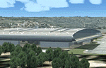
Vadodara International Airport (VABO) for FSX and FS2004.
Virtual aviation community stands basically on the grounds of what happens in the real world aviation and simulates the real thing, virtually. So that means they always have to be a step ahead and we follow. But my friend, we have a chance to make them follow us. Thats right! The proposed (final) integrated terminal at Vadodara shall have its construction commenced in mid of 2013 (the time can be altered, as real dudes define the situation). The design is finalized and here it is ..... the airport is basically " A basin kind".
Vadodara Airport or Civil Airport Harni (IATA: BDQ, ICAO: VABO) is a civilian airport located in the north-east of Vadodara, Gujarat, India in the suburb of Harni. A domestic airport until now, Vadodara Airport will become an international airport once the proposed new terminal is operational.
| Filename: | Vadodara_International_Airport_VABO.zip |
| License: | Freeware, limited distribution |
| Added: | 7th September 2010, 11:32:31 |
| Downloads: | 1,879 |
| Author: | Ashish Singh |
| Size: | 25.19 MB |
| Category: Flight Simulator 2004 - Scenery | |
| Skysoft Simulation - ZUJZ_2011 |
|
Images related to this file:
File Description:
Jiuzhai Huanglong Airport (ICAO: ZUJZ, IATA: JZH) situated at the famous tourist
spot Jiuzhaigou in Sichuan Province, China, where is the home of pandas. With an
elevation of 3448m, it is one of the highest airports in China as well as in the world.
While enjoying the breathtaking landscape around you, you should always be cautious
about the severe turbulence and intense crosswind whenever departure or arriving the
airport. The airport was constructed in the year 2003 with a runway length 3400 meters
(11 056 ft.) and width 60 meters (147 ft.).
In the year 2007, the airport has been expanded. The runway was extended by 200
meters (650 ft.) and 7 parking gates were added. Now the airport is capable for
medium jets to takeoff and landing. Certification needed in both airplanes as well as the
crews before executing takeoff or landing on the airport. It is expected that in the year
2015, the average number of flights everyday could increased to about 100.
| Filename: | Skysoft_Simulation__ZUJZ_2011.zip |
| License: | Freeware, limited distribution |
| Added: | 1st April 2011, 15:36:44 |
| Downloads: | 2,907 |
| Author: | Skysoft Simulation DevelopTeam |
| Size: | 24.48 MB |
| Category: Flight Simulator 2004 - Scenery | |
| The Queen Mary II at New York Harbor |
|
Images related to this file:
File Description:
The Queen Mary II at New York Harbor. Using the exceptionally fine AI model of the QM2 by the Japanese artist Mitsuya Hamaguchi (Hama), this package presents the Brooklyn Cruise Terminal (home of the Cunard Cruise Lines) with the QM2 making regular departures and arrivals. Also included is a representation of the Cape Liberty Cruise Port, Bayonne, New Jersey - just across the river. An animated wake has also been added to the default Cruise ship seen in the harbor. This package is designed to work in the default FS2004 setting ONLY. This scenery uses several custom objects created by John B.Loney Jr. as well as objects from the EZ Scenery and RWY12 libraries. Complete details will be found in the instructions.If you have the Lago FSE program you will also hear the horn of the QM2 occasionally. Please unzip to a temporary folder and follow the simple installation instructions. Compiled for your flying enjoyment by David "Opa" Marshall in collaboration with John B. Loney Jr.
| Filename: | The_Queen_Mary_II_at_New_York_Harbor.zip |
| License: | Freeware |
| Added: | 10th December 2009, 12:41:38 |
| Downloads: | 3,554 |
| Author: | David "Opa" Marshall |
| Size: | 1023.05 KB |
| Category: Flight Simulator 2004 - Scenery | |
| Scotports Volume 1 |
|
Images related to this file:
File Description:
It is well noted that Scottish Airports are very neglected by scenery developers in FS9, mainly the smaller Airports. Therefore I decided to do a little something about it! - Using the wonderful Airport Design Editor (ADE), I have constructed these sceneries from scratch, after deleting all of the disappointing default buildings and objects. The airports included are 99% realistic regarding runways, aprons and taxiways and general airport layout, however there may be a one or two minor discrepancies due to FS limitations. I have also added fictional ILS to runways which don't have ILS in the real world. All scenery objects and textures are by Sidney Schwartz (especially for ADE), of whom, without his long hours of work, none of this would have been possible. Airports in this package are: Campbeltown (EGEC), Eday (EGED), Kirkwall (EGPA), Sumburgh (EGPB), Wick (EGPC), Inverness v2 (EGPE), Islay (EGPI), and Dundee (EGPN). All these airports are served by Loganair.
| Filename: | Scotports_Volume_1.zip |
| License: | Freeware |
| Added: | 3rd November 2011, 19:35:10 |
| Downloads: | 4,348 |
| Author: | Chris Horsfield |
| Size: | 70.7 MB |
| Category: Flight Simulator 2004 - Scenery | |
| Margarita Island (SVMG) |
|
File Description:
This is the latest scenery file for Margarita Island (SVMG) - the seventh base of Margarita Air Club.
Margarita Air Club is a virtual flying club based in the Caribbean that beleives that flying on the simulator should be FUN, not a chore. If you like what you see, please visit our website at http://www.margaritaair.com.
DESCRIPTION:
This file is intended to COMPLETELY replace the older versions of SVMG (AVSIM old file name 'svmg.zip'). This file, written in xml language and compiled using the new FS2004 SDK's should be compatible with all near-future versions of MSFS (or at least thats what they promise - LOL).
Once installed, you will see the Margarita Air Club ramp at Del Caribe Airport, and all the TMAC buildings.
AI Aircraft traffic has also been added to the airport. Planes in company colors will be performing T+G's and scheduled cargo runs to some of the neighboring islands several times per day.
| Filename: | Margarita_Island_SVMG.zip |
| License: | Freeware, limited distribution |
| Added: | 27th April 2006, 01:54:21 |
| Downloads: | 4,060 |
| Author: | Todd Lucas |
| Size: | 2.46 MB |
| Category: Flight Simulator 2004 - Scenery | |
| Tavanasa Heliport |
|
File Description:
A small very accurate heliport in the Swiss mountains of Air Grischa with surrounding forest.
Smoke effects, static cars, trucks and corrected roads are included.
It's our fourth heliport of the SWISS HELICOPTER DESIGN GROUP.
| Filename: | Tavanasa_Heliport.zip |
| License: | Freeware, limited distribution |
| Added: | 13th September 2003, 17:26:25 |
| Downloads: | 3,220 |
| Author: | Andreas Hegi and Simon Baumann |
| Size: | 1.12 MB |
© 2001-2026 AVSIM Online
All Rights Reserved
Privacy Policy |