
Where Flight Simulation Enthusiasts Gather from Around the World!
AVSIM Library - Search Results

| Category: Flight Simulator 2004 - Scenery | |
| ETNL Rostock-Laage |

|
File Description:
This is a freeware scenery of Rostock-Laage Airport (ETNL), located in north-east Germany. It contains the new and old passenger-terminal and also some objects of the military-used part.
| Filename: | ETNL_RostockLaage.zip |
| License: | Freeware, limited distribution |
| Added: | 19th February 2006, 20:43:01 |
| Downloads: | 7,314 |
| Author: | Bernd Roth |
| Size: | 3.06 MB |
| Category: Flight Simulator 2004 - Scenery | |
| FS2004 Scenery - Lafayette Regional Airport |
|
Images related to this file:
File Description:
FS2004 Scenery - Lafayette Regional Airport (IATA: LFT, ICAO: KLFT, FAA LID: LFT) is a public use airport located two nautical miles (4 km) southeast of the central business district of Lafayette, a city in Lafayette Parish, Louisiana, United States. It is owned by the City & Parish of Lafayette. Created with Instant Scenery 2 by John B. Loney, Jr.
| Filename: | FS2004_Scenery__Lafayette_Regional_Airport.zip |
| License: | Freeware, limited distribution |
| Added: | 15th June 2010, 03:42:23 |
| Downloads: | 748 |
| Author: | John B. Loney, Jr. |
| Size: | 1.1 MB |
| Category: Flight Simulator 2004 - Scenery | |
| Wunstorf-v1_fs2004 |
|
Images related to this file:
File Description:
This airfield, located about 20 NM in the west of Hannover (Capital of Lower Saxony,
North Germany), is the home base of the German Air Force "Air-Transport-Wing 62"
(former Flugzeugfhrerschule "S" in the 60'ties) flying presently Transall C-160.
During the "Berlin Blockade" the airfield played an important part in supporting the
"Luftbrcke".
| Filename: | Wunstorfv1_fs2004.zip |
| License: | Freeware |
| Added: | 11th April 2011, 06:34:39 |
| Downloads: | 722 |
| Author: | Klaus Jone |
| Size: | 565.58 KB |
| Category: Flight Simulator 2004 - Scenery | |
| Chimney Rock |
|
File Description:
This is highly detailed scenery of Chimney Rock landmark in Nebraska. Chimney Rock has become one of the most famous landmarks in the American West. This unique formation--the most noted on the Oregon Trail--has come to symbolize the greatest voluntary migration in the history of mankind. Created with gmax. Textures made from actual photos.
| Filename: | Chimney_Rock.zip |
| License: | Freeware, limited distribution |
| Added: | 29th December 2004, 18:59:36 |
| Downloads: | 1,898 |
| Author: | Jorge Machado |
| Size: | 203.93 KB |
| Category: Flight Simulator 2004 - Scenery | |
| SGES - Guarani International - Ciudad del Este, Paraguay |
|
File Description:
Guarani International Airport (IATA: AGT ICAO: SGES) is an international airport serving Ciudad del Este, capital of the Alto Parana Department of Paraguay.The airport is located in the city of Minga Guazu and is Paraguay's second international airport. The airport was built to replace the city's former Alejo Garcia Airport, which eventually was surrounded by the city's development.
| Filename: | SGES__Guarani_International__Ciudad_del_Este_Parag.zip |
| License: | Freeware |
| Added: | 28th May 2014, 10:57:08 |
| Downloads: | 581 |
| Author: | Billy Guo |
| Size: | 346.12 KB |
| Category: Flight Simulator 2004 - Scenery | |
| Chitose Air Base (RJCJ) and New Chitose Airport (RJCC) |
|
Images related to this file:
File Description:
This project represents Chitose Air Base (RJCJ) and New Chitose airport (RJCC), a double airport on the island of Hokkaido Japan. Chitose is home to the 201st and 203rd Tactical Fighter Squadrons of the JASDF as well as the 701st Squadron who fly the Japanese head of state 747s. New Chitose is the third busiest airport in Japan.
| Filename: | Chitose_Air_Base_RJCJ_and_New_Chitose_Airport_RJCC.zip |
| License: | Freeware |
| Added: | 18th October 2015, 13:17:57 |
| Downloads: | 2,301 |
| Author: | Tony Dalton & Brent Newman |
| Size: | 1.15 MB |
| Category: Flight Simulator 2004 - Scenery | |
| Aupaluk CYLA in northern Quebec Canada |
|
Images related to this file:
File Description:
This is a very small village in northern Quebec, on the eastern shore of Nunavik in Ungava Bay. The population is only around 200. The name refers to the redness of the iron bearing soil. Kuujuaq, the regional centre, is 90 miles to the south, and there are regularly scheduled flights by an Air Inuit Twin Otter. The runway is 3,400 feet of gravel aligned 05-23. The ai was included with the posting of Akulivik but is included again here.
| Filename: | Aupaluk_CYLA_in_northern_Quebec_Canada.zip |
| License: | Freeware, limited distribution |
| Added: | 18th September 2018, 04:22:22 |
| Downloads: | 127 |
| Author: | Roger Wensley |
| Size: | 2.41 MB |
| Category: Flight Simulator 2004 - Scenery | |
| Simpson Lake CWSL in Nunavut, Canada |
|
Images related to this file:
File Description:
This was a DEW line I Station in the lower reaches of the Boothia Peninsula, 80 miles south of Taloyoak and 40 miles east of Shepherd Bay. The station was closed in 1963 and the buldings and other items have been removed apart from the garage and some diesel tanks. A NWS automated station was opened there in 1991. The runway is still there and is just over 3,500 feet of gravel 100' wide, aligned 044T/224T, and at 790 feet ASL. There are no lights, signage, or windsock. This is one of the less interesting DEW line stations to visit and walk around.
| Filename: | Simpson_Lake_CWSL_in_Nunavut_Canada.zip |
| License: | Freeware, limited distribution |
| Added: | 24th November 2012, 02:53:06 |
| Downloads: | 208 |
| Author: | Roger Wensley |
| Size: | 929.41 KB |
| Category: Flight Simulator 2004 - Scenery | |
| FALL - Lydenburg Airfield, South Africa |
|
Images related to this file:
File Description:
A Gmax representation of Lydenburg Airfield (FALL), Lydenburg, Mpumalanga, South Africa with photoreal textures and seasonal ground textures. There is also a new Landclass file included to add the town of Lydenburg to the East of the airfield and the township of Mashishing directly to the North of the airfield which you pass over on final approach to runway 22. Extra "hand-placed" autogen buildings were also added to make this approach a bit more "realistic".
Lydenburg airfield is a small airfield with two grass runways and only 6 hangars. The airfield is shared with the model-aircraft pilots who has their own area and two smaller runways.
| Filename: | FALL__Lydenburg_Airfield_South_Africa.zip |
| License: | Freeware, limited distribution |
| Added: | 9th May 2014, 10:07:30 |
| Downloads: | 450 |
| Author: | Kobus van Wyk, Aeroworx |
| Size: | 2.43 MB |
| Category: Flight Simulator 2004 - Scenery | |
| Rio de la Plata 1961 Ezeiza airport |
|
Images related to this file:
File Description:
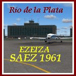
We proudly present part 1 of the Rio de la Plata scenery with the main airport of Buenos Aires (Ezeiza - SAEZ) as it was around 1961.
We also modified the environment.
We have produced this scenery to provide taxiways and details as they were around this period.
We have also included new parkings to allow the AI aircraft to taxi correctly at the new (old!) airport. Although we did not always have enough photos and information we tried to come as close as possible.
Our goal was to reflect something of the atmosphere and feel of that period, prior to the all-jet era of today.
| Filename: | Rio_de_la_Plata_1961_Ezeiza_airport.zip |
| License: | Freeware |
| Added: | 25th February 2016, 21:34:07 |
| Downloads: | 584 |
| Author: | Harry Biard, Alejandro Ramirez, Jaap de Baare and Wolfgang Gersch |
| Size: | 9.06 MB |
© 2001-2026 AVSIM Online
All Rights Reserved
Privacy Policy |