
Where Flight Simulation Enthusiasts Gather from Around the World!
AVSIM Library - Search Results

| Category: Flight Simulator 2004 - Scenery | |
| New Airport catania fontanarossa - LICC |

|
File Description:
The new airport of Catanaia in Sicily.
| Filename: | New_Airport_catania_fontanarossa__LICC.zip |
| License: | Freeware |
| Added: | 1st October 2006, 23:04:17 |
| Downloads: | 17,085 |
| Author: | Antonio Galia |
| Size: | 8.82 MB |
| Category: Flight Simulator 2004 - Scenery | |
| Caen, France |
|
File Description:
The french city of Caen in Normandie.
| Filename: | Caen_France.zip |
| License: | Freeware |
| Added: | 1st February 2004, 18:22:00 |
| Downloads: | 10,543 |
| Author: | La loutre Volante |
| Size: | 2.35 MB |
| Category: Flight Simulator 2004 - Scenery | |
| CYQX Gander 1955-1958 |
|
File Description:
Prior to the advent of long range passenger jet aircraft Gander in Newfoundland was one of the most important airports in the world. This scenery represents it in its heyday.
| Filename: | CYQX_Gander_19551958.zip |
| License: | Freeware |
| Added: | 10th March 2023, 03:15:34 |
| Downloads: | 88 |
| Author: | Ken Lawson |
| Size: | 22.65 MB |
| Category: Flight Simulator 2004 - Scenery | |
| Toronto, Ontario, Canada Area Power Stations Scenery |
|
File Description:
Toronto area power stations FS2004
The Pickering power station 20 miles E of Toronto
is one of the largest in the world with 8 units.
The Darlington station 43 miles east of Toronto
will be 4 units when completed. When used
with UT they are correctly located on the shore
line. Rwy 12 library will be required.
Works with Toronto2 scenery. Cooling towers are
reduced scale to reflect differences of CANDU
reactors
by David "Datatrain" Eastbury
| Filename: | Toronto_Ontario_Canada__Area_Power_Stations_Scener.zip |
| License: | Freeware |
| Added: | 1st February 2009, 22:50:19 |
| Downloads: | 1,286 |
| Author: | David Eastbury |
| Size: | 849.67 KB |
| Category: Flight Simulator 2004 - Scenery | |
| Mobile, Alabama Freeflow reduX |
|
File Description:
Mobile Alabama Freeflow ReduX. The new face of Mobile, Alabama is expanding with high-rise RSA tower. This scenery updates to Mdl format and adds more scenery to Mobile Alabama area of my earlier Freeflow Mobile scenery and covers all the way to Dauphin Island and Gulf shores. This file requires Freeflow Ultimate Florida in order to work and requires an un-install of the previous scenery. Includes options of AI ship and barge traffic and forest scenery.
| Filename: | Mobile_Alabama_Freeflow_reduX.zip |
| License: | Freeware |
| Added: | 30th May 2006, 00:40:18 |
| Downloads: | 2,479 |
| Author: | Ron Jeffers |
| Size: | 32.46 MB |
| Category: Flight Simulator 2004 - Scenery | |
| Alert Bay CYAL in British Columbia, Canada |
|
Images related to this file:
File Description:
Alert Bay is a small village on the small Cormorant Island, offshore from Port McNeill near the northern end of Vancouver Island. There is an airfield at the eastern end of the island with an asphalt runway 2,900 feet long aligned 09-27, without lights. Two houses have access with hangars at the edge of the field and at the end of their gardens. Nothing special about it but it completes the local scenery around Port McNeill.
| Filename: | Alert_Bay_CYAL_in_British_Columbia_Canada.zip |
| License: | Freeware, limited distribution |
| Added: | 25th November 2018, 00:35:01 |
| Downloads: | 156 |
| Author: | Roger Wensley |
| Size: | 4.19 MB |
| Category: Flight Simulator 2004 - Scenery | |
| Bella Coola Valley Terrain Mesh and Scenery Enhancements |
|
File Description:
One of the most spectacular watersheds of British Columbia's Midcoast, the Bella Coola Valley looks pretty boring in its default FS rendition. These files provide a LOD10 (38-m) mesh made from CDED1 0.75-arcsec data, a new landclass file, and accurate placements of lakes, rivers, streams, and roads. Also includes the glaciers of the Monarch Mt. Icefield and several forestry roads and clearcuts along the side valleys. Made with Ground2K4 based on Landsat 7 ETM+ satellite imagery.
| Filename: | Bella_Coola_Valley_Terrain_Mesh_and_Scenery_Enhanc.zip |
| License: | Freeware, limited distribution |
| Added: | 1st April 2004, 20:49:32 |
| Downloads: | 8,868 |
| Author: | Holger Sandmann |
| Size: | 20.74 MB |
| Category: Flight Simulator 2004 - Scenery | |
| 1960 Nice Côte d'Azur Airport (LFMN) |
|
Images related to this file:
File Description:
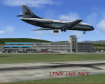
We have produced this scenery to provide taxiways and details as they were around 1960 at Nice airport. We have also included new parking to allow the AI aircraft to taxi correctly at the new (old!) airport. We had just a few photographs of the "old" Nice airport, so we tried to come as close as possible. Our goal was to reflect something of the atmosphere and feel of that period, prior to the all jet era of today.
| Filename: | 1960_Nice_Cte_dAzur_Airport_LFMN.zip |
| License: | Freeware, limited distribution |
| Added: | 20th December 2012, 21:16:20 |
| Downloads: | 3,997 |
| Author: | Harry Biard, Johan Dees, Jaap de Baare, Wolfgang Gersch, Nikko Yaginuma and Tom Gibson |
| Size: | 6.41 MB |
| Category: Flight Simulator 2004 - Scenery | |
| Alaska North Slope 4: Lonely Air Force Station (AK71) |
|
Images related to this file:
File Description:
The town of Barrow is in the far north of Alaska, and these are coastal villages or radar installations to the west, south, and now east of Barrow. There will be further additions. Lonely Air Force Station AK71 is 80 miles east of Barrow and on the coast. It was, and at first sight appears still to be, a DEW station until you are close enough to see that the gravel apron is deteriorating. There is a gravel runway around 5,000 feet long, a large hangar, the DEW buildings, radar under the domes, the remains of huge line-of-sight communications reflectors, and oil tanks. Some DEW sites are not worth a visit; others are surprisingly intact and this is one of those. The AI takes place three days a week and is a C130, in which case the DEW site is still functioning or under mothball maintenance, a chartered Reeve Aleutian in which case the site is closed and they are documenting wildlife, and a Cessna with a group of the curious.
| Filename: | Alaska_North_Slope_4_Lonely_Air_Force_Station_AK71.zip |
| License: | Freeware, limited distribution |
| Added: | 20th June 2016, 08:02:18 |
| Downloads: | 306 |
| Author: | Roger Wensley |
| Size: | 2.32 MB |
| Category: Flight Simulator 2004 - Scenery | |
| CYSM - Fort Smith, Northwest Territories, Canada |
|
Images related to this file:
File Description:
Fort Smith is just north of the border between Alberta and Northwestern Territories, midway between Lake Athabasca to the southeast in (mostly) Saskatchewan (80 miles) and Great Slave Lake to the north west (90 miles). The runways all used to be larger, and while I don't know the history it looks as if it is ex-military and these are the remains of what were once 10,000 feet of asphalt. The main runway is now 11/29 and 6,000 feet long, and the secondary one is 1,800 feet of mostly gravel. There is an airline based at the field, Northwestern Air, and fuel (both 100LL and JA-1) is available at a self service point so long as you give it a credit card to read while you fill. The town of Fort Smith is two miles east of the airfield, on the bank of the Slave River and where there are some rapids that require a portage to get around them. Before aviation came along the river was a major route to the north and all those furry animals, which was why the Hudson's Bay Company established an outpost there in 1872. Today it has a population of 2,400 and the main activities are government administration of much of the Northwest Territories, education, and tourism.
| Filename: | CYSM__Fort_Smith_Northwest_Territories_Canada.zip |
| License: | Freeware, limited distribution |
| Added: | 28th January 2012, 17:11:47 |
| Downloads: | 592 |
| Author: | Roger Wensley |
| Size: | 4.29 MB |
© 2001-2026 AVSIM Online
All Rights Reserved
Privacy Policy |