
Where Flight Simulation Enthusiasts Gather from Around the World!
AVSIM Library - Search Results

| Category: Flight Simulator 2004 - Scenery | |
| Pete & Sid's Viva Scenery Objects |

|
File Description:
Re-upload. This is a collection of scenery objects for use with the Pete & Sid's Viva Scenery Series. The ESDG hangers are by Bill Leaming and are included with his permission. The rest were created by Sidney Schwartz.
| Filename: | Pete__Sids_Viva_Scenery_Objects.zip |
| License: | Freeware |
| Added: | 8th December 2011, 09:01:23 |
| Downloads: | 765 |
| Author: | Sidney Schwartz & Peter Ham |
| Size: | 8.36 MB |
| Category: Flight Simulator 2004 - Scenery | |
| Gatwick Xtreme |
|
Images related to this file:
File Description:
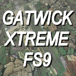
Extremely accurate scenery for Britains second main airport.Includes night
lighting, large amount of animation vehicles,replacement AFCAD2 file. All textures
made to the highest standard based on actual photographs. V1.02
DEMO FILE, fully funtional but has 'demo signs'
| Filename: | Gatwick_Xtreme.zip |
| License: | Commercial demo |
| Added: | 16th April 2010, 13:07:43 |
| Downloads: | 3,055 |
| Author: | UK2000 Scenery/Gary Summons |
| Size: | 46.92 MB |
| Category: Flight Simulator 2004 - Scenery | |
| Freer, Texas - Seven C's Ranch Airport private - 0XA4 |
|
File Description:
I found in Biz Jet route map that I never heard of the airport code. It is a private business called Edison Chouest Offshore for the home by the owner. The code is 0XA4 (Zero XRay Alpha Four).
| Filename: | Freer_Texas__Seven_Cs_Ranch_Airport_private__0XA4.zip |
| License: | Freeware |
| Added: | 20th June 2020, 18:35:46 |
| Downloads: | 79 |
| Author: | Stuart John Gilbert II |
| Size: | 4.93 MB |
| Category: Flight Simulator 2004 - Scenery | |
| Palm Springs International Airport (KPSP) |
|
Images related to this file:
File Description:

Detailed scenery for Palm Springs International Airport, Palm Springs, California (KPSP). This scenery has been designed and developed to capture the real airport 'feel' as much as possible. [NOTE: Reupload of previous corrupted file - not a new scenery]
| Filename: | Palm_Springs_International_Airport_KPSP.zip |
| License: | Freeware |
| Added: | 6th January 2010, 22:01:45 |
| Downloads: | 16,975 |
| Author: | Shehryar Ansari |
| Size: | 6.96 MB |
| Category: Flight Simulator 2004 - Scenery | |
| Atlas Mountains, Morocco 76m SRTM Terrain Mesh |
|
File Description:
USGS SRTM 3 arc-second, resampled to LOD9 (76 meters). This is a terrain mesh scenery of the Atlas Mountains in Morocco, Africa. It includes the High Atlas, the cities of Agadir & Marrakech and northwestern parts of the Sahara Desert.
| Filename: | Atlas_Mountains_Morocco_76m_SRTM_Terrain_Mesh.zip |
| License: | Freeware |
| Added: | 4th April 2004, 19:46:58 |
| Downloads: | 15,259 |
| Author: | Andreas Trawny |
| Size: | 15.95 MB |
| Category: Flight Simulator 2004 - Scenery | |
| LTFD - Edremit Korfez Airport |
|
File Description:
Edremit is a district in the coasts of Aegean Sea, linking to Balýkesir province, in the Marmara region of TURKEY.
Korfez Airport(LTFD) is located in between Kaz mountains and the gulf of Erdemit.
Edremit was founded in BC 1443 with the name of Adramyteion.Here was the most important settlement at that time.
Geographical characteristics of Edremit are determined by Kazdaðý
(Goose Mountain) which enclose the location in north direction.
The South part of Kazdaðý that commands the Gulf is ripped by innumerable deep valleys.The streams sourced from Kazdaðý give life to Edremit Gulf by passing canyons, flowing over waterfalls.
| Filename: | LTFD__Edremit_Korfez_Airport.zip |
| License: | Freeware |
| Added: | 22nd April 2008, 17:36:45 |
| Downloads: | 1,254 |
| Author: | Gökhan Bayrakdar |
| Size: | 7.19 MB |
| Category: Flight Simulator 2004 - Scenery | |
| Hauraki Gulf, v6 |
|
Images related to this file:
File Description:
This replaces all my previous Pakatoa Island and Hauraki Gulf sceneries. You must have Christian Stock's NZ mesh in the form of "Mountains of New Zealand" and topo in the form of "Lakes and Rivers of New Zealand" (payware).
New additions...PAKIHI ISLAND: Small jetty and nearby buildings. TAKANGAROA ISLAND: House on Island. House & Jetty island north of Takangaroa Island. MOTUREKAREKA ISLAND: Wreck of the Rewa. PONUI ISLAND: Chamberlain's Bay Airstrip. Chamberlain's Donkey Farm. Third Bay Airstrip. Motunau Bay Jetty. KARAMURAMU ISLAND: Jetty and quarry. ROTOROA ISLAND: Rotoroa Jetty. MOTUIHE ISLAND: Motuihe Wharf.
| Filename: | Hauraki_Gulf_v6.zip |
| License: | Freeware |
| Added: | 17th April 2010, 16:10:12 |
| Downloads: | 218 |
| Author: | Godfrey Tier |
| Size: | 6.61 MB |
| Category: Flight Simulator 2004 - Scenery | |
| Fernando de Noronha Photoreal |
|
Images related to this file:
File Description:

Fernando de Noronha is an archipelago of 21 islands and islets in the Atlantic Ocean, around 354 km (220 miles) offshore from the Brazilian coast. The main island has an area of 18.4 square kilometres (7.1 sq mi) and had a population of 3,108 in the year 2009.[3] The area is a special municipality (distrito estadual) of the Brazilian state of Pernambuco[4] (despite being closer to the state of Rio Grande do Norte)[5] and is also a UNESCO World Heritage Site. Its timezone is UTC-2h. Flight this great scenery today with photoreal environment and realistic terminal buildings.
| Filename: | Fernando_de_Noronha_Photoreal.zip |
| License: | Freeware, limited distribution |
| Added: | 17th November 2010, 15:32:36 |
| Downloads: | 2,740 |
| Author: | Jorge Amengol & Gustavo Luna |
| Size: | 2.61 MB |
| Category: Flight Simulator 2004 - Scenery | |
| High Prairie CZHP in Alberta, Canada |
|
Images related to this file:
File Description:
High Prairie is at 1,974 feet asl, 15 miles west of Lesser Slave Lake, 70 miles southeast of Peace River CYPE, and 90 miles east of Grande Prairie CYQU (both already posted). The town has a population of around 2,600 and is based on agriculture, forestry, and oil and gas. The initial impetus behind its growth was the routing of the railroad in 1914. The airport is around 2 miles south of the town, and is fairly basic. There is a single runway just under 4,000 feet of asphalt aligned 07-25. There is a daily flight and around 2010 this was by Central Mountain Air. I believe that there is now a newer terminal building, but a lack of information leaves the older one in place here. There are runway and taxiway lights, unlike some of my recent posts. I made this to fill in the gap between Edmonton and the airports to the northwest such as Grande Prairie.
| Filename: | High_Prairie_CZHP_in_Alberta_Canada.zip |
| License: | Freeware, limited distribution |
| Added: | 9th December 2018, 17:21:09 |
| Downloads: | 119 |
| Author: | Roger Wensley |
| Size: | 3.16 MB |
| Category: Flight Simulator 2004 - Scenery | |
| Solenzara Airforce Base (LFKS) Corsica France |
|
File Description:
Located on the east coast of Corsica (France) it had a great importance during the second world war as it was used a lot by the allied forces Very detailled Gmax scenery with buildings, aircrafts, helicopters and vehicles. I used airport 2.6 for the exclude and AFCAD 2.1 for the aprons and taxi.
| Filename: | Solenzara___Airforce_Base_LFKS___Corsica___France.zip |
| License: | Freeware, limited distribution |
| Added: | 23rd January 2004, 20:03:30 |
| Downloads: | 5,450 |
| Author: | Christian Santoni |
| Size: | 1.87 MB |
© 2001-2026 AVSIM Online
All Rights Reserved
Privacy Policy |