
Where Flight Simulation Enthusiasts Gather from Around the World!
AVSIM Library - Search Results

| Category: Flight Simulator 2004 - Scenery | |
| Amundsen-Scott Station |

|
File Description:
The Amundsen-Scott South Pole Station is the American scientific research station on the high plateau of Antarctica. This station is located at the southernmost place on the Earth, the Geographic South Pole, at an elevation of 2,835 meters (9301 feet) above sea level.
Since the Amundsen-Scott Station is located at the South Pole, it is at the only place on the land surface of the Earth where the sun is continuously up for six months and then continuously down for six months. (The only other such place is at the North Pole, on the sea ice in the middle of the Arctic Ocean.) Thus, during each year, this station experiences one extremely long "day" and one extremely long "night". During the six-month "day", the angle of elevation of the Sun above the horizon varies continuously. The sun rises on the September equinox, reaches its maximum angle above the horizon on the summer solstice in the Southern Hemisphere, around 20 December, and sets onthe March equinox.
During the six-month "night", it gets extremely cold at the South Pole, with air temperatures sometimes dropping below -73 C (-100 F). This is also the time of the year when blizzards, sometimes with gale-force winds, strike the Amundsen-Scott Station. The continuous period of darkness and dry atmosphere make the station an excellent place from which to make astronomical observations.
This file has the apron and characteristics of the airport the coordenates are placed as far south FS allow it.
| Filename: | AmundsenScott_Station.zip |
| License: | Freeware |
| Added: | 17th October 2011, 22:02:39 |
| Downloads: | 668 |
| Author: | Anwar Gonzalez |
| Size: | 5.92 KB |
| Category: Flight Simulator 2004 - Scenery | |
| Penshaw Monument Addon |
|
File Description:
The monument is situated on Penshaw Hill, overlooking the River Wear. Its high position means it is a familiar landmark for people over a wide area of north-east England.
The monument itself was erected in 1844, designed by John and Benjamin Green and modelled on the Theseum at Athens. It is dedicated to John George Lambton, first Earl of Durham and the first Governor of Canada.
Penshaw Hill, on which the monument is built, is associated with the local legend and song about the Lambton Worm
| Filename: | Penshaw_Monument_Addon.zip |
| License: | Freeware |
| Added: | 14th November 2003, 00:11:39 |
| Downloads: | 1,319 |
| Author: | Fred Gregory |
| Size: | 128.53 KB |
| Category: Flight Simulator 2004 - Scenery | |
| RAF Aldergrove Airport |
|
File Description:
This is a scenery I made of RAF Aldergrove. I originally made it for my own personal use but later decided to share it with fellow simmers. It is in no way an exact representation of the airport, merely designed ficticiously ! There are AI Pumas and Chinooks situated there that do flights of the airport. I've created 2 active runways thus enabling the helicopters to take off and land virtually at the same time (good to watch). Made with EZ Scenery. Author: Steve Caine.
| Filename: | RAF_Aldergrove_Airport.zip |
| License: | Freeware |
| Added: | 18th March 2009, 13:37:22 |
| Downloads: | 760 |
| Author: | Steve Caine |
| Size: | 878.83 KB |
| Category: Flight Simulator 2004 - Scenery | |
| vfr limburg photorealistic v0.01 first edit -updated installer- |
|
File Description:
vfr limburg "fotorealistic' first edit
built by ceyssens peter on 18 August 2008
this is my first photo realistiC scenery for fs9 & fsx
it is more determined the race circuit in zolder belgium
and the environment around 5a6 kilometers
and also my own home environment!
the scenery is built with maps2bgl
the photos are of google earth
I have the predisposition to build a fotoscenery of
limburg and very belgium but of course
that takes much time and thought process
ceyssens peter
contact email : [email protected]
| Filename: | vfr_limburg_photorealistic_v001_first_edit_updated.zip |
| License: | Freeware |
| Added: | 6th September 2008, 18:52:49 |
| Downloads: | 454 |
| Author: | ceyssens peter |
| Size: | 2.01 MB |
| Category: Flight Simulator 2004 - Scenery | |
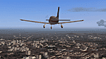
| Nis, Serbia VFR Scenery |
|
File Description:
Re-upload. Well we needed some visual points for VFR flying over Nis (the biggest city in southern Serbia with population of about 320 000 ),
near LYNI "Constantine The Great" Airport,
so we built some of more recognizable buildings in the area,GMAX,fairly complex,hope you like them!
Number of buildings in this version: 48 high-rise, 7 low-rise, 2 antenas,2 statues, 1 fortress
In this version river Nisava, major parks and road and railroad networks are included as new features.
| Filename: | Nis_Serbia_VFR_Scenery.zip |
| License: | Freeware |
| Added: | 19th August 2010, 03:45:21 |
| Downloads: | 2,124 |
| Author: | Nikola&Dusan Gajic |
| Size: | 2.33 MB |
| Category: Flight Simulator 2004 - Scenery | |
| Joslin-Magic Valley Regl KTWF |
|
File Description:
FS2004 Scenery-Joslin Field - Magic Valley Regl Airport (KTWF) serves Twin Falls, ID and Twin Falls County and is owned by the City & County Of Twin Falls. The airport has more than one runway. The longest is a paved runway extending 8703 feet. The facility is at an elevation of 4151 feet at a distance of about 4 miles from Twin Falls. Created with EZ Scenery, Rwy12 and Lago's FSE with AFCAD2 and Traffic Tools. Textures for custom EZ Scenery objects included. By John B. Loney, Jr.
| Filename: | JoslinMagic_Valley_Regl_KTWF.zip |
| License: | Freeware |
| Added: | 3rd July 2006, 01:48:04 |
| Downloads: | 1,093 |
| Author: | John B. Loney, Jr. |
| Size: | 891.05 KB |
| Category: Flight Simulator 2004 - Scenery | |
| Metro Field MTF in Fairbanks Alaska |
|
Images related to this file:
File Description:
Metro Field is more of a float plane "pond" than a field, close to and northeast of Fairbanks International Airport in Alaska. There is a gravel strip alongside the water, but the "strip" is actually a gravel road that functions as a runway when required. And if that sounds familiar it is also pretty much the description for nearby Chena Marina, though Metro is nowhere near as busy. This is one of four float plane bases around Fairbanks. You will definitely need Ultimate Terrain Alaska Canada.
| Filename: | Metro_Field_MTF_in_Fairbanks_Alaska.zip |
| License: | Freeware, limited distribution |
| Added: | 21st August 2010, 03:27:58 |
| Downloads: | 371 |
| Author: | Roger Wensley |
| Size: | 986.7 KB |
| Category: Flight Simulator 2004 - Scenery | |
| Bamfield Air Harbour 1.1 |
|
File Description:
Bamfield is a small harbour on the Pacific Side of Vancouver Island just south of Tofino. The scenery includes a couple of buildings and a dock. An AFCAD files is integrated so the harbour will show up on the flight simulator map and GPS. There are two starting locations and one runway. This is a great place to explore the island from. The real life Air Traffic frequeny is also used for the harbour. Version 1.1 corrects the province location and overwrites the previous version.
| Filename: | Bamfield_Air_Harbour_11.zip |
| License: | Freeware, limited distribution |
| Added: | 18th February 2004, 02:52:13 |
| Downloads: | 1,952 |
| Author: | David Voogd |
| Size: | 594.64 KB |
| Category: Flight Simulator 2004 - Scenery | |
| Ribeirao Preto - Brazil - Photoreal Scenery v1.1 |
|
Images related to this file:
File Description:
The Aeroclube Virtual de Ribeirao Preto in partnership with Paulo Ricardo, famous for his photoreal sceneries is launching the new version of the Ribeirao Preto Photoreal Scenery. Where we made bug corrections (even the heading problem found in the last version), afcad corrections, hangar and tower corrections and the inclusion of the detailed Aeroclube de Ribeirao hangar. If you have a low performance system, there is a light version of this scenery (sbrp_v11_light.zip).
This is a re-upload due Avsim hack (nothing has changed).
| Filename: | Ribeirao_Preto__Brazil__Photoreal_Scenery_v11.zip |
| License: | Freeware, limited distribution |
| Added: | 9th May 2010, 09:58:43 |
| Downloads: | 4,642 |
| Author: | Paulo Ricardo, Felipe Bachian, Andre Dilio |
| Size: | 49.9 MB |
| Category: Flight Simulator 2004 - Scenery | |
| South-east Asia SRTM Mesh part 4 |
|
File Description:
This release covers all of following countries: Thailand, Laos, Kampuchea and Vietnam. Also include parts of Malaysia (Malacca peninsula), Burma (along Thai border) and China (along Vietnam and Laos borders). See SE-Asia-Mesh-part4-1.jpg for detail of BGL coverage. This part includes Laos-N BGL file. Based on SRTM Data (3 arcsec, 90m), generated with Matthew Styles's program "SRTM To BGL v1.04", sampled to LOD9 resolution (76m). John Childs's Blackart program was used to fix large void areas by merging with DTED0 data.
| Filename: | Southeast_Asia_SRTM_Mesh_part_4.zip |
| License: | Freeware, limited distribution |
| Added: | 1st March 2004, 13:36:01 |
| Downloads: | 12,588 |
| Author: | Yohann Baptiste |
| Size: | 27.3 MB |
© 2001-2026 AVSIM Online
All Rights Reserved
Privacy Policy |