
Where Flight Simulation Enthusiasts Gather from Around the World!
AVSIM Library - Search Results

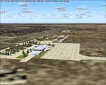
| Category: Flight Simulator 2004 - Scenery | |
| CZFN - Tulita - Northwest Territories, Canada |

|
Images related to this file:
File Description:
Tulita (Fort Norman until 1996) is another in the series of airfields that follow (approximately) the Mackenzie River. At the far northern end of the river and on the eastern side of the delta there is Tuktoyaktuk, then Inuvik, Fort McPherson, Fort Good Hope, Deline, Wrigley, Fort Simpson Island and Fort Simpson, and then Fort Liard at the southern end of the list of those in the Northwest Territories. South of Fort Liard there are Peace River and Dawson Creek, both of which are already posted. Tulita is at the junction of the Mackenzie and Great Bear Rivers, on the east bank of the Mackenzie and the south bank of the Great Bear, around 40 miles southeast of Norman Wells. The town has a population of about 480 folks. The airport is above and to the east of the town, and has 3,000 feet of gravel runway. The scheduled flights are by North Wright and I have also added a Buffalo DC3 and GA. There is a mandatory radio frequency but in this case I have set the "tower" to "unmanned" so you will report position and intentions. There is no fuel available.
| Filename: | CZFN__Tulita__Northwest_Territories_Canada.zip |
| License: | Freeware, limited distribution |
| Added: | 12th July 2014, 08:05:54 |
| Downloads: | 271 |
| Author: | Roger Wensley |
| Size: | 2.66 MB |
| Category: Flight Simulator 2004 - Scenery | |
| Boa Vista Photoreal |
|
Images related to this file:
File Description:
Photorealistic scenery of Boa Vista island (GVBA), Cape Verde Islands. Scenery includes photoreal ground textures of the whole island and AFCAD2 file with placement of aircraft parking.
| Filename: | Boa_Vista_Photoreal.zip |
| License: | Freeware |
| Added: | 2nd December 2012, 18:03:51 |
| Downloads: | 1,549 |
| Author: | Barry van der Waart |
| Size: | 57.73 MB |
| Category: Flight Simulator 2004 - Scenery | |
| Indochina 1962 |
|
File Description:
Here is a scenery of the major airports in Indochina circa 1962. The main airports included are Hanoi Gia Lam, Da Nang airbase, Saigon Tan Son Nhut, Vientiane Laos, Phnom Penh Cambodia, Rangoon and Mandalay Burma. Also included are several medium airports such as Pakse Laos, and Siem Riep Cambodia. I have included backdated AFCADS for the CalClassic propliner AI traffic for many small rural airports. For those interested in Saigon during the Vietnam war, included is an AFCAD of Tan Son Nhut airport as it was between 1966 and 1975. Many custom buildings and objects are in this scenery, and made from GMAX to ensure high framerates. Be sure to look for the vintage billboards at Saigon. The scenery is populated with custom made people, and includes a folder of EditVoicePack sound files, so the user can hear the proper ATC callouts for the time. Be sure to download Wolfgang Gersch's classic Bangkok and Singapore scenery here at AVSIM to complete this region.
| Filename: | Indochina_1962.zip |
| License: | Freeware, limited distribution |
| Added: | 7th April 2009, 09:01:16 |
| Downloads: | 5,933 |
| Author: | Mike Stevens |
| Size: | 3.54 MB |
| Category: Flight Simulator 2004 - Scenery | |
| Carp CYRP updated, near Ottawa in Ontario Canada |
|
Images related to this file:
File Description:
This version updates the post of 2006 with specifically modelled buildings for the east apron, plus a new AFCAD file. This is a stand-alone version and does not require you to have downloaded and installed the previous post. Carp airfield is fifteen miles west of Ottawa and two miles south of the town of Carp. There are two runways, 10/28 which is asphalt and almost 4,000 feet long and 100 feet wide, and 04/22 which is gravel and 2,000 feet long. The airfield has a fairly large polulation of general aviation residents and two years ago was expanding under new ownership, with a new terminal building and a large hangar opened and the "Touch'n Go" aviation warehouse that has opened more recently. The first version of Carp really included only the west apron, as that is where all (or almost all) the general aviation is located. I "represented" the east apron buildings without modelling any of them. This version corrects that, and the modeled east apron buildings are the HQ of Helicopter Transport Services Inc. and the adjacent Bell Helicopter service hangar, and the old First Air hangar and offices which are now under new ownership. The smaller hangars on the other side of the apron belong to chapter 245 of the Experimental Aircraft Association.
| Filename: | Carp_CYRP_updated_near_Ottawa_in_Ontario_Canada.zip |
| License: | Freeware, limited distribution |
| Added: | 16th February 2010, 03:18:39 |
| Downloads: | 562 |
| Author: | Roger Wensley |
| Size: | 6.03 MB |
| Category: Flight Simulator 2004 - Scenery | |
| KVLD Valdosta Regional Airport |
|
File Description:
Valdosta Regional Airport was constructed in the 1940s as a general aviation facility. The airport is situated on 760 acres of land, just south of the City of Valdosta. In 1980, commercial commuter service to/from Atlanta was inaugurated. The airport consists of 3 runways, two of which may be used by current ASA commercial aircraft.
| Filename: | KVLD_Valdosta_Regional_Airport.zip |
| License: | Freeware |
| Added: | 11th April 2010, 08:18:05 |
| Downloads: | 696 |
| Author: | Tommy Harris |
| Size: | 9.69 MB |
| Category: Flight Simulator 2004 - Scenery | |
| Santa Fe Airport - Argentina |
|
Images related to this file:
File Description:
Sauce Viejo airport serves the city of Santa Fe, capital city of the homonymous province. Among the buildings represented are the terminal (and control tower), the service area of the airport (fuel and other related buildings) and hangars belonging to the Government of Santa Fe and general aviation hangars in the south area of the airport.
| Filename: | Santa_Fe_Airport__Argentina.zip |
| License: | Freeware |
| Added: | 12th February 2010, 10:40:01 |
| Downloads: | 1,592 |
| Author: | Ramon Sola |
| Size: | 8.05 MB |
| Category: Flight Simulator 2004 - Scenery | |
| UK and Ireland thermals |
|
File Description:
A set of thermals that include the whole Territory of UK and Ireland.
| Filename: | UK_and_Ireland_thermals.zip |
| License: | Freeware |
| Added: | 30th August 2005, 13:18:23 |
| Downloads: | 758 |
| Author: | Alejandro Villa |
| Size: | 2.11 MB |
| Category: Flight Simulator 2004 - Scenery | |
| Landclass, Edmonton, Alberta, Canada |
|
File Description:
Correct representation of the landscape of Edmonton and surrounding communities using EZ Landclass.
| Filename: | Landclass_Edmonton_Alberta_Canada.zip |
| License: | Freeware |
| Added: | 27th December 2003, 19:59:25 |
| Downloads: | 3,395 |
| Author: | Andy Thomas |
| Size: | 2.61 KB |
| Category: Flight Simulator 2004 - Scenery | |
| LIMS - Piacenza San Damiano Airport Scenery |
|
File Description:
FS2004 Scenery LIMS Piacenza S.Damiano
This scenery represents the military airport of LIMS sited in northern part of Italy,home of 155°Gruppo - 50° Stormo ETS of Aeronautica Militare Italiana,equipped with Tornado ECR.
Designed with FSDS and macros found on the net.
| Filename: | LIMS__Piacenza_San_Damiano_Airport_Scenery.zip |
| License: | Freeware, limited distribution |
| Added: | 23rd October 2003, 22:50:30 |
| Downloads: | 4,513 |
| Author: | Alessandro Barbarini |
| Size: | 1.09 MB |
| Category: Flight Simulator 2004 - Scenery | |
| Cape Hooper CWFH and FOX-4 DEW Line Station in Nunavut, Canada |
|
Images related to this file:
File Description:
Cape Hooper is around 60 miles north of Kivitoo (FOX-D) and 140 miles south of Clyde River CYCY on the northeast-facing coast of Baffin Island. FOX-4 is still in use as a new and mostly-unmanned North Warning System site was established there in 1990 before the DEW line station was closed in 1991. Actually the DEW line station was not "closed" as such, they just stopped using it. The site of FOX-4 is on the top of a bump at the end of one of many long promontories that stick out into the Davis Strait between Baffin Island and Greenland, close to the far eastern end that is called Cape Hooper. There is a gravel runway to the west, down at 65' ASL; it is only just over 3,000' long and most material was delivered by sea to the beach at the southern end of the runway. The runway is signed as
"324T - 144T" as this is Northern Domestic Airspace where all runways are signed "true" and not "magnetic"; it is 013/193 magnetic with a huge magnetic variation of 48.9 degrees in this area where the magnetic field is mostly vertical, and so useless for navigation.
| Filename: | Cape_Hooper_CWFH_and_FOX4_DEW_Line_Station_in_Nuna.zip |
| License: | Freeware |
| Added: | 11th July 2011, 00:28:40 |
| Downloads: | 411 |
| Author: | Roger Wensley |
| Size: | 1.65 MB |
© 2001-2026 AVSIM Online
All Rights Reserved
Privacy Policy |