
Where Flight Simulation Enthusiasts Gather from Around the World!
AVSIM Library - Search Results

| Category: Flight Simulator 2004 - Scenery | |
| Kenneth Kaunda International Airport (FLKK) V1 |

|
Images related to this file:
File Description:
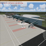
Hello FS9 sim fans who love flying in Africa, In my quest to bring you more African airports, I bring you Kenneth Kaunda International Airport (IATA: LUN, ICAO: FLKK). This is the International airport of the Republic of Zambia. Scenery was built using Sketchup, ADE,AFLT, SbuilderFs9, Tropical trees API by Bill Melichar. Needs RWY12 object library for airport objects to show up. You can get RWY12 object library in AVSIM/Flightsim. See readme for install instructions
| Filename: | Kenneth_Kaunda_International_Airport_FLKK_V1.zip |
| License: | Freeware |
| Added: | 10th March 2023, 03:18:38 |
| Downloads: | 401 |
| Author: | EMMANUEL P MWANDOSYA |
| Size: | 36.33 MB |
| Category: Flight Simulator 2004 - Scenery | |
| S98 - Vista Field - Washington, USA |
|
Images related to this file:
File Description:
FS9 Scenery - Vista Field (IATA: VSK, FAA LID: S98) was a public use airport located in Benton County, Washington, United States. The airport was located three nautical miles (6 km) northwest of the central business district of the City of Kennewick and was owned by the Port of Kennewick. It was also known as Vista Field Airport. Several shipping carriers operated out of the airport. There had been controversy in recent years over whether or not to continue to operate the airport or to shut it down, however it was officially closed on December 31, 2013. Vista Field is back, at least in FS9, with a hi-def runway by Donald Miller. For your flying pleasure by John B. Loney, Jr. and Donald Miller.
| Filename: | S98__Vista_Field__Washington_USA.zip |
| License: | Freeware, limited distribution |
| Added: | 19th September 2015, 21:33:58 |
| Downloads: | 235 |
| Author: | John B. Loney, Jr. |
| Size: | 20.53 MB |
| Category: Flight Simulator 2004 - Scenery | |
| PASD - Sand Point - Aleutians Alaska USA |
|
Images related to this file:
File Description:
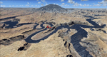
Sand Point is in the eastern third of the Aleutian chain of islands in Alaska, around 85 miles east of Cold Bay on Popof Island. The town has a population of around 1,000 and it's economy is solidly based on fishing. There is, in the town, a fish processing plant owned by Trident (their largest plant is in Akutan, east of Dutch Harbor) and the area close to the airport is used for crab pot storage etc. The single runway is aligned 13-31 (with right hand circuits on 13) and 6,000 feet long. There are scheduled flights by Grant Aviation to neighbouring local airfields and flights to and from Anchorage by Peninsula Air (included in the AI posted with Adak). The Coastguard also make occasional visits.
| Filename: | PASD__Sand_Point__Aleutians_Alaska_USA.zip |
| License: | Freeware, limited distribution |
| Added: | 22nd January 2015, 23:59:35 |
| Downloads: | 364 |
| Author: | Roger Wensley |
| Size: | 6.38 MB |
| Category: Flight Simulator 2004 - Scenery | |
| Byron Bay CWBB plus Edinburgh Island CWEI in Nunavut, Canada |
|
Images related to this file:
File Description:
Byron Bay was a DEW line station on the south coast of Victoria Island, 105 miles east of Lady Franklin Point. It closed in 1993. The buildings are still there, slowly accumulating the patina so admired by collectors on Antiques Roadshow. The runway is just over 4,500 feet and aligned 58T-238T. At the mid point between Lady Franklin Point and Byron Bay there is a North Warning Site on the highpoint of Edinburgh Island, just south of the closed Ross Point station on the "mainland" Victoria Island. The runway is just over 1,400 feet and is also up on the top of the island. There is a steep road down 600 feet to the coast for the annual fuel resupply and maintenance.
| Filename: | Byron_Bay_CWBB_plus_Edinburgh_Island_CWEI_in_Nunav.zip |
| License: | Freeware, limited distribution |
| Added: | 11th November 2012, 21:07:05 |
| Downloads: | 246 |
| Author: | Roger Wensley |
| Size: | 2 MB |
| Category: Flight Simulator 2004 - Scenery | |
| Lake Powell, Navajo Mountain (04UT), Utah/Arizona, Photo-Scenery (FS9 & FSX) |
|
Images related to this file:
File Description:
This package contains the center of Lake Powell and the Navajo Nation around Navajo Mountain. It contains remote areas of stunning beauty. Wonderful sandstone formations in bright shades of red and pink. Contains landmarks like the Rainbow Bridge National Monument and the confluence of the Colorado and San Juan Rivers. Extends my Monument Valley scenery to the west and brings you another 3.500 sq km in 4.7m/pix quality. To explore the scenery depart from Navajo Mountain dirt strip (04UT). High resolution versions of this scenery for FS9 and FSX (much sharper, but larger and multiple downloads) are available at www.blueskyscenery.com/CNY_South3West2.html . The screenies are taken from the high-res versions, so expect this version to be slightly more blurry. YourDonation@Work: Joaquin, Donald and Scott.
| Filename: | Lake_Powell_Navajo_Mountain_04UT_UtahArizona_Photo.zip |
| License: | Freeware, limited distribution |
| Added: | 23rd January 2010, 23:06:49 |
| Downloads: | 1,784 |
| Author: | Gottfried Razek - blueskyscenery.com |
| Size: | 91.43 MB |
| Category: Flight Simulator 2004 - Scenery | |
| UK Hospitals (Vol 1) |
|
File Description:
This scenery collection contains airfield data for 54 Helipad landing sites in Wales, Lancashire, Merseyside, Cheshire and Cumbria based on the information provided by the Confederation of Helicopter Ambulance Services. Information here http://www.chasuk.co.uk/Documentation/HospitalLandingSites/tabid/69/Default.aspx.
The scenery is intended to be used in FS2004 Century of Flight with Just Flight's VFR photographic VFR scenery installed. The height data from CHASUK has been ignored in favour of that obtained from the Just Flight default mesh.
I have started to add autogen trees etc. around some of the landing sites - but this takes a lot longer and so I'm issuing vol 1 first with autogen only added to a few of the sites in the Chester/Merseyside area.
| Filename: | UK_Hospitals_Vol_1.zip |
| License: | Freeware |
| Added: | 2nd April 2009, 16:44:10 |
| Downloads: | 1,100 |
| Author: | Russ McGinn |
| Size: | 231.54 KB |
| Category: Flight Simulator 2004 - Scenery | |
| North Tucson Photo Scenery |
|
File Description:
This is a photo scenery covering the area north of Tucson between Dan Relfe's Tucson photo scenery and MegaScenery Phoenix. It doesn't quite reach the Phoenix scenery, but it's close. La Cholla Airpark (57AZ) is included, with a custom AFCAD and AI traffic that use the roads. Some of the AI traffic is parked at the airport and some at the houses. Aircraft have the right of way on the roads at La Cholla. Full autogen is included for all photo tiles.
| Filename: | North_Tucson_Photo_Scenery.zip |
| License: | Freeware |
| Added: | 23rd January 2007, 04:24:09 |
| Downloads: | 1,598 |
| Author: | Kevin Burns |
| Size: | 26.73 MB |
| Category: Flight Simulator 2004 - Scenery | |
| Manchester Airport KMHT |
|
File Description:
FS2004 Scenery-Manchester Airport (KMHT) serves Manchester and Hillsboroughugh County and is owned by the City Of Manchester. The airport has more than one runway. The longest is a paved runway extending 7001 feet. The facility is at an elevation of 234 feet at a distance of about 3 miles from Manchester. Created using FSDS2, Rwy12, Lago's FSE, AFCAD2 and Traffic Tools2.x. Be sure to read the readme file for important information about this scenery. By John B. Loney, Jr.
| Filename: | Manchester_Airport_KMHT.zip |
| License: | Freeware |
| Added: | 6th November 2005, 18:41:58 |
| Downloads: | 6,904 |
| Author: | John B. Loney, Jr. |
| Size: | 2.02 MB |
| Category: Flight Simulator 2004 - Scenery | |
| Pearly Beach Airfield, South Africa |
|
Images related to this file:
File Description:
A Gmax representation of Pearly Beach Airfield, Western Cape, South Africa with photoreal textures. Pearly Beach airfield is a small privately owned airfield between the towns of Pearly Beach and Gansbaai in South Africa. Bearly Beach and Gansbaai are both very well known tourist spots for whale watching and even shark-cage diving with Great Whites which are regularly seen just of the coast. The runway is aligned 30/12 and measures 838m x 9m. Even the animated windpump is included.
| Filename: | Pearly_Beach_Airfield_South_Africa.zip |
| License: | Freeware, limited distribution |
| Added: | 24th February 2017, 19:46:06 |
| Downloads: | 243 |
| Author: | Kobus van Wyk, Aeroworx |
| Size: | 1.55 MB |
| Category: Flight Simulator 2004 - Scenery | |
| EGGP Liverpool - Local Landmarks - Runcorn/Widnes Bridges Ver 1.0 |
|
File Description:
This is the second in a series of individual landmark sceneries for use while VFR flying in the area of Liverpool John Lennon Airport (EGGP).
This scenery has been designed to compliment the Liverpool John Lennon Airport Scenery also by DerboSoft and was previously part of that scenery distribution.
The scenery is aligned to the Visual Flight / Getmapping VFR Scenery published by Just Flight. However this release also includes files to align the bridges to both the FS2002 and FS2004 default sceneries.
| Filename: | EGGP_Liverpool__Local_Landmarks__RuncornWidnes_Bri.zip |
| License: | Freeware |
| Added: | 16th January 2004, 01:09:22 |
| Downloads: | 7,729 |
| Author: | Paul Derbyshire |
| Size: | 69.07 KB |
© 2001-2026 AVSIM Online
All Rights Reserved
Privacy Policy |