
Where Flight Simulation Enthusiasts Gather from Around the World!
AVSIM Library - Search Results

| Category: Flight Simulator 2004 - Scenery | |
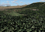
| Merrill Pass |

|
File Description:
FS2004 Scenery - Merrill Pass, Alaska
is one of the main air routes for VFR flight
from the Cook Inlet area, through the Alaska
Range, to the Bristol Bay area. This
fictional scenery places cabins at the lakes
on either side of this pass. Included is a
short flight to show the way through the
mountain pass.
| Filename: | Merrill_Pass.zip |
| License: | Freeware, limited distribution |
| Added: | 13th May 2004, 21:38:55 |
| Downloads: | 2,731 |
| Author: | Tom Fica |
| Size: | 734.97 KB |
| Category: Flight Simulator 2004 - Scenery | |
| Carroll County-Tolson KTSO |
|
Images related to this file:
File Description:
FS2004 Scenery - Carroll County-Tolson Airport (KTSO) serves Carrollton and Carroll County, OH USA and is owned by Carroll County Arpt Auth. The paved runway extends for 4300 feet. The facility is at an elevation of 1163 feet at a distance of about one mile from Carrollton. Created with Instant Scenery by John B. Loney, Jr.
| Filename: | Carroll_CountyTolson_KTSO.zip |
| License: | Freeware, limited distribution |
| Added: | 2nd November 2009, 19:59:13 |
| Downloads: | 200 |
| Author: | John B. Loney, Jr. |
| Size: | 409.91 KB |
| Category: Flight Simulator 2004 - Scenery | |
| Argentina ,Valle de Punilla/ Lago San Roque Area, v1.0 |
|
Images related to this file:
File Description:
LOD 13 mesh and scenery of the Sierra de Cordoba, Argentina, area. Includes Santa Maria de Punilla and Villa Carlos Paz airstrips as well as a reconfiguration of La Cumbre(SACC) to fit the new mesh.
Roads, rivers and landmarks have been placed to aid VFR pilots
Includes Voicepack modifications for the ICAO identifiers (requires EditVoicepack).
| Filename: | Argentina_Valle_de_Punilla_Lago_San_Roque_Area_v10.zip |
| License: | Freeware, limited distribution |
| Added: | 16th May 2010, 09:57:58 |
| Downloads: | 609 |
| Author: | Alf B. Meier |
| Size: | 7.83 MB |
| Category: Flight Simulator 2004 - Scenery | |
| Italy, Umbria 2, Trasimeno, Photo Real |
|
File Description:
Umbria, Italy, Photoreal Scenery Part 2 (Trasimeno).
The photoreal scenery includes a wide area around Lake Trasimeno. The airport of Perugia San Egidio (ICAO code LIRZ) is found near the scenery (see map). For the best results, use it in association with other parts of Umbria photoreal: Umbria 1 Terni, Umbria 3 Perugia, Umbria 4 Arezzo.
| Filename: | Italy_Umbria_2_Trasimeno_Photo_Real.zip |
| License: | Freeware |
| Added: | 29th October 2008, 22:07:39 |
| Downloads: | 4,805 |
| Author: | Fulvio Mazzokan |
| Size: | 63.54 MB |
| Category: Flight Simulator 2004 - Scenery | |
| EDDK - Cologne-Bonn Freeware Scenery Version 1.5 |
|
File Description:
This is the version 1.5 of the freeware scenery of EDDK Cologne-Bonn. It's ground layout should be compatible with the new EDDK scenery by Aerosoft. The scenery is especially made for online flying and should keep your frame rates high. We fixed some Bugs and added a new AFCAD and some gimmicks. Read the Readme inside the archive!
| Filename: | EDDK__CologneBonn_Freeware_Scenery_Version_15.zip |
| License: | Freeware |
| Added: | 3rd August 2007, 12:34:17 |
| Downloads: | 12,823 |
| Author: | Georg Aubele, Dieter Barthelmeus |
| Size: | 2.04 MB |
| Category: Flight Simulator 2004 - Scenery | |
| LIRN Naples Capodichino Air Base 1955-1957 |
|
File Description:
In the mid 1950s Naples Capodichino was an important military base for both the US Navy and the Italian Air Force. This scenery represents it as it was before the opening of a new civilian terminal in 1959, and includes a number of custom built structures as well as extensive military traffic by Al Von Pingel.
| Filename: | LIRN_Naples_Capodichino_Air_Base_19551957.zip |
| License: | Freeware, limited distribution |
| Added: | 6th April 2026, 01:56:10 |
| Downloads: | 54 |
| Author: | Ken Lawson, Al von Pingel |
| Size: | 182.48 MB |
| Category: Flight Simulator 2004 - Scenery | |
| The Gibraltarbridge |
|
File Description:
The Gibraltarbridge would be the biggest bridge ever, if built. Anyway, this is probably the largest
Gmax-model ever made for the Microsoft Flightsimulator!
A bridge spanning 9 miles over the Straits of Gibraltar, grounded on 3 pylones, which reaches the height of 3000 feet tall each, twice as high as the world's tallest skyscraper.
Happy Flying!.
| Filename: | The_Gibraltarbridge.zip |
| License: | Freeware |
| Added: | 27th December 2003, 01:59:36 |
| Downloads: | 2,417 |
| Author: | Soren H. Nicolaisen |
| Size: | 1.79 MB |
| Category: Flight Simulator 2004 - Scenery | |
| Esperance (YESP) - Western Australia |
|
File Description:
Esperance (YESP)located on the southern coast of Western Australia. The town named after the French Frigate L'Esperance which arrived in the area back in 1792 with French Explorer D'Entrecasteaux.
This version of Esperance Airport has been created with Rwy12 Object Placer progy. The Rwy12 Static Object Library must be installed in FS9 for this scenery to appear.
| Filename: | Esperance_YESP__Western_Australia.zip |
| License: | Freeware |
| Added: | 8th October 2005, 15:00:24 |
| Downloads: | 965 |
| Author: | Derek Froud |
| Size: | 7.68 KB |
| Category: Flight Simulator 2004 - Scenery | |
| Real ZBAA 2013 |
|
File Description:
This scenery updated to 2013, based on Real ZBAA 2005 for Ai-China. It updated new T3 Terminal and State Guesthouse, also include the low-resolution satellite background, the old part of east 18R / 36L is coordinate error , but the new T3 part in accordance with the real coordinates of production. The scenery isn't ground lighting and taxiway signs.
| Filename: | Real_ZBAA_2013.zip |
| License: | Freeware |
| Added: | 9th November 2017, 18:26:07 |
| Downloads: | 1,917 |
| Author: | AI-China, Mikezj1971 & SKDG |
| Size: | 14.91 MB |
| Category: Flight Simulator 2004 - Scenery | |
| St. Paul Downtown Holman Field |
|
File Description:
St. Paul Downtown Airport is located only five minutes from the business center of St. Paul. St. Paul Downtown Airport has been developed to meet the needs of corporate and business aviation. With a 6,711 ft. runway, instrument landing system, FAA control tower, restaurant and catering facilities, and several commercial fixed base operators providing a full range of services, St. Paul Downtown Airport is fully suited for business and corporate users. Originally created for use in FS2002 for St. Paul based St. Paul Airlines (VA), this KSTP scenery also works great in FS9. All the hangars and buildings are custom tailored to suit St. Paul Airlines' services but the main passenger terminal stands as in the real life with photoreal textures. Hope you enjoy this scenery.
| Filename: | St_Paul_Downtown_Holman_Field.zip |
| License: | Freeware, limited distribution |
| Added: | 18th August 2003, 03:41:12 |
| Downloads: | 1,952 |
| Author: | Naresh Gurung |
| Size: | 2.61 MB |
© 2001-2026 AVSIM Online
All Rights Reserved
Privacy Policy |