
Where Flight Simulation Enthusiasts Gather from Around the World!
AVSIM Library - Search Results

| Category: Flight Simulator 2004 - Scenery | |
| Bumba Airport (FZFU/BMB) |

|
File Description:
Scenery for Bumba airport (FZFU/BMB), namely a small airport located in the North part of the Democratic Republic of Congo (DRC), Mondala Province, serving the small town of Bumba located near the Congo river. Bumba is an ideal reference point for VFR flights along the Congo river in that region, as well as around that part of the DRC forest. The scenery contains two parts: the landclass, that defines the terrain at and around the airport, and the airport scenery, which contains the runway, the aprons, and the 3D objects. In comparison with the default FS2004 scenery, this contains brand new runway and aprons, drawn using custom textures that should give a more realistic feeling of the airstrip, and the landclass has been modified in order to represent faithfully the real landscape around the airport. The Static Object Library of RWY12 is necessary in order to properly display the 3D objects: it can be found easily in the AVSIM library.
| Filename: | Bumba_Airport_FZFUBMB.zip |
| License: | Freeware |
| Added: | 30th April 2020, 18:31:15 |
| Downloads: | 157 |
| Author: | Marco Ruggieri |
| Size: | 7.52 MB |
| Category: Flight Simulator 2004 - Scenery | |
| Lucknow Airport, India [ VILK ] |
|
Images related to this file:
File Description:
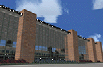
Lucknow,also Famous as 'City of Nawabs' and is capital of Uttar Pradesh,also called a political Sate of India. The Airport is 230 Nm SE of new Delhi.From previous experience I've learned a great deal of file size management to yield maximum frame rate.Now this Airport has a new Apron , which is actually not new, but lets call it new .i.e. 4-6 years old along with Taxiway Delta and echo.I just Found that theirs are no resources available in our virtual aviation community that has information in any form for this Airport scenery, afcads/afxs This ironically 'new' apron and taxiway is why,this airport has been developed.The airport has ADVANCED hanger....and many other things that will make you fly for at least one time in/out of this Place. The airport name is 'Chaudhary Charan Singh Airport" and has all basic navigational tools with CAT II ILS .how about some pics ? ..........will work in FSX.
| Filename: | Lucknow_Airport_India__VILK_.zip |
| License: | Freeware |
| Added: | 16th August 2010, 20:49:50 |
| Downloads: | 1,548 |
| Author: | Ashish Singh |
| Size: | 23.85 MB |
| Category: Flight Simulator 2004 - Scenery | |
| USS Langley relocation to British Columbia -- 2 locations |
|
File Description:
These files relocate the USS Langley of the MAAM Avenger package into the waters of British Columbia, Canada.
CVL48 is located South of Victoria Harbour (CYWH) and North of Port Angeles (KNOW), Washington in the Strait of Juan de Fuca.
CVL49 is located NW of Vancouver (CYVR) in the Strait of Georgia.
| Filename: | USS_Langley_relocation_to_British_Columbia__2_loca.zip |
| License: | Freeware, limited distribution |
| Added: | 10th August 2008, 09:16:39 |
| Downloads: | 1,200 |
| Author: | Brent Hricziscse and Bill Dick |
| Size: | 1.82 MB |
| Category: Flight Simulator 2004 - Scenery | |
| ETND - Diepholz AB - Bremen, Germany |
|
Images related to this file:
File Description:
Diepholz Airbase is the home of Luftwaffenversorgungsregiment 2 of the German Airforce and although the home of Flugplatz Diepholz-Duemmerland southwest of Bremen.
| Filename: | ETND__Diepholz_AB__Bremen_Germany.zip |
| License: | Freeware |
| Added: | 10th September 2015, 17:25:50 |
| Downloads: | 682 |
| Author: | David Kolas |
| Size: | 2.93 MB |
| Category: Flight Simulator 2004 - Scenery | |
| Frozen Canadian & USA Rivers & Lakes Revision |
|
Images related to this file:
File Description:
This "freezes" all lakes and rivers for winter flying and means they can be landed on with skis or wheels; it is meant for low level flying rather than high level jet flights. This edition is complete in itself and now really covers all of Canada and parts of the USA along the border, including large parts of Michigan, Wisconsin, Minnesota, North Dakota, and Montana. It is reversible with an "untick" in the FS scenery library. The revision is the addition of frozen sea in the area of Baffin Island (where I and Sid & Pete have recently posted all of the Baffin Island airfields) as I missed this area last time. Sorry about that. I have spent some time making sure that the sea and the inlets along the coast in the south do not get frozen too, and also some of the lakes that are close to the coast and rarely get cold enough to freeze over. The Great Lakes do not usually totally freeze, but this is an either ON or OFF modification and partial freezing cannot be convincingly simulated, so I went for total ice. Along the north shore I went for the peak of the winter with sea ice all the way to the permanent polar cap; this is not totally realistic as there is usually a partially open lead along the coast, but as with the Great Lakes...... It will work without Ultimate Terrain, but as UT is what gets all the lakes and rivers there and in the right place (except in the far north) it is obviously much improved with UT. The pics show Rockcliffe in the winter with the frozen Ottawa River for real and in FS for comparison; without UT the river would not be in the right place.
| Filename: | Frozen_Canadian__USA_Rivers__Lakes_Revision.zip |
| License: | Freeware, limited distribution |
| Added: | 6th September 2011, 00:42:43 |
| Downloads: | 622 |
| Author: | Roger Wensley |
| Size: | 1.2 MB |
| Category: Flight Simulator 2004 - Scenery | |
| Sembach Air Base 1990 |
|
Images related to this file:
File Description:
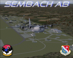
This scenery is a representation of Sembach Air Base in the former West Germany during 1990. At the time, Sembach was host to the 66th Electronic Combat Wing, which was responsible for the home-based EC-130H "Compass Call" aircraft of the 43rd Electronic Combat Squadron, and also had in-direct control of the 42nd Electronic Combat Squadron based at RAF Upper Heyford in the U.K. flying the Grumman EF-111A Raven.
The 66th ECW moved into Sembach during 1986, and spent the next six years flying from there. The role of the aircraft was electronic disruption of enemy radio and radar transmissions, to limit the enemies ability to co-ordinate their own forces and also the transmission of propaganda in an attempt to win hearts and minds.
Sembach was also known as Det.1 of the 81st Tactical Fighter Wing, based at the Twin Bases complex of RAF Woodbridge and RAF Bentwaters. The A-10A's of the six squadrons there would regularly deploy to Sembach and other Forward Operating Locations (FOLs) within West Germany, which was a part of their war-time role.
Included in this package are repaints of all six EC-130H's present at Sembach as of April 1990.
| Filename: | Sembach_Air_Base_1990.zip |
| License: | Freeware, limited distribution |
| Added: | 14th November 2012, 01:37:20 |
| Downloads: | 1,378 |
| Author: | Brian Clarke, Chris A. Brown, Daryl Payne, Stewart Pearson |
| Size: | 1.75 MB |
| Category: Flight Simulator 2004 - Scenery | |
| Kasba Lake CJL8 Northwest Territories Canada |
|
Images related to this file:
File Description:
This is a sixth airfield with links to Lake Athabasca, which is in Alberta and Saskatchewan. Kasba Lake is some 135 miles northeast of Stony Rapids and is in the Northwest Territories. The airfield is owned and run by and for Kasba Lake Lodge and it is one of several fishing vacation spots that are serviced by flights from Stony Rapids. It is these flights to the north that explain the number of regular scheduled flights into Stony Rapids from the south. The Kasba Lake Lodge has docks for boats and also for clients that want to arrive in their own floatplanes. The ai is for both Kasba Lake and Obre Lake and replaces the porpoising plane that I had used for Obre Lake. Norilor flies the weekend package-deal-long-distance delivery flights for Kasba Lake direct from Winnipeg, and now also for Obre Lake.
| Filename: | Kasba_Lake_CJL8_Northwest_Territories_Canada.zip |
| License: | Freeware, limited distribution |
| Added: | 9th August 2018, 14:21:17 |
| Downloads: | 148 |
| Author: | Roger Wensley |
| Size: | 2.48 MB |
| Category: Flight Simulator 2004 - Scenery | |
| Omni Aviation School and PhilipinesAirlines Flight Trianning Center AFCAD and Scenery |
|
File Description:
Manny Aquino for the acacia and acacia tree textures
OMNI AVIATION- www.omni-aviation.com
Tonet, Mike B and Pecorino for identifying the trees in front of the omni barracks and for identifying a missing taxiway. :-)
My cousin Spike Acenas for taking pictures of the airport.
Ina Patrimonio for taking some of the PFSGers up in an aerial tour around Clark last Feb 17 2002. :-)
Dennis T. for more OMNI pics.
Capt's: Ina Patrimonio, Joy Roa, Jessica Horne & Rene Mapua.
Installation:
Copy the OMNI folder to your FS2002/scenery/ folder and activate the scenery in FS2002.
Happy flying!
Clark Intl Airport AFCAD with Omni Aviation School and Philipines Airlines Flight Trianning Center.They also use Clark Tower to make Communication when their Aircraft wanna take off and landing. Its Pattern is on Right Hand Side at 700ft and their Parking Ramps are just for Cessna,Piper or Beech Craft!
| Filename: | Omni_Aviation_School_and_PhilipinesAirlines_Flight.zip |
| License: | Freeware |
| Added: | 15th November 2003, 05:28:34 |
| Downloads: | 962 |
| Author: | Peter Binamira(Scenery) and Cadmus Lee( AFCAD ) |
| Size: | 1.14 MB |
| Category: Flight Simulator 2004 - Scenery | |
| Riga landclass |
|
File Description:
This landclass is made for use with the aiport scenery for Riga (the Capital of Latvia) by
Matthew Ministry, wich is called "Riga airport".
It gives the area around the airport a more woody look.
| Filename: | Riga_landclass.zip |
| License: | Freeware |
| Added: | 13th May 2006, 20:48:44 |
| Downloads: | 5,632 |
| Author: | Johan Thiers |
| Size: | 1.3 KB |
| Category: Flight Simulator 2004 - Scenery | |
| VTUQ (Korat) Airport |
|
File Description:
VTUQ , Korat airport is locate in the north east of Thailand far from Bangkok around 300 Km.This scenery is only for FS2004 and not compartible with FS2002.The program for use is GMAX/AFCAD/G2K4.
| Filename: | VTUQ_Korat_Airport.zip |
| License: | Freeware |
| Added: | 20th July 2004, 16:50:27 |
| Downloads: | 934 |
| Author: | Polapan Sirivongse |
| Size: | 159.71 KB |
© 2001-2026 AVSIM Online
All Rights Reserved
Privacy Policy |