
Where Flight Simulation Enthusiasts Gather from Around the World!
AVSIM Library - Search Results

| Category: Flight Simulator 2004 - Scenery | |
| North Cascades Bush Airstrips 4 |

|
File Description:
A final four airstrips in the North Cascades. I designed these mainly for my own entertainment, and the scenery is VERY basic - as you can tell from the file size - they're probably of interest only to 'fans' of my previous three North Cascades releases...and the small number of them still using FS9.
| Filename: | North_Cascades_Bush_Airstrips_4.zip |
| License: | Freeware, limited distribution |
| Added: | 29th August 2008, 08:49:35 |
| Downloads: | 564 |
| Author: | James Belk |
| Size: | 7.14 KB |
| Category: Flight Simulator 2004 - Scenery | |
| McGhee Tyson Knoxville Airport (KTYS) |
|
Images related to this file:
File Description:
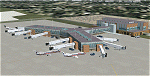
Scenery for McGhee Tyson Airport (KTYS) which serves the city of Knoxville, Tennessee, USA. The airport is a medium-sized regional airport which also serves as a cargo center, and is the home of the Air National Guard 134th Air Refueling Group.
[NOTE: Reupload of previous corrupted file - not a new scenery]
| Filename: | McGhee_Tyson_Knoxville_Airport_KTYS.zip |
| License: | Freeware, limited distribution |
| Added: | 6th January 2010, 22:02:48 |
| Downloads: | 5,511 |
| Author: | Shehryar Ansari |
| Size: | 2.25 MB |
| Category: Flight Simulator 2004 - Scenery | |
| Catamarca Airport in Argentine - (SANC) |
|
File Description:
This is very operative airport of Felipe Varela (SANC) in San Fernando del Valle de Catamarca, Provincia de Catamarca, Republica Argentina,with all navaids and the objects in this correct place. This is not photorealistic scenery. ONLY FOR FS2004. Building with SceneGenX 1.0 Build 60 of Tom Hiscox and some objects of RWY12.
| Filename: | Catamarca_Airport_in_Argentine__SANC.zip |
| License: | Freeware |
| Added: | 7th August 2006, 00:38:24 |
| Downloads: | 1,432 |
| Author: | carlos maida |
| Size: | 491.22 KB |
| Category: Flight Simulator 2004 - Scenery | |
| Raiatea Airport, Uturoa, French Polynesia, NTTR |
|
File Description:
This is a total update of the airport at Raiatea in French Polynesia. It is the largest airport in the Society Islands outside of Tahiti. This scenery contains a new realistic terminal, the rustic hangar area, and the tower, along with tropical landscaping, and an afcad by Ray Smith. This island along with all of the Society Islands of French Polynesia are among the most beautiful paradises on Earth. They can all be greatly enhanced by using the terrain mesh by John Applegate, and Rolf Keibel, updated for FS2004 under the name of fpsimesh.zip. There are also some new landclass files for this area which will also greatly enhance this forgotten area in FS, and their location is available in the read me file of this scenery.
| Filename: | Raiatea_Airport_Uturoa_French_Polynesia_NTTR.zip |
| License: | Freeware |
| Added: | 21st May 2004, 15:24:33 |
| Downloads: | 10,654 |
| Author: | Bill Melichar |
| Size: | 3.15 MB |
| Category: Flight Simulator 2004 - Scenery | |
| Alaska South Slope 1: Noatak PAWN in AK, US |
|
Images related to this file:
File Description:
The town of Kotzebue is in the far northwest of Alaska, and these are villages to the north and then the east of Kotzebue on the South Slope of the Brooks Range of mountains. There will be further additions. Noatak is a small village (population now around 520 and rising) on the west bank of the Noatak River, around 50 miles north of Kotzebue. It is on the edge of the Noatak National Preserve and as the only village on the river is the centre for fishing, rafting, canoe, and other types of outdoor expeditions. The airfield has almost 5,000 feet of lit gravel just south of the town, aligned 18-36. There are scheduled flights by Era (now renamed Ravn) and by Bering Air, both of them originating in Kotzebue and routing north to Noatak, Kivalina, Point Hope, and then back again. The AI includes these flights plus a daily Everts Air cargo flight and GA. There are new bgl's for Kotzebue; the development of the northern and eastern AI meant that more dedicated parking spaces were needed at Kotzebue. The two new Bering Air planes are as listed in the AI folder, and there is also a new Era Cessna 208 to be installed. The next South Slope scenery will be Noorvik ORV, to the east of Kotzebue.
| Filename: | Alaska_South_Slope_1_Noatak_PAWN_in_AK_US.zip |
| License: | Freeware, limited distribution |
| Added: | 2nd September 2016, 20:54:32 |
| Downloads: | 250 |
| Author: | Roger Wensley |
| Size: | 4.22 MB |
| Category: Flight Simulator 2004 - Scenery | |
| FS2004 Scenery PWAK-Wake Island NAS AFCAD update |
|
File Description:
FS2004 Scenery PWAK-Wake Island NAS AFCAD update
AFCAD Update for Wake Scenery from John Stinstrom. You need the original files from here:
https://library.avsim.net/download.php?DLID=147801
If you find a defect please eMail me via as: [email protected].
This package is based entirely on publicly available photographs and documentation and therefore not real.
This package must never be uploaded to any website that charges for access or downloads nor may it be distributed in any manner for compensation.
If any of these files harm your computer or FS9 installation, this is not my responsibility.
This project or any of its contents are never to be distributed for any form of compensation and requires direct express permission from in notes named
creators for any form of distribution.
| Filename: | FS2004_Scenery_PWAKWake_Island_NAS_AFCAD_update.zip |
| License: | Freeware |
| Added: | 27th January 2021, 05:08:11 |
| Downloads: | 197 |
| Author: | Bernd Barsch |
| Size: | 1.89 MB |
| Category: Flight Simulator 2004 - Scenery | |
| LGTS 2014 - Thessaloniki Makedonia Airport |
|
Images related to this file:
File Description:

Eight years after the first scene the group of Greek airports Project invites you to travel in Thessaloniki which marked the route of the group in the area of Flight Simulator.
The scene following the design of our philosophy which allows the simmer to enjoy a full scene without getting tired to find solutions which have to do with settings, yields etc, without unnecessary construction that nobody ever sees and which only need to create a commercial impression in some photos.
Objects reconstructed with Gmax and 3dmax that make you enjoy your virtual trip to the airport, and not only because this time we have also included many points from the beautiful city of Thessaloniki as for example the known White Tower, the Aristotelous Square, the facilities of the Thessaloniki International Fair, the football stadiums of the best known groups, the opera house, the City Hall, and many others in a separate scenery (THESSALONIKI_VFR ) included in this version which you are not obliged to install but in our opinion will give you a different sensation in your approach to Macedonia airport.
The THESSALONIKI_VFR also combined with the very good photoreal from Antonis Gikas state of GAP "Hellenic Actual Scenery" and with any other photoreal is circulated to the region.
This photoreal version is currently for FS9 but very soon will follow and the version for FSX, P3DV1/P3DV2.
Retained many of the features of the previous version as the transparent windows which give different feel on the inside part of the terminal, and replaced with different modern way.
Of course for the FSX version corrected all non-compliant issues from FS9 - FSX.
Enjoy free your flight for the magnificent Thessaloniki, in Greece, in Macedonia.
| Filename: | LGTS_2014__Thessaloniki_Makedonia_Airport.zip |
| License: | Freeware |
| Added: | 20th March 2014, 20:10:20 |
| Downloads: | 3,556 |
| Author: | GREEK AIRPORTS PROJECT - Team Chief: Michalis Triantafillou |
| Size: | 91.66 MB |
| Category: Flight Simulator 2004 - Scenery | |
| Gander CYQX in Newfoundland Canada |
|
Images related to this file:
File Description:
Gandeer is on the east coast of Canada and is the closest North American airport to Europe on the great circle route. In the early days of transatlantic flight, and in fact into the 1960's, this made it very important as a refueling stop either before the ocean hop or just after. Since then it's importance as an airport has faded somewhat as planes now fly directly to the larger city destinations. It is still an active air force base for ocean patrol and search and rescue planes, and military flights are around half of the total flights into and out of the airport. The main attractions of the airport now are the long runways and the cheaper landing fees, and there are some cargo flights and cheap charter passenger flights. This version of Gander is based upon a forgotten-about video taken in October 2010. By then the two longer runways, 13-31 at 8,900 feet and 03-21 at 10,200 feet (though in FS9 this is still designated 04-22, as it had been in 2003) had been closed (one at a time) and totally resurfaced. The third runway 09-27 (3,500 feet in 2003) was closed and starting the process of being broken up, along with associated aprons. This was part of a long process of demolition of some of the older buildings, aprons, and taxiways as they became unused with the fall in the number of daily flights. I have made it clear which of the 2010 taxiways and aprons were still in use by showing them as asphalt, while those in the process of decaying disuse or removal are in the darker tarmac texture; this is somewhat realistic as when asphalt aprons are "ploughed" for removal the darker underside becomes visible. In the renovation process of taxiway repairs only the centre strip of the taxiways was repaired and this is marked by new and closer edge lines. One end of the closed runway was still being used in 2010 for access and parking. There is a warning note in the April 2010 edition of the NAV CANADA Flight Supplement that states "surface rut on Gander Flight Training's private taxiway" (written with extremely shortened words). The Gander layout page is included here, showing that in the Spring of 2010 a much-shortened version (1,875 feet) of the 09-27 runway was still in use; my version is for late 2010 and after that runway was closed. The older buildings (and some of them are now 70 years old or more) are built in concrete and flat roofed with bitumen water proofing; hence the almost black roofs. The terminal building is one of these, though it has been enlarged by the inclusion of a hangar that is now used as the main terminal space. Almost all of the buildings are correctly replicated here. The main GA parking area is to the east of 03-21 where there are two large hangar buildings. One of them is for maintenance and the other is for a large FBO called Gander Aviation. There are other FBO's on the airport, closer to the terminal. These are Irving and Woodward, both to the west, and Allied to the south. There is a further FBO at the eastern end of the apron, name unknown. Shell, who only did refueling, were next to Woodward in 2010 but left, I believe, in 2012. The large red building behind Woodward and Shell is for the maintenance of all airport equipment (from luggage trolleys, snow clearers, de-icing trucks etc to air conditioning, radar, and radios). Most of the remaining buildings are for the air force base, though there are some private companies (such as Universal Helicopters) and even a small private cottage.
| Filename: | Gander_CYQX_in_Newfoundland_Canada.zip |
| License: | Freeware, limited distribution |
| Added: | 29th April 2020, 19:15:01 |
| Downloads: | 665 |
| Author: | Roger Wensley |
| Size: | 29.37 MB |
| Category: Flight Simulator 2004 - Scenery | |
| Timaru Airport |
|
File Description:
Richard Pearse Airport and South Canterbury Aero Club, Timaru, NZ.
The first release of phase 2 of the Godzone project, an attempt to add photo-realism to the New Zealand simming experience.
For use with FS2004 only!
| Filename: | Timaru_Airport.zip |
| License: | Freeware, limited distribution |
| Added: | 14th March 2004, 17:44:10 |
| Downloads: | 4,261 |
| Author: | Robin Corn |
| Size: | 5.48 MB |
| Category: Flight Simulator 2004 - Scenery | |
| Stuttgart, Germany (EDDS) |
|
File Description:
A detailed freeware scenery of EDDS Stuttgart, an international airport in south west Germany, optimized for high frame rates. The ground layout should mostly be compatible to the German Airports Version of EDDS. Read the readme file!
| Filename: | Stuttgart_Germany_EDDS.zip |
| License: | Freeware |
| Added: | 31st March 2006, 00:18:43 |
| Downloads: | 27,040 |
| Author: | Georg Aubele |
| Size: | 2.16 MB |
© 2001-2026 AVSIM Online
All Rights Reserved
Privacy Policy |