
Where Flight Simulation Enthusiasts Gather from Around the World!
AVSIM Library - Search Results

| Category: Flight Simulator 2004 - Scenery | |
| Alaska South Slope 6; Shungnak SHG |

|
Images related to this file:
File Description:
There are four main northwestern Alaska towns which are serviced by Alaska Airlines, and from which local flights spread out. The northernmost is Barrow. Southwest of Barrow is Kotzebue, then Nome, and the furthest south is Bethel (not yet made). This is a continuation of the series for the flights from Kotzebue, 150 miles to the east where Shungnak is on the bank of the Kobuk River. The next addition will be a few miles further east, Kobuk and a strip just to the north of Kobuk. Shungnak is a small village, like Ambler, with a population of around 260 beside the Kobuk River, the river being the reason for the existance of the villages as it served (and still does) as both a source of food and a transport route. The airfield is just beside the village, with a runway around 4,000 feet of lit gravel and aligned 09-27, with PAPI on both ends. There are scheduled flights by Era (now renamed Ravn) and by Bering Air, both of them originating in Kotzebue and routing east to Ambler, Shungnak, Kobuk, and then back again. The AI includes these flights along with Everts Air and GA.
| Filename: | Alaska_South_Slope_6_Shungnak_SHG.zip |
| License: | Freeware, limited distribution |
| Added: | 12th October 2016, 23:18:32 |
| Downloads: | 208 |
| Author: | Roger Wensley |
| Size: | 1.99 MB |
| Category: Flight Simulator 2004 - Scenery | |
| CZFN - Tulita - Northwest Territories, Canada |
|
Images related to this file:
File Description:
Tulita (Fort Norman until 1996) is another in the series of airfields that follow (approximately) the Mackenzie River. At the far northern end of the river and on the eastern side of the delta there is Tuktoyaktuk, then Inuvik, Fort McPherson, Fort Good Hope, Deline, Wrigley, Fort Simpson Island and Fort Simpson, and then Fort Liard at the southern end of the list of those in the Northwest Territories. South of Fort Liard there are Peace River and Dawson Creek, both of which are already posted. Tulita is at the junction of the Mackenzie and Great Bear Rivers, on the east bank of the Mackenzie and the south bank of the Great Bear, around 40 miles southeast of Norman Wells. The town has a population of about 480 folks. The airport is above and to the east of the town, and has 3,000 feet of gravel runway. The scheduled flights are by North Wright and I have also added a Buffalo DC3 and GA. There is a mandatory radio frequency but in this case I have set the "tower" to "unmanned" so you will report position and intentions. There is no fuel available.
| Filename: | CZFN__Tulita__Northwest_Territories_Canada.zip |
| License: | Freeware, limited distribution |
| Added: | 12th July 2014, 08:05:54 |
| Downloads: | 271 |
| Author: | Roger Wensley |
| Size: | 2.66 MB |
| Category: Flight Simulator 2004 - Scenery | |
| Hicks Farm Field CF12 near Ottawa in Ontario, Canada |
|
Images related to this file:
File Description:
Hicks Farm is in Ontario and around 8 miles west of Rideau Valley Airpark CPL3 (which did not appear in FS9, probably because it was then mainly used by gliders, but is a post of mine). CPL3 is 15 miles south of Ottawa Airport, tucked into a right angle bend of the Rideau River. Ultimate Terrain puts the river into place, and I am not sure of how or if either CPL3 or CF12 work without UT, maybe somebody can let me know. Fly west from CPL3 along the river and Hicks Farm will be on the south side. It has a (mainly) grass runway 34/16 with a section of asphalt and totals some 5,500 feet overall. Alan, the owner of Hicks Farm, is in his mid 80's and was told last year that his insurance company no longer felt comfortable with him flying his Lear off a farm strip. The result of his enforced retirement from flying his Lear is that the grass has been allowed to take over somewhat, though there is still sufficient space to land most single engine light aircraft.
| Filename: | Hicks_Farm_Field_CF12_near_Ottawa_in_Ontario_Canad.zip |
| License: | Freeware, limited distribution |
| Added: | 11th February 2010, 00:50:23 |
| Downloads: | 271 |
| Author: | Roger Wensley |
| Size: | 1.43 MB |
| Category: Flight Simulator 2004 - Scenery | |
| Mobile Alabama Freeflow |
|
File Description:
This file covers several Mobile Alabama River scenery in conjunction with the new Florida Freeflow scenery available here..you will need the Freeflow Ultimate Florida addon for this file..This file includes..USS Alabama,USS Drum,Convention center,Container port,Alabama State Docks,Terminal Railroad,Cochrane Africatown bridge,and some ships and barges..
| Filename: | Mobile_Alabama_Freeflow.zip |
| License: | Freeware |
| Added: | 9th July 2005, 17:19:42 |
| Downloads: | 3,575 |
| Author: | Ron Jeffers |
| Size: | 12.28 MB |
| Category: Flight Simulator 2004 - Scenery | |
| OASG - Sheberghan Airfield - Jowzjan, Afghanistan |
|
File Description:
Sheberghan Airfield (ICAO: OASG) is located in the Jowzjan Province in the northwest part of Afghanistan. The airfield is located in a plain adjacent to a river, 17 nautical miles (31 km) northeast of Sheberghan, 12 nautical miles (22 km) west of Aqchah, and 40 nautical miles (74 km) east of Andkhoy.
| Filename: | OASG__Sheberghan_Airfield__Jowzjan_Afghanistan.zip |
| License: | Freeware |
| Added: | 11th November 2014, 18:02:50 |
| Downloads: | 273 |
| Author: | Billy Guo |
| Size: | 222.96 KB |
| Category: Flight Simulator 2004 - Scenery | |
| INA v5.1 Indonesian Landmark Scenery |
|
File Description:
INA version 5.1
THIS SCENERY IS COMPATIBLE WITH MICROSOFT FLIGHT SIMULATOR 2004 CENTURY OF FLIGHT ONLY
Indonesia Scenery
Main road network, rail road, lake / reservoir, and river, including all the shoreline in Java-Madura, Bali, and the whole Sumatera island, also Indonesian Thousand archipelago. This scenery using LWM and VTP data type.
| Filename: | INA_v51__Indonesian_Landmark_Scenery.zip |
| License: | Freeware, limited distribution |
| Added: | 5th June 2006, 04:56:10 |
| Downloads: | 2,878 |
| Author: | M. Andra Ganie |
| Size: | 1.75 MB |
| Category: Flight Simulator 2004 - Scenery | |
| Bethel area airfields in southwest Alaska close to the Yukon River |
|
Images related to this file:
File Description:
This presumes you have already installed my post of Bethel PABE. In the Yukon River area of Alaska there are a lot of small villages close together, which is unusual for Alaska. Almost all of them are on the coast or a river bank, and the local economies depend on fishing. Some are larger than others and have a fish processing plant, such as in Emmonak. This is the largest such plant and it exports prepared fish by cargo planes which fly in on a daily basis, using an extended runway. This post includes airfields to the south and west of PABE, 17 of them; some of them already included and now modified. There will be more airfields to the north and northwest of Bethel in a future post. There are revisions to Bethel to include parking spaces for Yute Air (newly included here) and extra spaces for Ryan Air. Both of these flew Cessna 205 planes into the smaller village strips from Bethel (past tense as Yute Air recently went bankrupt). The northwest area is served both from Bethel and also from St Mary's PASM, which is in the northwest and at a more economical range to the local airfields (100 miles closer than Bethel). These smaller airfields have few airfield buildings or any other creature comforts; featuring heavily are a new standard blue garage building (sometimes not yet installed) and a small and old terminal shed (that has sometimes collapsed and been removed). Go to "http://vfrmap.com/" for free vfr maps of the area, There is a pic of the local chart area included here. The screenshots are a random sample. Kipnuk PAKI is the one that appears to have a second and long grass runway; what it actually has is the ground prepared for a new and long gravel runway but which hasn't been started yet as it has taken 10 years just to prepare the ground. I have no idea why.
| Filename: | Bethel_area_airfields_in_southwest_Alaska_close_to.zip |
| License: | Freeware, limited distribution |
| Added: | 16th April 2019, 22:47:47 |
| Downloads: | 154 |
| Author: | Roger Wensley |
| Size: | 5.93 MB |
| Category: Flight Simulator 2004 - Scenery | |
| Grindstone Island grass strip New York and the St. Lawrence River |
|
File Description:
Grindstone Island is in the St. Lawrence River and an area known as 1,000 Islands, close to Lake Ontario. I am posting it here along with Maxson as they are close, although at the Grindstone Island strip there is absolutely nothing except a grass runway. I have no idea who uses it or how often, but it is there. And now it is here too.
| Filename: | Grindstone_Island_grass_strip_New_York__and_the_St.zip |
| License: | Freeware |
| Added: | 1st August 2007, 18:35:52 |
| Downloads: | 486 |
| Author: | Roger Wensley |
| Size: | 172.73 KB |
| Category: Flight Simulator 2004 - Scenery | |
| East Vancouver Island |
|
File Description:
These files are a revision of the default Vancouver Island shorelines and landclass textures from Sooke to Campbell River, British Columbia. Included are the islands from the Southern Gulf Islands to Texada Island and inland to Cowichan Lake. Most of the smaller lakes within 20 km of the shoreline have been redrawn as well.
| Filename: | East_Vancouver_Island.zip |
| License: | Freeware, limited distribution |
| Added: | 19th November 2003, 14:01:50 |
| Downloads: | 8,200 |
| Author: | Harvey Janszen |
| Size: | 256.63 KB |
| Category: Flight Simulator 2004 - Scenery | |
| LPFZ Ferreira do Zezere (Pombeira) Airfield |
|
Images related to this file:
File Description:
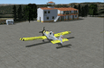
LPFZ is a certified airfield for ULM and helicopters in the center of Portugal, closer to Zezere River. It's mostly used by customers of neighbouring resorts and for fire fighting during summer season. This scenery is to be used ONLY with freeware scenery PTTerrain from PTSIM (http://www.ptsim.com). Not tested for FSX.
| Filename: | LPFZ_Ferreira_do_Zezere_Pombeira_Airfield.zip |
| License: | Freeware |
| Added: | 30th March 2013, 20:42:55 |
| Downloads: | 174 |
| Author: | Joao A. Graca Ferreira |
| Size: | 2.3 MB |
© 2001-2026 AVSIM Online
All Rights Reserved
Privacy Policy |