
Where Flight Simulation Enthusiasts Gather from Around the World!
AVSIM Library - Search Results

| Category: Flight Simulator 2004 - Scenery | |
| KLBB - Lubbock Preston Smith Intl - Texas V3.0.1 |

|
Images related to this file:
File Description:

Lubbock is another one of those little known, neglected airports that populate the
FS world. Avery simple airport, LBB somewhat feels like a little DFW. There is a very DFW-ish main terminal with fewer than
10 gates and plenty of space to grow. The only mainline service is courtesy Southwest, but several RJ's freqent Lubbock
several times per day along with the big freighters. This airport was built from the ground up with excellent detail,
and because of the sparse traffic, frame rates are excellent as well.
V2.0 Update:
Recently, Lubbock has moved their east-west runway 8/26 roughly 1000 feet to the East so as to eliminate runway incursions
by separation from the north-south runway 17R-35L. Version 2.0 reflects this modificaton. Several taxiways have been removed
or modified, and airport fencing has been altered to reflect the change.
V3.0 Update:
This update fixes some major errors mainly on the West side of the airport. The cargo ramp and some of the GA parking had been
found to be located in the wrong positions. They have been relocated and rebuilt to match GoogleEarth images. Also, the afcad
has been updated to line up with these changes along with airline parking updates at the main terminal. All the jetways have
been replaced with more accurate representations, and they have also been adjusted to match their current real world positioning.
v3.0.1 update:
There was a missing scenery library that has been added to the download, so now the jetways will appear if they had not before.
| Filename: | KLBB__Lubbock_Preston_Smith_Intl__Texas__V301.zip |
| License: | Freeware |
| Added: | 18th May 2013, 07:39:35 |
| Downloads: | 1,553 |
| Author: | FRFStudio.net / William Morgan |
| Size: | 8.17 MB |
| Category: Flight Simulator 2004 - Scenery | |
| OSM World: South America |
|
Images related to this file:
File Description:
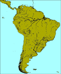
OSM World is a community project! If you wish to help, check the documentation and contact the author!
Welcome to OSM Wold: South America! This is a vector data scenery package covering the South American area. Coastlines, Rivers, lakes, roads, railways, and power lines with detail never before seen! All in an autogen-compatible density! You can see roundabouts, train terminals, harbor areas in a resolution of a point every 10 meters. At this same resolution a vectorial city class places residential (in small and big building variations, depending on surface area) and industrial areas exactly where they are supposed to be. This gives the city areas a resolution far superior to the capacity of FS-2004 default landclass bitmaps, limited to approximately 1 Km x 1 Km squares. OSM World: South America will even give you small roads leading to small towns (even a few houses across)! From big highway intersections, including ramps, to the tiniest rural pathways covering the entire South american area! Wherever in South America you fly, there is something to see!
You can enjoy this scenery near coastlines too! harbor areas and extremely detailed coastal topology (try the southern Chile). This scenery makes sure that the ocean is always flat, you can forget about the climbing water often found around photo-sceneries! This scenery is best paired with a good set of terrain meshes (like the freeware global SRTM mesh by Stephen Rothlisberger , available here: http://simviation.com/1/fs2004terrainmesh).
| Filename: | OSM_World_South_America.zip |
| License: | Freeware |
| Added: | 5th August 2015, 02:31:08 |
| Downloads: | 3,106 |
| Author: | Mario Noriega, Luis Miguel Hernandez |
| Size: | 64.37 MB |
| Category: Flight Simulator 2004 - Scenery | |
| Tongass Remote Airfield v2 - for Tongass Fjords |
|
Images related to this file:
File Description:
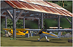
Tongass Remote Airfield v2 - for Tongass Fjords (FS9)
"Tongass Remote Airfield" v2 (RATR) Alaskan bush flying scenery (Fictitious).
This airstrip is for Flight Simulator 2004 and for the "Tongass Fjords" (FS9) addon by Holger Sandmann & Bill Womack; you must have "Tongass Fjords" (FS9) for this to work. Version 2 is a detailed, stand alone, remake of the first version, see PDF file.
Field history and description:
In the early days this area was well known to prospectors and hunters. A small mine was established and later abandoned. Around the late 40s a crew was contracted to clear a small landing area to gain easier access for hunters and campers. Due to the extreme remoteness of this area that clearing took several years. The last phase was the approach, clearing by hand a descending glide slope through just the tops of the tall trees. There is now just enough room for a very experienced pilot to get in and out of this field. The airfield is 26 miles north of Petersburg Alaska (PAPG). This is a tricky narrow approach with a left hand dogleg and then an immediate right hand dogleg turn just before the final approach. Not much time to set up your approach; also, it's a very short runway. For experienced pilots only, and make sure that your life insurance is up to date. Good luck.
| Filename: | Tongass_Remote_Airfield_v2__for_Tongass_Fjords.zip |
| License: | Freeware, limited distribution |
| Added: | 22nd March 2010, 13:16:16 |
| Downloads: | 627 |
| Author: | Jay Langham |
| Size: | 6.18 MB |
| Category: Flight Simulator 2004 - Scenery | |
| Carrier Division Two off Cape Cod |
|
File Description:
This scenery places the two Yorktown-class aircraft carriers of the pre-WW2 U.S. Navy with a screen of four cruisers at sea 100 miles due east of Provincetown, Massachusetts, on the tip of Cape Cod. The ships are the Virtual Navy's Task Force 16 relocated and with the Hornet posing as the Yorktown. This package contains the carriers, cruisers, ship wakes, AFCAD files for all six ships and Arrestor Cables catch zones for the carriers. It provides start points on both carriers, on the catapults of all four cruisers, and in the water between the carriers for seaplanes. Also included are flight starts for Paul Clawson's Curtiss SOC Seagull on the catapults of the cruisers and for the plane of your choice on the carriers, and authentic repaints of the SOC for aircraft assigned to the cruisers plus one for the personal aircraft of the Admiral commanding CarDiv2. There is also a selection of Golden Wings splash screens featuring the ships and planes of CarDiv2. Carrier Division 2 is being released in celebration of Golden Wings 3, but works just as well in a standard FS9 installation. Catapult floatplane operations require the Carrier Operations Gauge Package and Paul Clawson's Curtiss SOC Seagull or another catapult floatplane. Ships and wake effects by The Virtual Navy, modified AFCAD files, SOC repaints, flights and ship placement by Mick Morrissey. A big Thank you to the Virtual Navy for allowing this use of their ships!
| Filename: | Carrier_Division_Two_off_Cape_Cod.zip |
| License: | Freeware, limited distribution |
| Added: | 17th September 2005, 12:50:26 |
| Downloads: | 3,291 |
| Author: | Mick Morrissey |
| Size: | 5.19 MB |
| Category: Flight Simulator 2004 - Scenery | |
| Kugaaruk CYBB and DEW Pelly Bay CWPB in Nunavut, Canada |
|
Images related to this file:
File Description:
Kugaaruk is on the coast of northern mainland Canada on the Boothia Peninsula, 60 miles into a deep north-south fjord-like inlet called Pelly Bay. The name was changed from Pelly Bay in 1999, and the population is around 800. Gjoa Haven is 150 miles to the west, and Hall Beach just over 200 miles to the east. Six miles south of the village, and connected by a gravel road, there is a NWS station and what remains of a DEW Auxiliary Site; the DEW site was closed in 1992, a year after the NWS station became operational. There is also a 3,350 feet long gravel runway beside Barrow Lake 2 miles east of the site, Pelly Bay CWPB. Kugaaruk airfield is adjacent to the village and the 5,000 feet of 100 feet wide gravel runway is aligned 049T/229T where T stands for "true" as opposed to magnetic. There are flights by First Air and Canadian North and the AI includes a daily flight of each from Yellowknife via Gjoa Haven (as per real life) plus a cargo visit by Buffalo. Although the runway is long enough to accomodate a 737 it is not licensed for regular scheduled jet flights; the reason for this is that the approach lighting is "inadequate". Included here is a new .bgl for Gjoa Haven which will remove the small hold short line from the gravel; my mistake.
| Filename: | Kugaaruk_CYBB_and_DEW_Pelly_Bay_CWPB_in_Nunavut_Ca.zip |
| License: | Freeware, limited distribution |
| Added: | 25th November 2012, 00:43:07 |
| Downloads: | 430 |
| Author: | Roger Wensley |
| Size: | 6.1 MB |
| Category: Flight Simulator 2004 - Scenery | |
| Aspen (KASE), Colorado, Photo-Scenery (FS9 & FSX) |
|
Images related to this file:
File Description:

There sure is more than one reason to go to Aspen and this is sure another must-have of my Colorado sceneries. If you're coming IFR there's a couple of very demanding approach procedures. From a LOC/DME to several visual approaches there's everything your heart might desire. Due to the steep and high surrounding terrain these are quiet some hair raisers (see www.airnav.com/airport/KASE). If you're coming VFR then the traffic pattern altitude is 9.005 ft for light aircraft (vs. 9.505 for aircraft 12.500 lbs or more). Weather and wind permitting, RW15 is preferred for all landings (left pattern). RW33 has a right pattern and is preferred for all takeoffs. You even need a written permission to depart RW15. When departing VFR make a right turn to a heading of 360 degrees ASAP for noise abatement and hold this heading for at least 2 miles from the field. And don't forget to enjoy the impressive mountain scenery with two 14ers: Snowmass Mtn. and Castle Pk. to the southwest. This scenery brings you another 3.500 sq km of beautiful Colorado in 4.7m/pix quality. High resolution versions of this scenery for FS9 and FSX (much sharper, but larger and multiple downloads) are available at www.blueskyscenery.com/GNB_South2West2.html . The screenies are taken from the high-res versions, so expect this version to be slightly more blurry. YourDonation@Work: Dedicated to Mark, Markus and Yves.
| Filename: | Aspen_KASE_Colorado_PhotoScenery_FS9__FSX.zip |
| License: | Freeware, limited distribution |
| Added: | 30th January 2010, 17:04:55 |
| Downloads: | 3,582 |
| Author: | Gottfried Razek - blueskyscenery.com |
| Size: | 92.5 MB |
| Category: Flight Simulator 2004 - Scenery | |
| RAF Wittering 1990 |
|
Images related to this file:
File Description:

Wittering was opened as an RAF station in 1924, but flying here started way back in 1916 with the Royal Flying Corps.
Initially the Central Flying School was based here from 1926 until 1935. During World War 2, Wittering was a part of 12 Group, which was responsible for the defence of the Midlands.
The station took on a nuclear responsibility in 1956 with the arrival of the V-Force Valiants, and later Victor bombers. Because of this, the runway was increased in length.
After the V-Bombers left, the station took on the mantle of Home of the Harrier, a title it carried with it from 1969, until the stations closure in 2010.
This scenery is made up of various library objects, using ScruffyDuck's ADE9X, to make a close representation of the base, as opposed to being factually accurate.
Brian has incorporated most of the extra runways and representations of deck landing areas that were used at Wittering for V/STOL training - these runways are not active, but may still obviously be used for taking off and landing yourself.
Also included are repaints of John Young's Harrier GR3/T4 AI model, available from flightsim.com. These represent the aircraft of No.1(F) Squadron and No.233 OCU, during 1989-90.
There are also a set of representative flightplans to allow the Harriers to fly "typical" missions and flights.
| Filename: | RAF_Wittering_1990.zip |
| License: | Freeware, limited distribution |
| Added: | 6th October 2013, 17:17:42 |
| Downloads: | 1,393 |
| Author: | Brian Clarke, Daryl Payne |
| Size: | 20.58 MB |
| Category: Flight Simulator 2004 - Scenery | |
| Warsaw City 2015 DEMO |
|
Images related to this file:
File Description:

WARSAW CITY 2015 DEMO is a sophisticated scenery package, featuring a detailed scenery of Warsaw city in Poland with surrounding airports, fully compatible with FS2004.
This product is a fully functional DEMO version of the commercial payware product. It features same layouts as in the full version but with limited 3D objects and low resolution textures. Using this free demo ensures no problems with online (VATSIM, IVAO, multiplayer etc.) flying in case some users use the payware scenery and some don't.
Warsaw is the capital and the largest city of Poland located on the Vistula (Wisla) River. Warsaw City 2015 gives you a possibility to fly over an extremely large area of Warsaw city. We have included a photoreal ground textures of about 5200 square km. The city centre has hundreds of custom buildings modeled, there are all VFR-important landmarks on the whole included area too. We have also created 13 variously detailed airports and heliports for the project: Modlin EPMO, Babice EPBC, Chrcynno/Nasielsk, Sobienie EPSJ, Goraszka EPGO, Konstancin-Jeziorna, Konstancin Heliport, Reczaje (lite), Kroczewo (lite), Trebki Nowe (lite), Wincentow 1 (lite), Wincentow 2 (lite), Zabia Wola (lite).
The product is equipped with an automatic installer, which means that the scenery will be automatically added to the Flight Simulator Scenery Library. Please uninstall all previous versions of similar sceneries you may have installed before. Please make also sure that no duplicate AFCAD files are installed.
Enjoy your virtual flying with Drzewiecki Design!
| Filename: | Warsaw_City_2015_DEMO.zip |
| License: | Commercial demo |
| Added: | 2nd September 2015, 22:23:02 |
| Downloads: | 931 |
| Author: | Drzewiecki Design |
| Size: | 23.41 MB |
| Category: Flight Simulator 2004 - Scenery | |
| Zion National Park North, Cedar Breaks National Monument, Cedar City (KCDC), Utah, Photo-Scenery (FS9 & FSX) |
|
Images related to this file:
File Description:
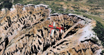
Cedar Breaks National Monument is a large amphitheater cliff in bright colors of red, orange and purple.
It lies east of Cedar City in the northern region of the scenery. The cliff was formed by erosion thru wind,
water and ice. Today erosion continues with a pace of about 2 inches every 5 years. Although it is called
Cedar Breaks, there are no cedars growing there but juniper trees. For a scenic flight to Cedar Breaks
National Monument best depart from Cedar City Regional Airport (KCDC) and head east. The scenery extends
south to Zion National Park and covers a large part of Zion Canyon and the Kolob Canyons area.
Zion National Park is another place where erosion of the Colorado Plateau formed the most beautiful colorful
stone formations of unique and wonderful shapes. There are nine different layers of stone visible in the park.
Most of them consist of sandstone. But there is also limestone, gypsum, siltstone, shale, clay and mudstone.
The Virgin River cut a spectacular and famous canyon thru Zion Park that is as narrow as 20ft and up to 2000ft tall.
High resolution versions of this scenery for FS9 and FSX (much sharper, but larger and multiple downloads)
are available at www.blueskyscenery.com/CNY_South2West5.html . The screenies are taken from the high-res versions,
so expect this version to be slightly more blurry.
Thanks to Joop Mak for providing a custom AFCADs that correct airport layouts so that they align with the photo-textures!
They are available here: www.blueskyscenery.com/AFCADs.html . YourDonation@Work: Dedicated to Richard, P.J. and Felix.
| Filename: | Zion_National_Park_North_Cedar_Breaks_National_Mon.zip |
| License: | Freeware, limited distribution |
| Added: | 14th March 2010, 00:30:28 |
| Downloads: | 1,566 |
| Author: | Gottfried Razek - blueskyscenery.com |
| Size: | 97.13 MB |
| Category: Flight Simulator 2004 - Scenery | |
| KIAH - Houston Intercontinental Airport v3.0 |
|
File Description:
Flightlevel390 is proud to present to you KIAH-Houston's George Bush Intercontinental Airport version 3.0.This scenery was created using EZ-Scenery object placer & Flightones' Instant Scenery.This scenery WILL NOT work in FS X.This will work with Default FS9 terrain,although it is optimized for use with ultimate terrain...This will be the final project under the FL390 brandname,all projects hereafter will be with BSMP...
Includes the Main terminals,Continental Maintenence Base,FedEx cargo ramp,UPS cargo ramp,City cargo ramp,fuel farm by 15R,CFR building further down 15R,CFR Building along Rwy 9-27 taxiway,FBOs on both sides of the 33s,including the big Landmark Aviation FBO,static ground equipment & some custom made signs.Also includes full ramp night lighting,aircraft gate outline markings at each gate.
This version adds some more stuff and fixing some stuff that was noted in previous versions.This also fixes the blurries that some people had reported.
Features a very good and super accurate AFCAD file and decent rendition of the real airport layout.***
Most of the objects in this scenery are all default with some of our own custom made stuff and some objects from some 3rd party EZ Object Libraries and RWY12 Object Libraries.
***You will need to download the EZ-Scenery & RWY12 Object Libraries which can be had at avsim,flightsim.com and our own website available as single downloads instead of multiple seperate downloads.I also recomend that you install our recently released EZ-Object Library Installer which is available at flightsim.com and our own website in the downloads section.File name on flightsim.com is ( EZOLIv33.zip )....
Downloading the installer will ensure that you will have all of the fixed default textures from Sid Schwartz's default libraries....As always...Enjoy!!
| Filename: | KIAH__Houston_Intercontinental_Airport_v30.zip |
| License: | Freeware |
| Added: | 15th June 2008, 17:39:45 |
| Downloads: | 8,417 |
| Author: | Joe DeGregorio |
| Size: | 3.08 MB |


© 2001-2026 AVSIM Online
All Rights Reserved
Privacy Policy |