
Where Flight Simulation Enthusiasts Gather from Around the World!
AVSIM Library - Search Results

| Category: Flight Simulator 2004 - Scenery | |
| FinneyGround_VERT_Logistics for Rwy12 |

|
File Description:
This is a set of Logistics objects for Rwy12.
These objects were created in GMax and textured by Robert "Lt.Finney" Finnegan, and modified,grouped and formatted for Rwy12 by Gary "Gman" Mills.
These objects were custom made for use with the VERTva.com Base Sceneries so that our users could have some fun populating the VERT bases to give them some signs of activity. And of course they work well at any airport, and in some cases seaports, factories, heliports, etc.
For more information on VERTva Base sceneries, visit VERTva.com
This is #2 of 3 files
| Filename: | FinneyGround_VERT_Logistics_for_Rwy12.zip |
| License: | Freeware, limited distribution |
| Added: | 17th September 2005, 00:37:16 |
| Downloads: | 8,116 |
| Author: | Robert Finnegan Gary Mills |
| Size: | 1.29 MB |
| Category: Flight Simulator 2004 - Scenery | |
| Telluride Regional Airport v3 ( KTEX ) |
|
File Description:
FS2004 Scenery - Telluride Regional Airport (IATA: TEX, ICAO: KTEX) is a public airport located 5 miles (8 km) west of Telluride, in San Miguel County, Colorado, USA. It is the highest commercial airport in North America, at an elevation of 9,078 feet (2767 m) above sea level. Located on a plateau, the airport's single runway literally dips slightly in the centre. This is version 3. Unlike versions 1 and 2, this scenery had the advantage of Google Earth's satellite image. Created using Instant Scenery by John B. Loney, Jr.
| Filename: | Telluride_Regional_Airport_v3__KTEX_.zip |
| License: | Freeware, limited distribution |
| Added: | 25th March 2008, 15:55:10 |
| Downloads: | 2,799 |
| Author: | John B. Loney, Jr. |
| Size: | 17.23 MB |
| Category: Flight Simulator 2004 - Scenery | |
| Julius Nyerere International Airport (HTDA) V3 |
|
Images related to this file:
File Description:
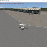
Thanks for downloading Julius Nyerere International Airport (HTDA) Version 3. This is the Largest Airport in Tanzania. The Airport scenery was built from Sketchup, SBUILDER and ADE v1.76 utilizing Google Earth for correct positions. Objects placed with Instant Scenery 3. This is version 3, it includes Terminal 1, Terminal 2 (new semi-photoreal textures), Terminal 3 (now open), VIP terminal, Fire Station and Radar and Control tower in the correct position. and the "correct" afcad. Needs RWY12 Object library (available on avsim and flightsim). see readme for install instructions.
| Filename: | Julius_Nyerere_International_Airport_HTDA_V3.zip |
| License: | Freeware |
| Added: | 15th October 2019, 01:21:54 |
| Downloads: | 561 |
| Author: | Emmanuel Mwandosya |
| Size: | 31.59 MB |
| Category: Flight Simulator 2004 - Scenery | |
| Project Mexico Real LOD10 File 3 of 11 |
|
Images related to this file:
File Description:
Re-upload. File 3rd of 11 of a Terrain Mesh that covers the entirety of Mexican Territory and related bordering U.S., Guatemala and Belice areas, part of the "Proyecto Mexico Real" project, compiled at LOD10 (1.24 arcseconds in latitude and 1.65 arcseconds in longitude) resolution from INEGI data. Intended to enhance the virtual flying experience complementing the LOD8 and LOD9 versions compiled from the same data. Compatible backwards with Flight Simulator 2000, Flight Simulator 2002 and Combat Flight Simulator 2. Refer to the file contents about the cover area to this compressed file.
| Filename: | Project_Mexico_Real_LOD10_File_3_of_11.zip |
| License: | Check within download |
| Added: | 8th June 2010, 03:17:03 |
| Downloads: | 3,255 |
| Author: | Juan Jose Galvan Bautista |
| Size: | 73.67 MB |
| Category: Flight Simulator 2004 - Scenery | |
| Project Mexico Real LOD10 File 10 of 11 |
|
Images related to this file:
File Description:
Re-upload. File 10th of 11 of a Terrain Mesh that covers the entirety of Mexican Territory and related bordering U.S., Guatemala and Belice areas, part of the "Proyecto Mexico Real" project, compiled at LOD10 (1.24 arcseconds in latitude and 1.65 arcseconds in longitude) resolution from INEGI data. Intended to enhance the virtual flying experience complementing the LOD8 and LOD9 versions compiled from the same data. Compatible backwards with Flight Simulator 2000, Flight Simulator 2002 and Combat Flight Simulator 2. Refer to the file contents about the cover area to this compressed file.
| Filename: | Project_Mexico_Real_LOD10_File_10_of_11.zip |
| License: | Check within download |
| Added: | 5th September 2010, 20:55:05 |
| Downloads: | 3,062 |
| Author: | Juan Jose Galvan Bautista |
| Size: | 70.54 MB |
| Category: Flight Simulator 2004 - Scenery | |
| Project México Real LOD10 File 4 of 11 |
|
File Description:
File 4th of 11 of a Terrain Mesh that covers the entire Mexican Territory and related areas bordering the U.S., Guatemala and Belice areas. Part of the "Proyecto México Real" project, compiled at LOD10 (1.24 arcseconds in latitude and 1.65 arcseconds in longitude) resolution from INEGI data. Intended to enhance the virtual flying experience complementing the LOD8 and LOD9 versions compiled from the same data. Compatible backwards with Flight Simulator 2000, Flight Simulator 2002 and Combat Flight Simulator 2. Refer to the file contents about the cover area to this compressed file.
| Filename: | Project_Mxico_Real_LOD10_File_4_of_11.zip |
| License: | Check within download |
| Added: | 6th June 2006, 00:58:59 |
| Downloads: | 3,067 |
| Author: | Juan José Galván Bautista |
| Size: | 74.49 MB |
| Category: Flight Simulator 2004 - Scenery | |
| Project México Real LOD10 File 6 of 11 |
|
File Description:
File 6th of 11 of a Terrain Mesh that covers the entire Mexican Territory and related areas bordering the U.S., Guatemala and Belice areas. Part of the "Proyecto México Real" project, compiled at LOD10 (1.24 arcseconds in latitude and 1.65 arcseconds in longitude) resolution from INEGI data. Intended to enhance the virtual flying experience complementing the LOD8 and LOD9 versions compiled from the same data. Compatible backwards with Flight Simulator 2000, Flight Simulator 2002 and Combat Flight Simulator 2. Refer to the file contents about the cover area to this compressed file.
| Filename: | Project_Mxico_Real_LOD10_File_6_of_11.zip |
| License: | Check within download |
| Added: | 6th June 2006, 01:07:16 |
| Downloads: | 3,024 |
| Author: | Juan José Galván Bautista |
| Size: | 71.63 MB |
| Category: Flight Simulator 2004 - Scenery | |
| Project México Real LOD10 File 11 of 11 |
|
File Description:
File 11th of 11 of a Terrain Mesh that covers the entirety of Mexican Territory and related bordering U.S., Guatemala and Belice areas, part of the "Proyecto México Real" project, compiled at LOD10 (1.24 arcseconds in latitude and 1.65 arcseconds in longitude) resolution from INEGI data. Intended to enhance the virtual flying experience complementing the LOD8 and LOD9 versions compiled from the same data. Compatible backwards with Flight Simulator 2000, Flight Simulator 2002 and Combat Flight Simulator 2. Refer to the file contents about the cover area to this compressed file.
| Filename: | Project_Mxico_Real_LOD10_File_11_of_11.zip |
| License: | Check within download |
| Added: | 6th June 2006, 01:52:33 |
| Downloads: | 3,098 |
| Author: | Juan José Galván Bautista |
| Size: | 69.98 MB |
| Category: Flight Simulator 2004 - Scenery | |
| Europe Soaring Scenery |
|
File Description:
FS2002/2004 Europe Soaring Scenery
This file adds some thermals to default Microsoft scenery for some main cities region:
1.Madrid City,Spain - Barajas Airport(LEMD).
2.Oslo City,Norway - Gardermoen Airport(ENGM).
3.Helsinki City - Malmi Airport(EFHF).
4.Copenhagen,Denmark - Kastrup Airport(EKCH).
5.Dublin City,Ireland - Dublin Intl. Airport(EIDW).
6.Glasgow City,Scotland - Glasgow Airport(EGPF).
7.Brussels City - Belgium - Brussels National Airport(EBBR).
8.Moscow City - Sheremetyevo Airport(UUEE).
9.Amsterdam City - Schipol Airport(EHAM).
It is freeware.
By Francisco Vargas.
E-mail:[email protected]
| Filename: | Europe__Soaring_Scenery.zip |
| License: | Freeware |
| Added: | 9th November 2005, 10:46:31 |
| Downloads: | 10,348 |
| Author: | Francisco Augusto Vargas Carneiro |
| Size: | 1.62 MB |
| Category: Flight Simulator 2004 - Scenery | |
| Beaver Municipal, Ok |
|
File Description:
FS2004 Scenery - Beaver Municipal (K44) is a small airport located in Beaver, Ok. It has 2 runways, one asphalt and the other grass. There is no fuel, maintenence nor attendents. The airport is publicly owned by the City of Beaver. Coordinates: 36-47-56.0930N/100-31-47.5350W ( 36.79891/-100.52987) Located 1 mile SW of Beaver, Oklahoma. Surveyed Elevation is 2491 feet MSL. Beaver Municipal was formerly known as Q44. PLEASE READ THE README FILE!!! Created with EZ Scenery. One non-defaut ai aircraft included. By John B. Loney, Jr.
| Filename: | Beaver_Municipal_Ok.zip |
| License: | Freeware, limited distribution |
| Added: | 4th June 2007, 19:29:29 |
| Downloads: | 442 |
| Author: | John B. Loney, Jr. |
| Size: | 712.49 KB |


© 2001-2026 AVSIM Online
All Rights Reserved
Privacy Policy |