
Where Flight Simulation Enthusiasts Gather from Around the World!
AVSIM Library - Search Results

| Category: Flight Simulator 2004 - Scenery | |
| Allianz Arena in Munich, Germany |

|
File Description:
This scenery adds the "Allianz Arena", a famous soccer stadium in the north of Munich to the FS world. During the FIFA Worldcup it's the official stadium for games in Munich. The Worldcup starts with the opening match between CostaRica and Germany on June 9th, 2006 in this Stadium.
Night Textures are included.
| Filename: | Allianz_Arena_in_Munich_Germany.zip |
| License: | Freeware |
| Added: | 9th June 2006, 15:56:13 |
| Downloads: | 3,472 |
| Author: | Martin Hal |
| Size: | 1.07 MB |
| Category: Flight Simulator 2004 - Scenery | |
| Heli Missions 2008 |
|
File Description:
The Heli Missions project is created for use with Lago FS Enhancer program and Gottfried Razek Los Angeles-Catalina island sceneries.
100 missions and flights around LA area.
Heli Med Transport, police operations, ecological missions, executive freighters, search and rescue in sea and
moutains missions.
By André Drumond (Centro Aeronáutico virtual) Brazil.
| Filename: | Heli_Missions_2008.zip |
| License: | Freeware |
| Added: | 17th July 2008, 20:01:13 |
| Downloads: | 441 |
| Author: | André Drumond |
| Size: | 3.35 MB |
| Category: Flight Simulator 2004 - Scenery | |
| FS2004 KPLU |
|
File Description:
KPLU airport Thun Field is in Washington State USA about 40 Miles North of Seattle. In default FS 2004, the airport is named 1S0.
This download changes the airport to the correct KPLU designation. The scenery is also changed to reflect e ralistic object
locations. AI traffic is also included. Read the instructions.
| Filename: | FS2004_KPLU.zip |
| License: | Freeware |
| Added: | 22nd November 2024, 15:22:41 |
| Downloads: | 84 |
| Author: | Peter Bendl |
| Size: | 13.05 MB |
| Category: Flight Simulator 2004 - Scenery | |
| Randolph AFB |
|
File Description:
Randolph AFB scenery for FS 2004. Very highly detailed scenery, with this being the fourth version. Many imrovements since the last version, including many new structures. Includes photo-realistic seasonal ground textures and extensive night lighting, as well as loads of custom-made buildings. Complete package includes AFCAD files and AI aircraft.
| Filename: | Randolph_AFB.zip |
| License: | Freeware |
| Added: | 24th July 2006, 02:36:20 |
| Downloads: | 3,094 |
| Author: | James S. Shaddox |
| Size: | 30.64 MB |
| Category: Flight Simulator 2004 - Scenery | |
| West Sussex Piers |
|
File Description:
The piers and works between Selsey Bill and Beachy Head; at Bognor, Littlehampton, Worthing, Shoreham, Brighton West, and Brighton; mark the route of the low-level air-speed world record flight by Neville Duke in a Hawker Hunter in 1953 at an average speed of 747 mph. This scenery was made for the FS Kiosk at the Tangmere Museum, Sussex, England, to enable visitors to emulate Neville Duke's record flight in the Hunter, and is released to the FS community for that purpose. and any other, such as racing. The zipfile contains two sets of coastal objects for the same area; one is for FS2004 using the default scenery, the other for FS2004 using VFR photo scenery, such as JustFlight's "Photograhic Scenery" or "Roads & Rivers of Europe".
| Filename: | West_Sussex_Piers.zip |
| License: | Freeware |
| Added: | 7th August 2005, 12:55:06 |
| Downloads: | 2,166 |
| Author: | John McKeon |
| Size: | 484.05 KB |
| Category: Flight Simulator 2004 - Scenery | |
| Ford India Scenery Project - Part 1 |
|
Images related to this file:
File Description:

The Ford India Project is a 6 part Project to create a 1930's India - Part 1 Pondicherry UT India VOPC is now available for your Flight Sim enjoyment. The scenery is a historical rendition of VOPC Pondicherry circa 1930's. This package is the first part and the foundation of the other 5 parts. Part 2 is also complete which includes the TATA and Son's Air Services route across India with 1930's version of Colombo, Madras, Hyderabad, Bombay, Ahmedabad and Karachi.
Additionally, a comprehensive AI package is available which includes 4 aircraft and 22 liveries specific to India with flights transiting along the TATA routes and circuits at Pondicherry. Part 2 and the AI Traffic pack is now available only at the Ford Project site - http://www.ford-tri-motor.net/ford-india-project.htm - if you like the Pondicherry scenery then you will indeed enjoy the additions of Part 2 and the AI traffic package to enrich and enjoy the 1930's flying throughout the Indian Empire.
| Filename: | Ford_India_Scenery_Project__Part_1.zip |
| License: | Freeware, limited distribution |
| Added: | 21st June 2013, 20:35:51 |
| Downloads: | 147 |
| Author: | Garry J. Smith, Edward C. Moore |
| Size: | 6.34 MB |
| Category: Flight Simulator 2004 - Scenery | |
| Himalayas LOD9 Base Mesh, Volume 3 - Southwestern Ranges |
|
Images related to this file:
File Description:
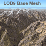
Detailed terrain mesh of the Southwestern Himalayan Ranges, N28-37 E78-82. The files in this package are based on Shuttle Radar (SRTM) Version 2 data but with many of the void areas, especially the most significant sections, filled with elevation data generated from topographic maps by Jonathan de Ferranti. While Jonathan's work is unrelated to flight simulation he kindly gave me permission to compile his data for use in FS. The result is a wonderful improvement in detail and accuracy over any existing mesh file, freeware or commercial, based on SRTM or DTED data alone.
Due to the large area of the Himalayas I've compiled the source data as two separate series: the "Himalayan Peaks" series covers prominent mountains and ranges in higher detail and locally overrides any existing LOD9 terrain mesh. In addition, the LOD9 "base mesh" series, with LOD8 and LOD7 "buffer" mesh files, covering the entire Himalayas, is meant for those who do not yet have an add-on terrain mesh of these beautiful mountains.
| Filename: | Himalayas_LOD9_Base_Mesh_Volume_3__Southwestern_Ra.zip |
| License: | Freeware, limited distribution |
| Added: | 30th May 2010, 10:00:26 |
| Downloads: | 155,808 |
| Author: | Holger Sandmann, Jonathan de Ferranti |
| Size: | 62.16 MB |
| Category: Flight Simulator 2004 - Scenery | |
| Himalayas LOD9 Base Mesh, Volume 5 - Hindu Kush and Pamir |
|
Images related to this file:
File Description:
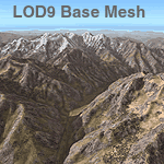
Detailed terrain mesh of the Hindu Kush and Pamir Ranges, N32-40 E70-76. The files in this package are based on Shuttle Radar (SRTM) Version 2 data but with many of the void areas, especially the most significant sections, filled with elevation data generated from topographic maps by Jonathan de Ferranti. While Jonathan's work is unrelated to flight simulation he kindly gave me permission to compile his data for use in FS. The result is a wonderful improvement in detail and accuracy over any existing mesh file, freeware or commercial, based on SRTM or DTED data alone.
Due to the large area of the Himalayas I've compiled the source data as two separate series: the "Himalayan Peaks" series covers prominent mountains and ranges in higher detail and locally overrides any existing LOD9 terrain mesh. In addition, the LOD9 "base mesh" series, with LOD8 and LOD7 "buffer" mesh files, covering the entire Himalayas, is meant for those who do not yet have an add-on terrain mesh of these beautiful mountains.
| Filename: | Himalayas_LOD9_Base_Mesh_Volume_5__Hindu_Kush_and_.zip |
| License: | Freeware, limited distribution |
| Added: | 29th May 2010, 08:57:29 |
| Downloads: | 7,607 |
| Author: | Holger Sandmann, Jonathan de Ferranti |
| Size: | 85.72 MB |
| Category: Flight Simulator 2004 - Scenery | |
| Himalayas LOD9 Base Mesh, Volume 4 - Kashmir and Jammu |
|
File Description:
Detailed terrain mesh of the Kashmir and Jammu Ranges, N30-39 E76-78. The files in this package are based on Shuttle Radar (SRTM) Version 2 data but with many of the void areas, especially the most significant sections, filled with elevation data generated from topographic maps by Jonathan de Ferranti. While Jonathan's work is unrelated to flight simulation he kindly gave me permission to compile his data for use in FS. The result is a wonderful improvement in detail and accuracy over any existing mesh file, freeware or commercial, based on SRTM or DTED data alone.
Due to the large area of the Himalayas I've compiled the source data as two separate series: the "Himalayan Peaks" series covers prominent mountains and ranges in higher detail and locally overrides any existing LOD9 terrain mesh. In addition, the LOD9 "base mesh" series, with LOD8 and LOD7 "buffer" mesh files, covering the entire Himalayas, is meant for those who do not yet have an add-on terrain mesh of these beautiful mountains.
| Filename: | Himalayas_LOD9_Base_Mesh_Volume_4__Kashmir_and_Jam.zip |
| License: | Freeware, limited distribution |
| Added: | 22nd February 2006, 20:32:50 |
| Downloads: | 7,505 |
| Author: | Holger Sandmann, Jonathan de Ferranti |
| Size: | 29.24 MB |
| Category: Flight Simulator 2004 - Scenery | |
| Himalayas LOD9 Base Mesh, Volume 1 - Southeastern Ranges |
|
Images related to this file:
File Description:
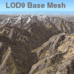
Detailed terrain mesh of the Southeastern Himalayan Ranges, N26-32 E90-98. The files in this package are based on Shuttle Radar (SRTM) Version 2 data but with many of the void areas, especially the most significant sections, filled with elevation data generated from topographic maps by Jonathan de Ferranti. While Jonathan's work is unrelated to flight simulation he kindly gave me permission to compile his data for use in FS. The result is a wonderful improvement in detail and accuracy over any existing mesh file, freeware or commercial, based on SRTM or DTED data alone.
Due to the large area of the Himalayas I've compiled the source data as two separate series: the "Himalayan Peaks" series covers prominent mountains and ranges in higher detail and locally overrides any existing LOD9 terrain mesh. In addition, a LOD9 "base mesh" series, with LOD8 and LOD7 "buffer" mesh files, covering the entire Himalayas, is meant for those who do not yet have an add-on terrain mesh of these beautiful mountains.
| Filename: | Himalayas_LOD9_Base_Mesh_Volume_1__Southeastern_Ra.zip |
| License: | Freeware, limited distribution |
| Added: | 29th May 2010, 09:01:26 |
| Downloads: | 10,302 |
| Author: | Holger Sandmann, Jonathan de Ferranti |
| Size: | 71.82 MB |


© 2001-2026 AVSIM Online
All Rights Reserved
Privacy Policy |