
Where Flight Simulation Enthusiasts Gather from Around the World!
AVSIM Library - Search Results

| Category: Flight Simulator 2004 - Scenery | |
| Anaktuvuk Pass PAKP in Alaska |

|
Images related to this file:
File Description:
Anaktuvuk Pass is a village located 85 miles north of Bettles and just north of the Brooks Range, in a valley that is a route between north and south. The inhabitants are mainly Numamiut, a section of the Inupiat that existed in history (and until today) away from the coastal food supply of fish etc. The current population is around 350. The airport has one gravel runway, aligned 1-19 with PAPI at both ends, and 5,500 feet long as there is no connection to the outside world other than the runway for all necessities that are not available on the tundra. There are two aprons, with light planes and passengers at the northern end of the runway and the Everts cargo flights unloading at the mid runway apron. A note here about my scenery making. There will not be many more to follow this as I am almost at the end of the photos I either took or found for scenery purposes, plus I expect to move on from FS9 at some point during next year.
| Filename: | Anaktuvuk_Pass_PAKP_in_Alaska.zip |
| License: | Freeware, limited distribution |
| Added: | 25th November 2019, 17:51:38 |
| Downloads: | 242 |
| Author: | Roger Wensley |
| Size: | 8.59 MB |
| Category: Flight Simulator 2004 - Scenery | |
| KNUQ - Moffett Federal Airfield - Mountain View - California (USA) |
|
Images related to this file:
File Description:
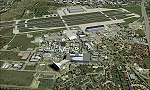
Known originally as Naval Air Station Sunnyvale after its christening in 1933, Moffett Field was renamed in 1942 in honor of Rear Admiral W.A. Moffett a founder of the Navy's Lighter than air program. By this time the LTA program had been reduced to the use of smaller dirigibles for scouting and anti-submarine work but the airfield remained immensely important as a fixed-wing facility due to it's strategic location between Seattle and San Diego. The Ames Research Center established before the war also blossomed into a major post-war aeronautical research and development center due in part to its highly advanced wind tunnel facilities. After the Second World War, Moffett Field developed into a West Coast hub for Patrol and ASW operations against encroaching Soviet missile boats. The NASA presence at Moffett began as early as 1939 with the establishment of the Aames Research Facility and evolving into the sophisticated R&D complex it is today. This particular scenery package attempts to represent the base more or less as it is today.
| Filename: | KNUQ__Moffett_Federal_Airfield__Mountain_View__Cal.zip |
| License: | Freeware |
| Added: | 21st August 2014, 10:41:53 |
| Downloads: | 1,349 |
| Author: | John Stinstrom |
| Size: | 12.36 MB |
| Category: Flight Simulator 2004 - Scenery | |
| Northern Oman SRTM mesh |
|
File Description:
This terrain mesh scenery covers northern of Oman emirate as well as some parts of United Arab Emirates (Dubai, Sharjah, Ras Al Khaima, Fujiarah...). The southern and western boundaries are approx 22°N / 54°E.
No part of Iran has been included.
Based on SRTM Data (3 arcsec, 90m) and sampled to LOD9 resolution (76m) using Matthew Styles's program "SRTM To BGL v1.04". While only tested with Fs2004, this mesh should also run with FS2002.
SRTM 3 arcsec dataset has numerous void areas in this part of the world. But thanks to John Child's beautiful and powerful "Blackart" utility it's now easy to patch these areas with lower resolution dataset: I took the coupled interpolation method to merge SRTM 3-arcsec with SRTM 30-arcsec dataset when needed. This gives the best results, as patched areas with 30-arcsec data are blending naturally with surrounding 3-arcsec mesh. Of course the resolution of patched areas is quite poor, but still a bit better than the default LOD5 mesh.
| Filename: | Northern_Oman_SRTM_mesh.zip |
| License: | Freeware, limited distribution |
| Added: | 20th June 2004, 14:11:59 |
| Downloads: | 8,220 |
| Author: | Yohann Baptiste |
| Size: | 16.44 MB |
| Category: Flight Simulator 2004 - Scenery | |
| Kona at Keahole International Airport PHKO |
|
File Description:
This is a completely new Kona, which is now more correctly laid out and very detailed. This is one of the most unique and beautiful airports in the world. It resembles a Hawaiian Village and Botanic garden combined, and is completey open air. The airport is built on old lava flows, and the terminal area is full of lava rock walls, which was probably mined while constructing the taxiways, tarmacs, and terminal itself. This scenery redoes the entire airport, and includes details like baggage carrousels, benches at the gate areas, check-in counters, parking lot shelters, and some purple baggage carts to go with the Island atmosphere. Since this airport has no jetways, I have created some new lower impact air stairs, and have positioned them around the two main gate areas. There is also a large air stair at each gate area to accommodate heavy jetliners. The unique ramp lights found at this airport are also included as well as some interesting night lit ramp textures. It has not been tested in FS2002.
| Filename: | Kona_at_Keahole_International_Airport______PHKO.zip |
| License: | Freeware |
| Added: | 16th January 2004, 14:14:35 |
| Downloads: | 6,779 |
| Author: | Bill Melichar |
| Size: | 5.52 MB |
| Category: Flight Simulator 2004 - Scenery | |
| Howick Airfield (FAHC), South Africa |
|
Images related to this file:
File Description:
This package will add a custom (Gmax) made Howick Airfield (FAHC), KwaZulu Natal, South Africa with photoreal textures and seasonal ground textures.
Howick is a small town in the KwaZulu Natal Midlands just off the N3 freeway which connects Johannesburg and Durban and home to the famous Howick waterfall. The Umgeni river falls 95m (311 ft) over the cliffs on the way to the Indian Ocean. The town is also home to the Midmar dam. This dam is very well known as being the location of the annual Midmar Mile swimming event which, in 2009, was recognized by the Guinness Book of World Records as the world's largest open water swimming event with 13 755 competitors taking part.
The sloped grass runway is aligned 16/34 and 825m long and sits at an elevation of 3 615ft. Both runways have obstacles on the approach, with powerlines 730m from the threshold of runway 16, while runway 34's approach have hills around 900m before the threshold. The sloped runway has been created in FS2004 within the limits of the simulator itself.
| Filename: | Howick_Airfield_FAHC_South_Africa.zip |
| License: | Freeware, limited distribution |
| Added: | 15th January 2021, 20:25:51 |
| Downloads: | 201 |
| Author: | Kobus van Wyk |
| Size: | 7.67 MB |
| Category: Flight Simulator 2004 - Scenery | |
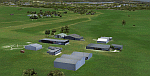
| Sulphur Creek Ranch ID74 private airfield in Idaho USA |
|
Images related to this file:
File Description:
This airfield is in the mountains of Idaho, around 30 miles south of Johnson Creek 3U2 which was the third in the series to be posted. Sulphur Creek Ranch is a privately owned airfield, serving the "Ranch", which translates into "restaurant-bar-lodge-and-holiday-cabins". The field is at 5,744 feet ASL, and the runway is 2,920 feet long and aligned 10-28. It is a single-ended runway, with 28 used for landing and 10 for take offs; this is down to a large chunk of mountain occupying the sky at the western end of the runway. The AI planes comply with this single runway concept and the only snag is that you cannot announce a landing as there is no runway offered for you to select for landing in the AI procedure. When taking off runway 10 is offered and you can announce take off. The land used by the ranch is mostly flat, and with a slant approach on finals and a late turn it is fairly straightforward. The largest landark is the man-made lake. Morgan Ranch 02ID is nearby and the grass area has been modified down in size as per reality. The buildings have been omitted as they are not adjacent to the runway and not visible, and I have no information on them.
| Filename: | Sulphur_Creek_Ranch_ID74_private_airfield_in_Idaho.zip |
| License: | Freeware, limited distribution |
| Added: | 25th May 2017, 17:54:33 |
| Downloads: | 164 |
| Author: | Roger Wensley |
| Size: | 6.21 MB |
| Category: Flight Simulator 2004 - Scenery | |
| Exploring Mt Rainier Natl Park v1.1 |
|
File Description:
Exploring Mt Rainier Natl Park v1.1
UPDATE! Includes missing textures which resulted in some users experiencing CTD and freezes. A complete remapping of Mount Rainier National Park in Washington State. Based upon commercial topographic maps, the designed scenery includes, every hiking trail drawn in meticulous detail including every real life switchback; every lake and small alpine pond 20 feet in diameter and over, modified landclass of alpine, forest & rock; every perennial and many intermittent creeks, all steams and rivers (many braided), a complete glacier mapping of every glacier with custom textures and ice fields on the mountain, a complete mapping of all rock faces and rock, moraine rock deposits, glacier outwash area, mudflows, roads, swamp and marsh areas. Includes some effects. Designed to compliment UT USA and any LOD 9 or 10 mesh. Works well with FS Genesis LOD 10 mesh and Birds Eye View Textures. By Bryan Wallis and Lou Frost.
| Filename: | Exploring_Mt_Rainier_Natl_Park_v11.zip |
| License: | Freeware, limited distribution |
| Added: | 18th February 2006, 23:14:40 |
| Downloads: | 4,149 |
| Author: | Bryan Wallis & Lou Frost |
| Size: | 11.61 MB |
| Category: Flight Simulator 2004 - Scenery | |
| Talkeetna Village AK44 in Alaska, home of Don Sheldon's Talkeetna Air Service |
|
Images related to this file:
File Description:
Talkeetna is around 75 miles north of Anchorage in Alaska on the east shore of the Susitna River. The town is where Don Sheldon got off the train in 1938, and where, ten years later, he started Talkeetna Air Services. There are two airfields in Talkeetna, PATK with its long asphalt runway and Talkeetna Village AK44 in the middle of the town. This is AK44; the default FS version with Ultimate Terrain installed had the runway half in the river, but there is still space for the 900 feet of runway that is described in the book "Wager With The Wind" that tells Don's story. The result is a step back in time to 1973, when the second hangar was built. If you also want to install PATK do a search. I have partially populated the village with cabins, and UT is probably required for the river to be there; I haven't tested this without it.
| Filename: | Talkeetna_Village_AK44_in_Alaska_home_of_Don_Sheld.zip |
| License: | Freeware |
| Added: | 4th February 2010, 01:24:40 |
| Downloads: | 564 |
| Author: | Roger Wensley |
| Size: | 3.66 MB |
| Category: Flight Simulator 2004 - Scenery | |
| Canadian and Northern USA Winter Flying |
|
File Description:
This is an expanded version of a previous post a year ago, and stretches from east of Quebec City through Quebec, Ontario, and Manitoba, and now also through Saskatchewan, and into Alberta (past Calgary). There is also a northern area roughly centered on Hudson Bay. The exact coverages are given in the notes. All rivers and lakes within the area will "freeze" and allow ski planes to land, or even wheeled planes come to that. And it is not permanent, when you want to go back to floats just "untick" it in the FS library, and it will melt. The area covered crosses into the US too, down to around 45 degrees north, so that means most of Montana, all of North Dakota, half of Minnesota, and some of Wisconsin, Michigan etc. It seemed silly to stop at the border. Ultimate Terrain is highly recommended, so that there will actually be the right lakes and rivers ready to freeze.
| Filename: | Canadian_and_Northern_USA_Winter_Flying.zip |
| License: | Freeware |
| Added: | 26th May 2008, 13:24:29 |
| Downloads: | 669 |
| Author: | Roger Wensley |
| Size: | 354.86 KB |
| Category: Flight Simulator 2004 - Scenery | |
| "Himalayan Peaks" LOD10 Mesh, Volume 4 - Annapurna |
|
Images related to this file:
File Description:

Highly detailed terrain mesh of the Annapurna area, N28-30 E83-85. The files in this package are based on Shuttle Radar (SRTM) Version 2 data but with many of the void areas, especially the most significant sections, filled with elevation data generated from topographic maps by Jonathan de Ferranti. While Jonathan's work is unrelated to flight simulation he kindly gave me permission to compile his data for use in FS. The result is a wonderful improvement in detail and accuracy over any existing mesh file, freeware or commercial, based on SRTM or DTED data alone.
Due to the large area of the Himalayas I've compiled the source data as two separate series: the "Himalayan Peaks" series covers prominent mountains and ranges in higher detail and locally overrides any existing LOD9 terrain mesh. In addition, a LOD9 "base mesh" series covering the entire Himalayas will be available for those who do not yet have an add-on terrain mesh of these beautiful mountains.
| Filename: | Himalayan_Peaks_LOD10_Mesh_Volume_4__Annapurna.zip |
| License: | Freeware, limited distribution |
| Added: | 29th May 2010, 08:59:29 |
| Downloads: | 10,459 |
| Author: | Holger Sandmann, Jonathan de Ferranti |
| Size: | 15.07 MB |
© 2001-2026 AVSIM Online
All Rights Reserved
Privacy Policy |